If you are headed to the Real Twin Peaks 2024 event, there are plenty of opportunity to explore the locations throughout Snoqualmie Valley, Washington. From the bus tour to free panels, there is so much to see and learn about this place that is both wonderful and strange. While many fans know classic locations like Twede’s Cafe, The Roadhouse Inn and Restaurant, Kiana Lodge, or Snoqualmie Falls, here are eleven Twin Peaks film location in Washington for super fans like me.
POLICE CAR PASSING BOBBY AND SHELLY
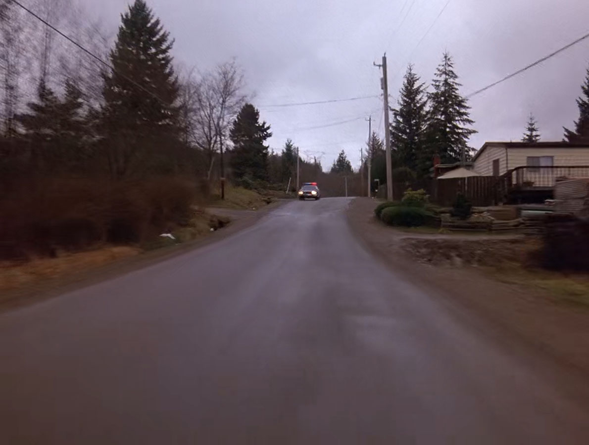
In the Twin Peaks pilot, a police car speeds by Bobby Briggs as he drives Shelly Johnson home. It’s a brief scene and you’ll miss it if you blink.
The actual location is found at 37624 SE 80th Street in Snoqualmie.
DEER MEADOW, WASHINGTON
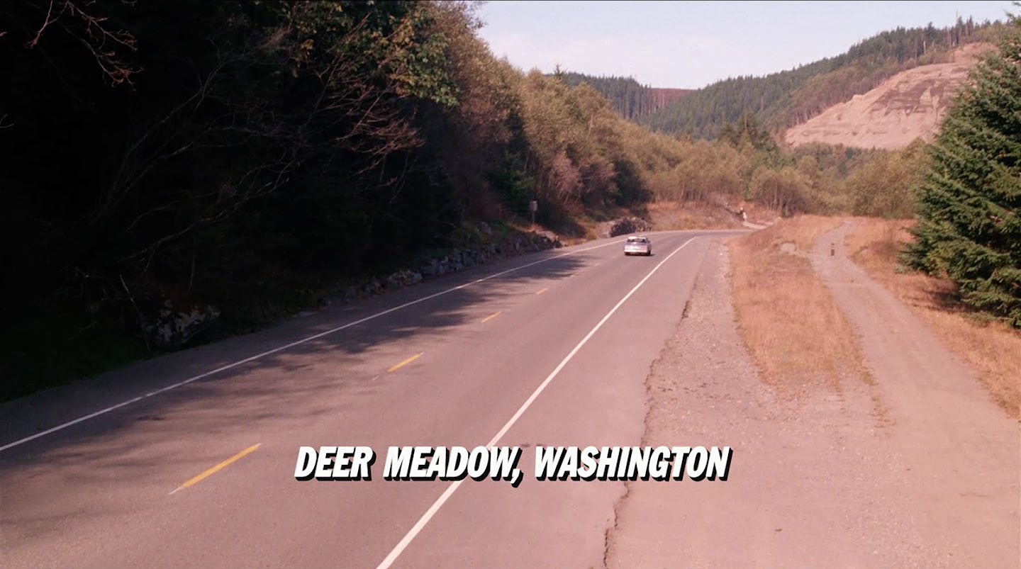
Speaking of driving, the location where Special Agents Chet Desmond and Sam Stanley enter Deer Meadow, Washington in Twin Peaks: Fire Walk With Me is found on the old Sunset Highway outside of North Bend, Washington. They are driving in the direction of I-90 which is the opposite direction of most of how this driving scene was shot. The location is found around 47°26’24.3″N 121°40’01.0″W.
In 1912, local auto groups partnered with Washington State Good Roads Association, a national advocacy group that worked to improve road systems. Together they encourage politicians to build three highways in Washington state, with being the “Sunset Highway.” This road would run “west from the Idaho line, over Snoqualmie Pass and down into Fall City.” It would then continue south around Lake Washington and into Seattle.
In March 1914, the State Highway Board accepted bids for road construction that would encompass about 23.4 miles of the Sunset Highway between North Bend and Cle Elum. At the road’s dedication in 1915, Governor Ernest Lister said the Sunset Highway was the “first passable route between east and west sides of the mountains.”
Improvements would continue in the 1920s and 30s thanks to additional federal funds made available under the Federal Highway Act of 1921. By 1934, the highway was completely paved and it received official designations as State Road No. 2, Primary State Route No. 2, and U.S. Highway 10.
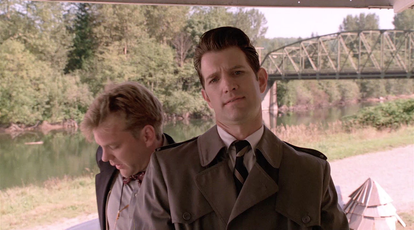
AGENT COOPER WATCHING JAMES HURLEY AND LAURA PALMER
The Deer Meadow, Washington road is nearby Olallie State Park and the Weeks Falls trail. This area is filled with Twin Peaks locations from Twin Peaks: Fire Walk With Me and Season 3. You do need a Discover Pass to visit the Washington State park but it’s easy to purchase online.
While there are numerous location along the trail, the scene where Agent Cooper watches James Hurley and Laura Palmer in Part 17 is found near the Weeks Falls trail entrance.
The spot is located around 47°26’10.1″N 121°39’14.8″W, which its just to the right as you enter the trail.
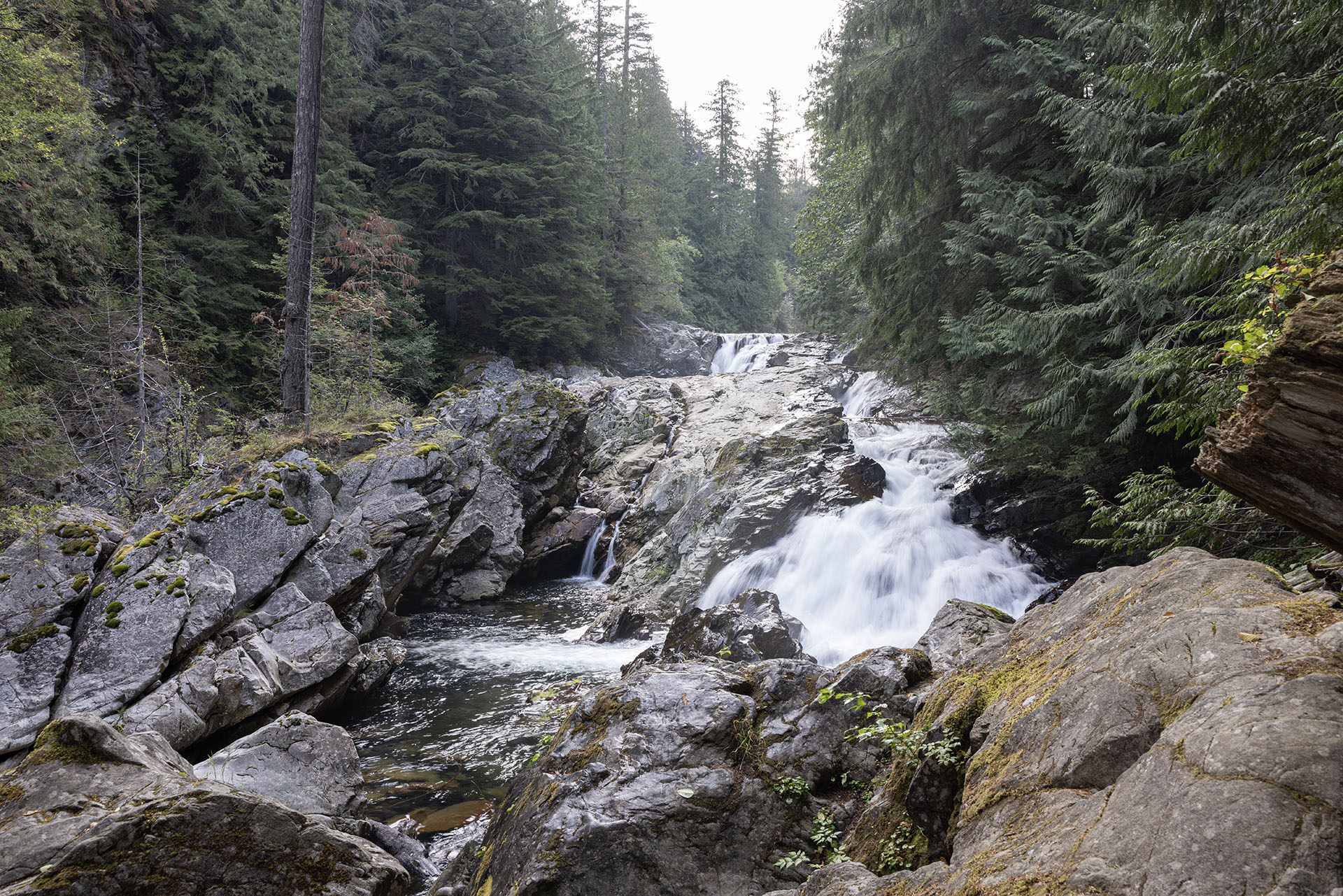
WEEKS FALLS
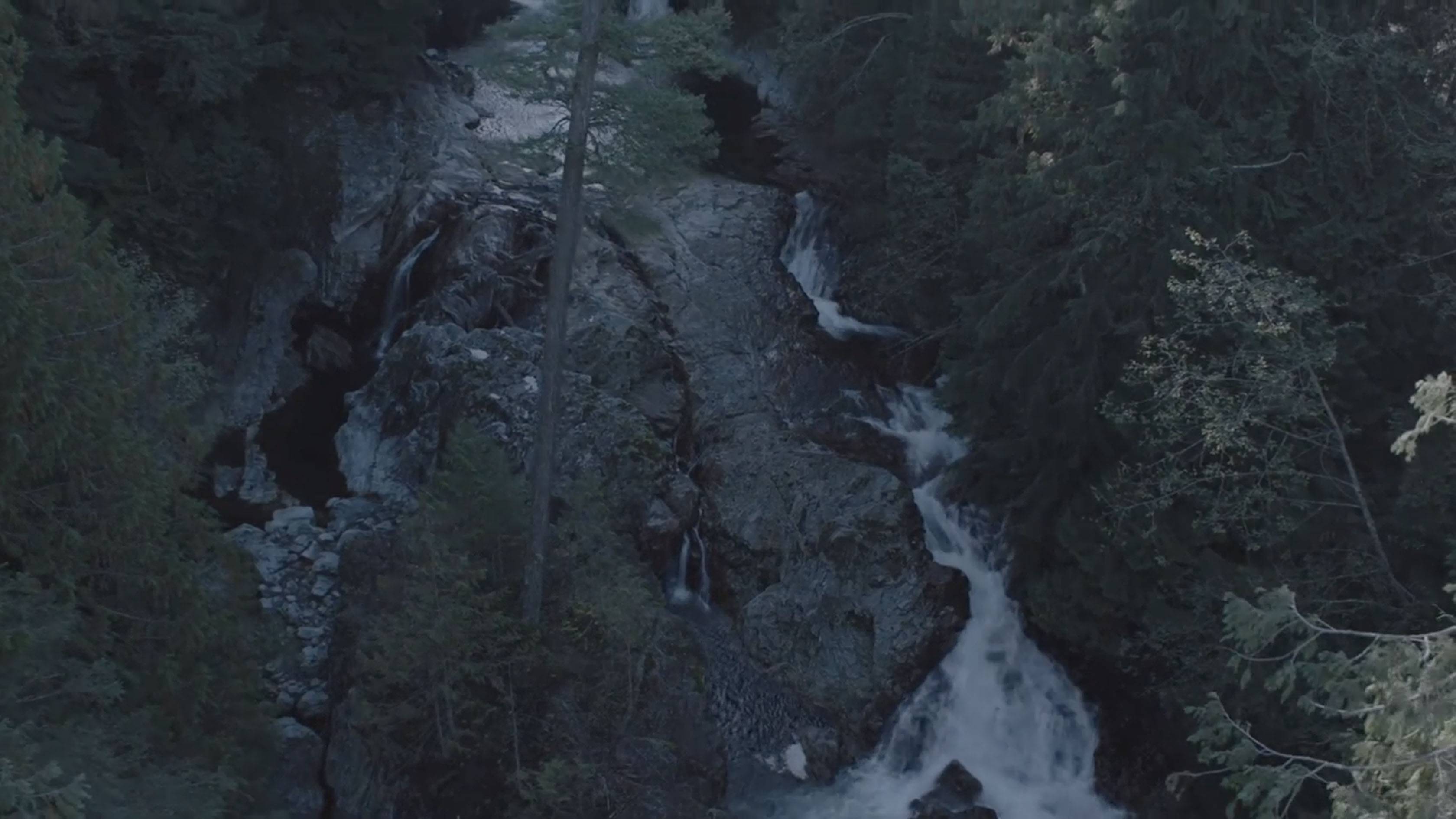
If you continue all the way down the Weeks Falls Trail in Olallie State Park, you’ll see Weeks Falls which makes a brief cameo in Part 15 from Season 3.
William Weeks was the co-owner of the North Bend Lumber Co. He was born on February 26, 1863 in Lancaster, Hampshire and died on September 10, 1937 in North Bend. The town of Edgewick, along with the falls at Olallie State Park, are named after Mr. Weeks. Interestingly, the town was swept away in a terrible flood in 1918 according to fascinating article on SavorSnoqualmieValley.com.
HORNE’S DEPARTMENT STORE EXTERIOR
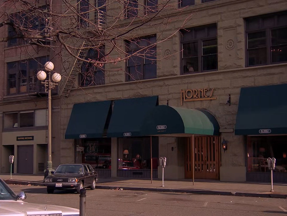
The Horne’s Department Store exterior only appears in two episodes from Twin Peaks season1 – 1.005 and 1.006.
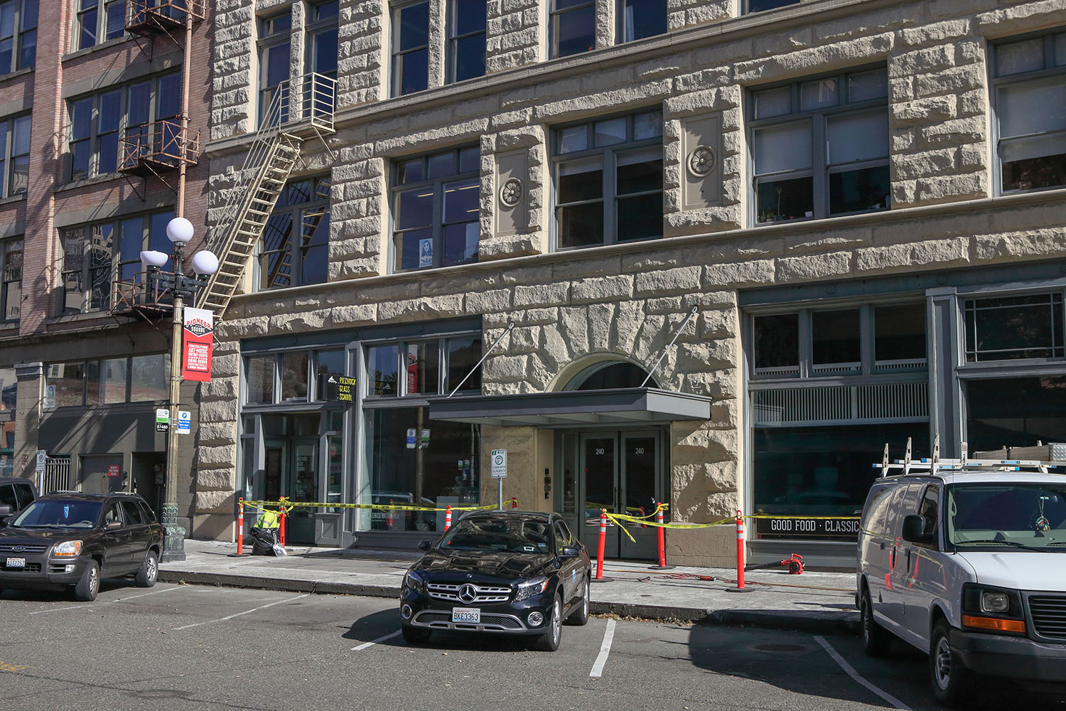
The location is found at 212 Second Avenue South in downtown Seattle. The building was originally constructed by Charles Baker, an engineer who created the first plat for the town known today a Snoqualmie.
 The Horne’s Department store logo is close to the logo found in the “Twin Peaks Access Guide to the Town.”
VIEW OUTSIDE THE DOUBLE R DINER
In Twin Peaks season 2, the view outside the Double R Diner was captured in the town of Carnation, Washington.
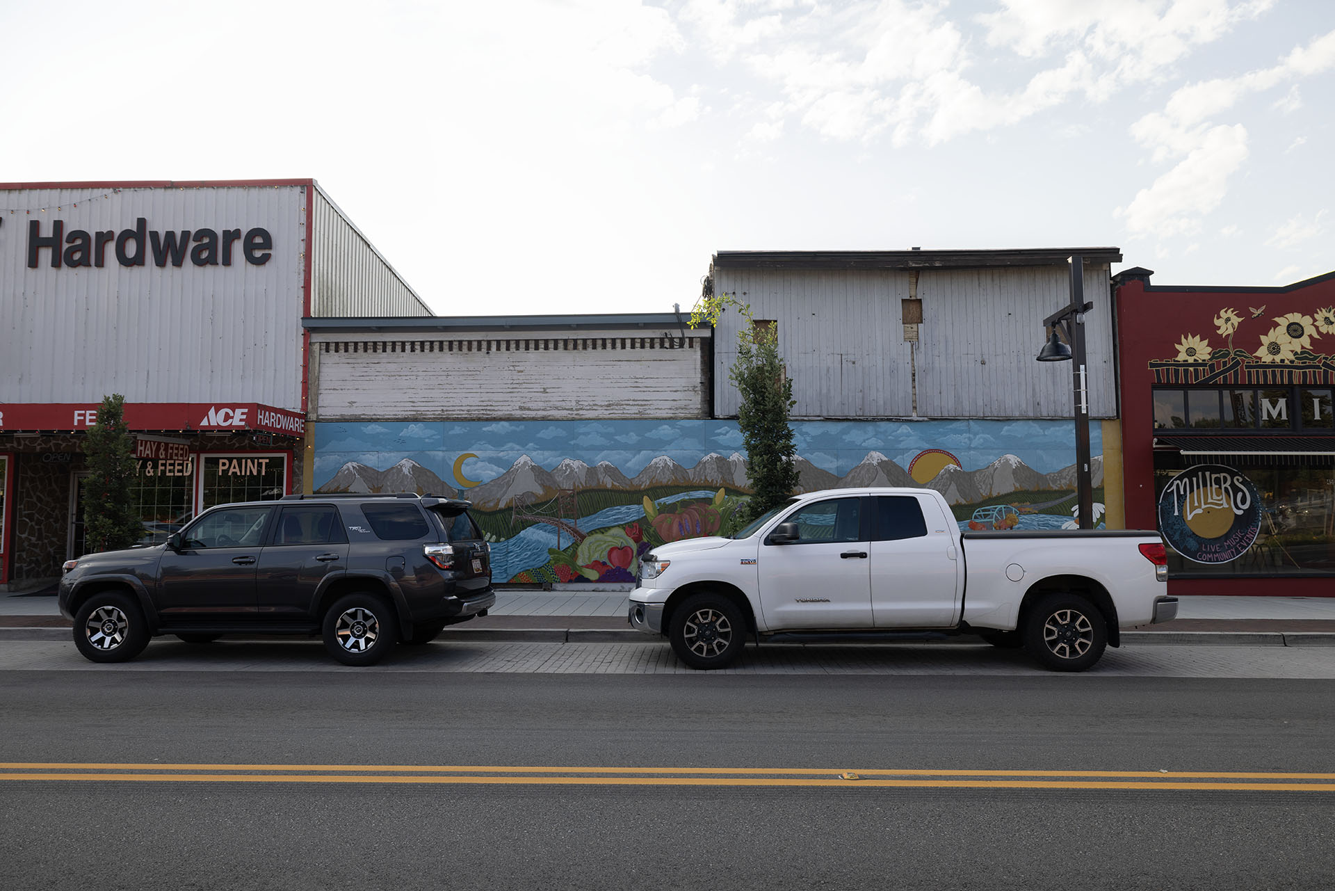
The location is found at 47°38’53.6″N 121°54’50.6″W. The Cedar Log bar closed long ago and the Carnation Barbershop is now an ACE Hardware.
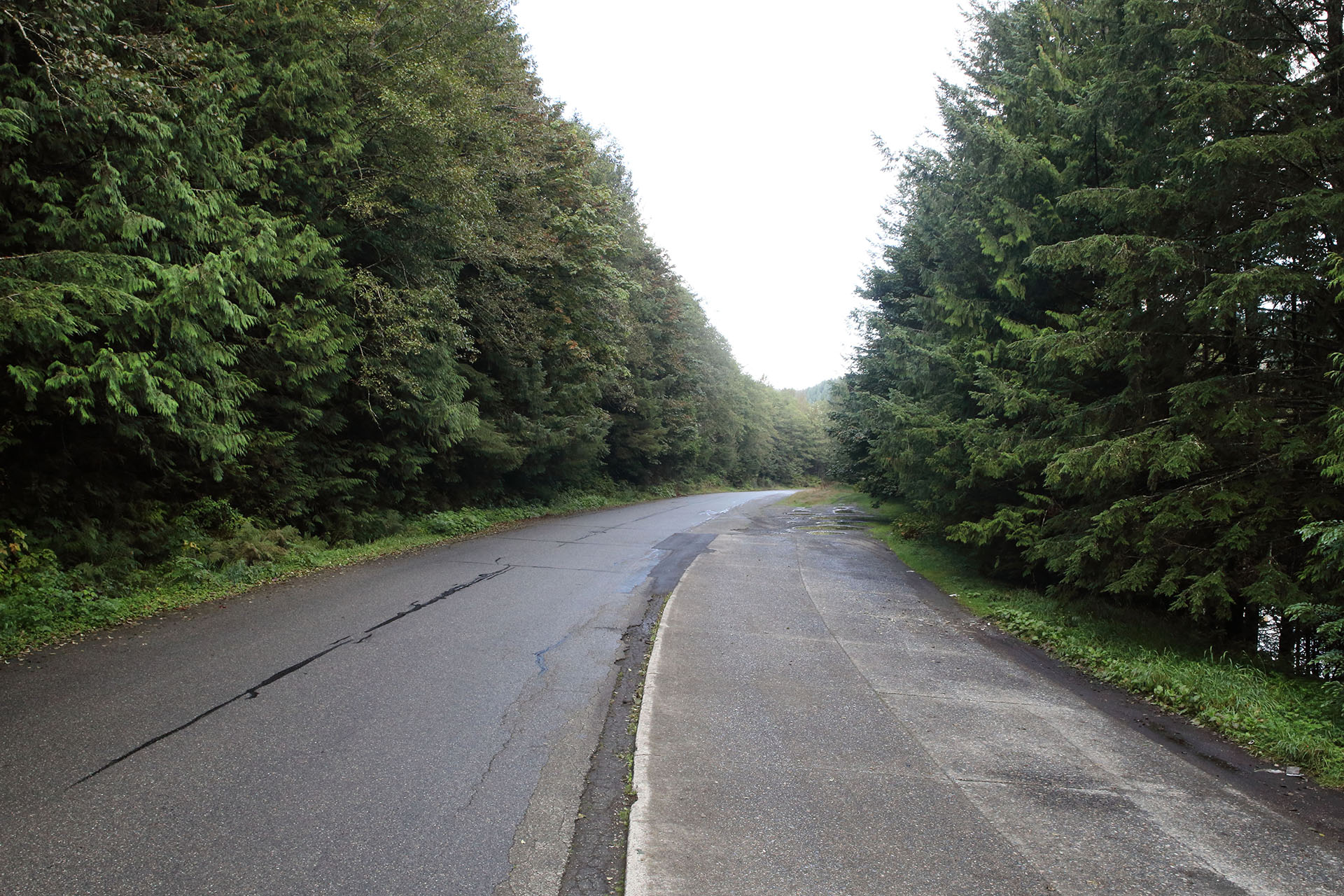
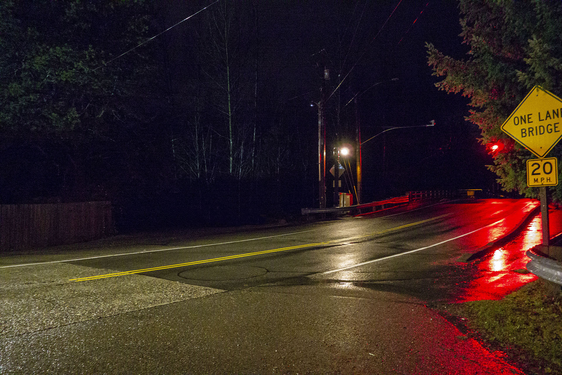
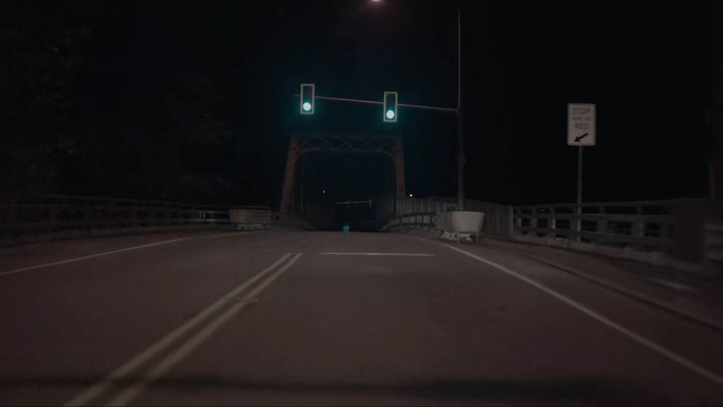
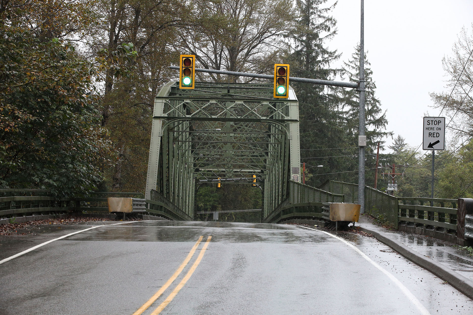
SPARKWOOD & 21
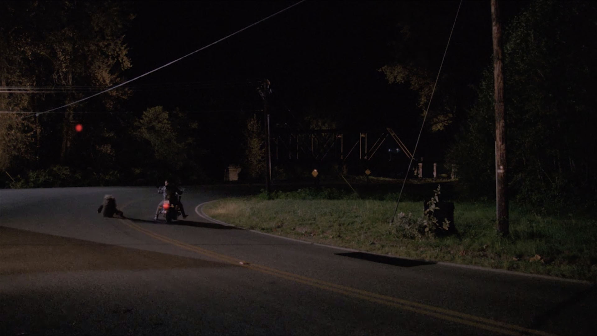
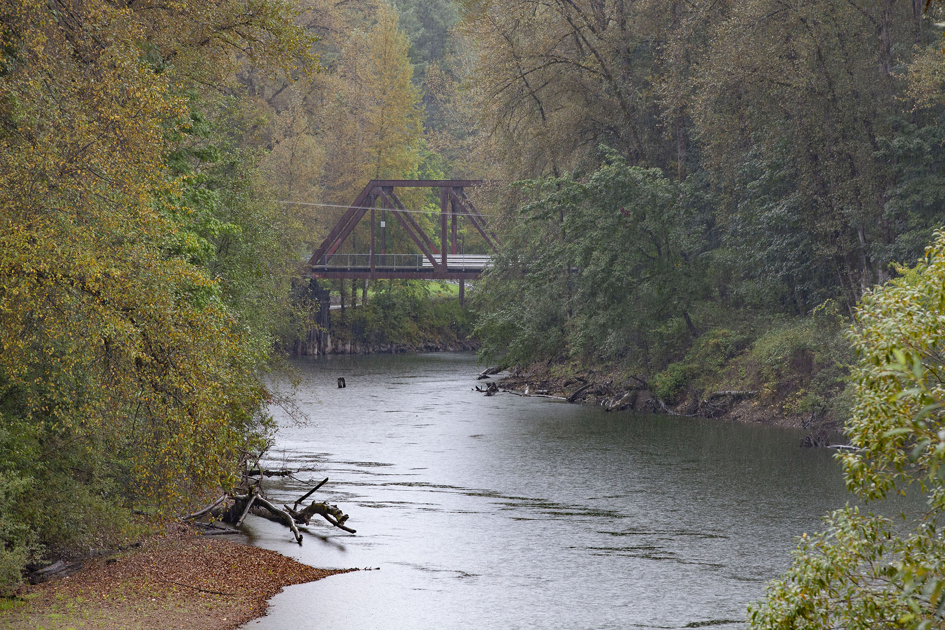
In Twin Peaks: Fire Walk With Me, we finally see the moment James Hurley describes with Laura Palmer at the light at Sparkwood & 21. This spot is located at the intersection of SE Reinig Road and 396th Drive SE. The approximate coordinates are 47°31’49.1″N 121°48’20.1″W. Look carefully as you’ll spot Ronette Pulaski’s bridge in the distance.
This is the location during the day. There is no traffic light – it was added by the crew for this shot.
If you plan on visiting at night, be prepared to see nothing. There are no street lights and it’s very dark. Standing along the side of the road, I could feel a presence in the woods behind me.
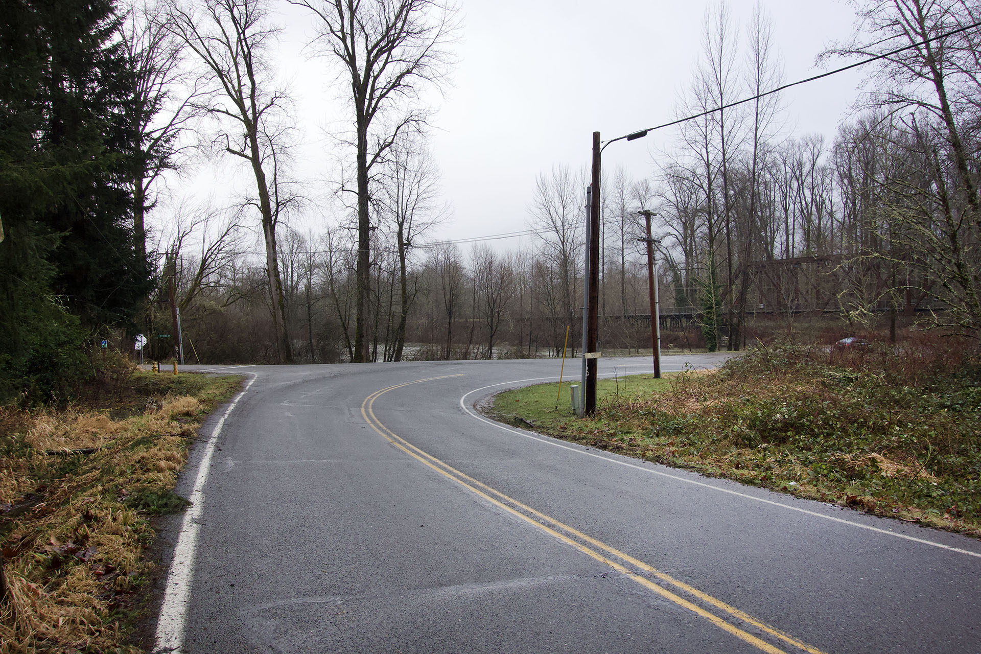
NUMBER 6 UTILITY POLE FROM PART 6
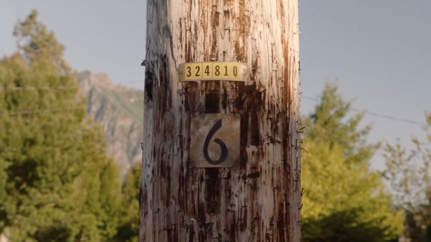
Following a terrible accident in Twin Peaks Part 6 from season 3, there is a pan-up shot of a utility pole featuring the same numbers once found at the original Fat Trout Trailer Park in Twin Peaks: Fire Walk With Me. You can read more about the utility poles in this article. Look carefully and you’ll spot Mount Si (also known as the “Twin Peaks” of Twin Peaks) in the background.
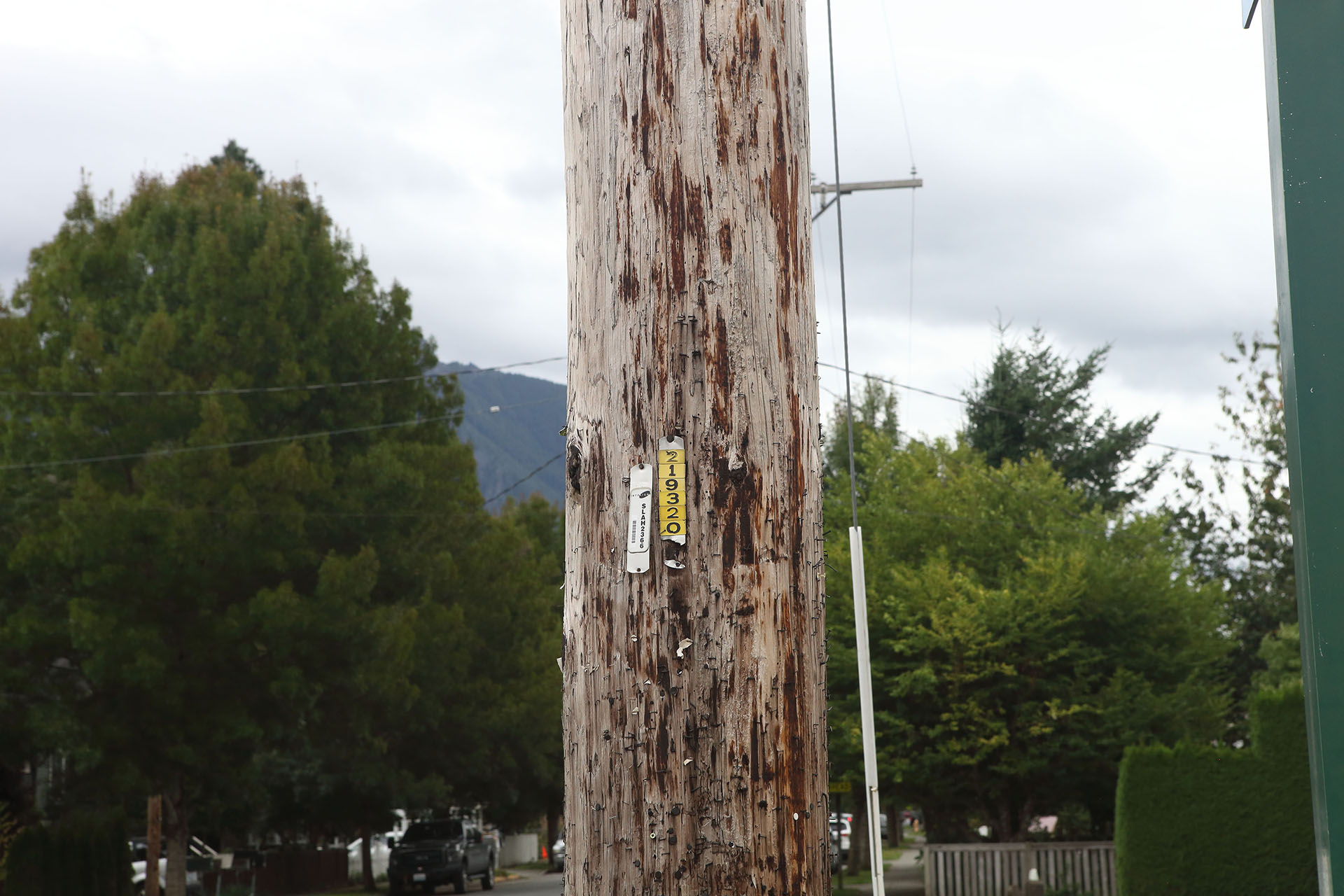
This utility pole (which doesn’t have a “6” today as that was added by the crew) is located at 47°31’31.1″N 121°48’45.8″W in Snoqualmie.
MEADOWBROOK BRIDGE
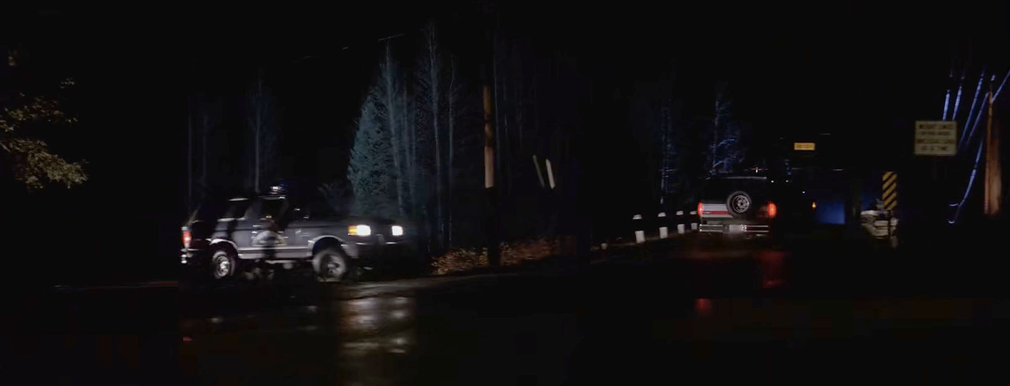
Just down the street from the Utility Pole in Part 6, you will find Meadowbrook Bridge. This historic Snoqualmie bridge has the distinction of being in the Pilot, Twin Peaks: Fire Walk With Me and Part 18.
There are really two distinct shots of the bridge. The Pilot scene was shot around 47°31’34.1″N 121°48’43.9″W, while the scene in Part 18, which features Richard/Cooper driving across the bridge with Carrie Page, is found at 47°31’35.8″N 121°48’44.2″W.
You can also see the bridge behind Agents Desmond and Stanley as they knock on Carl Rodd’s door at the Fat Trout Trailer Park.
The Meadowbrook Bridge has a long history in the area. Following the opening of the Snoqualmie Falls Lumber Co. Mill in 1914, the area saw a dramatic increase in both population and traffic. An old dirt road bridge needed an upgrade. On October 19, 1921, townsfolk gathered to dedicate a new Parker through truss bridge. A dedication plaque still exists on the bridge – No. 1725 A in King County, Washington. Don H. Evans served as the bridge engineer, while Ward & Ward, Inc. was the contractor on record.
You can see Ronette Pulaski’s bridge from the Meadowbrook Bridge too!
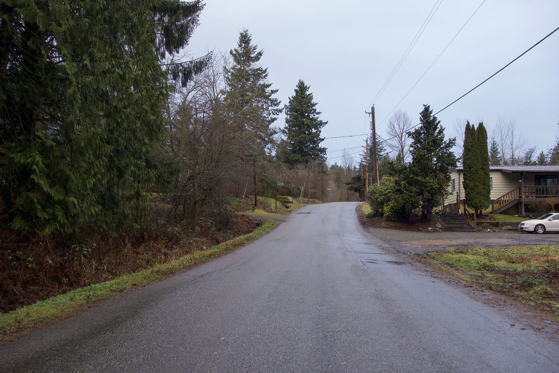
ALTERNATE WELCOME TO TWIN PEAKS SIGN SPOT
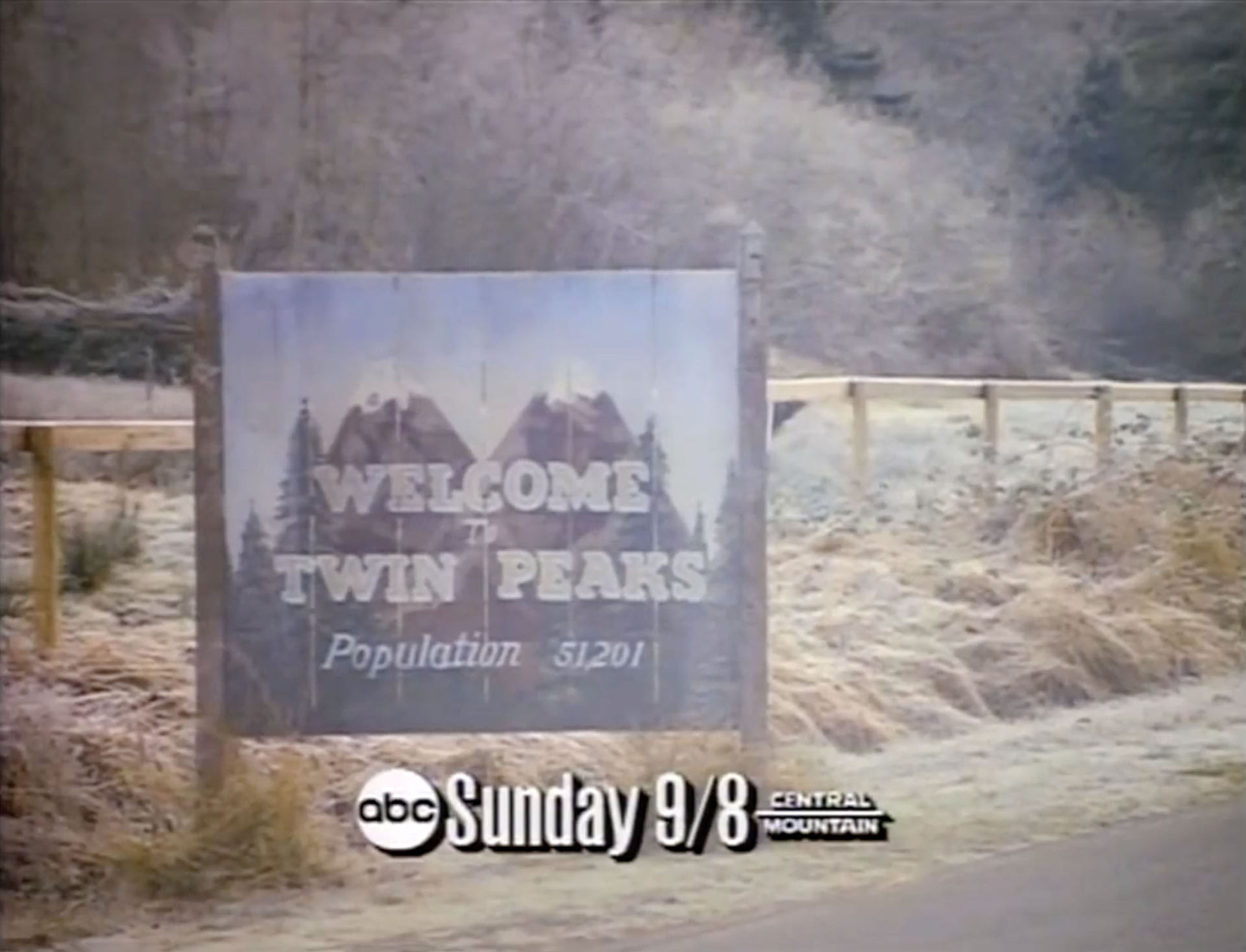
As part of a commercial for the Twin Peaks pilot, the Welcome To Twin Peaks Sign was moved to the other side of Reinig Road.
The spot where this promo was shot is on Reinig Road in Snoqualmie, Washington. The approximate coordinates are 47°31’30.8″N 121°47’00.5″W.
SCOTT’S DAIRY FREEZE
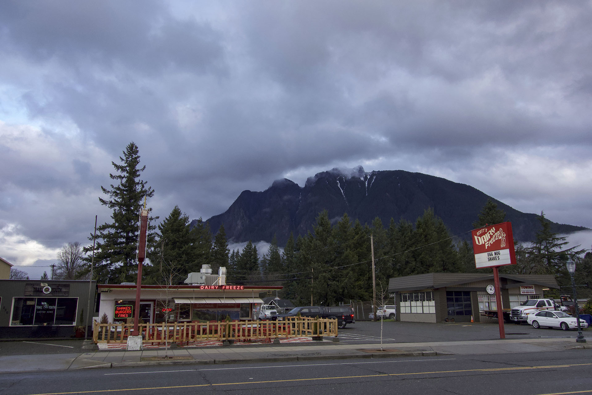
The final location in this super fan tour is Scott’s Dairy Freeze located at 234 E North Bend Way in North Bend. You can see Mount Si in the distance of this shot.
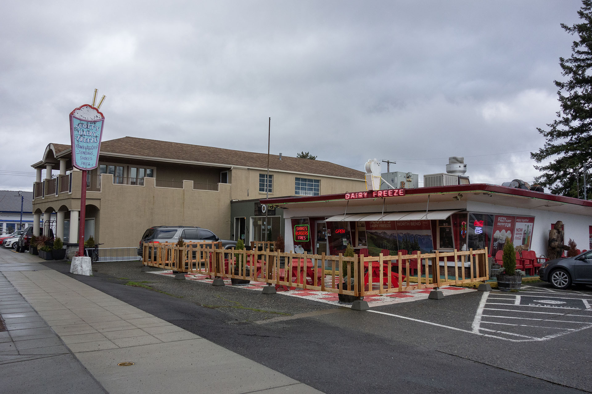
Located in a building constructed in 1951, this restaurant is well known for burgers and ice cream. Before you read any further – this location was not featured in Twin Peaks but it has an interesting connection to the show.
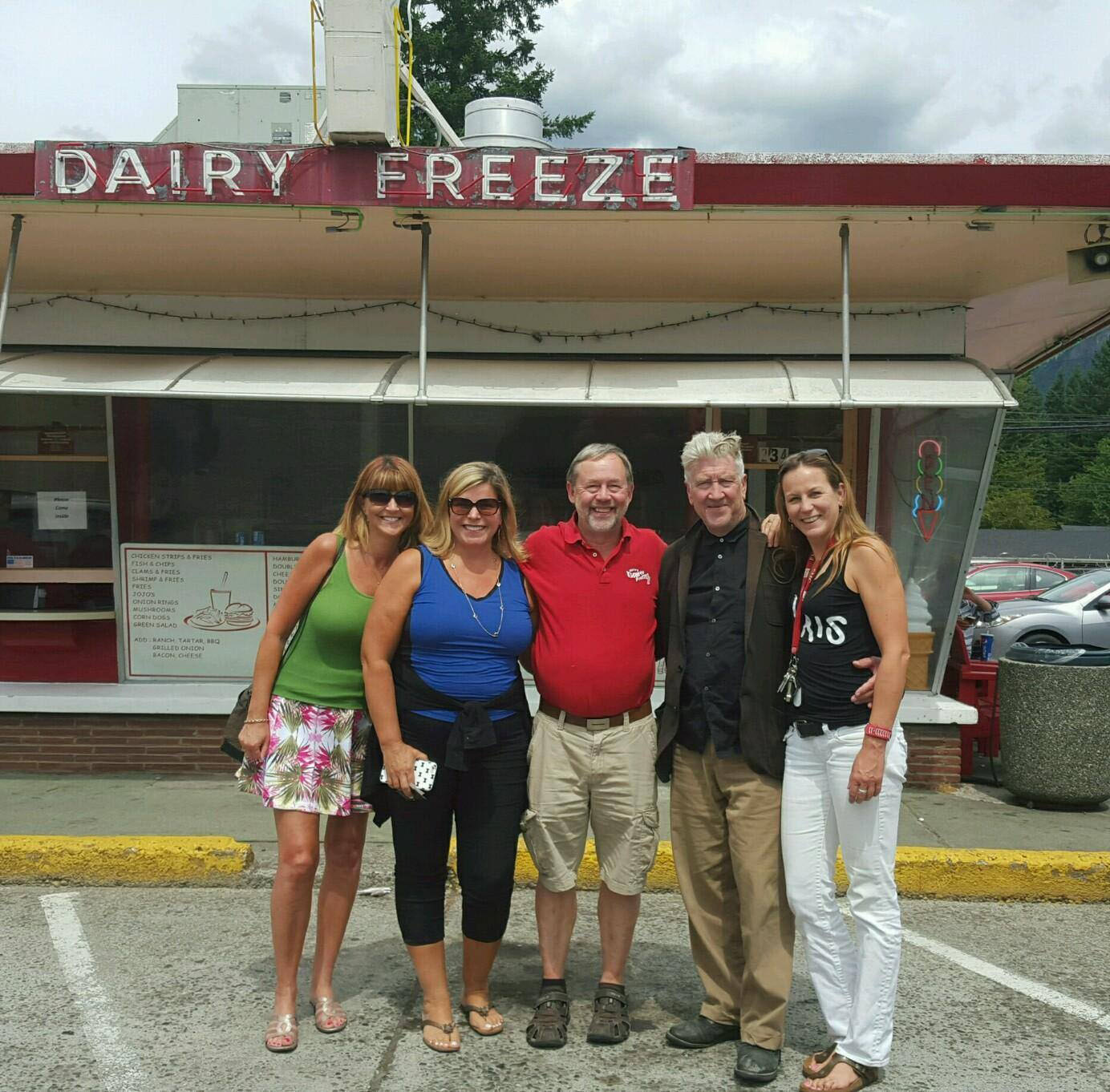
When David Lynch was in North Bend for production in 2015, he enjoyed chocolate ice cream cones from Scott’s Dairy Freeze.
Alan and Dorothy Scott opened the location in 1951 and they sold it to their daughter and son-in-law, Pat and Rob Baker, in 1969. Ken Hearing, who once served as North Bend’s mayor, bought it in 1990. He owned it until 2016 when Andy Moreno assumed ownership of this North Bend treasure. By 2022, ownership changed hands again and now Alvaro Lira and his father Arturo runs the shop.
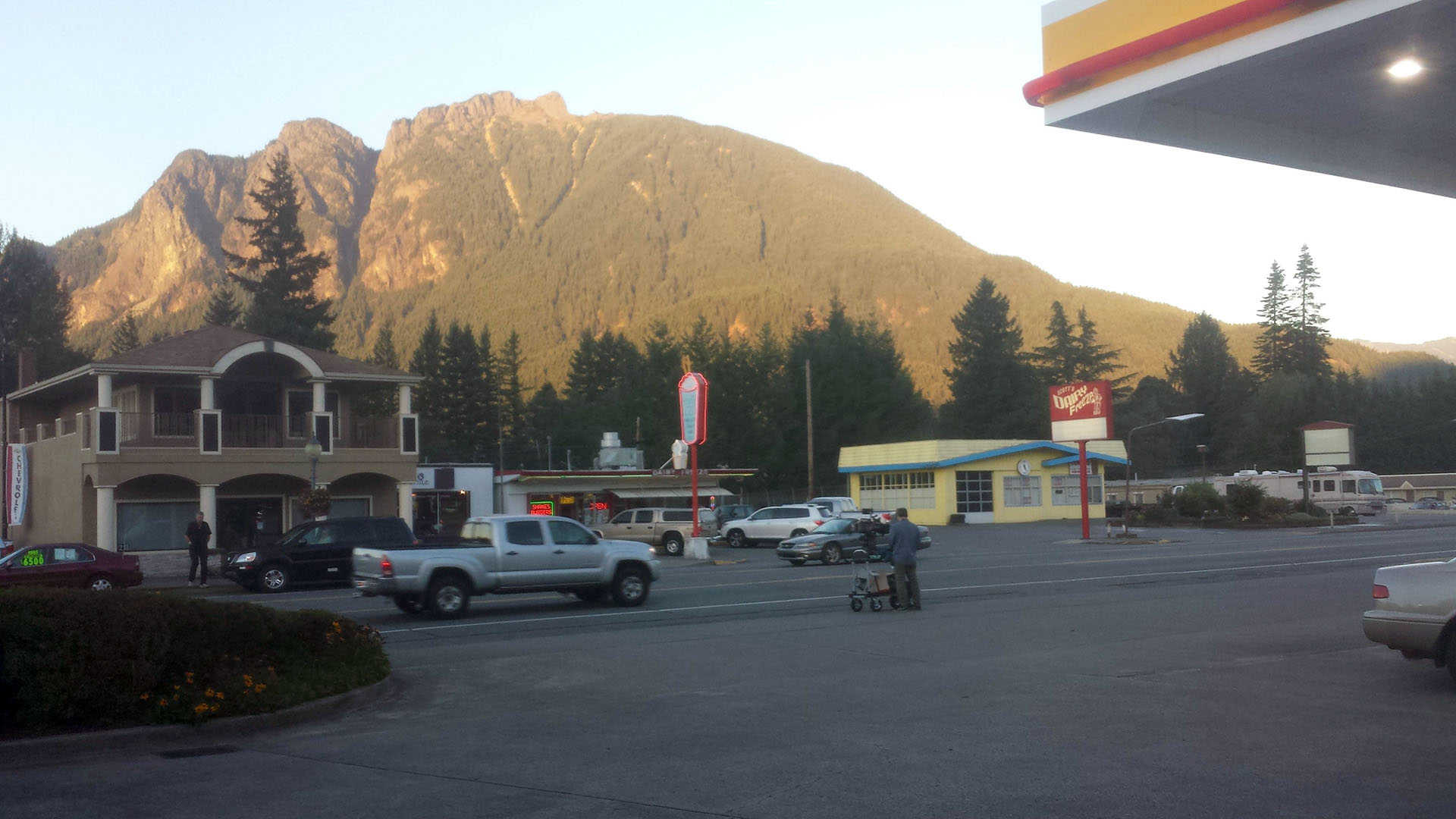
The Mauve Zone did have a behind the scenes image of a camera operator capturing footage near Scott’s Dairy Freeze during season 3 production. I’m assuming it was shots of Mount Si bathed in late afternoon sunlight.
This article has an in-depth look at this brief establishing shot from Part 10.
These are just a handful of unique places you may not have visited. See even more spot on the Twin Peaks Film Locations page.
Author
Discover more from TWIN PEAKS BLOG
Subscribe to get the latest posts sent to your email.
I am visiting Washington state from the other side of the world this summer and I genuinely appreciate this article. Thank you!