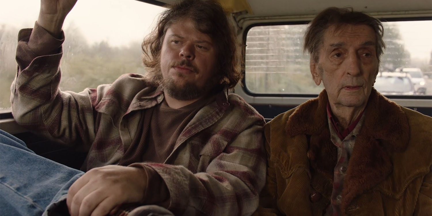
I recently realized I have not properly detailed all the film locations associated with new Fat Trout Trailer Park from Twin Peaks: The Return. The original Fat Trout from Twin Peaks: Fire Walk With Me was demolished by February 2011 following multiple flooding incidents from the nearby Snoqualmie River. The relocated trailer park is found just down the street from the historic North Bend Theatre and Twede’s Cafe in North Bend, Washington. One of the first appearances (aside from a teaser trailer from Showtime) is seen in Part 6 when Mickey (Jeremy Lindholm) asks Carl Rodd (Harry Dean Stanton) for a ride into town. I love documenting driving scenes in the show as they show off the magic of editing.
WHERE WAS MICKEY AND CARL RODD’S RIDE INTO TOWN FILMED FOR PART 6 OF TWIN PEAKS: THE RETURN?
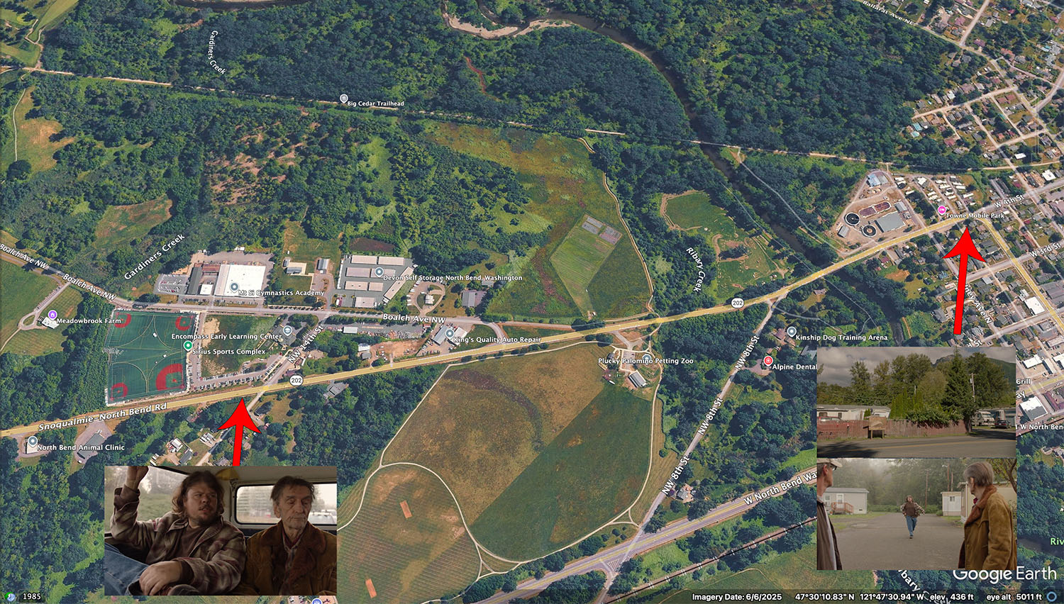
The ride into town scene starts at the Fat Trout Trailer Park, which is the Towne Mobile Home Park located at 336 Bendigo Boulevard in North Bend, Washington. The action continues along Highway 202 toward Snoqualmie.
The 55 and older mobile home park has been along Bendigo Boulevard for decades. I found newspaper reports from the Snoqualmie-North Bend Valley Record from the mid-1970s stating it was operating. Highway 202 is the main road connecting the two small towns in Snoqualmie Valley. It also appears in Twin Peaks episode 2.011 when James Hurley is seen riding his motorcycle on a two lane road.
This driving scene was filmed on Monday, September 21, 2025.
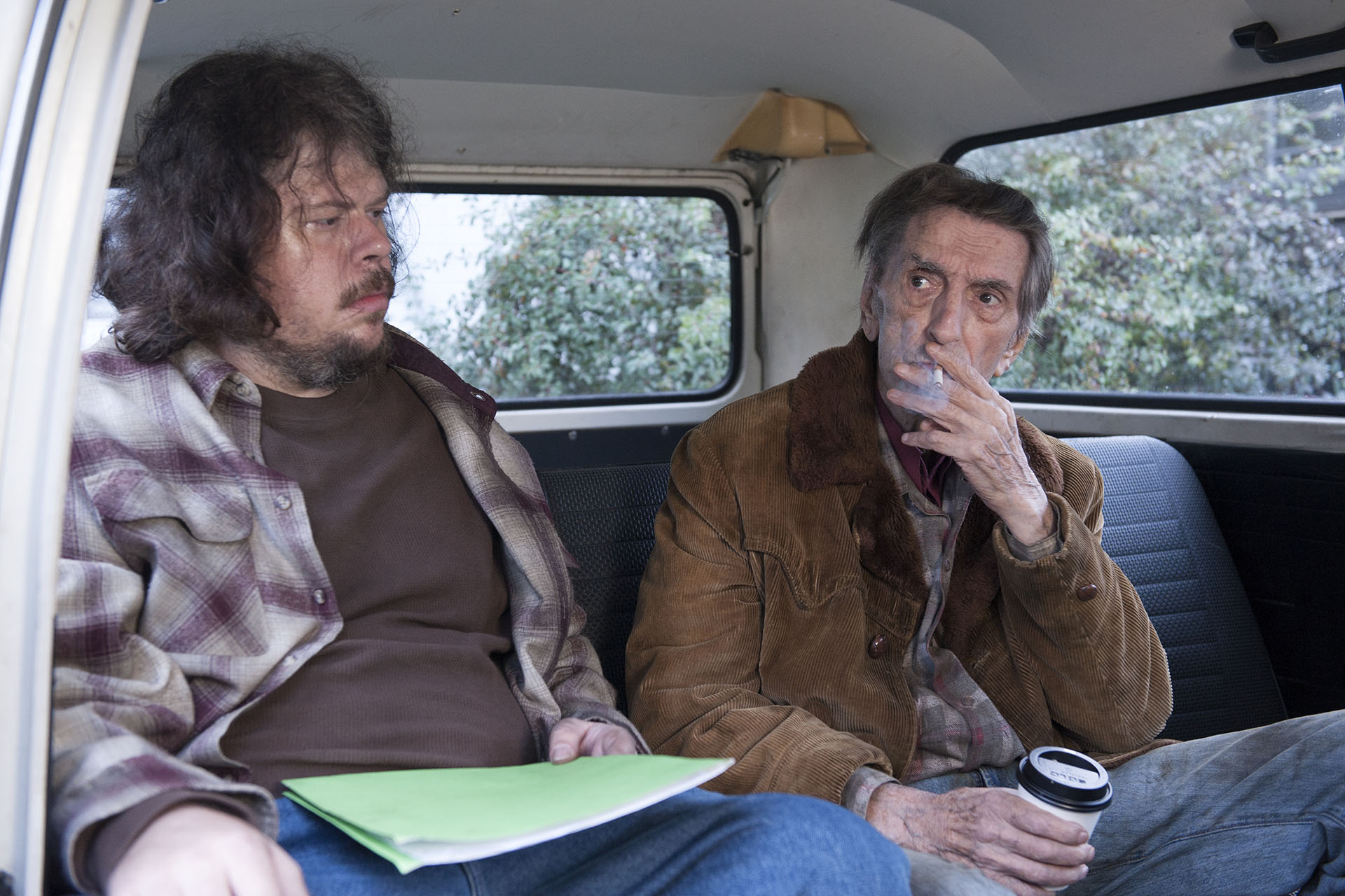
A photo of Jeremy and the great HARRY DEAN was taken by on-set photographer Suzanne Tenner and included as part of publicity for Part 6. We don’t see their characters from this angle in the broadcast version. We also don’t see the green folder Jeremy is holding or the coffee cup in Harry Dean’s hand.
STARTING AT THE FAT TROUT TRAILER PARK
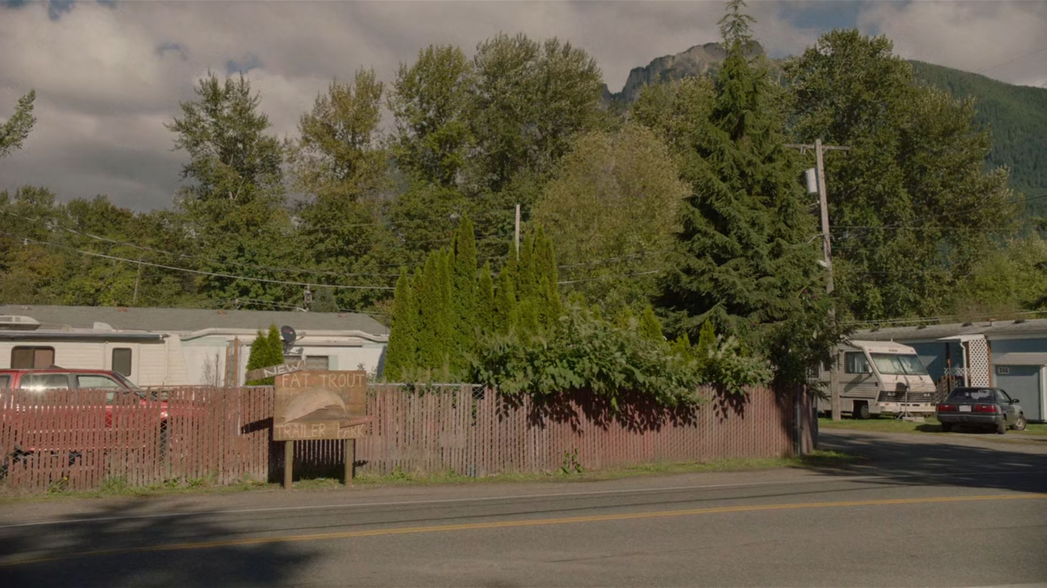
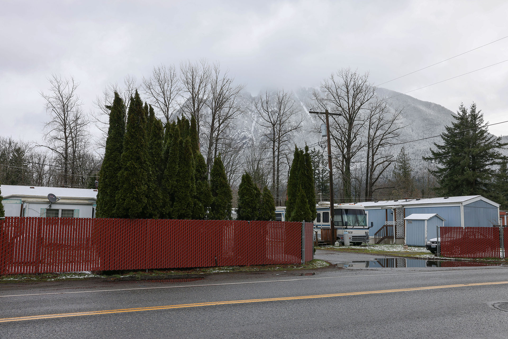
The scene begins with an establishing shot of the Fat Trout Trailer Park sign next to a red fence. A faint sound of trail whistle is heard blowing in the distance.
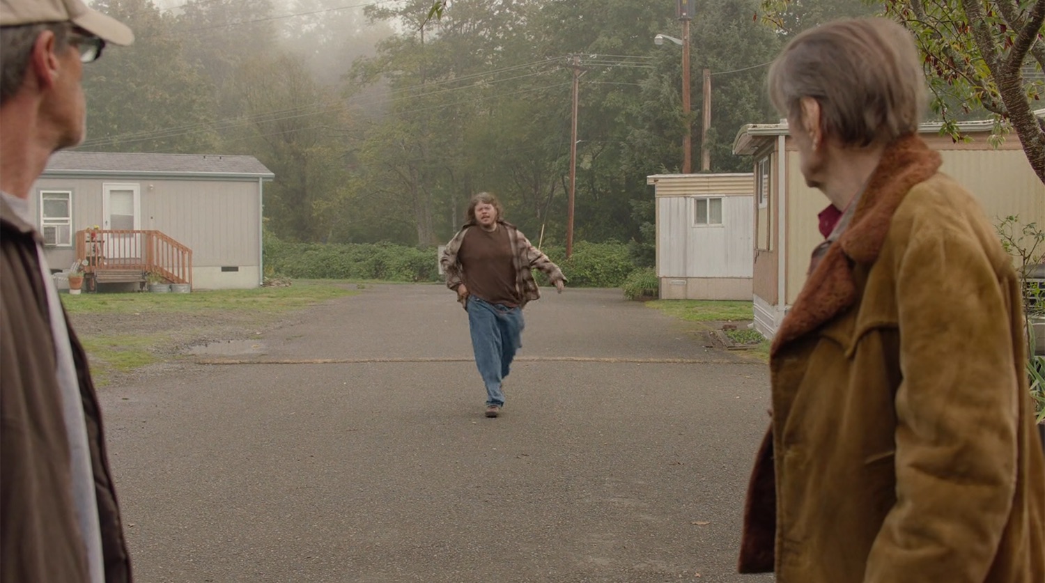
The scene cuts to Mickey (Jeremy Lindholm) running toward Carl Rodd and a driver named Bill (which may be Bill McCarthy who worked as part of the transportation crew on the series). Mickey asks if he can get a ride into town to check Linda’s mail at the Post Office (or “P.O.” as he says on screen).
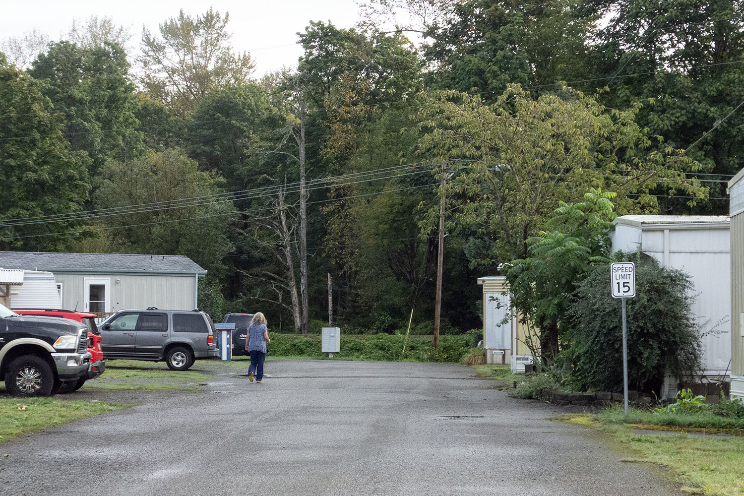
The scene was filmed along the middle road of the Towne Mobile Home Park. In the distance beyond the community, you will find the Snoqualmie Valley Trail. A green tractor is seen in the episode moving slowly along the trail just as Mickey gets into the vehicle with Carl.
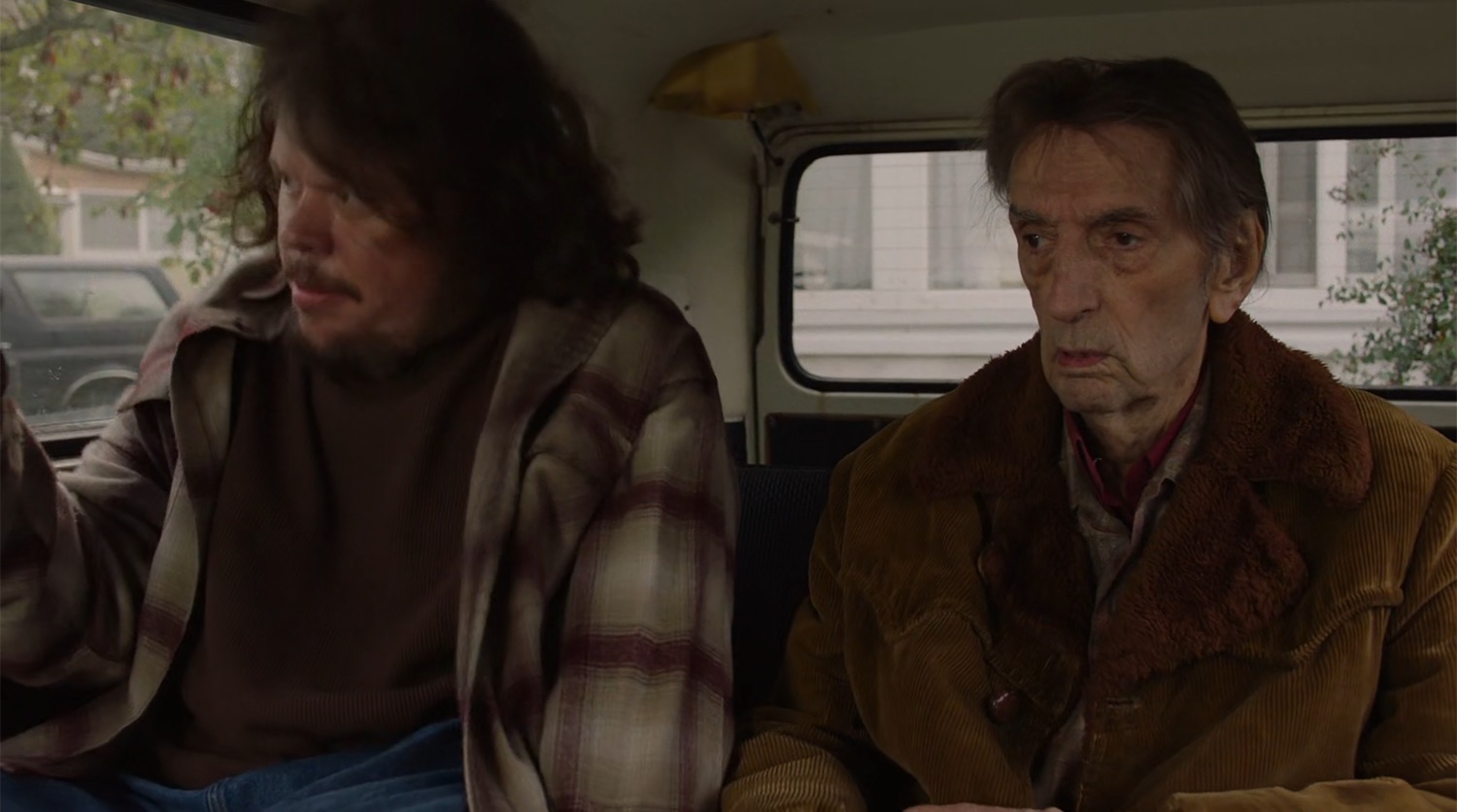
Mickey squeezes into a spot next to Carl in the back of his 1965 Volkswagen De Luxe Station Wagon.

We won’t see the exterior of Carl’s van until Part 11 when he summons driver Bill via whistle.
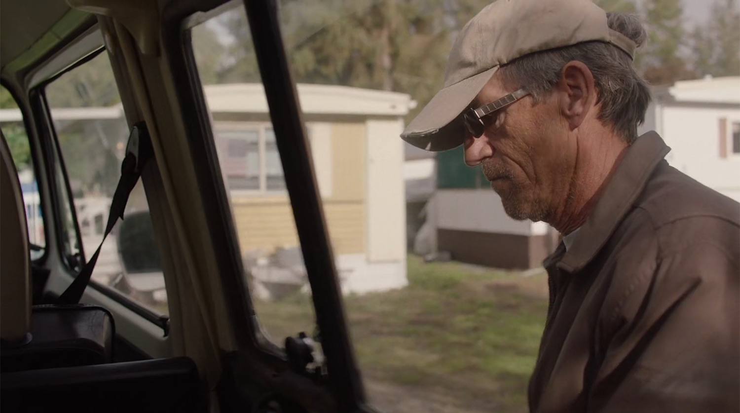
The uncredited driver Bill then closes the van door. You can see part of Steven and Becky’s trailer to the right behind Bill.

Bill circles the van to the driver’s side and enters the vehicle.

The scene continues with Bill driving out of the New Fat Trout and turning right onto a road.
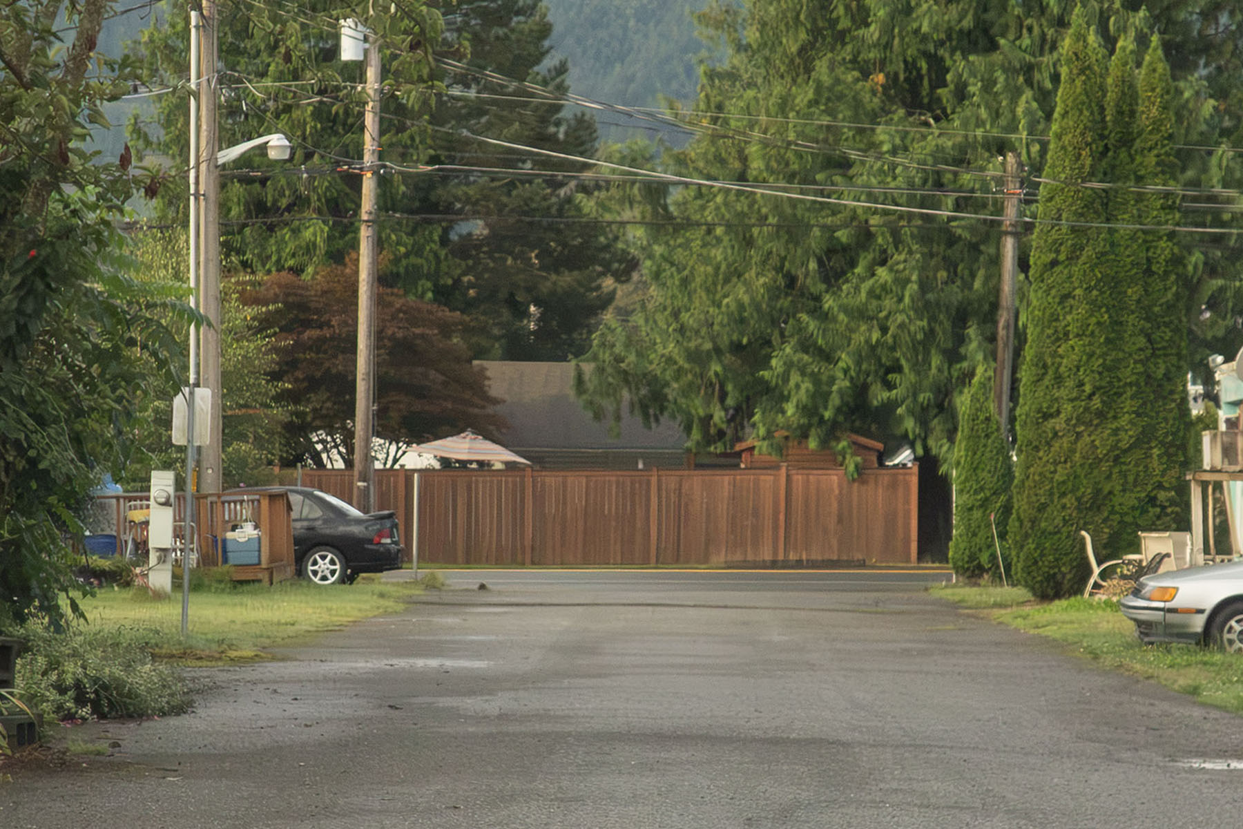
In reality, Bill is turning right onto Bendigo Boulevard which turns into Highway 202 or Snoqualmie-North Bend Road.
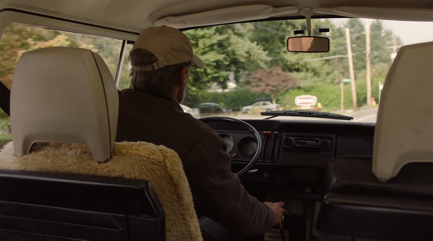
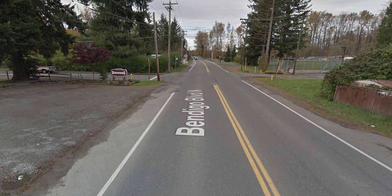
You can briefly seen an out of focus sign for Dr. James L. Browning Family Dentistry. It’s still visible via Google Street View look from November 2015. Browning practiced dentistry for 42 years, first in Michigan and then for more than 30 years in North Bend. Upon his retirement in 2017, he handed the practice over to Dr. Lisa McCoy and Dr. Jacob Deno who renamed it Mt. Si Family Family Dentistry. The sign was subsequently updated following the name change.
ON THE ROAD WITH MICKEY AND CARL RODD
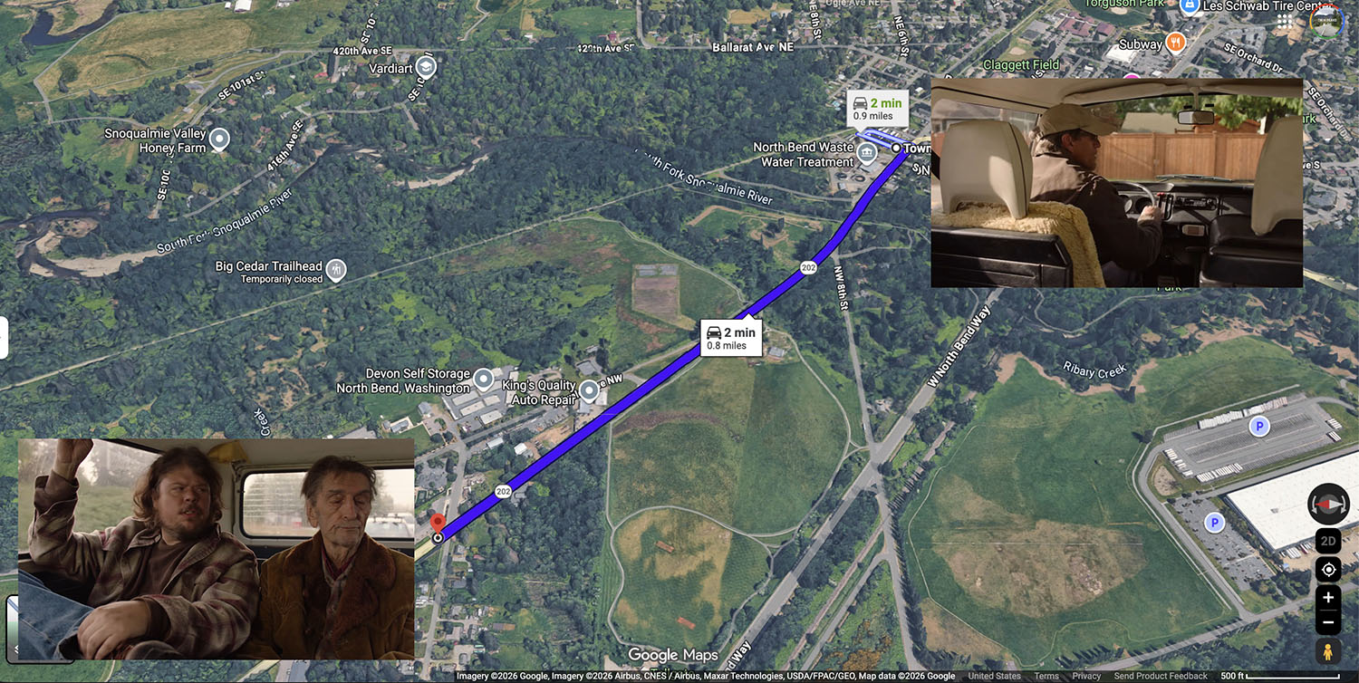
In Part 6, the action cuts from Bill turning right to Mickey and Carl Rodd on the way into town. In reality, the scene picks up nearly a mile from where Bill made his turn.
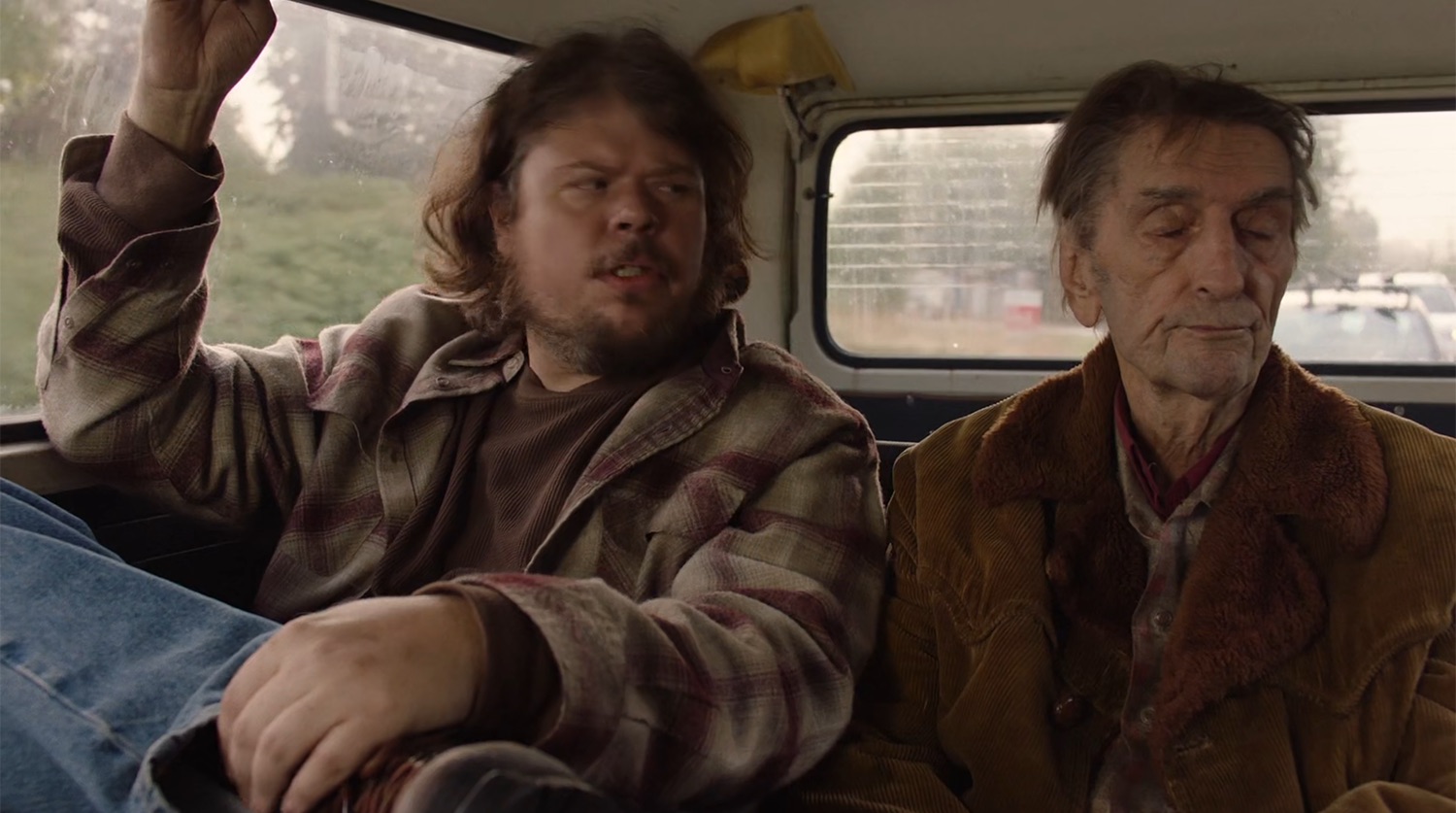
To find the start of the backseat driving scenes, I needed to locate the small white and red sign seen outside the rear window. Look carefully and you’ll see additional cars following closely behind the Volkswagen van. Those vehicles are part of the production team for safety and to ensure no other cars got in the shot.
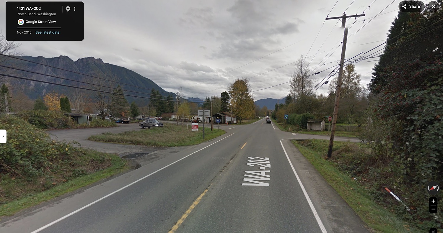
Thankfully, the colorful sign was still present in the Google Maps Street View from November 2015. It’s a “For Sale” sign at the corner of NW 14th Street and Snoqualmie-North Bend Road (Highway 202). The approximate coordinates are 47°30’19.4″N 121°47’51.2″W.
Today, the area has parking for the Sirius Sports Complex that was constructed starting in September 2020 and officially opened on October 5, 2021.
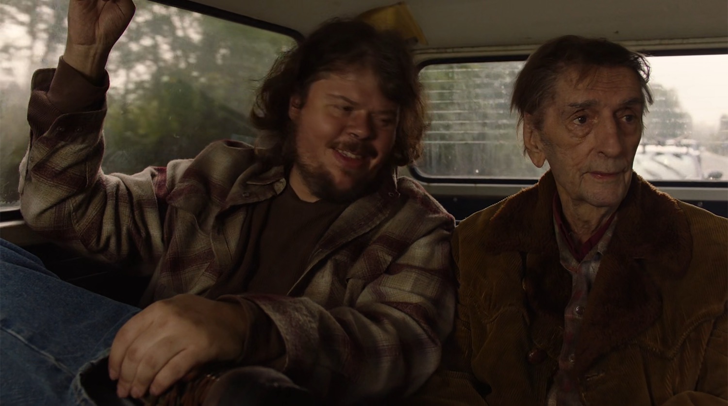
Along their journey, Carl tells Mickey that he goes into town around the same time every day as it “gets me out of this trailer park.”
“Not much I got to look forward to at my age, Mickey, except the hammer slamming down,” Carl continues.
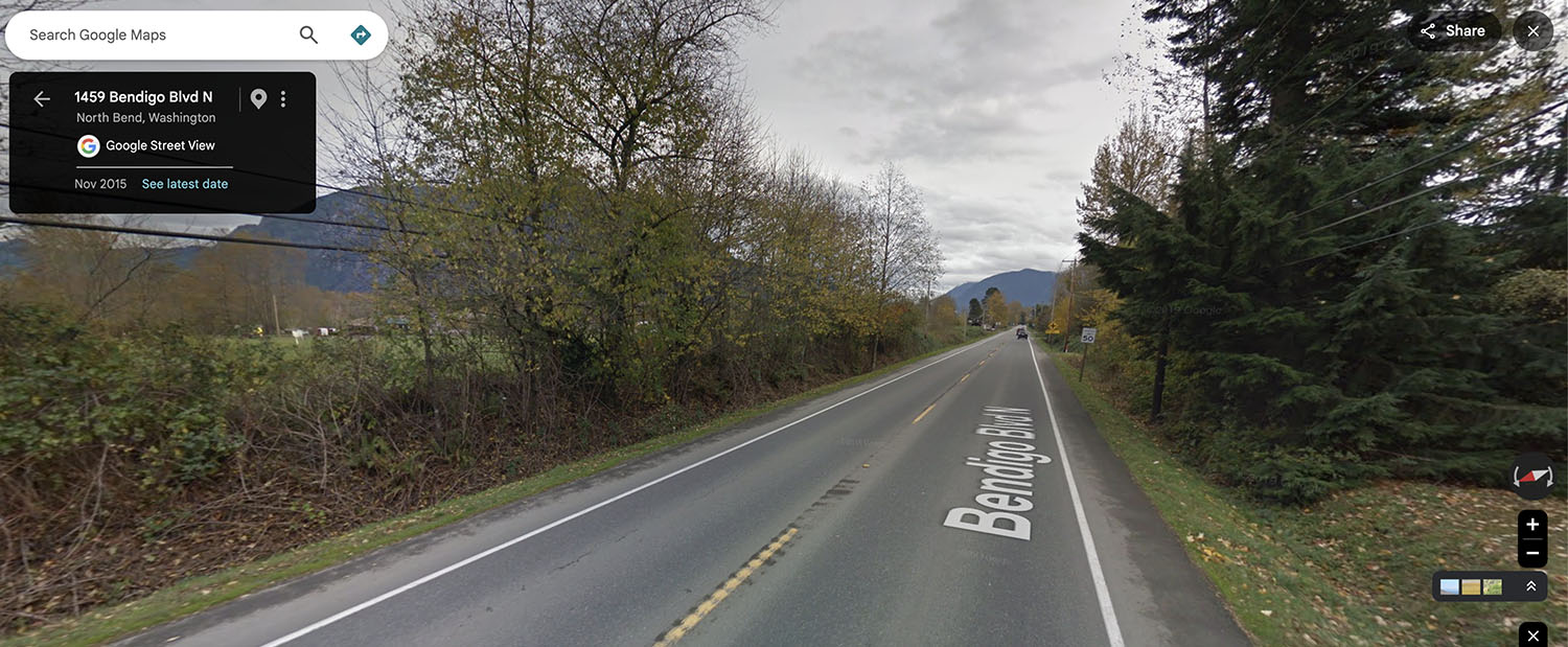
You can see the trees they drive by in this Google Street View shot from November 2015. The area looks completely different today following the construction of the sports complex.
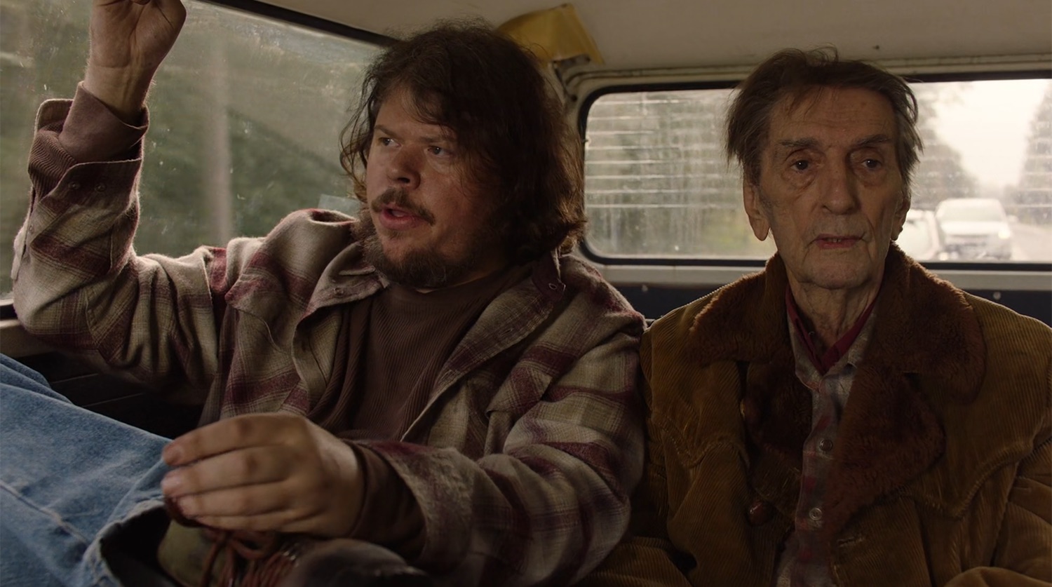
Carl asks Mickey about Linda who says that she is “doing a lot better” after the government agencies gave her an electric wheelchair. But it took about six months to get the chair from the government. Carl responds, “Fuckin’ government.”
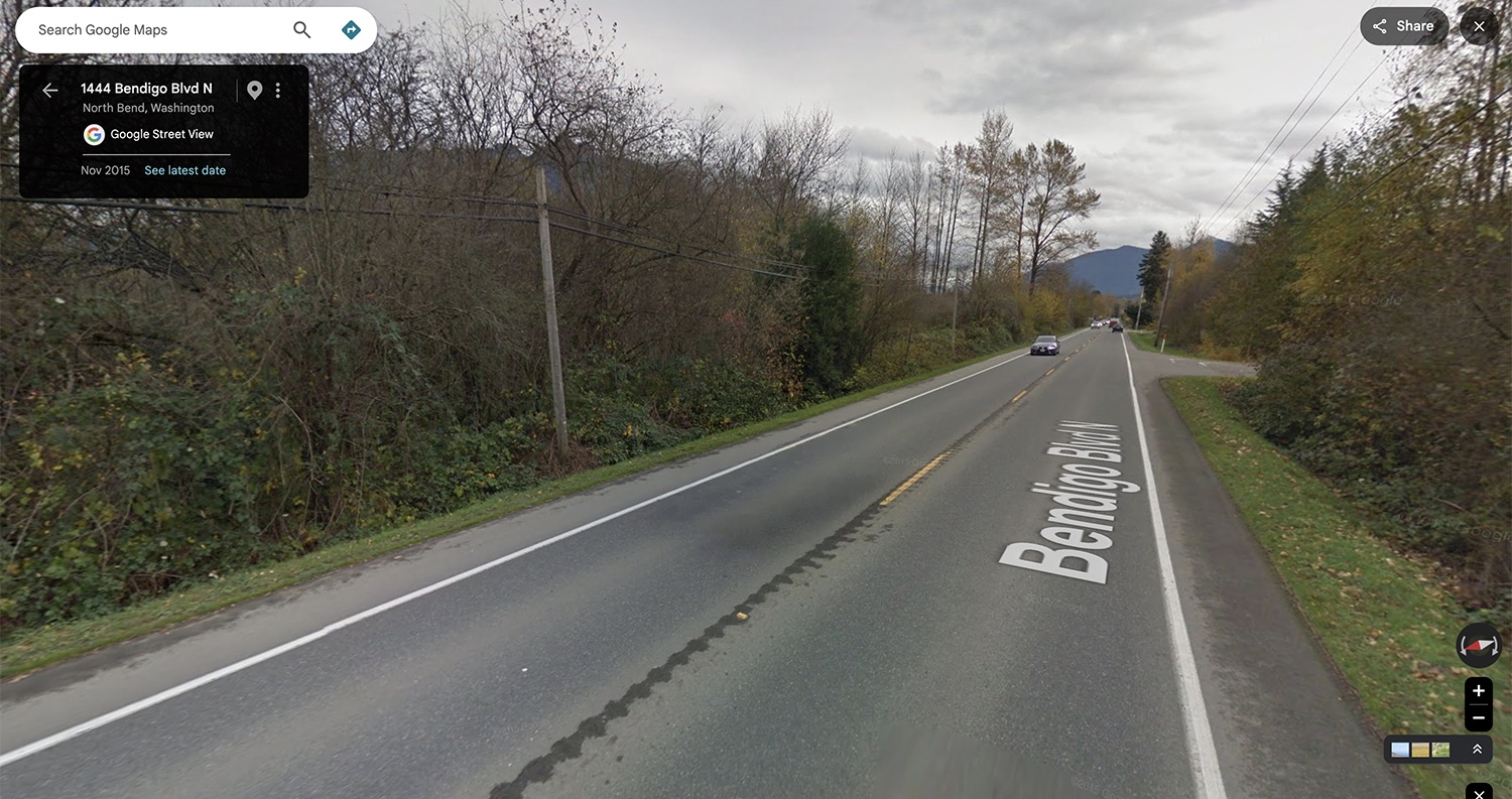
The first part of this drive on screen along Highway 202 ends around the coordinates 47°30’28.7″N 121°48’05.0″W. You can see the same utility pole outside the rear view window of Carl’s van.
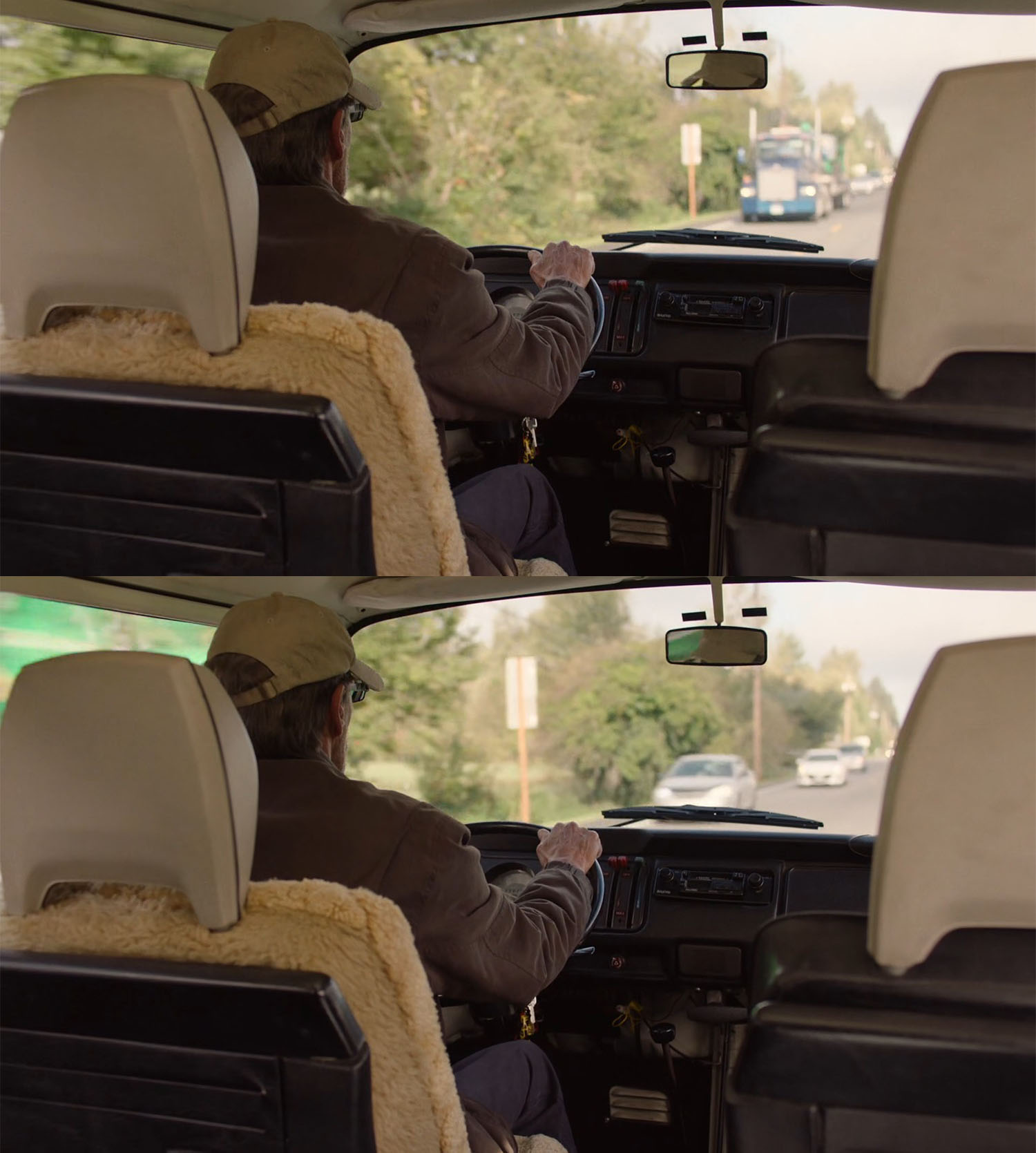
As soon as Carl says “Fuckin’ government,” the scene cuts to a brief shot of Bill driving the van.
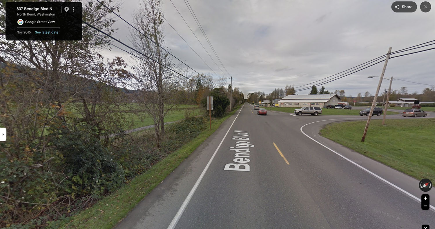
This brief insert took place at a spot before Carl and Mickey were seen riding in the backseat. The back of the sign out the front window – which said “Speed Zone Ahead / 30 M.P.H.” – was found near the intersection of Highway 202 / Snoqualmie-North Bend Road and Bolach Avenue NW. The sign was removed at some point after 2023.
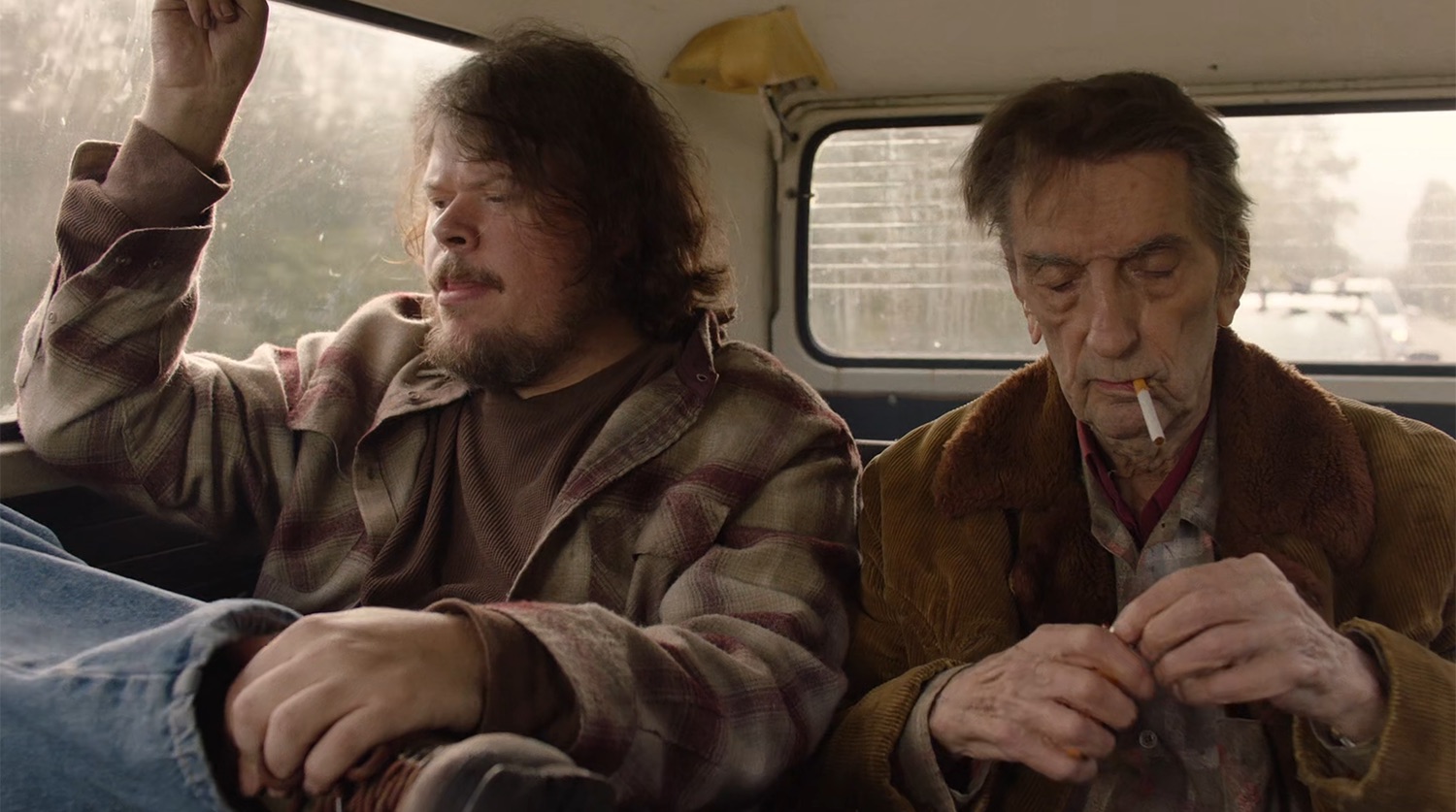
The action cuts back to Carl Rodd lighting a cigarette. The chase cars are still seen behind the van.
Carl Rodd offers a smoke to Mickey who accepts but quickly declines saying he quit about a year ago.
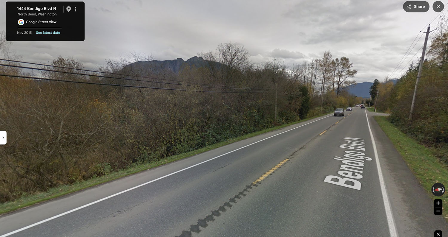
The van has traveled just slightly beyond the area before the cut to Bill the driver. The approximate coordinates are 47°30’28.9″N 121°48’05.5″W. Most likely, the crew continued filming the scene with Jeremy and Harry Dean in one longer take.
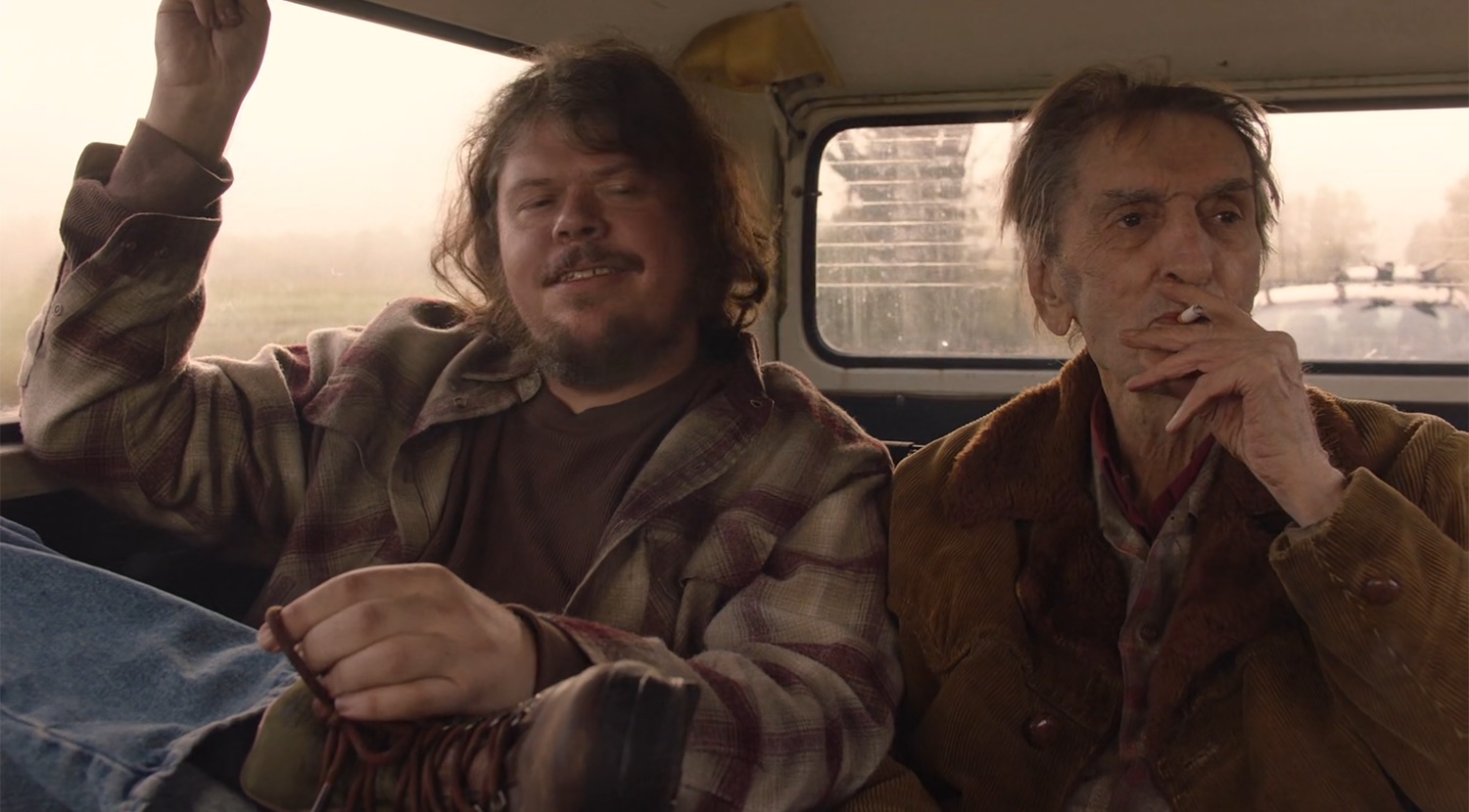
Carl then tells Mickey that he’s been smoking all his life – “I’ve been smoking for 75 years, every fucking day. [laughs].” The scene ends and cuts to an establishing shot of the Double R Diner.
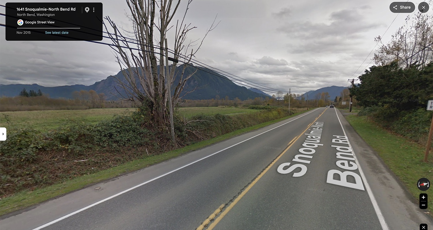
The ending spot was fairly easy to locate thanks to the oversized tree along the side of the road. The approximate coordinates are 47°30’38.2″N 121°48’19.1″W. The tree today isn’t as magnificent as in 2015. If you get to the elk fields, you’ve gone too far.
Author
Discover more from TWIN PEAKS BLOG
Subscribe to get the latest posts sent to your email.