
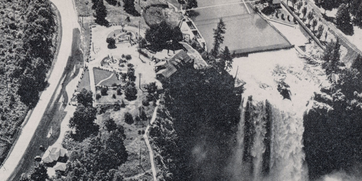
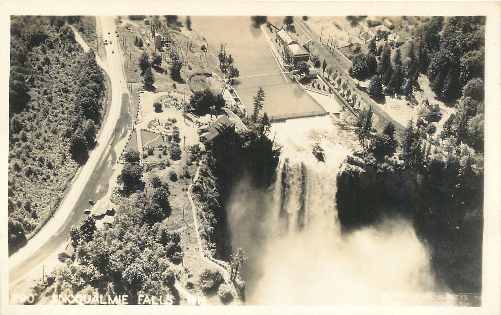
I love finding postcards from the Real Twin Peaks of Snoqualmie Valley that have a strong connection to Washington state. This black and white postcard contains an aerial view of the majestic and sacred Snoqualmie Falls captured by a former aerial photography company based in Seattle, Washington that was owned by a Norwegian immigrant.
SNOQUALMIE FALLS, WASHINGTON POST CARD BY GRAYCRAFT CARD CO. – S-249
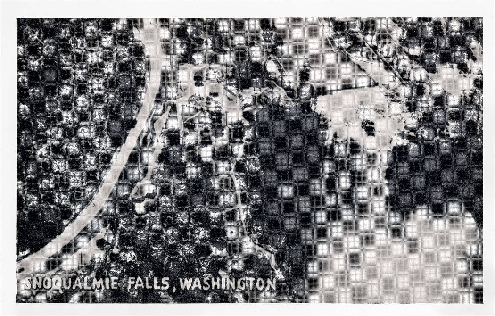
This black and white postcard features the 268-foot Snoqualmie Falls next to the former Snoqualmie Falls Lodge which was remodeled and expanded in 1988. It’s known today as Salish Lodge & Spa. My favorite details is the lettering used for the place marker – “SNOQUALMIE FALLS, WASHINGTON.”

It reminds me of the font used for the short-lived “Twin Peaks Gazette” newspaper sent to Twin Peaks fans in the early 1990s.
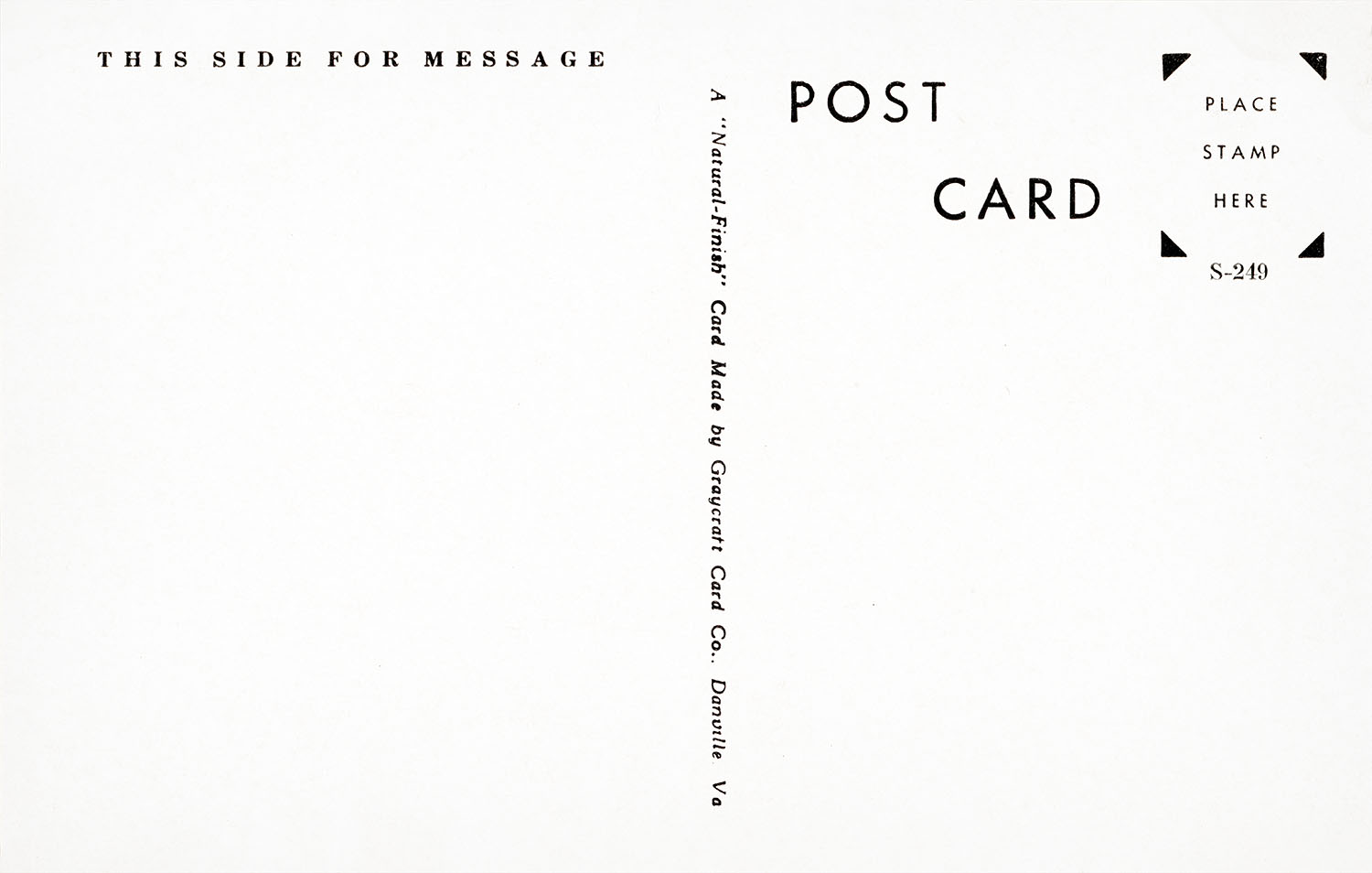
The back of the postcard contains manufacturing information. It’s a “Natural-Finish” card made by the Graycraft Card. Co. in Danville, Virginia with a catalog number of S-249. It’s undated but that didn’t stop me from finding an approximate timeframe the card was produced.
We’ll start with the Virginia-based Graycraft Card Co.
WHAT IS GRAYCRAFT CARD CO.?
Robert Hawley Sanford, Jr. founded Graycraft Card Co. on Nov. 16, 1939 in Danville, Virginia. The company specialized in black and white photography of small town communities mostly in the Southern part of the United States. They operated out of 109 Main Street in Danville for about 15 years. The shop was later demolished to build the Memorial Highway. Sanford passed a few years later on Dec. 13, 1966 at the age of 71.
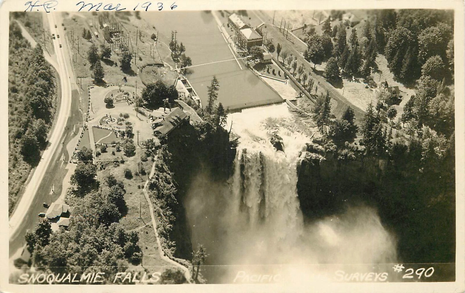
Since the company mostly produced cards of small Southern towns, I figured they must have licensed the photograph of Snoqualmie Fall. Another eBay auction revealed an answer. The same image used on the Graycraft postcard was labeled “Pacific Aerial Surveys #290.”

The front of this card contained the handwritten date of March 1936.
A second card contained a similar but faint “Pacific Aerial Surveys” label in the bottom right corner.
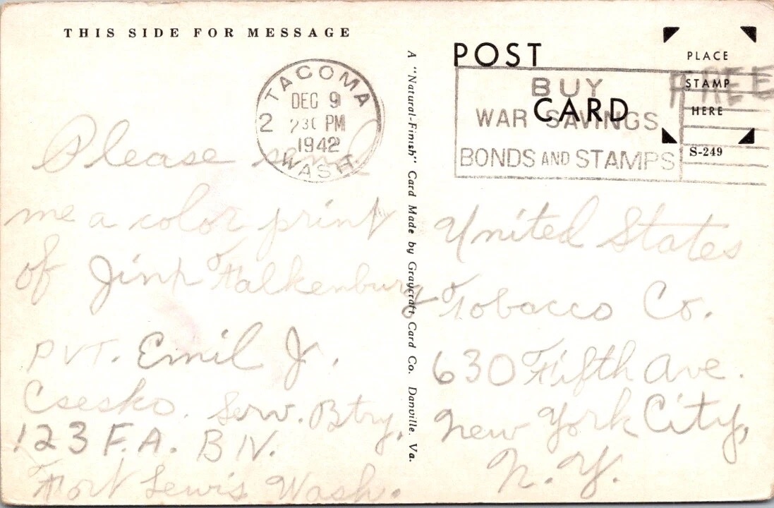
This card was postmarked on Dec. 9, 1942. Since the Graycraft Card Co. operated from 1939 to approximately 1954, we have to assume the card was produced during that time.
But what about the original aerial photograph? This is where the connection to Washington state and Norway intersect.
WHAT IS PACIFIC AERIAL SURVEYS, INC. OF SEATTLE, WASHINGTON?
Pacific Aerial Surveys, Inc. was launched in 1929 by Knute S. Melsom and his wife Inger-Marie. Born on April 29, 1897 in Vestby, Oslo Norway, Knute moved to Seattle in 1913 at the age of 15. Inger also moved from Norway to Washington state in 1920, but the couple didn’t know each other in their home country.
Knute learned to fly as an Army Air Corp cadet in 1918 and later served with the Air Force during World War II. He owned an automobile dealership on Bainbridge Island (also home to Kiana Lodge which was used as a Twin Peaks film location) before forming his aerial photography company.
On July 27, 1934, Melsom incorporated the aerial photography business for $5,000 with Floyd H. Backberg, and Clifford E. Hoof in Seattle, Washington for $5,000. Mrs. Melsom eventually served as the firm’s vice president as well as an architect. Knute was also member of the American Society of Photogrometry, an international organization.
By August 1935, Pacific Aerial Surveys were well engaged in photographing Washington. The Journal of San Juan Islands reported on August 29, 1935 that the company presented 60 aerial views of San Juan county to the Commercial Club which gave “an entirely new and different aspect to the various islands.”
In 1939, the company was contracted by AAA to make photographic maps of 6,715 square miles of Washington state farm lands in Whitman, Lincoln, Walla Walla, Douglas, Garfield, Yakima and Asotin counties. AAA hoped these aerial pictures would help identify under cultivated acreage on each farm. They were paid $15,645 (approximately $365,000 in 2025) to take pictures of farms.
Unlike the “panoramic” photo option on the iPhones of today, aerial panoramic photography worked slightly different in the mid-1900s according to the Whidbey News Times on Jan. 21, 1965
The cameras took from two to six pictures a mile with each negative overlapping the next. At 25,000 feet a camera with a six inch focal-length lens can cover an area of 40 square miles on one shot. Aerial survey maps are more complete than any other kind. It is possible to pick out gravel deposits, slides, swamps, and even soil condition by the type of vegetation growing in a area.
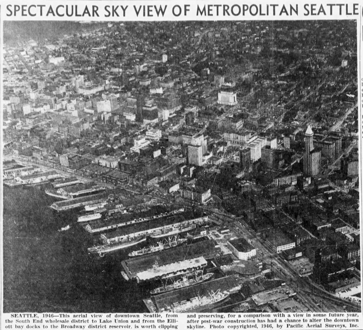
In the years that followed, the company would continue being contracted for aerial survey work by government agencies and other businesses, covering all parts of western United States, Canada and Alaska. They would also supply photography to local newspapers such as The Seattle Star, The Olympian, The News Tribune and The Kitsap Sun to name a few.
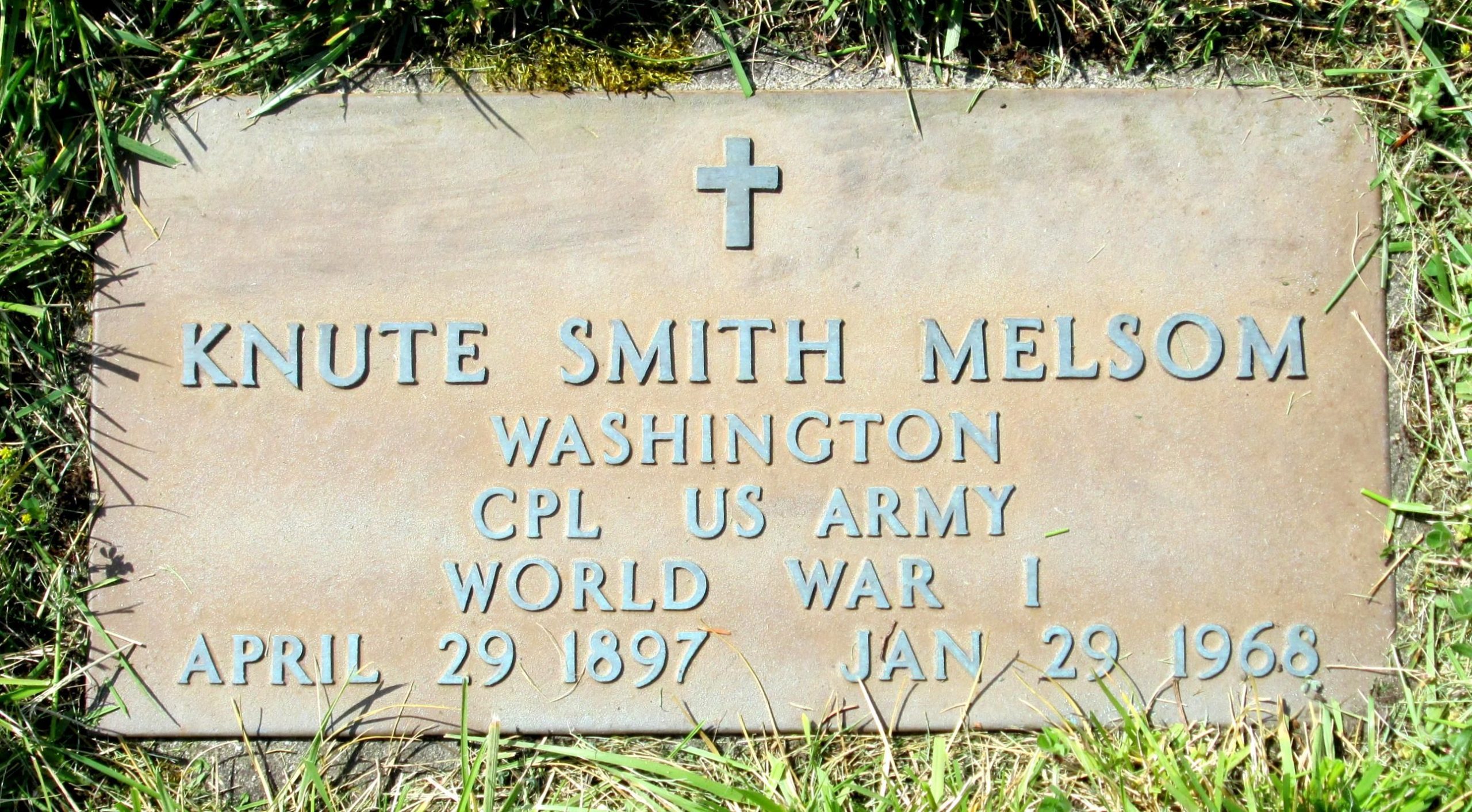
In 1963, the Melsoms retired and moved to Whidbey Island. Sadly, Knute passed suddenly at his home on January 29, 1968.
Their son Knute “Fred” Melsom took over the family business. In 1965, the firm owned “three airplanes and $75,000 worth of camera equipment” according to a Whidbey News Times article from January 21.
In 1974, Fred followed his dream to live and work in Anchorage, Alaska. According to his obituary, he purchased Big Red’s Flying Service, an air taxi service on Lake Hood and became a bush pilot. He returned to Seattle and worked as an aerial photo pilot for Burlington Northern. In 1987 Fred & wife Sylvia owned and operated Sound Aerial Surveys on Boeing Field for 16 years. He retired in 2004 and passed 10 years later on Sept. 14, 2014 at the age of 80.
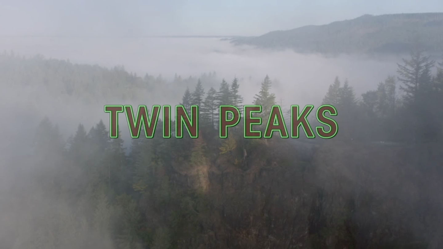
Today we have drone photography capable of capturing stunning image of Washington state’s wilderness (similar to the opening credits of Twin Peaks: The Return). But it’s neat to see how a talented Norwegian immigrant documented the wilderness and landscape for most of the 20th Century.
You can download high-resolution images of these postcards on my Flickr account – https://www.flickr.com/photos/aloha75/albums/72177720331531617
Author

Discover more from TWIN PEAKS BLOG
Subscribe to get the latest posts sent to your email.