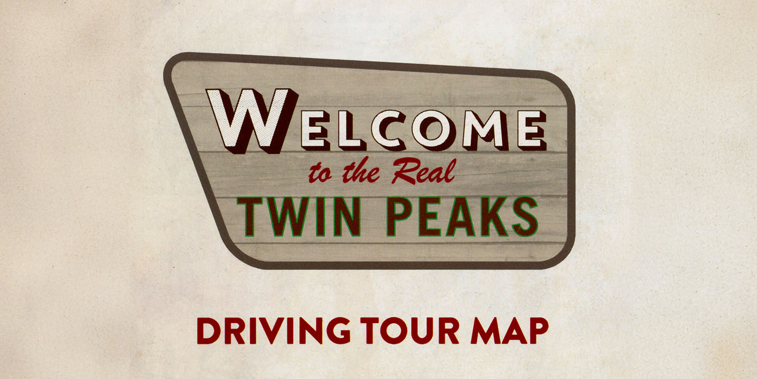
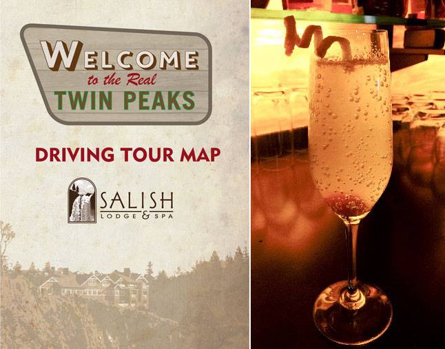
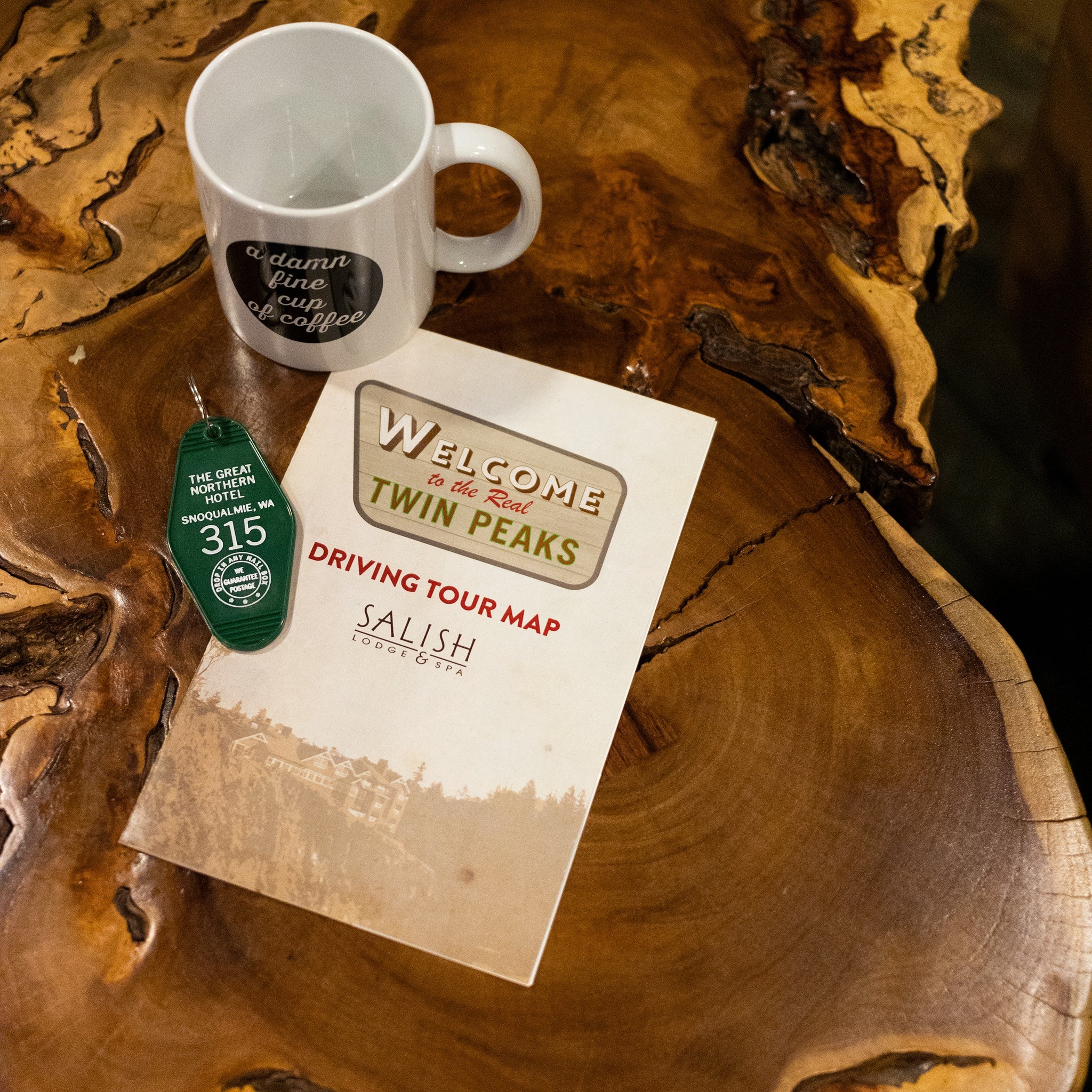
During the Real Twin Peaks 2025 event in Snoqualmie Valley, Washington, I stayed at the iconic Salish Lodge & Spa in Snoqualmie, Washington. Upon check-in, they provided me a copy of the their “Welcome To the Real Twin Peaks Driving Tour Map.” While you can find hundreds of film locations documented on Twin Peaks Blog, this map offers a nice summary for those seeking the greatest hits in Washington state.
THE GREAT NORTHERN ESCAPE PACKAGE AT SALISH LODGE & SPA
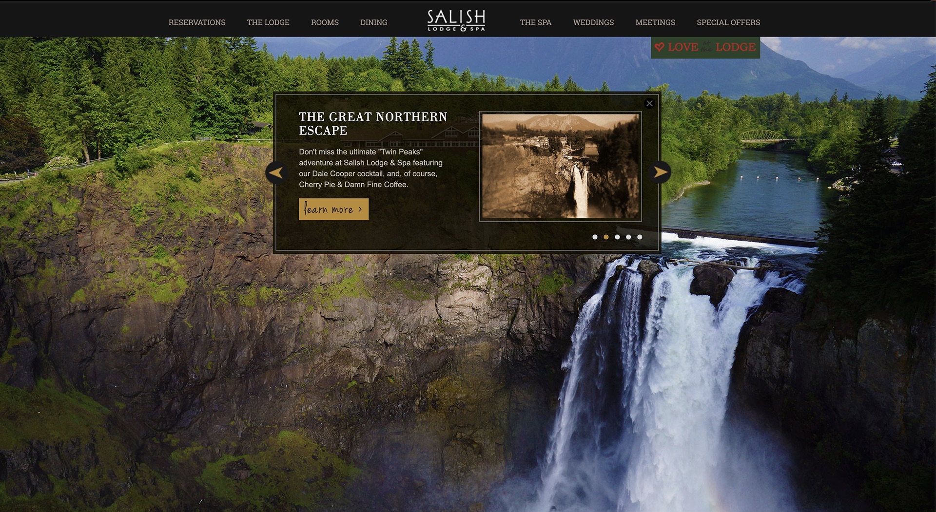
One of the earliest references I found for the driving tour map comes from the Columbia Hospitality Facebook page. In a post from Jan. 22, 2015, they announced a special “Twin Peaks” package which was called “The Great Northern Escape.” This package appeared on the main page of SalishLodge.com as a special offer. The Facebook post read:
Calling all Twin Peaks fans – Salish Lodge & Spa (a.k.a. The Great Northern) is offering an amazing package including Dale Cooper cocktails, Cherry Pie & Damn Fine Coffee, as well as a driving map of all things Twin Peaks in the area. Book your Great Northern Escape today!
The Great Northern Escape was the ultimate “Twin Peaks” adventure that included a map of all the show’s hot spots.
The cover of this map contains a similar image found on the map I received in 2025, except the Salish Lodge & Spa logo is from before their rebranding around 2019.
Rachel Belle from KIRO News Radio spoke with Rod Lapasin (who served as general manager of Salish Lodge from Sept. 2011 to Aug. 2016, for a March 17, 2015 article,
“[The special hotel package] comes with the driving map of the ‘Twin Peaks’ beautiful sites, cherry pie and a darn good cup of coffee. We have a specialty cocktail that comes with that, which is the Dale Cooper. And then a $15 gift card to be able to watch Season One, stream it in your room.”
Rachel noted Lapasin said “darn good” to which he responded, “It was damn good, it still is damn good, yep yep yep. Just making it family-friendly.”
He continued speaking about the fans who visit the Lodge and nearby Snoqualmie Falls.
“We’ve had people come up in costume, dressed as characters from the show, looking for pictures in front of the hotel with the falls in the background.”
So it appears this map was first created around 2015, just a few months after Mark Frost and David Lynch’s announcement that a third season would be made for Showtime. I can imagine the Lodge was capitalizing on the excitement from fans.
REAL TWIN PEAKS DRIVING TOUR MAP FROM SALISH LODGE & SPA | FRONT AND BACK COVER
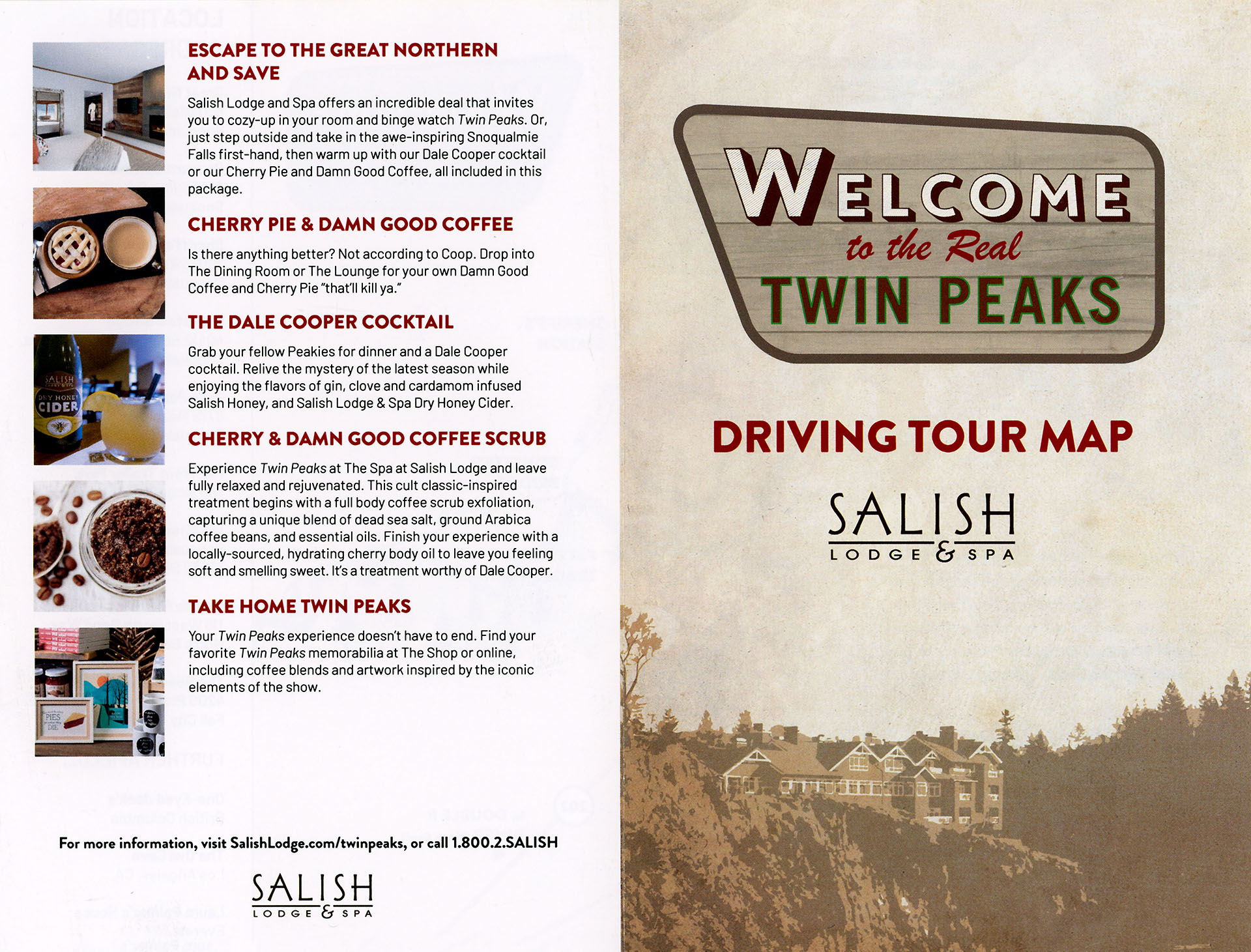
The front cover of the Welcome To the Real Twin Peaks Driving Tour Map contains a stylized logo floating over an image of the Salish Lodge.

The Salish Lodge & Spa logo that appeared on the cover of the original 2015 map was found on the hotel’s roadside sign through at least March 19, 2021 (which was the last time the sign was featured on the hotel’s Instagram account). I saw it during my first return to Snoqualmie Valley in Sept. 2019 following a 23-year hiatus.
By Nov. 3, 2021, the roadside sign logo was updated with a new logo that removed the Snoqualmie Falls image. This simplified “Salish Lodge & Spa” logo had already been used on other items throughout the resort such as merchandise bags and signage. I photographed the sign on Feb. 27, 2023 during the first Real Twin Peaks 2023 event.

Salish Lodge & Spa is owned by the Snoqualmie Tribe, and greets Lodge guests with a special land acknowledgement displayed within the hotel’s lobby. To learn more about how to support the Snoqualmie Tribe and help protect, respect and restore their lands, please visit the Snoqualmie Tribe Ancestral Lands webpage.
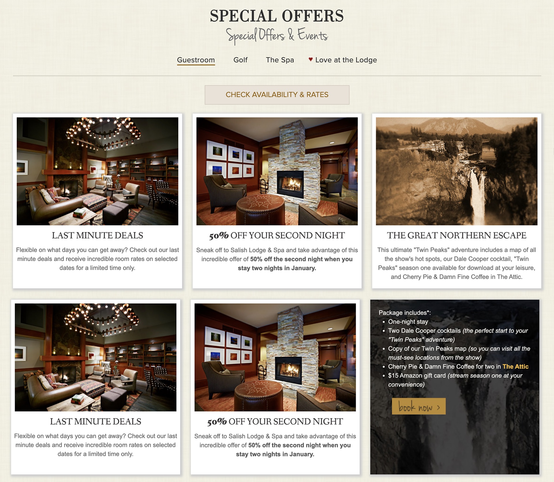
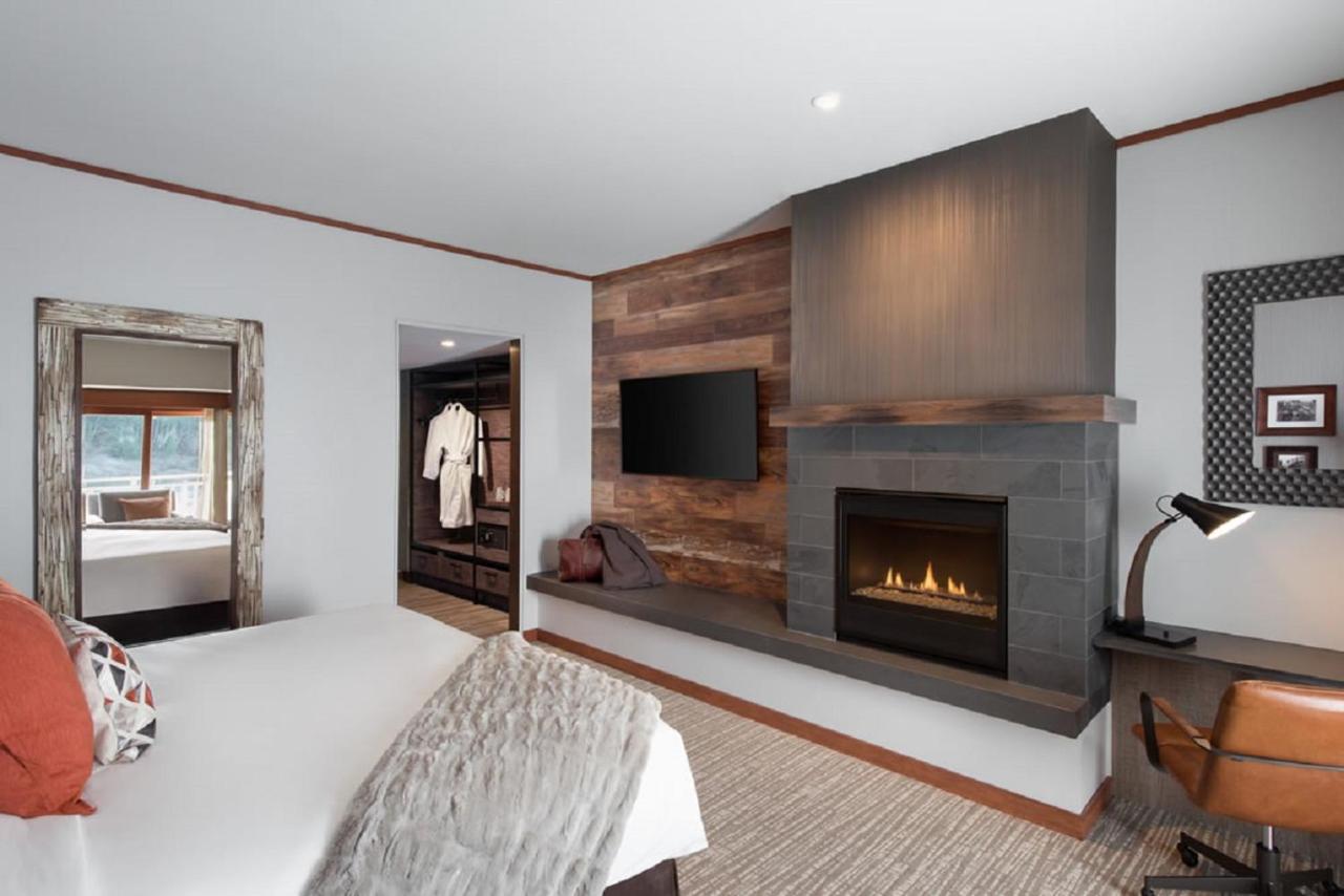
The back cover contains five points related to a stay at Salish Lodge & Spa. The first point features a look at renovated guest rooms. The $12 million remodel began in October 2017 and was completed on July 2, 2018. Based on concepts by Betty Blount of Seattle’s Zena Design Group, this was the largest overhaul of the Lodge’s 86 rooms since its first major expansion in 1988.
ESCAPE TO THE GREAT NORTHERN AND SAVE
Salish Lodge and Spa offers an incredible deal that invites you to cozy-up in your room and binge watch Twin Peaks. Or, just step outside and take in the awe-inspiring Snoqualmie Falls first-hand, then warm up with our Dale Cooper cocktail or our Cherry Pie and Damn Good Coffee, all included in this package.
The driving map mentions the “Escape to the Great Northern” package yet it doesn’t seem like that package was available when I received the map in early 2025.
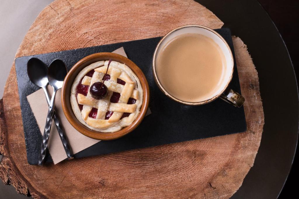
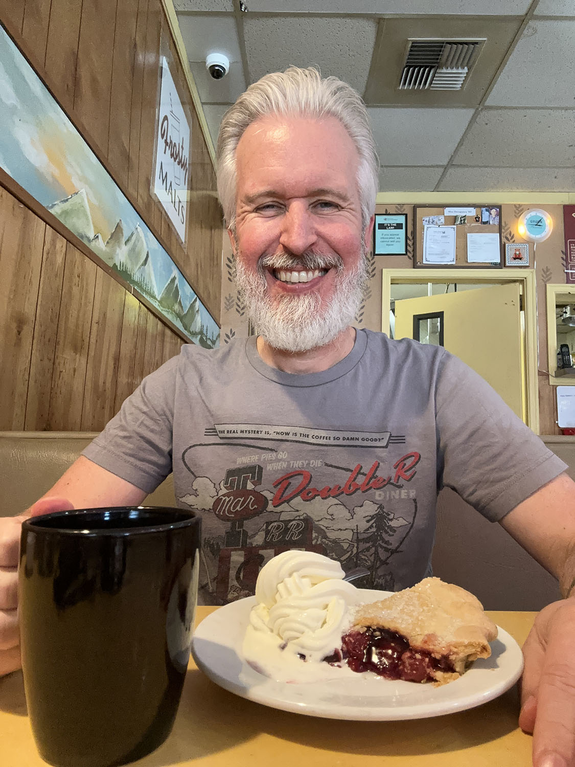
CHERRY PIE & DAMN GOOD COFFEE
Is there anything better? Not according to Coop. Drop into The Dining Room or The Lounge for your own Damn Good Coffee and Cherry Pie “that’ll kill ya.”
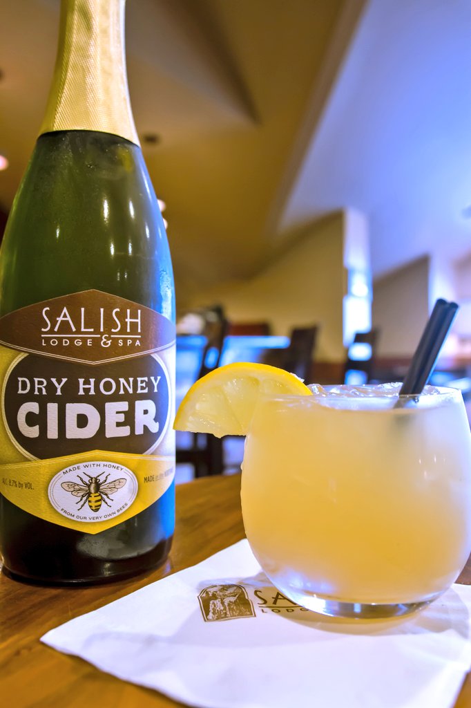
THE DALE COOPER COCKTAIL
Grab your fellow Peakies for dinner and a Dale Cooper cocktail. Relive the mystery of the latest season while enjoying the flavors of gin, clove and cardamom infused Salish Honey, and Salish Lodge & Spa Dry Honey Cider.
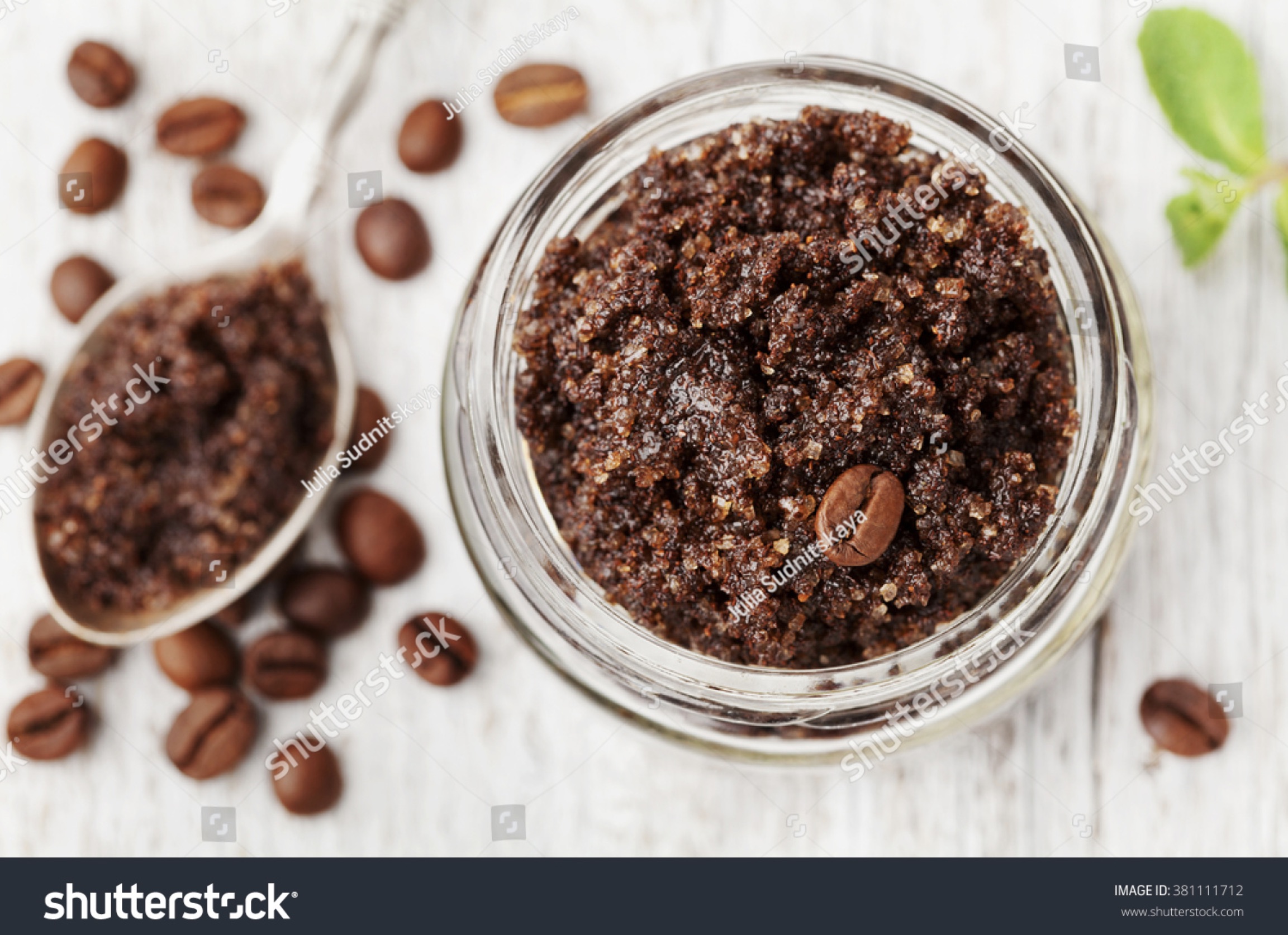
CHERRY & DAMN GOOD COFFEE SCRUB
Experience Twin Peaks at The Spa at Salish Lodge and leave fully relaxed and rejuvenated. This cult classic-inspired treatment begins with a full body coffee scrub exfoliation, capturing a unique blend of dead sea salt, ground Arabica coffee beans, and essential oils. Finish your experience with a locally-sourced, hydrating cherry body oil to leave you feeling soft and smelling sweet. It’s a treatment worthy of Dale Cooper.
The Shutterstock image was uploaded by Julia Sudnitskaya on Feb. 23, 2016. The caption reads, “Body scrub of ground coffee, sugar and coconut oil in glass jar on white rustic table, homemade cosmetic for peeling and spa care, top view
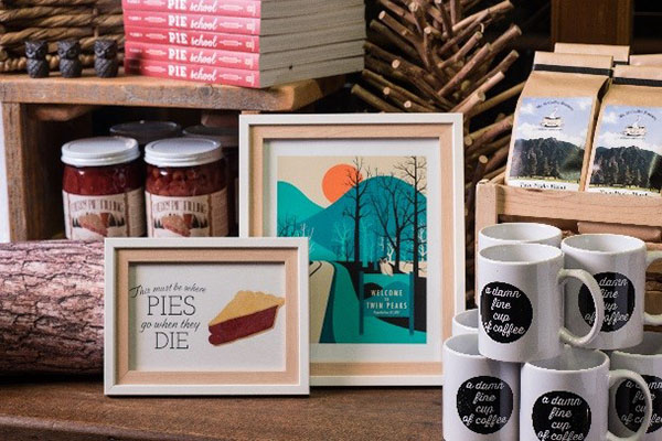
TAKE HOME TWIN PEAKS
Your Twin Peaks experience doesn’t have to end. Find your favorite Twin Peaks memorabilia at The Shop or online, including coffee blends and artwork inspired by the iconic elements of the show.
The map also contains a special URL to learn more about the Twin Peaks package, yet the link appears to be defunct as of 2025.
REAL TWIN PEAKS DRIVING TOUR MAP FROM SALISH LODGE & SPA | MAP
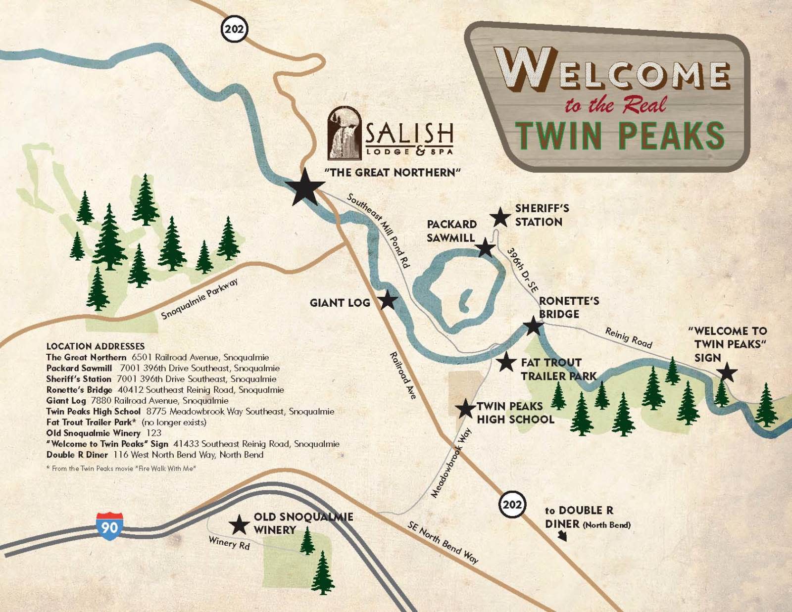
Thanks to an article by Margaret Seiler for PDXMonthly.com on April 15, 2015, I found an image of the original 2015 driving map. It contains a few points of note.
- The Fat Trout Trailer Park location is on the wrong side of Meadowbrook Way. It should be north of Twin Peaks High School. The star on the map indicates the former location of Mo’s Motors from Twin Peaks: Fire Walk With Me
- The Old Snoqualmie Winery address is incomplete, only listing “123.” The location is known as Snoqualmie Point Park and is located at 37580 Winery Road in Snoqualmie.
- The Double R Diner address is listed as 116 West North Bend Way, which is the building across the street from Twede’s Cafe. The correct address is 137 West North Bend Way in North Bend.
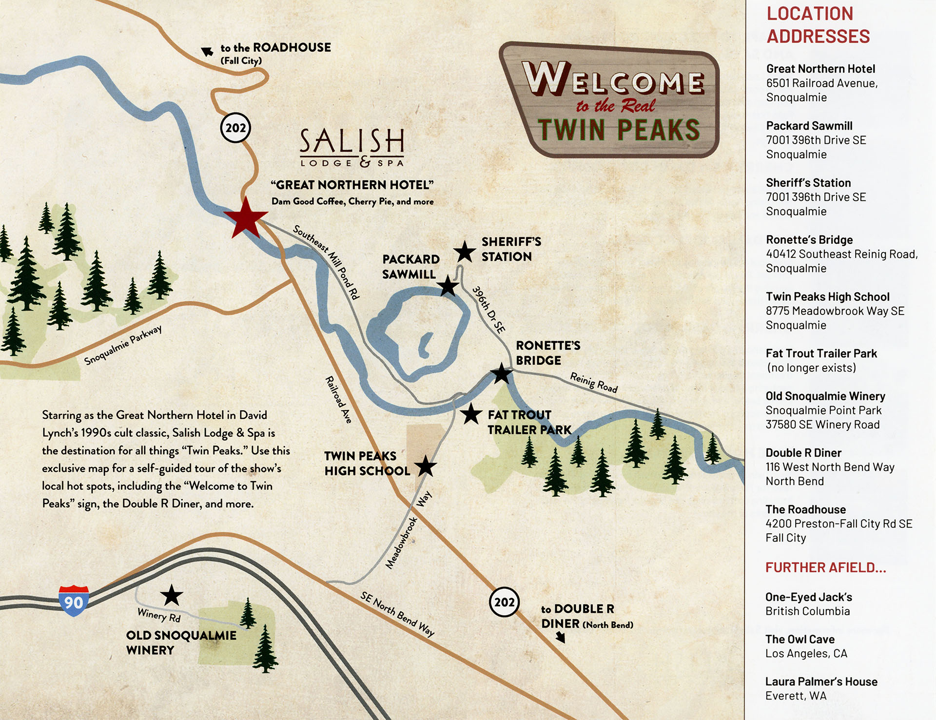
The updated map contains some additional locations not featured on the original map such as The Roadhouse, Owl Cave and Laura Palmer’s House in Everett, WA. The following description is printed on the map where the addresses were once printed:
Starring as the Great Northern Hotel in David Lynch’s 1990s cult classic, Salish Lodge & Spa is the destination for all things “Twin Peaks.” Use this exclusive map for a self-guided tour of the show’s local hot spots, including the “Welcome to Twin Peaks” sign, the Double R Diner, and more.
The Salish Lodge & Spa logo was also updated and a small caption was added, “Dam [sic] Good Coffee, Cherry Pie and more.” The Welcome to Twin Peaks Sign Spot location, however, is missing from this map (which is extremely odd to omit such an iconic location).
REAL TWIN PEAKS LOCATION ADDRESSES
Here is a closer look at the featured locations along with links to article and directions via Google Maps.
GREAT NORTHERN AND WHITE TAIL FALLS
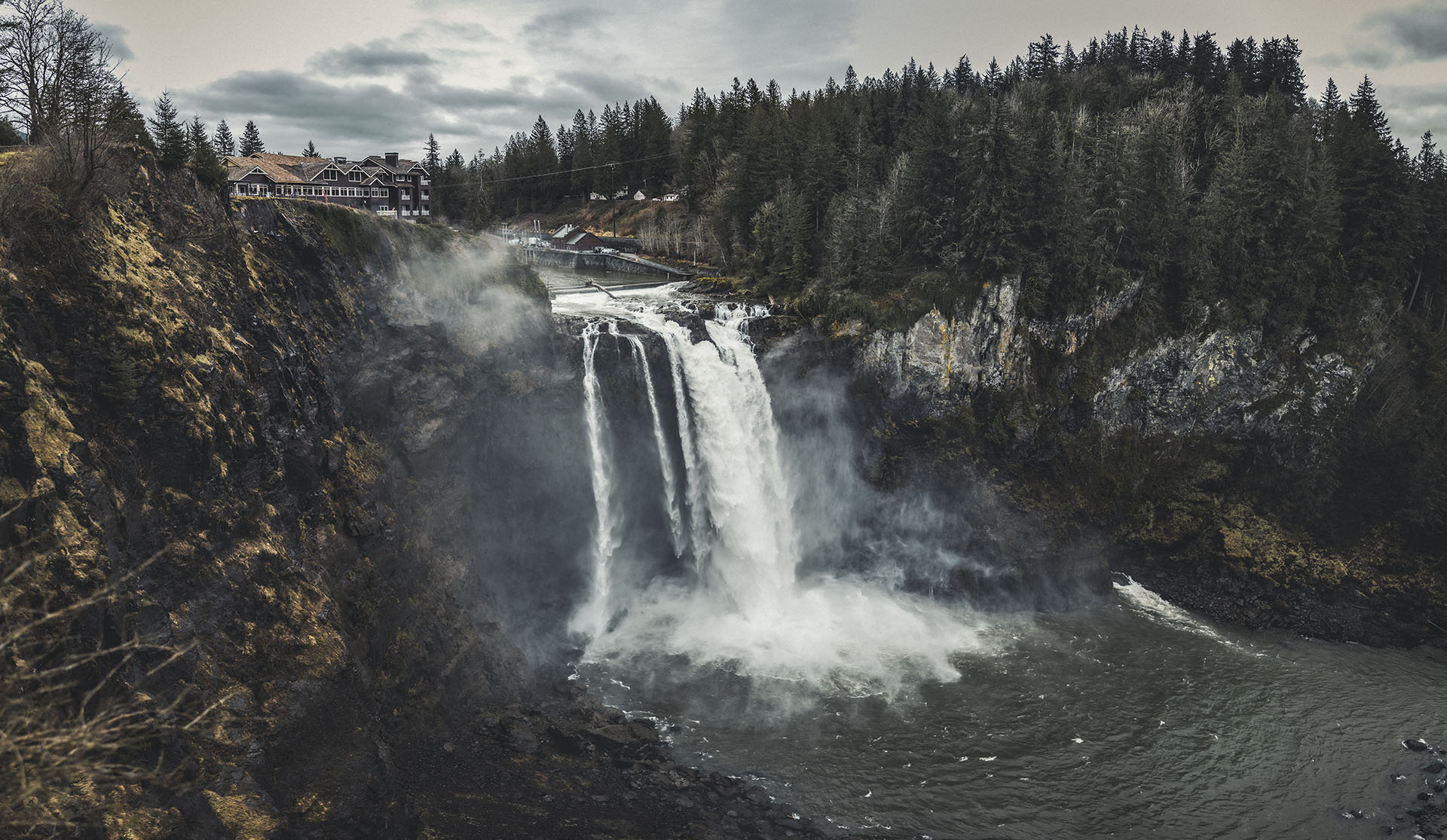
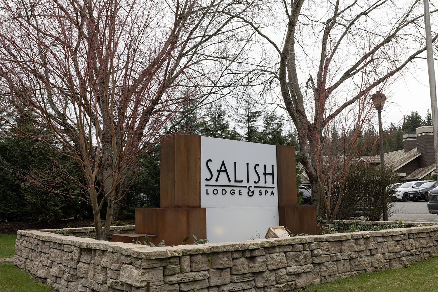
Great Northern Hotel (Salish Lodge & Spa) and White Tail Falls (Snoqualmie Falls) are located at 6501 Railroad Avenue in Snoqualmie. The Lodge originally opened in 1916 as Snoqualmie Falls Lodge, a eight-room roadside stop known for their hearty breakfasts. In 1988, the Lodge was expanded to a 91 room destination and renamed Salish Lodge. A spa was added in 1996 and renamed Salish Lodge & Spa. The Snoqualmie Tribe assumed ownership of the lodge and surrounding area in 2019.
Snoqualmie Falls see more than 2 million visitors a year and is believe to be the birthplace of the Snoqualmie People. The 268-foot waterfall is 10 feet higher than Niagara Falls.
THE GIANT LOG

The Giant Log, known as the Centennial Log in downtown Snoqualmie, is not included in the more recent map. This log was featured in the opening credits for the pilot and episode 2.001 and is located at 7864 Washington 202. The approximate coordinates are 47°31’48.5″N 121°49’34.9″W.
Snoqualmie Mayor Charles Peterson dreamed of displaying this giant log as an icon for the town. It was installed in August 1979 and remained uncovered for more than a decade. As Snoqualmie’s Centennial Celebration approached at the end of the 1980s, protecting the log became a community effort with funds being provided by townsfolk, businesses and even producers of Twin Peaks. Construction on the cover found at the site today started in 1989 and a roof was completed by 1992.
PACKARD SAWMILL AND SHERIFF’S STATION
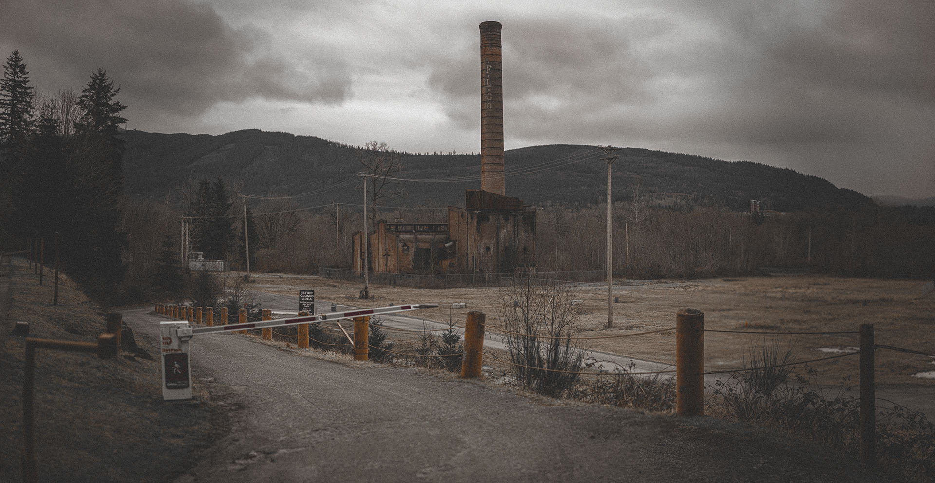
The Packard Sawmill and Twin Peaks Sheriff’s Station is located at Dirtfish Rally School, located at 7001 396th Drive SE in Snoqualmie. All that is left of the former Snoqualmie Fall Lumber Company is a smoke stack and a small brick structure of Mill #1. This would have been the view seen in the opening credits of Twin Peaks. The mill
Snoqualmie Falls Lumber Company cut its first log at the second all-electric lumber mill in the United States that opened in 1917. It was more than just a sawmill as the company established the town of Snoqualmie Falls located across the river and up a hill from Snoqualmie. At its peak, the mill town included 250 homes, a hotel, community center, 50-bed hospital, barber shop, grade school, boarding house for single men and eight bunkhouses built for Japanese workers.
Weyerhaeuser operated two mills on the site until 1961 when Mill #2 closed just a few years after they opened a plywood plant in 1959. Operations continued for decades that followed until May 5, 1988 when Weyerhaeuser announced the Snoqualmie Mill would close permanently sometime between February and April 1989. The former Plywood Plant on the mill property caught fire in Feb. 1989 and burned down. It’s the destroyed mill seen in footage from Twin Peaks episode 2.001.
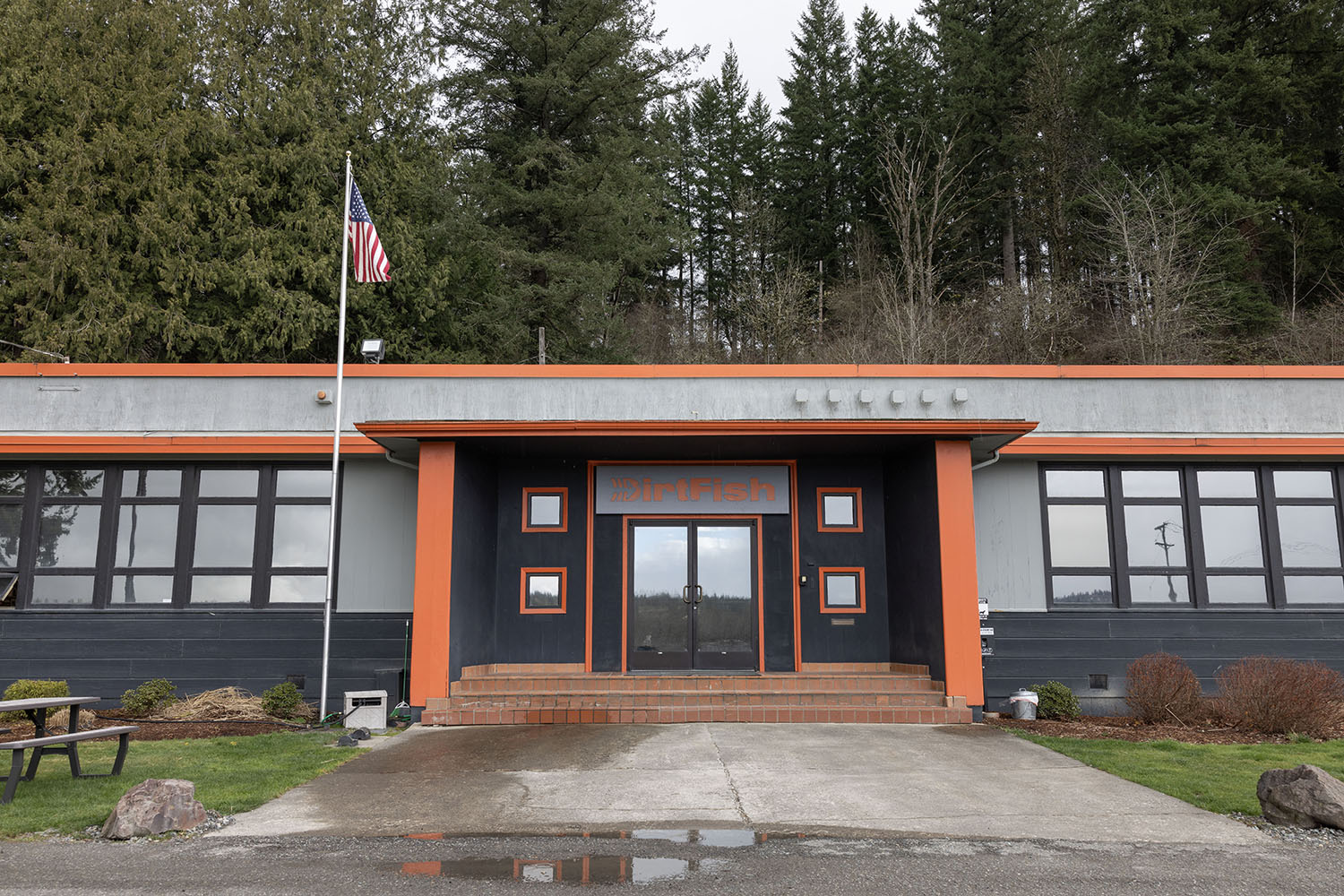
DirtFish Rally School is home to the film location for the Twin Peaks Sheriff’s Department. This building, constructed around 1948, is the former administrative office for Weyerhaeuser’s Snoqualmie Lumber Mill. Outside, the DirtFish team has parked a replica Twin Peaks Sheriff’s Department Ford Bronco. Inside, you can explore scenes from the pilot and Twin Peaks: The Return. They are also selling pieces of Lucy Brennan’s desk from the third season and a pin set with icons from the location.
RONETTE’S BRIDGE
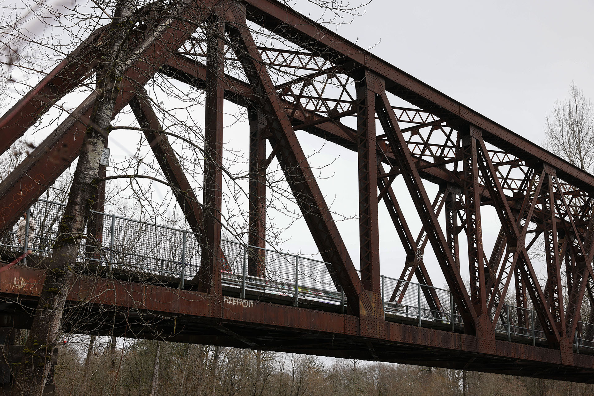
Ronette’s Bridge is located at 40412 Southeast Reinig Road in Snoqualmie. Constructed in 1916, the bridge was part of the Chicago, Milwaukee, St. Paul & Pacific’s Everett Branch (CMStP&P) railroad. The railroad track once crossed Reinig Road and terminated at the nearby Snoqualmie Falls Lumber Company. Today, this bridge is part of the 32-mile Snoqualmie Valley Trail.
WELCOME TO TWIN PEAKS SIGN SPOT
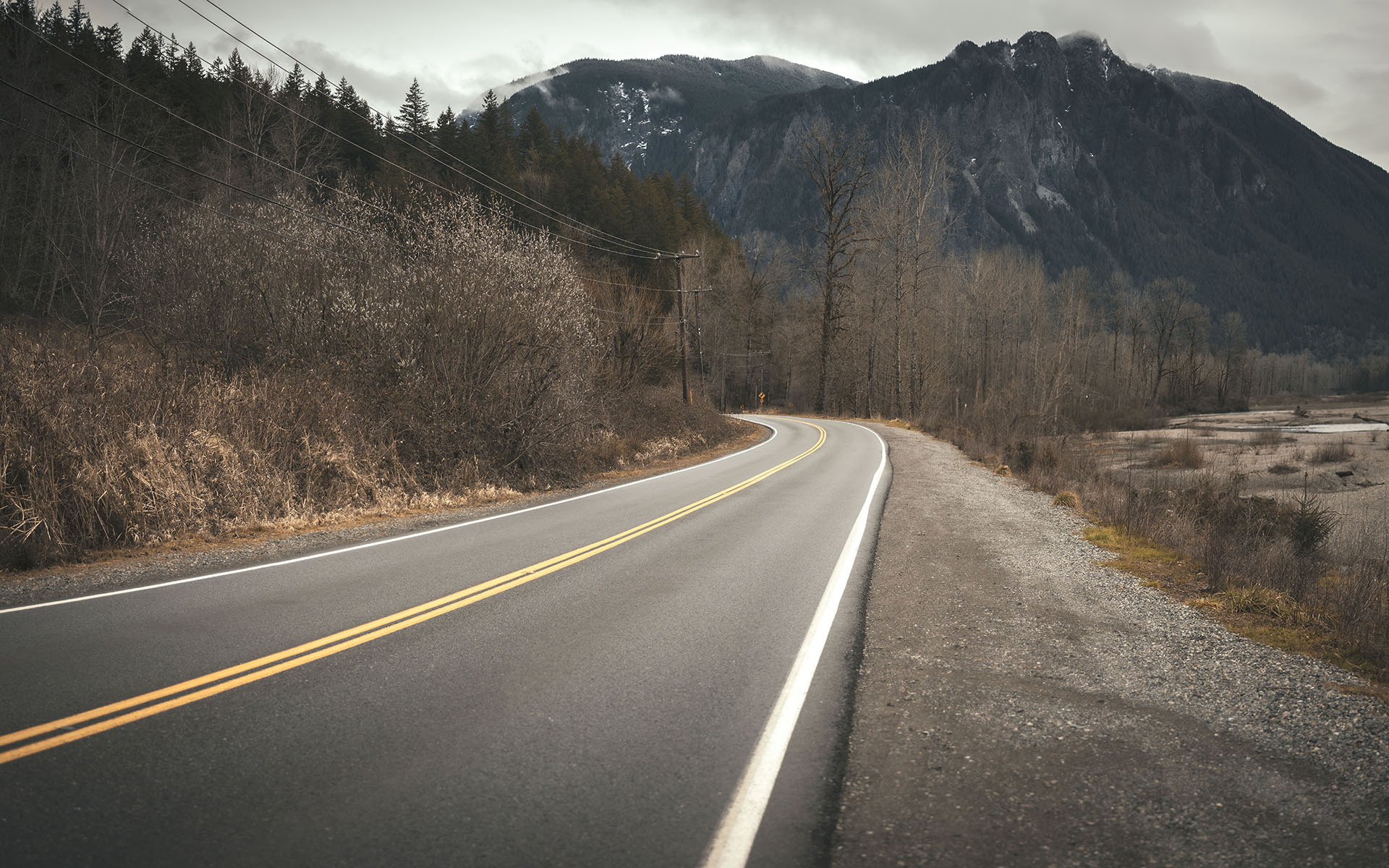
While the Welcome to Twin Peaks sign spot was found on the map in 2015, it was not included on the more recent version. The approximate coordinates for this location along Reinig Road in Snoqualmie are 47.525452, -121.785446. The road was named after the Reinig family who moved to the region in the late 1800s.
In 2023, King County did a revetment project to ensure that the nearby Snoqualmie River wouldn’t wash away the road. This meant clearing out trees along the right side of the road and relocating utilities to the opposite side of the street.
TWIN PEAKS HIGH SCHOOL
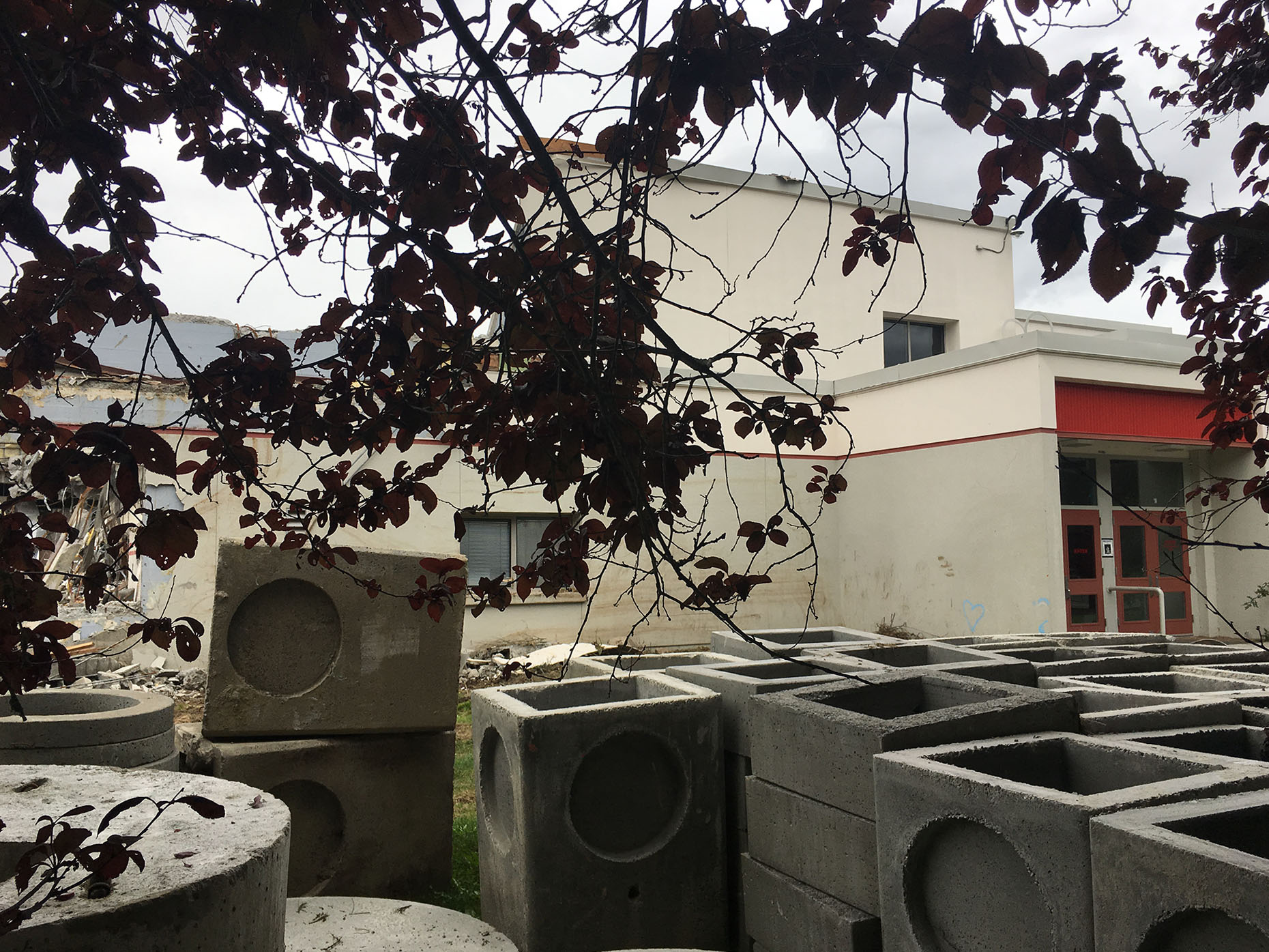
For the Pilot episode, Mount Si High School served as the film location for Twin Peaks High School. Located at 8651 Meadowbrook Way SE in Snoqualmie, Washington, the high school was used as the exterior establishing shot in the first two seasons. Several interior scenes were also shot here including scenes in the hallway, classroom, courtyard, reception lobby and the library.
As the population of Snoqualmie Valley grew, coupled with continued flooding from the nearby Snoqualmie River, there was a need for a bigger and more modern high school. The original high school closed on June 14, 2019, with demolition beginning on July 5.
FAT TROUT TRAILER PARK
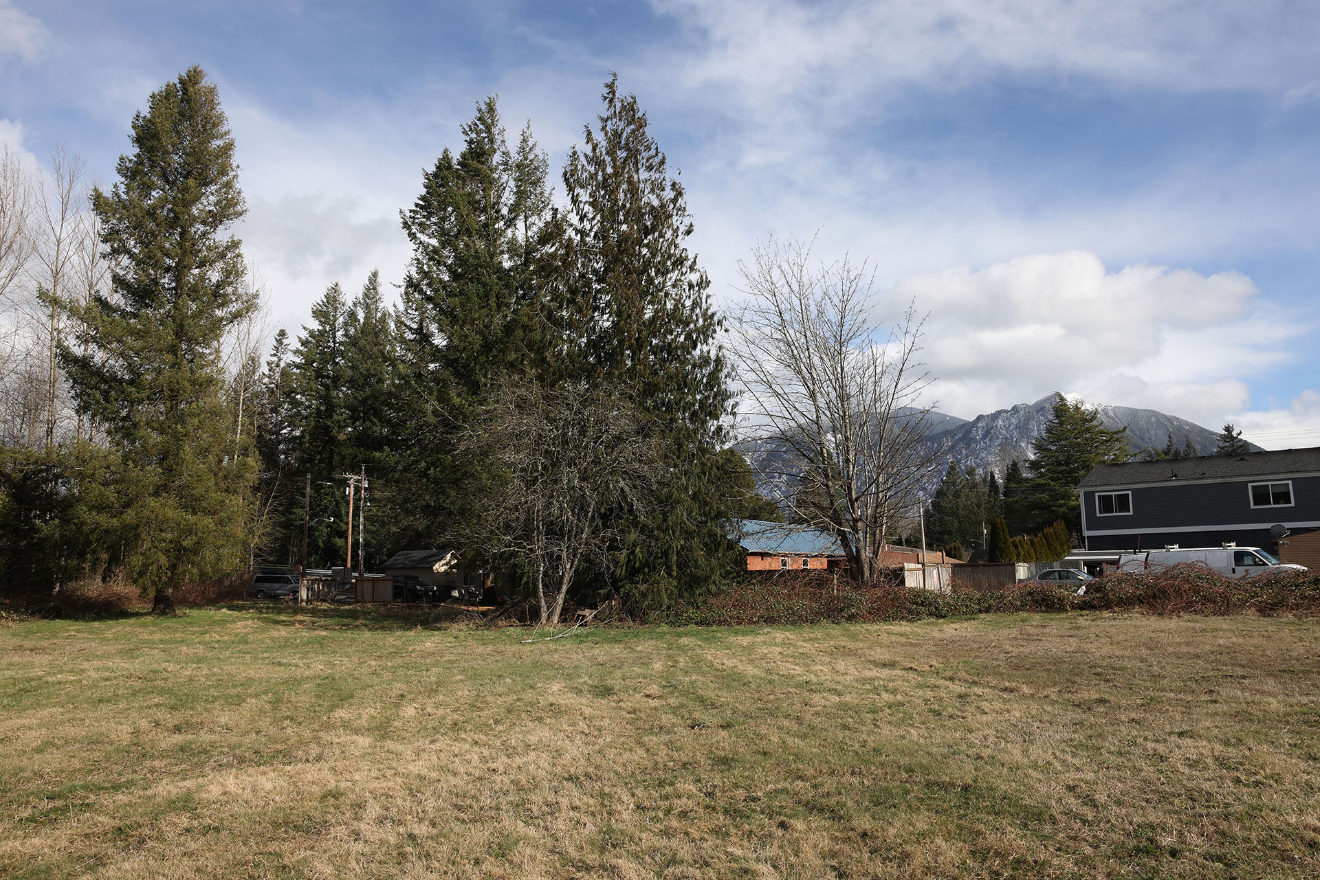
The Riverside Mobile Home Park was the location of the Fat Trout Trailer Park from Twin Peaks: Fire Walk With Me. This spot is found at 39531 SE Park Street in Snoqualmie. Once occupied by the father of Snoqualmie Valley, Jeremiah Borst in the late 1800s, the trailer park may have been established around 1985. It was the first location filmed for Lynch’s feature film on Sept. 4-5, 1991.
Following repeated issues with flooding from the nearby Snoqualmie River, FEMA gave $1.1M in funding on Nov. 24, 2009 to “permanently eliminate the risk to people from flooding by purchasing repetitively flooded and substantially damaged properties, and relocating the current residents to new housing.” The 20 mobile homes and other structures would be demolished by Feb. 2011.
OLD SNOQUALMIE WINERY – MOUNTAIN OVERLOOK

Located at 37580 SE Winery Road, the Old Snoqualmie Winery, known today as Snoqualmie Point Park, was the location for the Mountain Overlook. This is where James Hurley broods with Laura’s half heart necklace, spot of the Donna and Laura picnic scene and various wide shots of snowcapped mountains.
Before it was a park, this location was home to the Snoqualmie Winery which ceased operations in 1991. Jim and Dari Aker formed the Snoqualmie Point partnership and purchased the winery company’s lease. This lease included the old winery building that the couple used as a wedding and banquet hall venue for about two years. Sadly, on February 13, 1999, Mr. Aker discovered the winery building was on fire while showing a couple the venue.
In the late 1990s, the location almost became an eight building office complex complete. With the help of Mountains to Sound Greenway Trust and a partnership of government officials, agencies, The Trust for Public Land and citizens, development plans were stoped and the area was designated as a City of Snoqualmie park. It was officially opened on October 27, 2007 at 9:30 a.m.
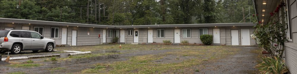
DOUBLE R DINER
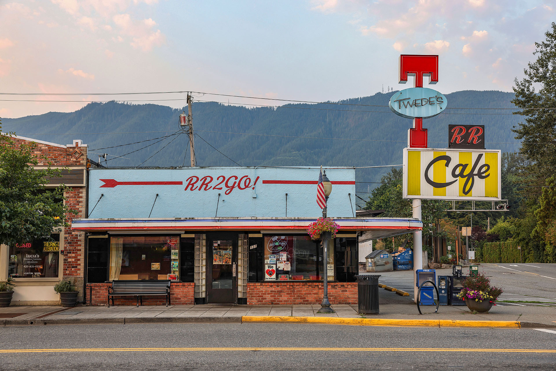
The small town restaurant that served as the Double R Diner in Twin Peaks originally opened in 1941 by Roy Thompson as Thompson’s Cafe but was renamed to Mar-T Cafe ten years later. Located at 137 W North Bend Way in North Bend, Mr. Kyle Twede purchased the restaurant in 1997 from Pat Cokewell who owned the establishment for 21 years.
On Twin Peaks Day 2020, Rachel and Max, the new owners of Twede’s Cafe shared the news they were taking over the iconic restaurant from Kyle Twede. Since then, they have pour an incredible amount of love into the restaurant, especially during one of the most challenging times in recent years. This is a must see destination during any visit to the real Twin Peaks!
THE ROADHOUSE

The Roadhouse Restaurant & Inn is located at 4200 Preston Fall City Road SE in Fall City. All of the exteriors (excluding one small part in episode 1.003) were shot at this location. The interiors were shot in a couple of different spots in Washington state and southern California.
Paul Holden built the original single-story Riverside Tavern at this site in 1925, near Riverside Campgrounds and a dance pavilion. Owner Mae Brown added a second story with guest rooms and changed the name to Riverside Tavern and Lodge in 1933. In 1966, Ed DeGrace acquired the building, did some remodeling, and changed the name to the Colonial Inn, a restaurant enjoyed by the community for over twenty years.
Scott Krahling of Sammamish and Charlie Kellogg of Fall City then purchased the building and business in 2005. After extensive refurbishing, they opened in 2008 as the Fall City Roadhouse. Long-time employees Cynthia Heyamoto and John Manning purchased the Roadhouse in 2018. You can actually stay here on the second floor. I highly recommend it as it was reasonably priced and such a unique spot to visit.
TWIN PEAKS LOCATION FURTHER AFIELD…
The more recent driving map from Salish Lodge included three additional locations for One-Eyed Jacks, The Owl Cave and Laura Palmer’s House.
ONE-EYED JACKS
The driving map mentions One Eyed Jacks was located in British Columbia which isn’t accurate. For location shots in the first season, the crew used a private home (and dock) located in Maibou Lake Mountain Club in Agoura Hills, California.

Other interior scenes were shot on a set built at City Studios (now Occidental Studios) in Van Nuys, California.
THE OWL CAVE
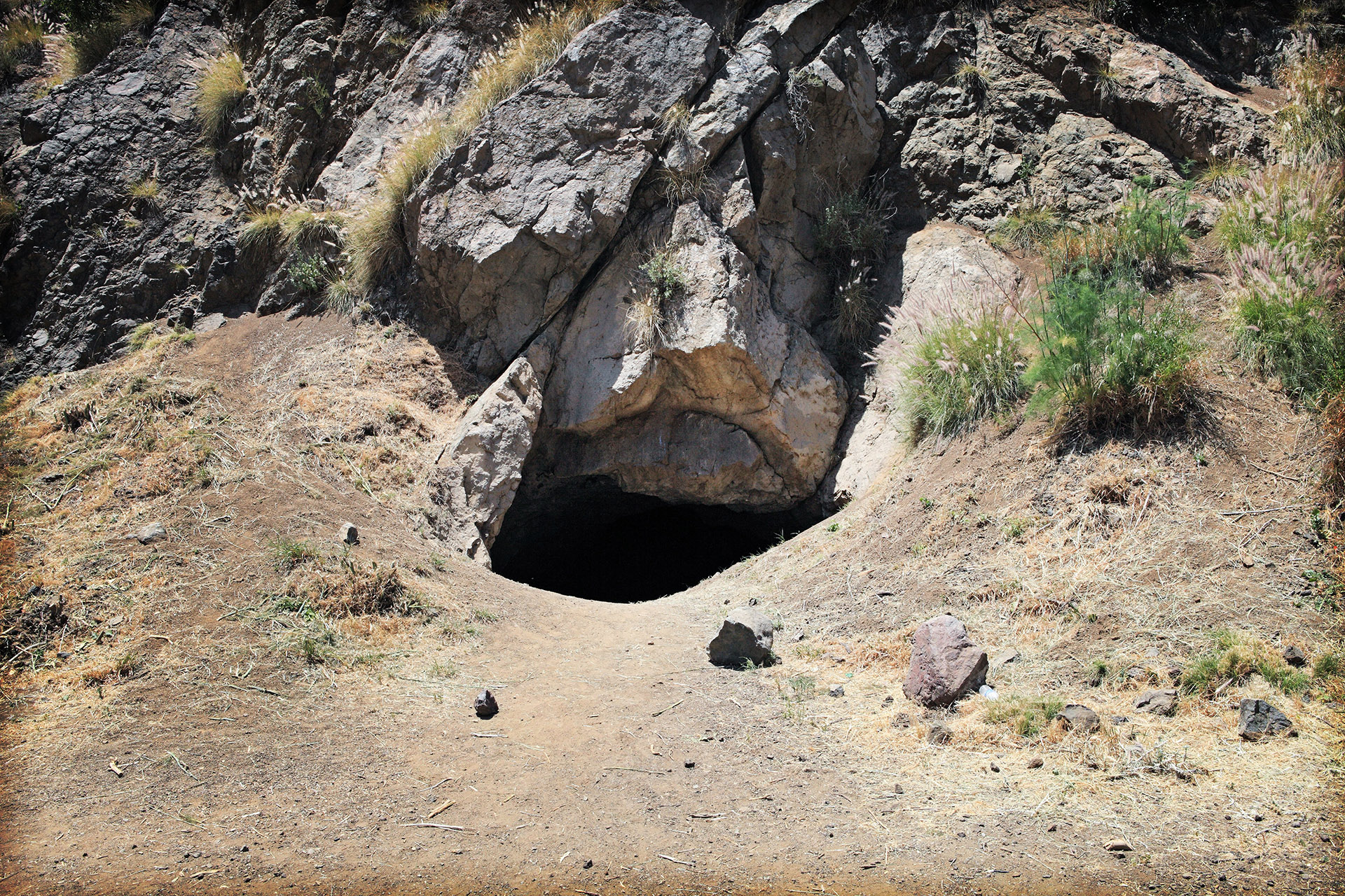
Owl Cave is actually Bronson Cave located in Bronson Canyon at 3200 Canyon Drive in Los Angeles, California. The approximate coordinates for this location are 34°07’16.0″N 118°18’49.4″W. The cave is located in the southwest section of Griffith Park making it easily accessible from Hollywood.
It’s difficult to list the number of shows and films shot here which includes Invasion of the Body Snatchers, The Searchers, Robot Monster, and the 1966 Batman television show. SecretTimes.com has an even more extensive list here.
Sadly the cave entrance is now closed to the public due to safety concerns. Yet you can still see the exterior of this mysterious location.
LAURA PALMER’S HOUSE

Much like the “two Chalfonts” at the Fat Trout Trailer Park, two houses were used for the Palmer House in Washington – an exterior of one in Monroe, Washington and the interior and exterior of another in Everett, Washington. The latter was seen extensively in Twin Peaks: Fire Walk With Me and Twin Peaks: The Return. The Monroe house exterior only appears in the first two seasons of the show.

In Everett, the home is owned by Mary Reber who played Mrs. Tremond in Part 18. You can visit the house by booking a tour a VisitPalmerHouse.com. I highly recommend this tour as Mary is truly an angel in our Twin Peaks fan community.
Download high-resolution images of Twin Peaks maps on my Flickr account – https://www.flickr.com/photos/aloha75/albums/72177720326508148
I love finding and collecting this kind of ephemera from the show I adore. If you have a different version of this map not pictured above, please let me know in the comments below or contact me at TheTwinPeaksBlog@gmail.com
Author
Discover more from TWIN PEAKS BLOG
Subscribe to get the latest posts sent to your email.
Thank you for all of the time and effort you put in to bring these little TP gems to us. We appreciate your thoughtful work and unfailing dedication.
See you in the trees!
RR
@Rachel – Thank you for the kind words! It’s a joy sharing my interests (or is that obsession?) with others who love the show like I do.
You put so much effort into this and it’s a blast reading about your findings. Like Rachel said, thank you!