In Twin Peaks Part 11 on Showtime, Bill Hastings leads FBI Agents Cole, Rosenfield and Preston along with Buckhorn Detective Macklay to the location where he claims to have seen Major Briggs. The address for the location is 2240 Sycamore in Buckhorn, South Dakota. But where was the scene filmed for the series?
WHERE IS THE ZONE FROM PART 11 LOCATED?
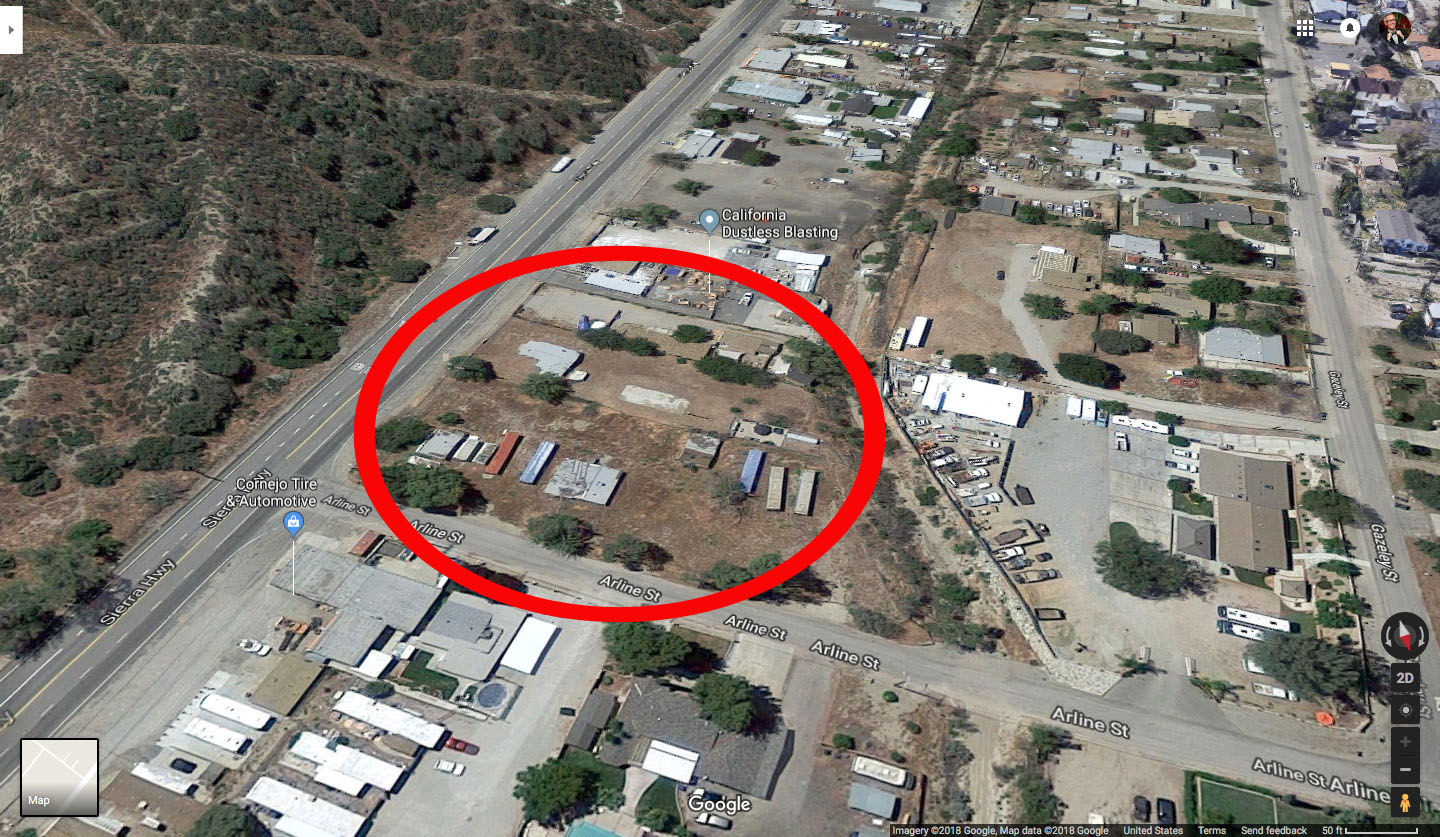
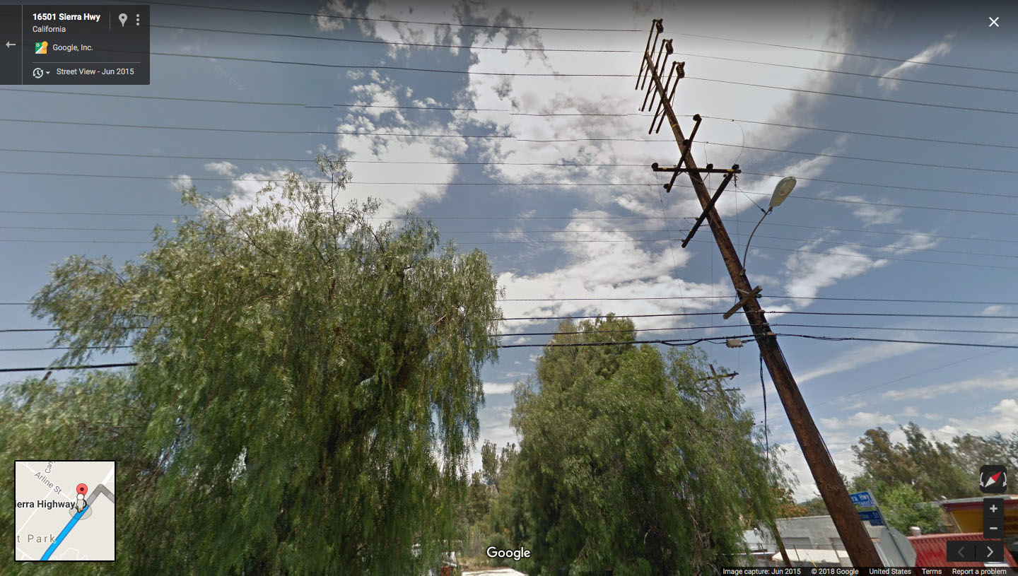
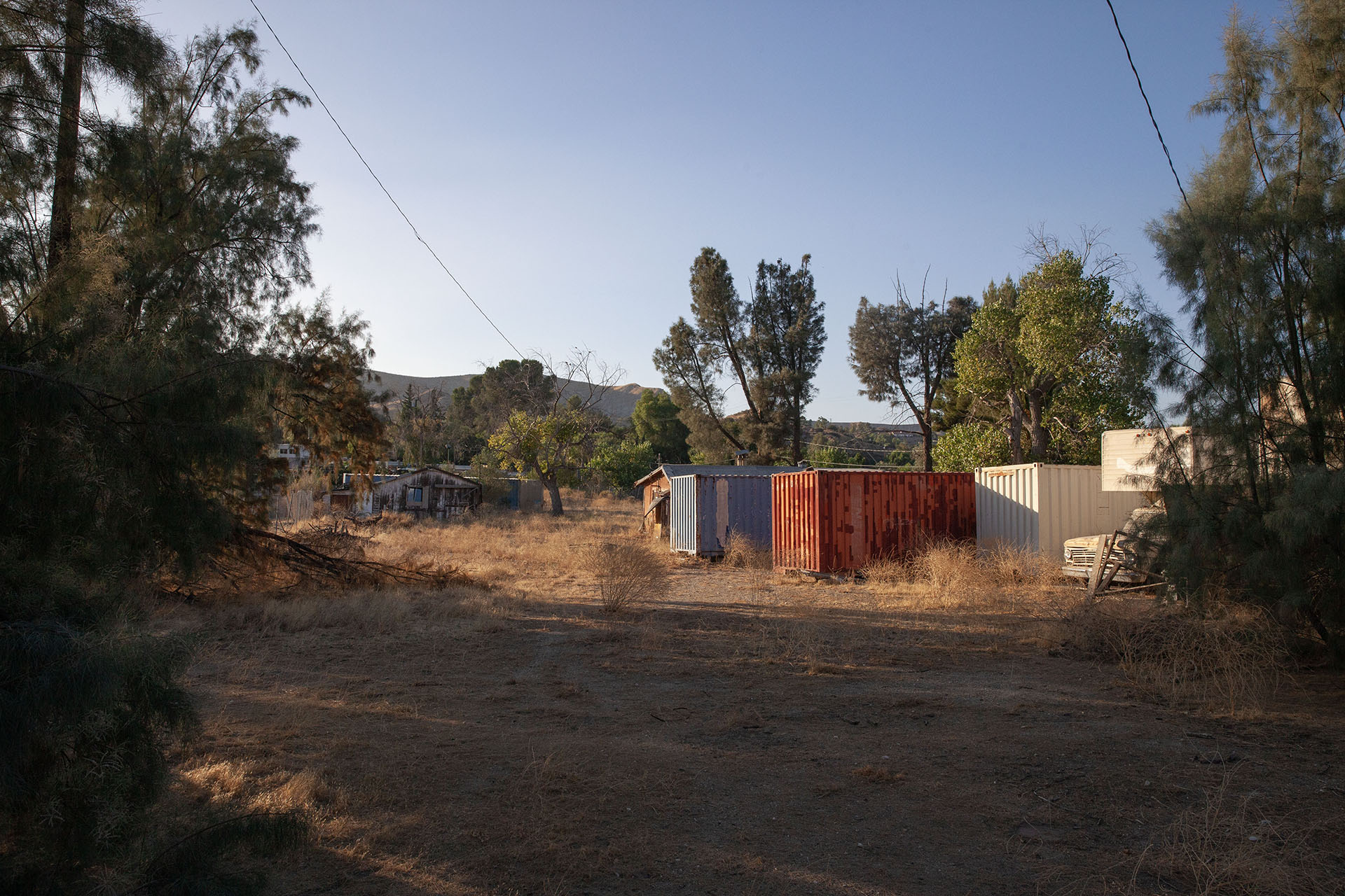
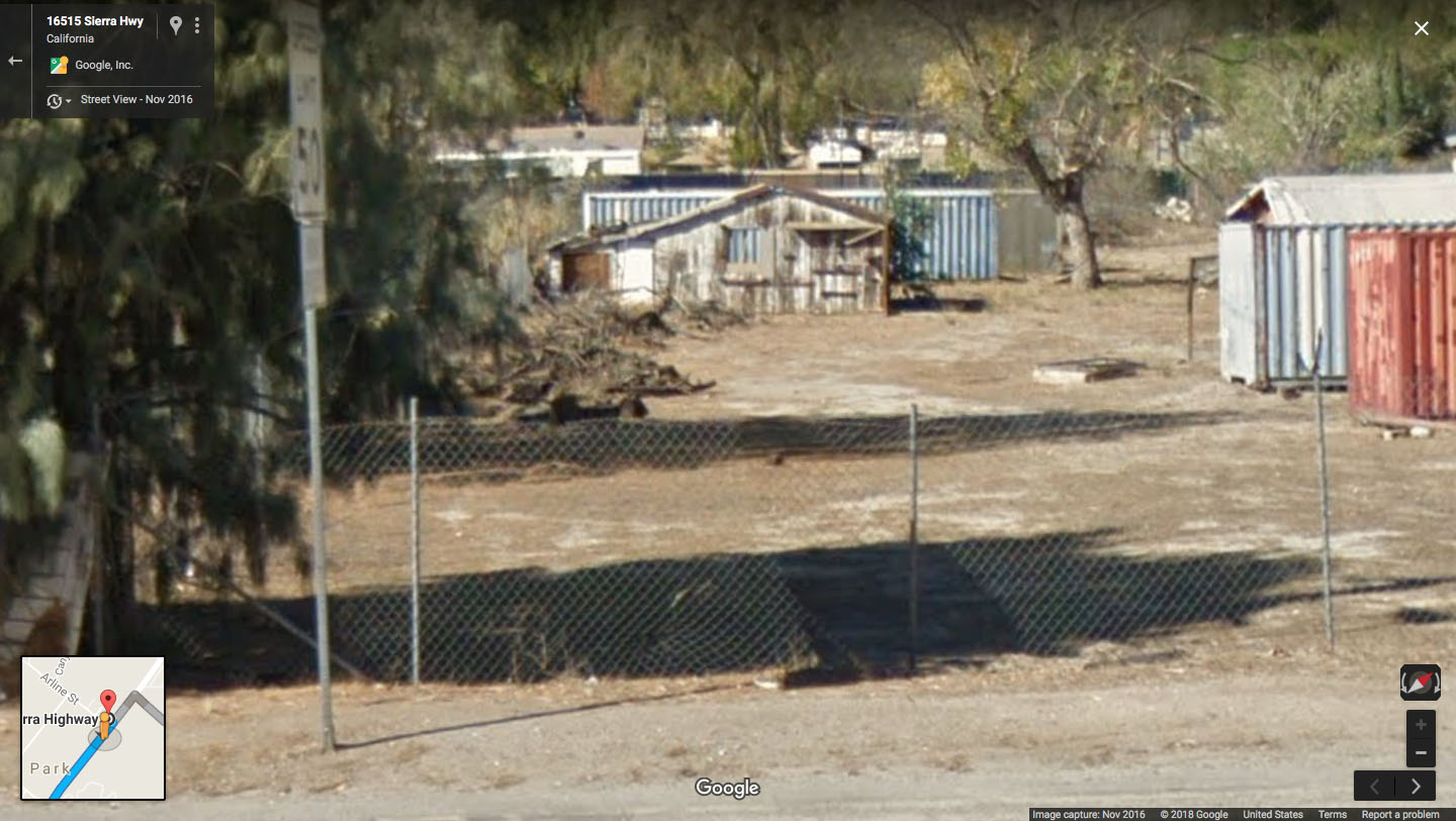
In reality, the Zone scene was filmed next to 16493 Sierra Hwy, Canyon Country, California. The address, which is actually 16515 Sierra Hwy, was occupied by someone in 2007-2008 and was listed for sale in December 2011 by Keller-Davis Real Estate.
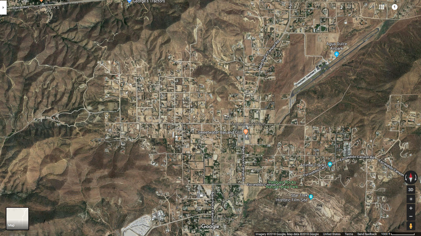
You can see where some of the scenes took place in this aerial view of The Zone location:
So how did I find it? The easiest answer – by dumb luck … or maybe divine intervention from Major Briggs.
FINDING THE ZONE FROM PART 11
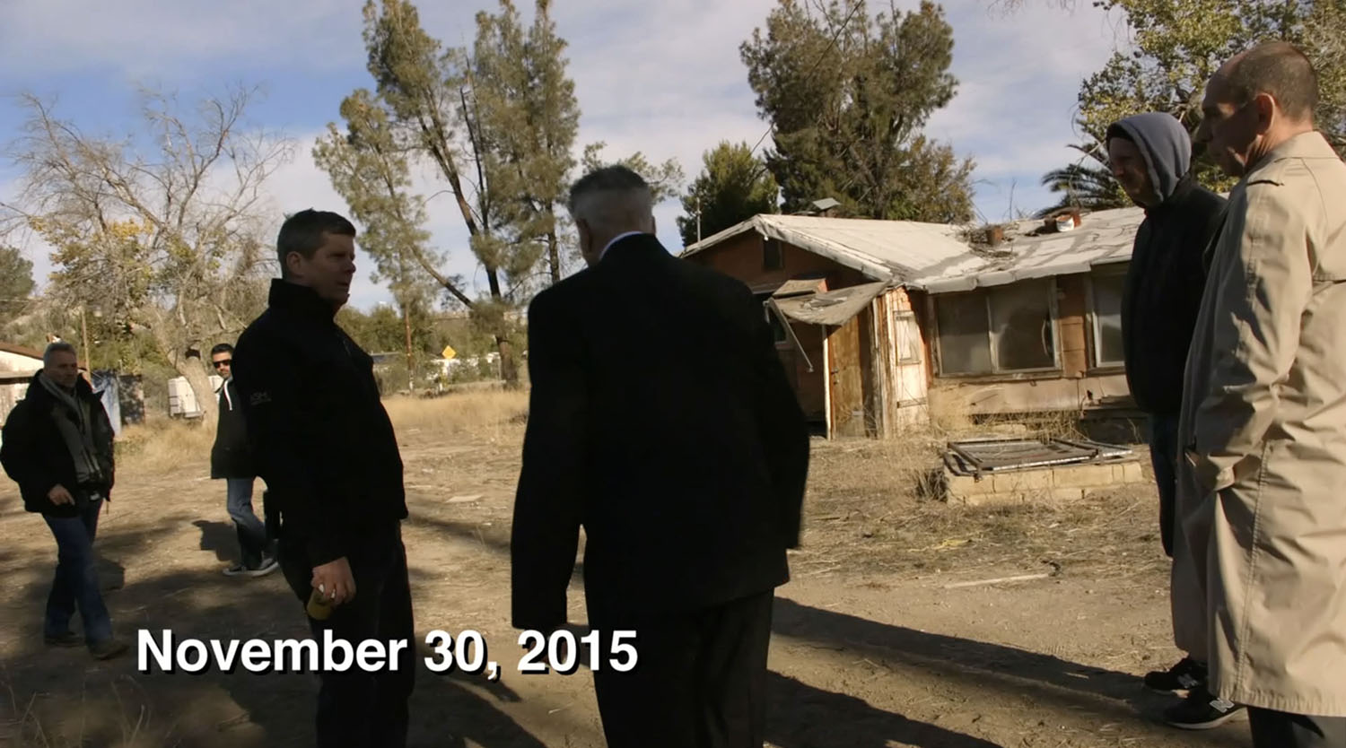
Most of this scene was captured on November 30, 2015. There were a few pick up shots with Bill Hastings on December 8. Showtime aired Part 11 on July 23, 2017.
I had attempted to find the Zone location a few times. I found several reference photos on my computer from searches I conducted on July 23, September 3 and October 26, 2017, but I did not find the actual spot.
On February 8, 2018, a tweet from Travis Blue, a fellow long-time Twin Peaks fan and location hunter, prompted me to try again. His tweet was a challenge, and it made me determined to find it! By 7:46 p.m., that evening, I shared happy news on Twitter.

The scene runs about seven-minutes and 30-seconds, so I first looked for clues to help with my quest – a street sign, geographic marker, architectural detail, a street address.
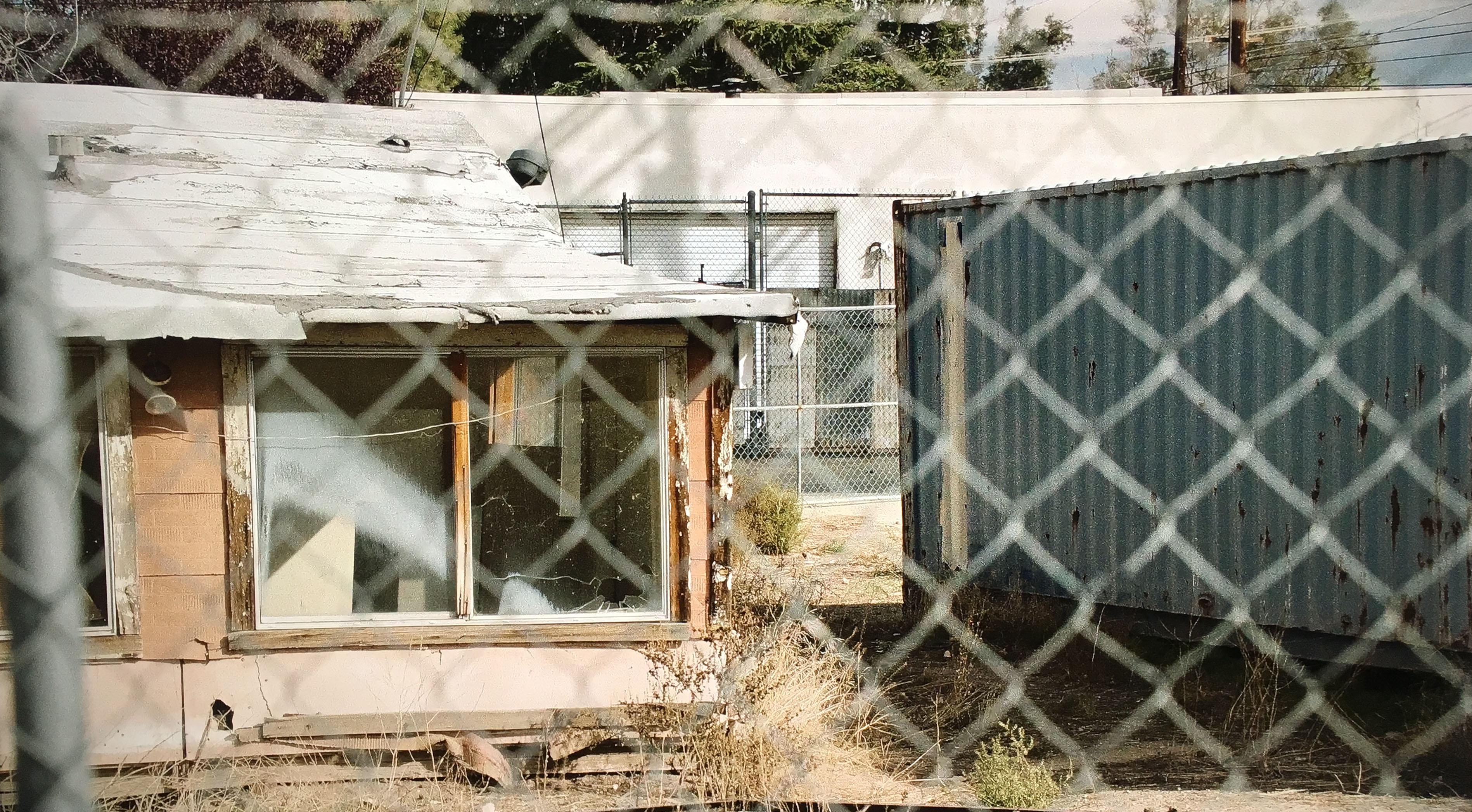
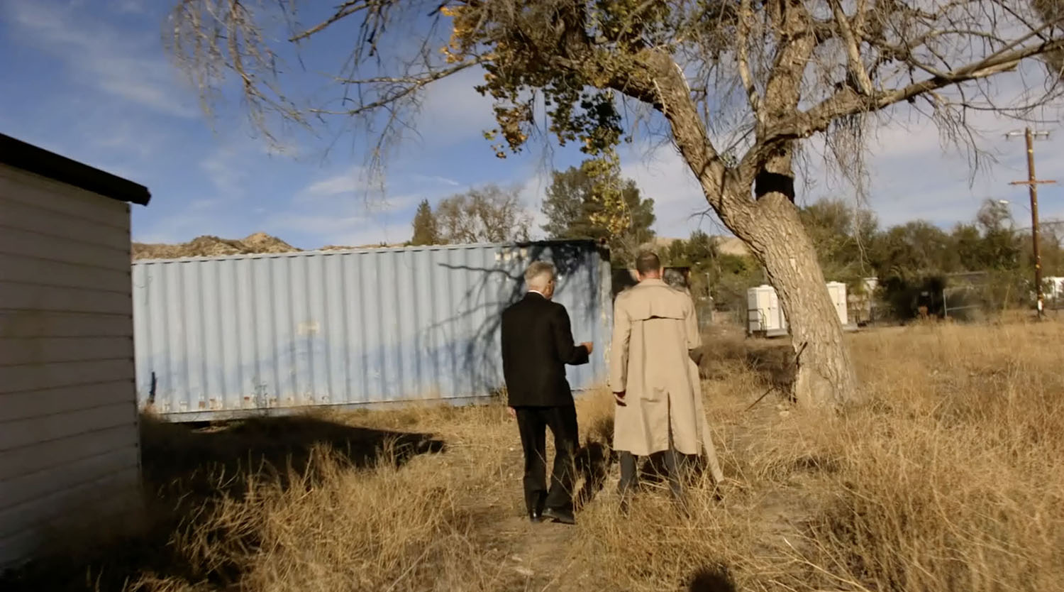
The scene takes place close to a road in an area surrounded by mountains or hills. In the background, I spotted what appeared to be a service garage. The property also had bright red and blue shipping containers, a clue that would prove vital to finding the exact location.
Rumors were the scene was filmed in Van Nuys, CA. It made sense to me since several scenes were shot in the nearby Japanese Gardens. Over the summer and fall, I looked around Van Nuys but couldn’t find anything that matched. The area was too residential and didn’t have hills.
EXPANDING THE SEARCH AREA FOR THE ZONE
I also heard from fellow Twin Peaks location hunter Ivan that Piru, California might be the spot. Funny thing is the town is located next to Buckhorn, California! But it’s a different Buckhorn than used in the series (which establishing shots were actually captured in Butte, Montana).

I found utility poles in Piru that looked similar to ones from the Zone scene, but that was the only detail that sort of matched.
So I expanded my search to include Santa Clarita and Agua Dulce.
I looked for spots I thought might contain shipping containers then took a closer look using street view on Google Maps. Nothing. I mean NOTHING!
THANK YOU MAJOR BRIGGS FOR HELPING ME FIND THE ZONE
At this point, I’d just about given up hope. Zooming in, scrolling left, then right, then zooming out. The process was exhausting, especially after searching through several Southern California towns.
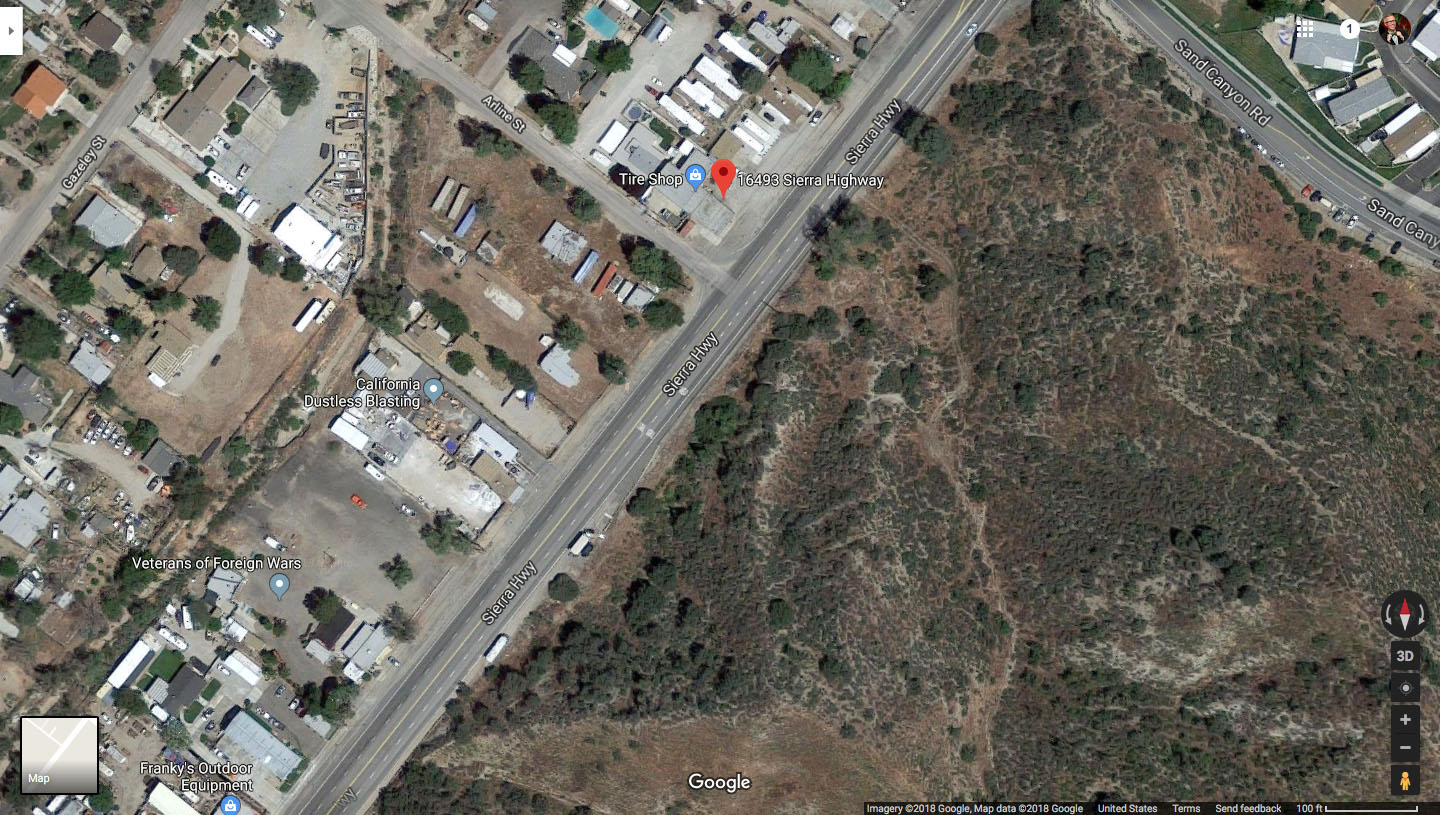
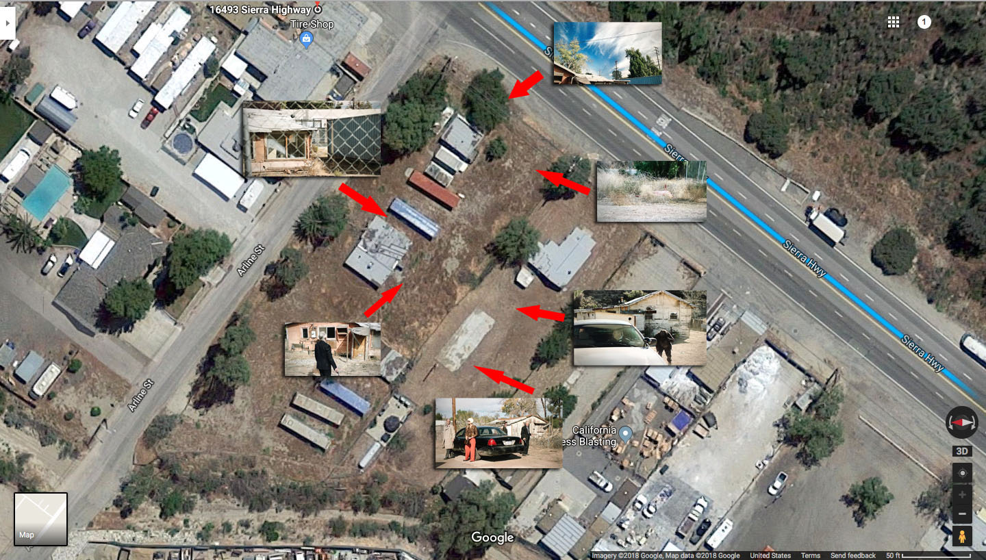
For some reason still unclear to me today, I moved my mouse from Agua Dulce, down the Sierra Highway and zoomed in looking for the blue and red containers.
And then there they were. I was speechless. I couldn’t believe I found THE ZONE!
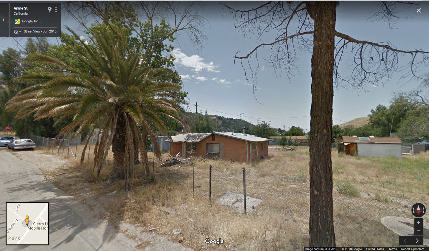
Using street view, I confirmed the surrounding buildings matched the buildings in Part 11. The garage building is actually Cornejo Tire on Arline Street (the road behind The Zone location).
VISITING THE ZONE IN 2020
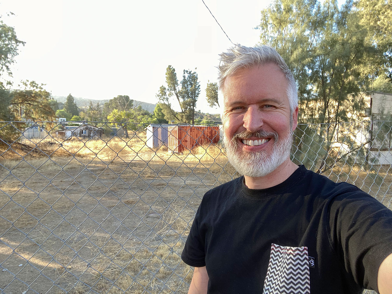
When I first published this article in March 2018, I only had Google Street View references. During a visit to Southern California in September 2020, I stopped by the location on September 20. At the time, the area was closed off by a chain-link fence, so I wasn’t able to take screen accurate images.

According to a Google Street View image from April 2024, it looks like the fence was removed in 2023.
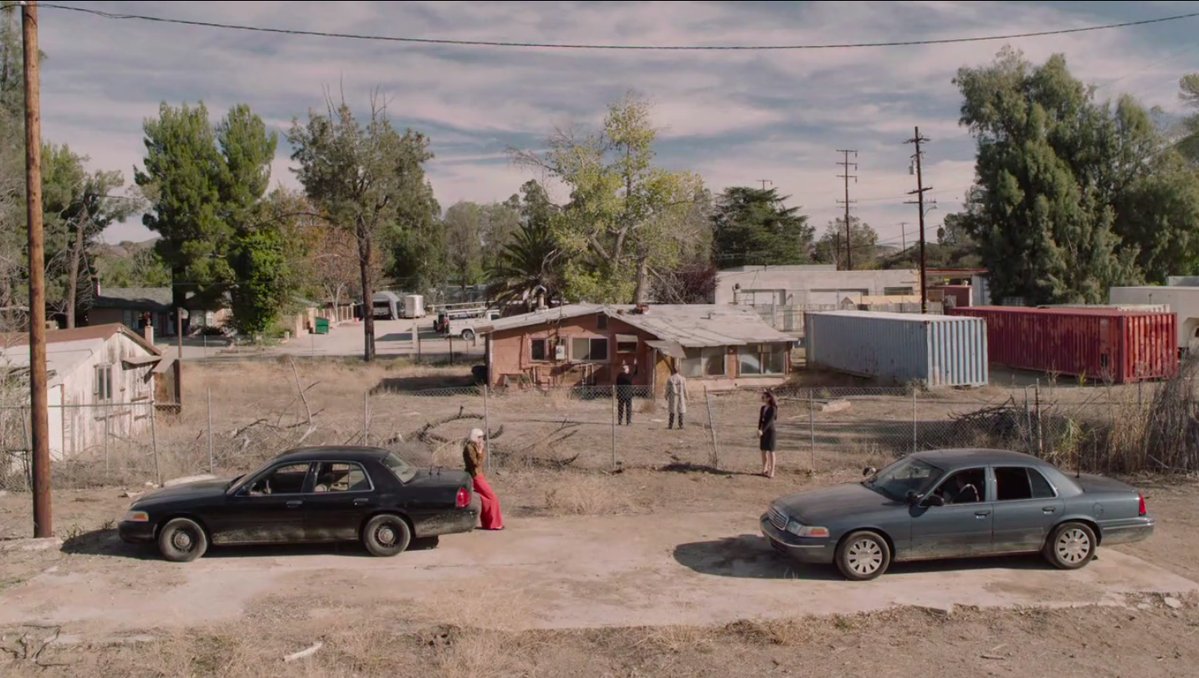
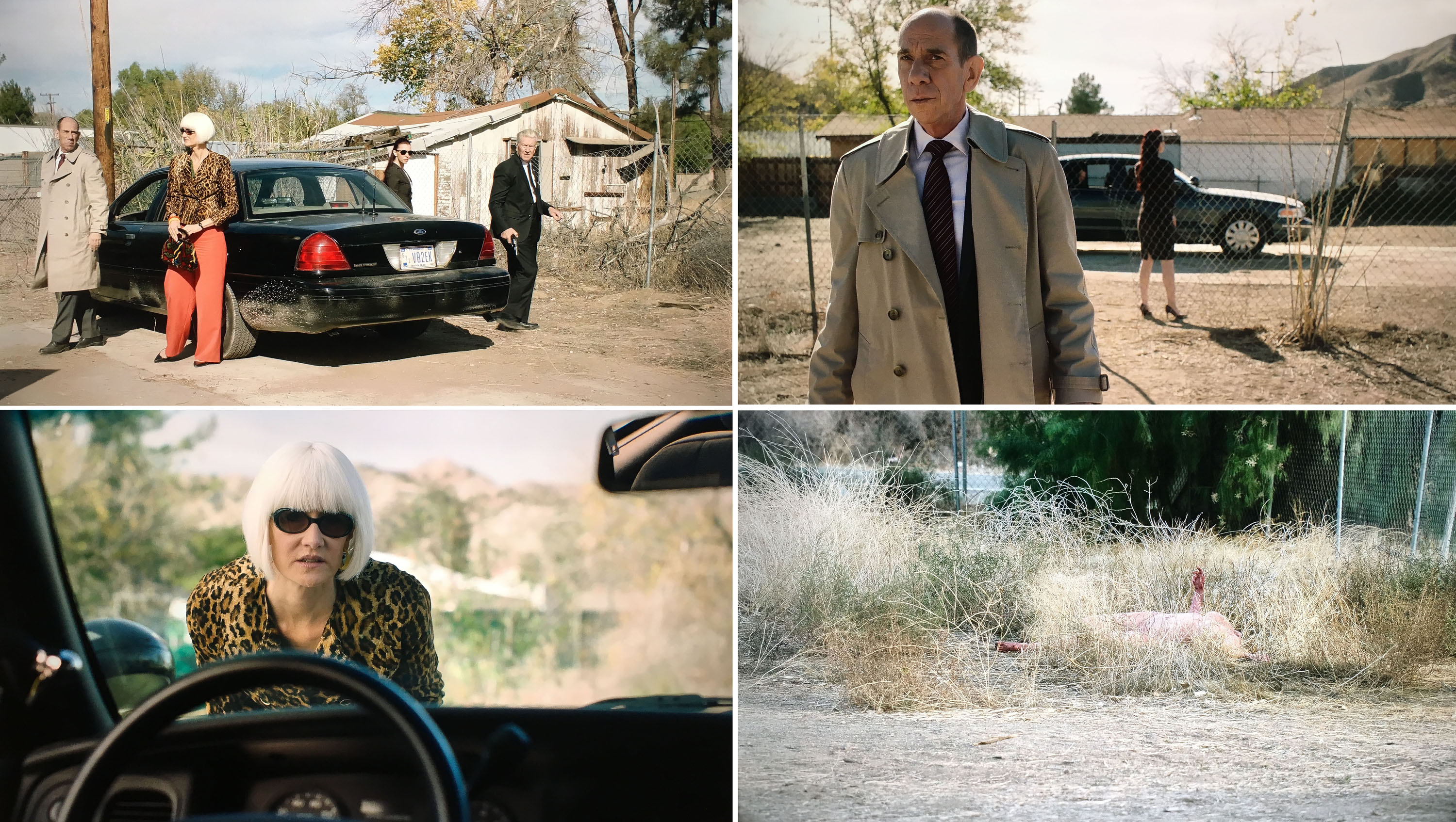
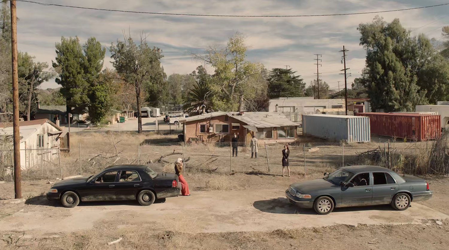
The scene opens with two cars pulling into the dirt lot next to The Zone location.
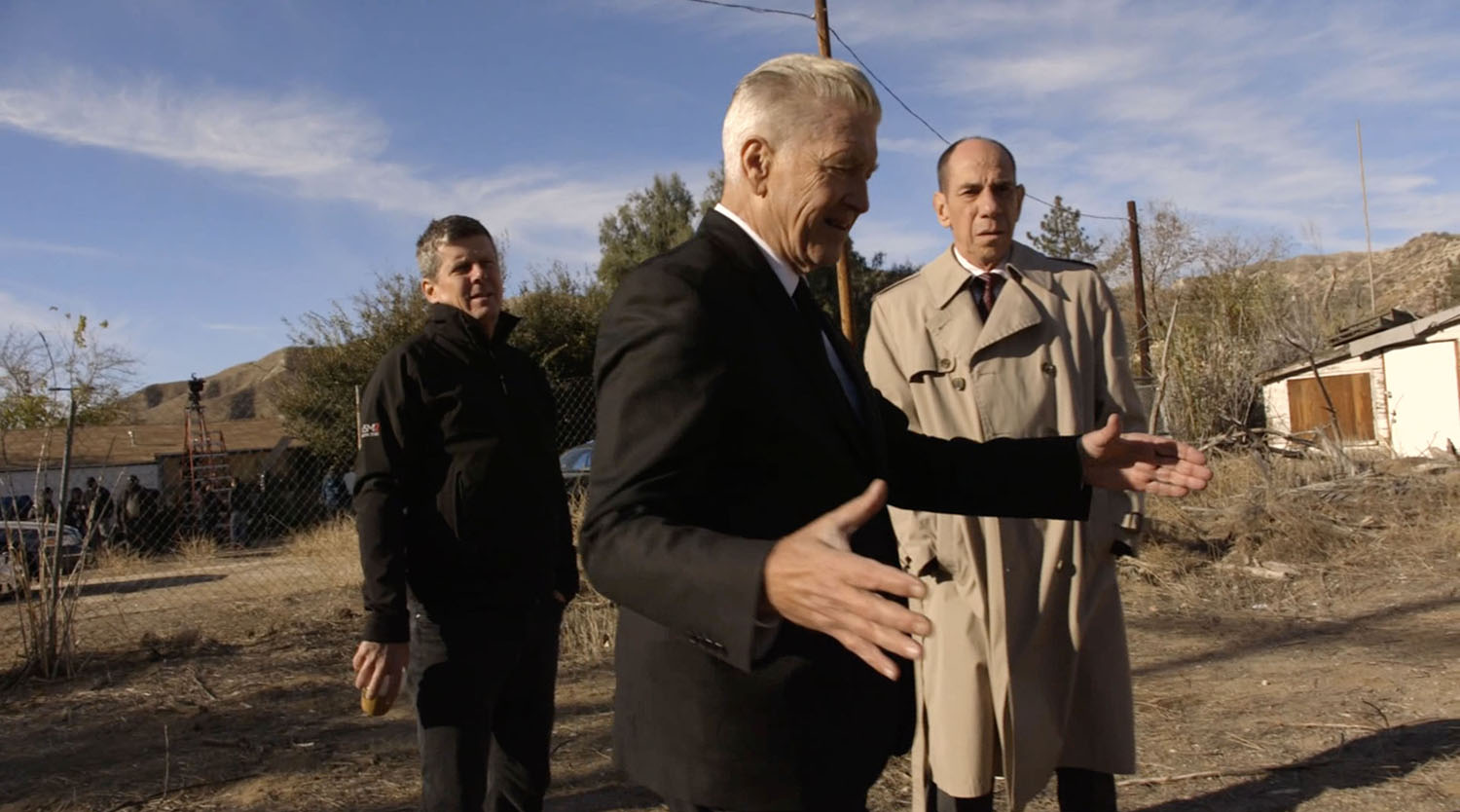
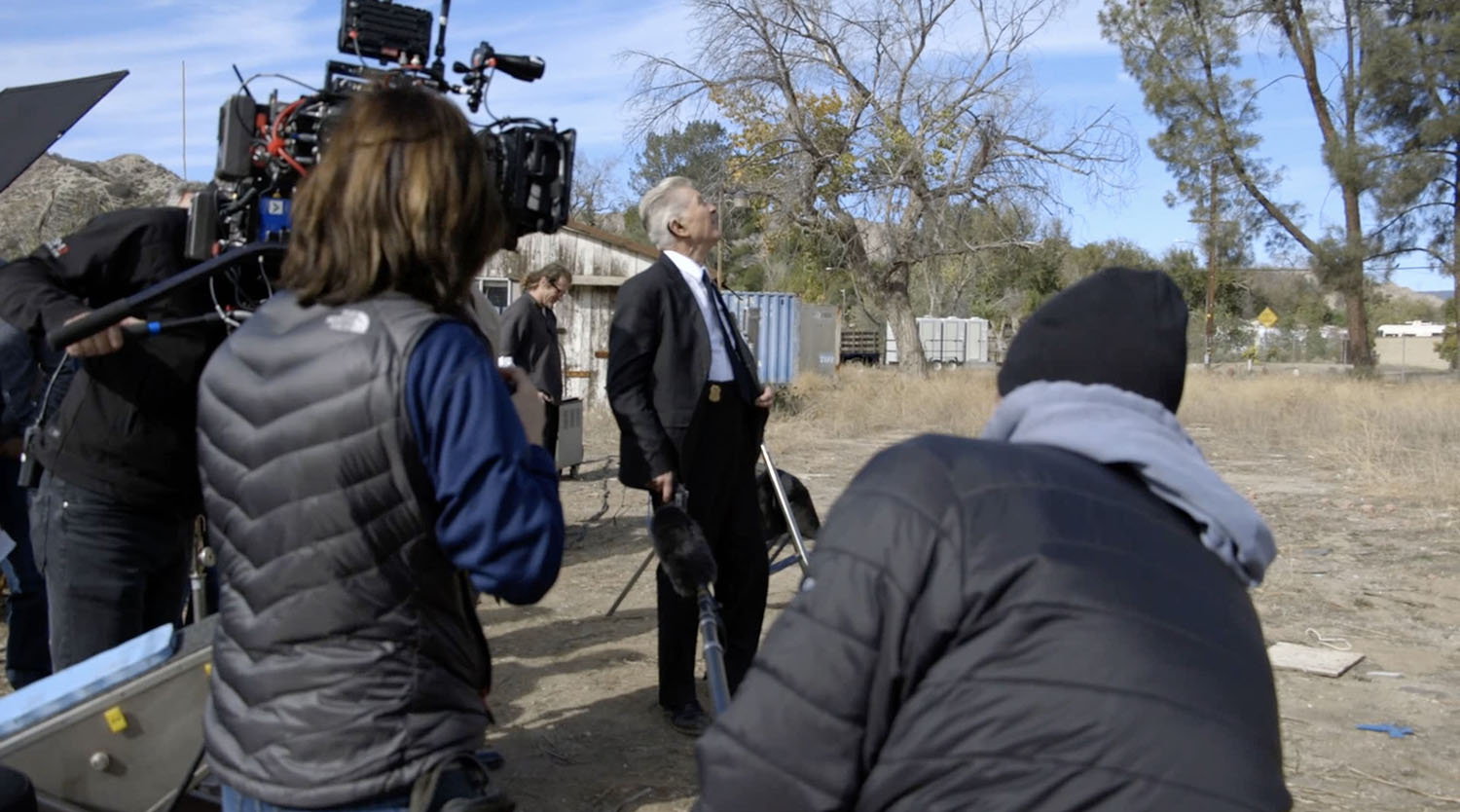
To capture this image, the crew mounted the camera on a tall ladder. Look behind Cinematographer Peter Deming in this Behind the Curtain image with David Lynch and Miguel Ferrer. I dream of taking a ladder to this location to capture exact shot.
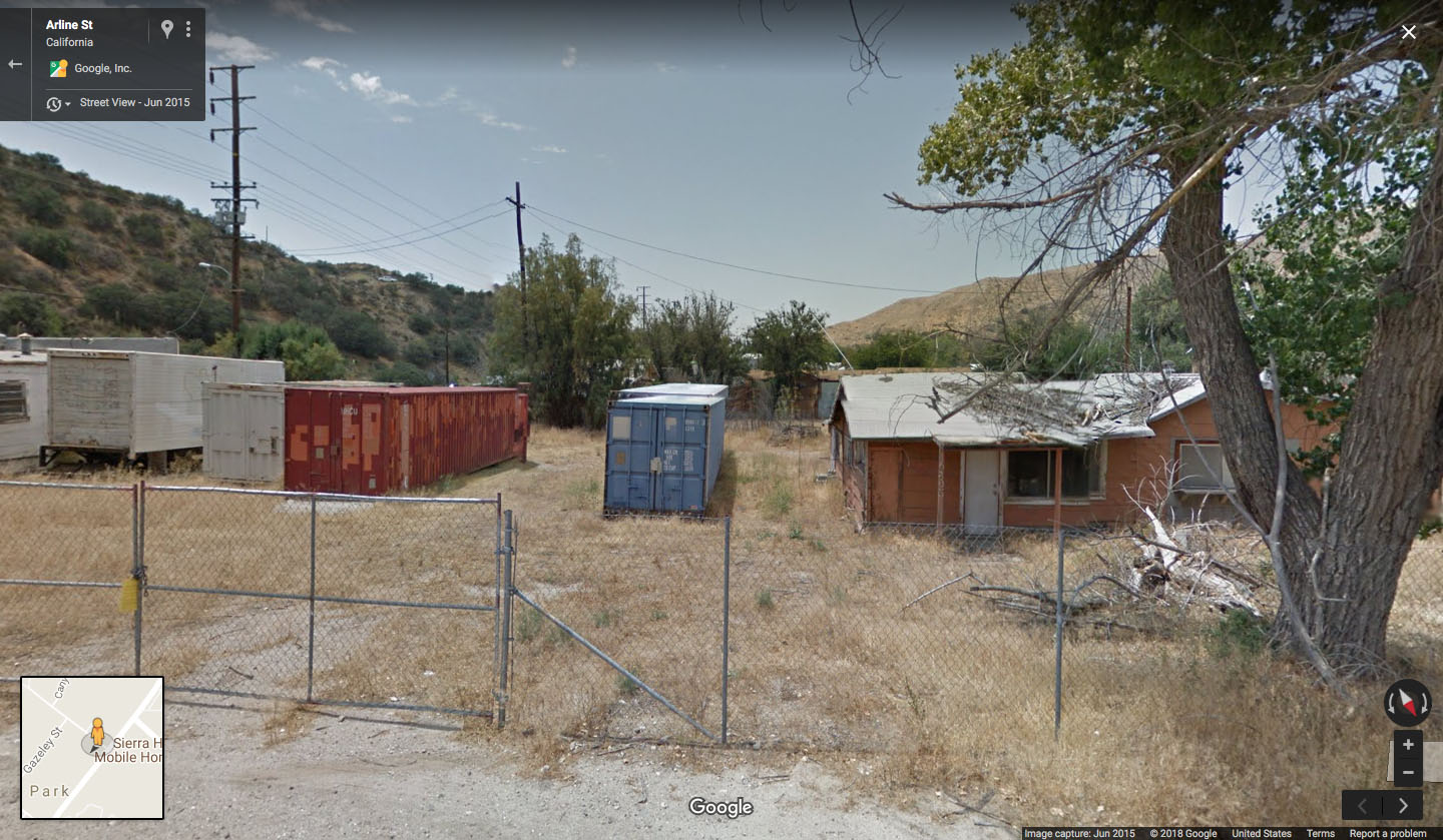
In 2018, the only Street View image I could get of the containers and house was from the street behind The Zone area.
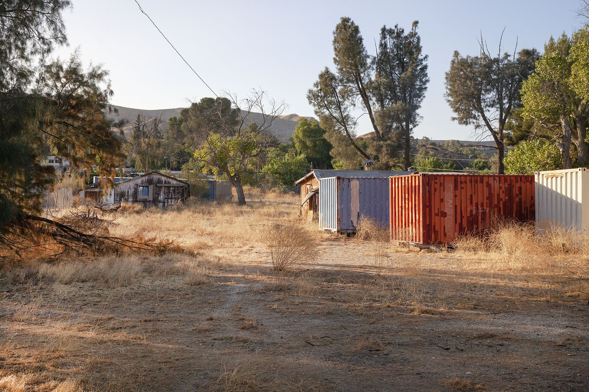
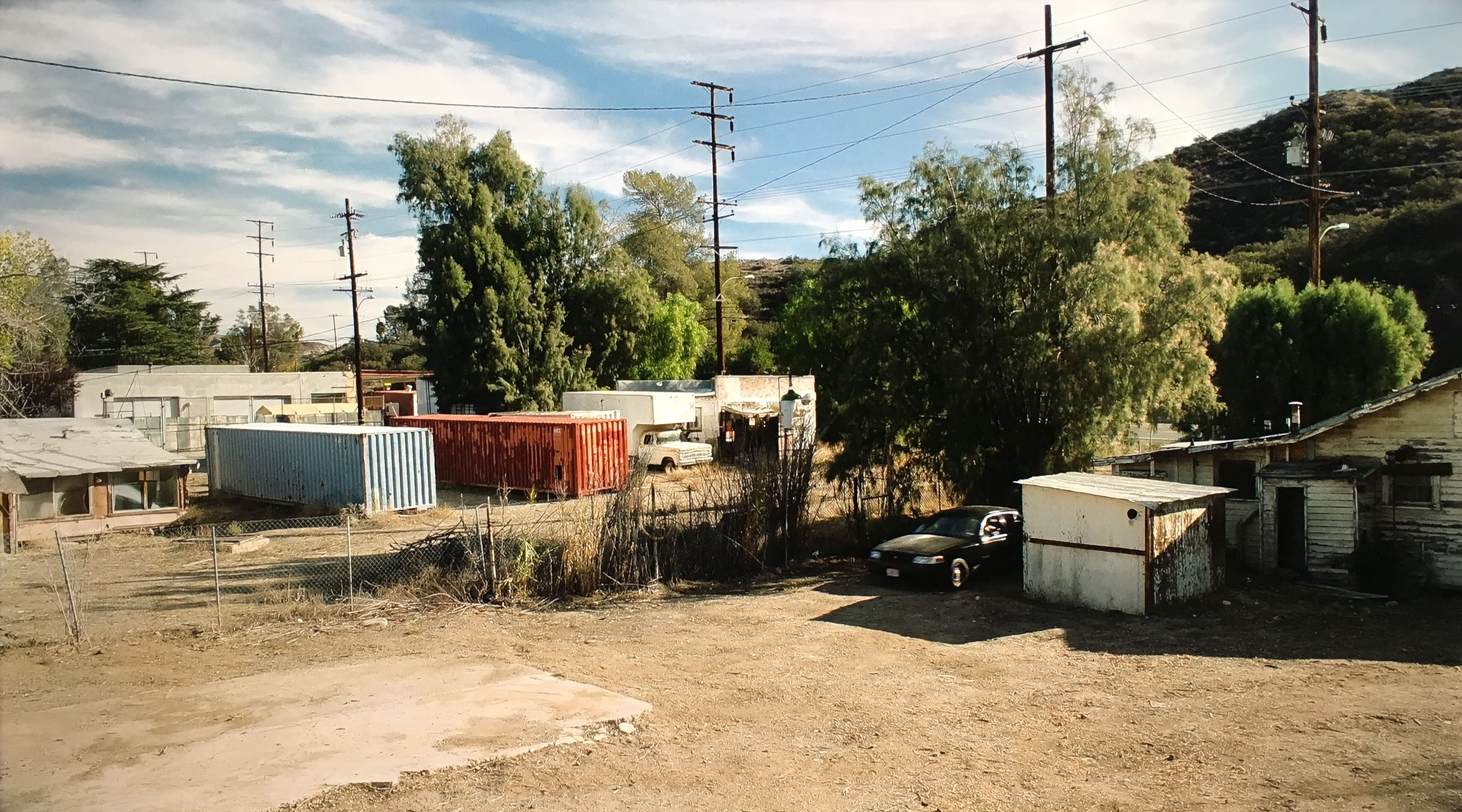
I shot this image through the fence in September 2020.
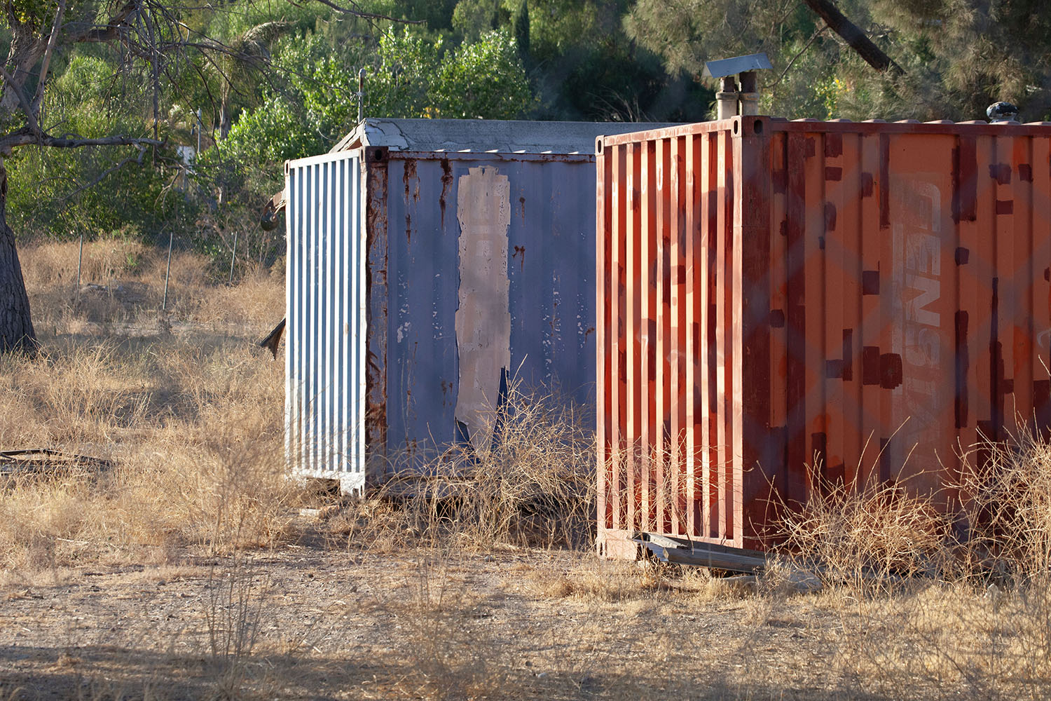
Standing there, I couldn’t believe these were the same containers from the episode.
THE HOUSE ON THE ZONE PROPERTY
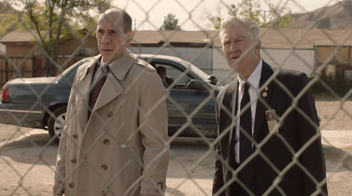
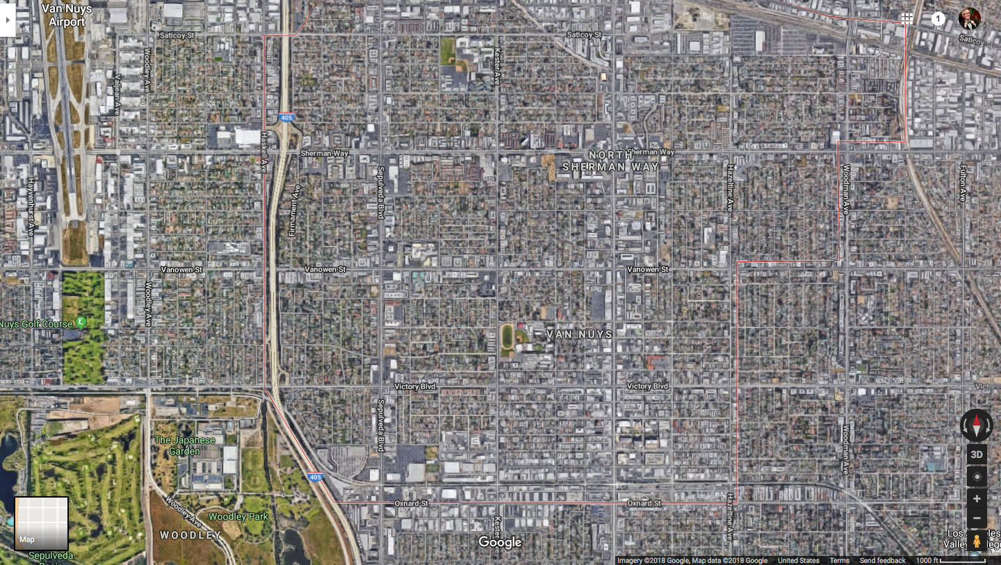
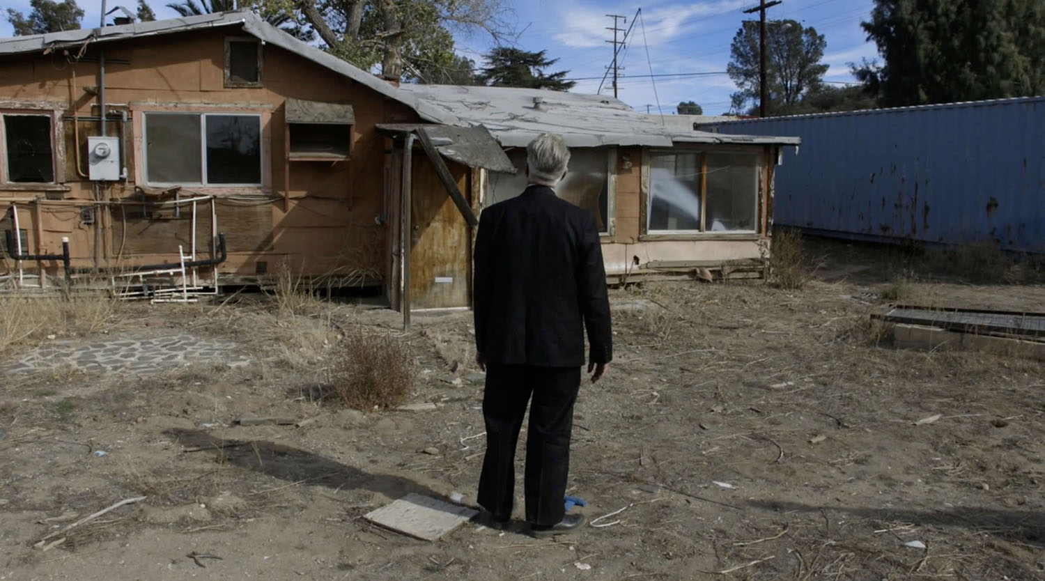
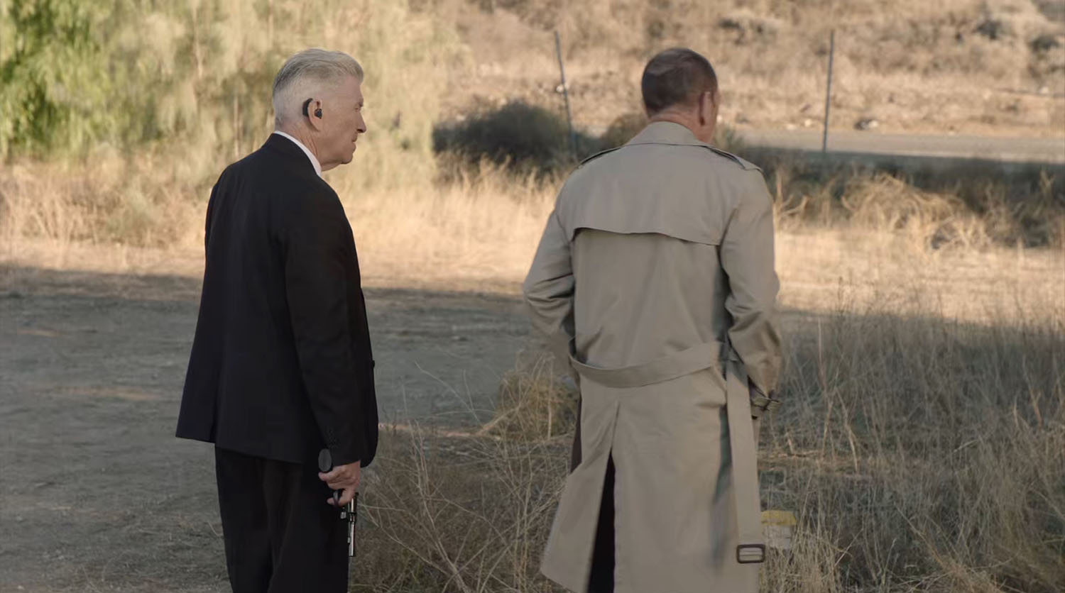
Special Agent Albert Rosenfield and Deputy Director Gordon Cole look at the house next to the shipping containers. Notice Cole’s American Flag pin is turned in the shot.
This is the view from behind the house as seen from Google Street View.
They used a reversed shot when the Woodsman appears behind the house.
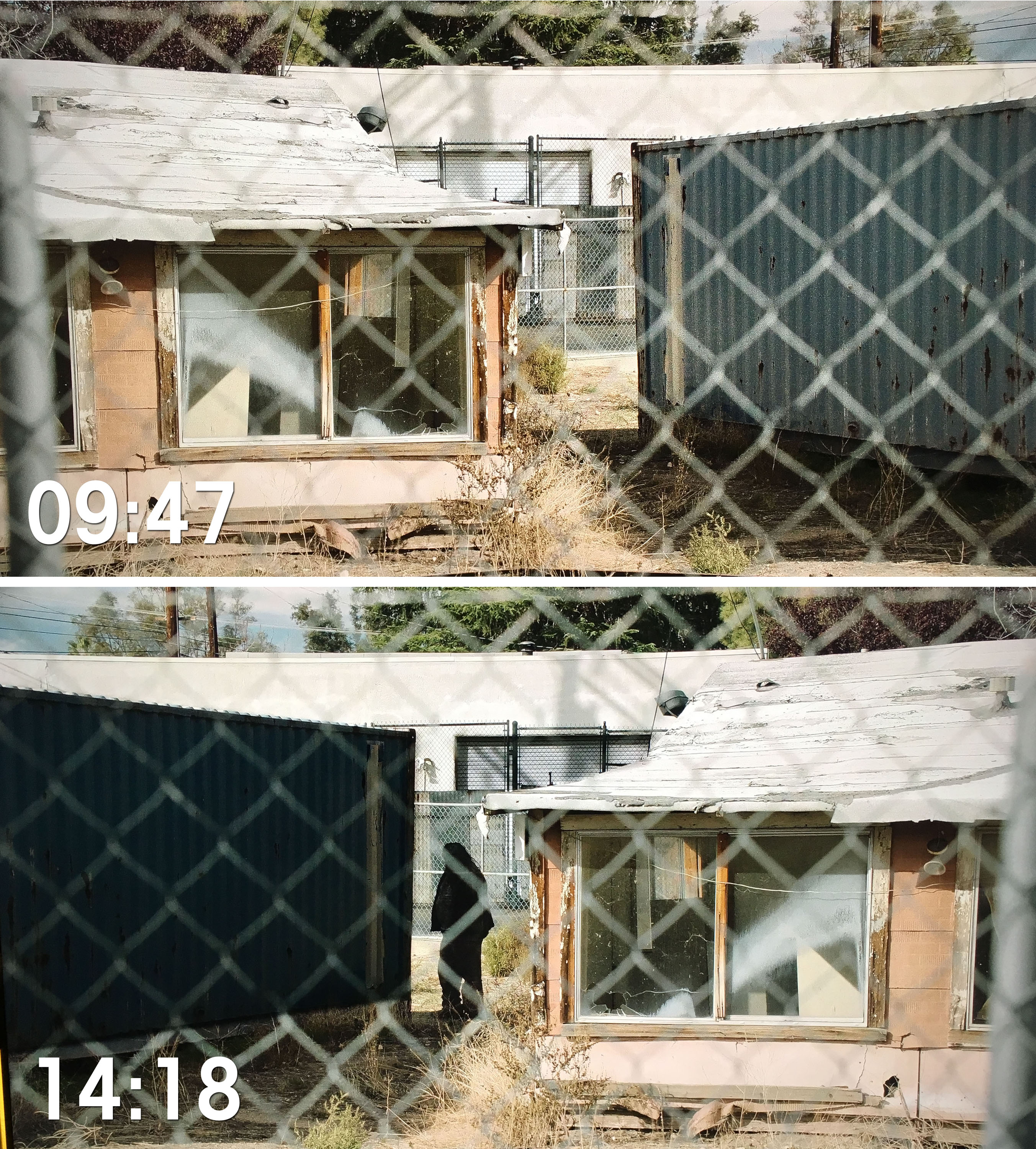
The original scene appears at nine-minute, 47-second mark, while the reversed scene appears around the 14-minute, 18-second mark.
GORDON COLE BEING PULLED INTO THE ZONE
The Behind the Curtain footage from Part 11 on the Twin Peaks – From Z to A Collection offers some awesome shots of David Lynch blocking being pulled into The Zone. Look at the blue “T” mark at Lynch’s feet – that’s his mark for the scene.
There is additional shots of Lynch looking up at the sky. Suzanne Tenner, the on-set photographer, is in the foreground. David Lynch’s mark is seen at the far right.
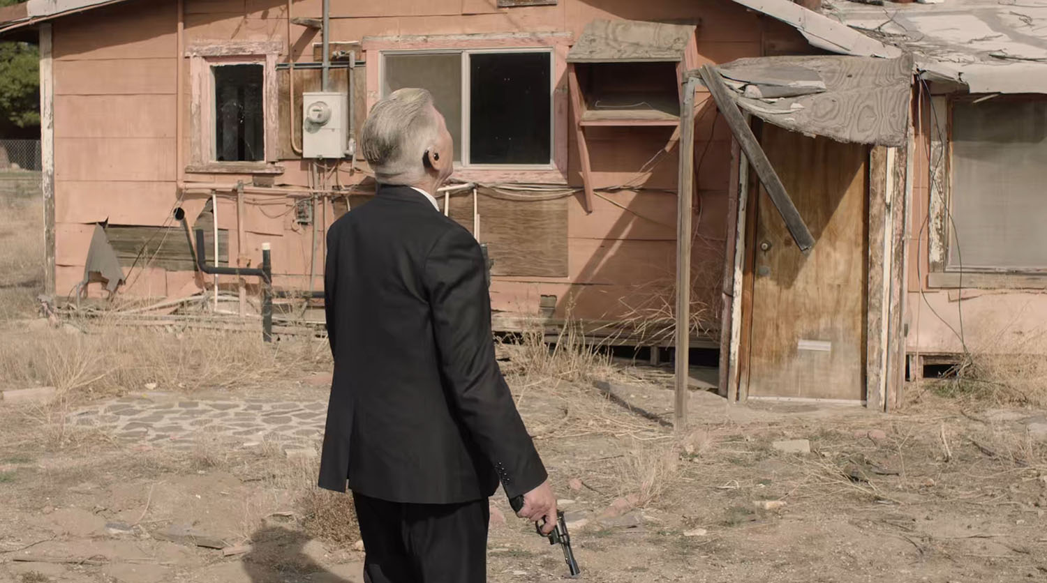
In the scene, Cole walks toward the house. We don’t see the mark as the camera doesn’t pan down to his feet.
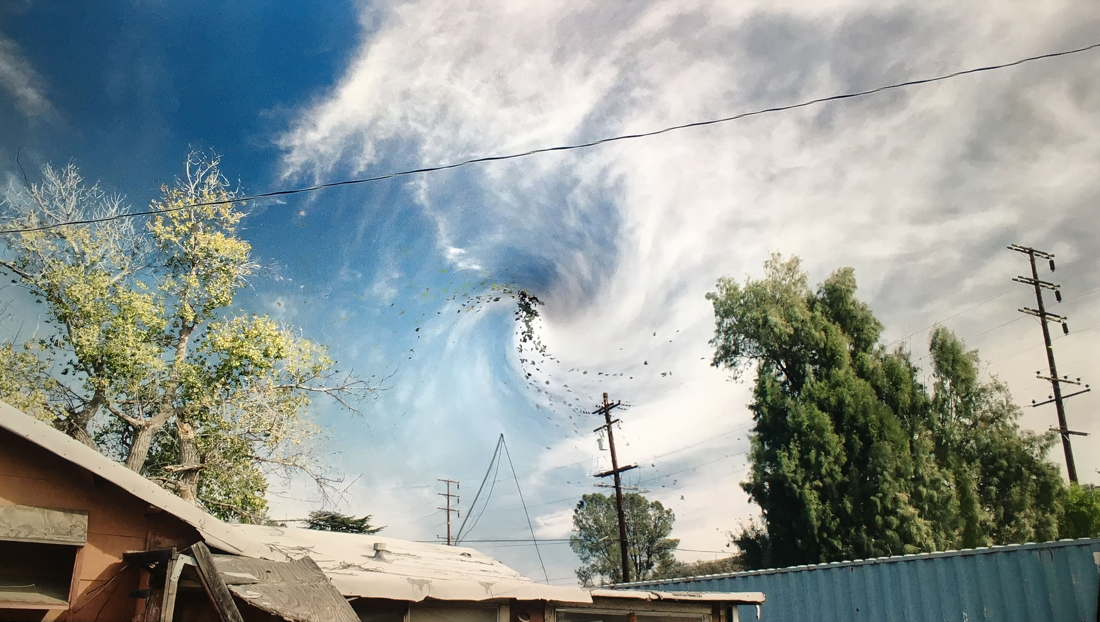
As he looks up, the sky starts to swirl. They needed to get a good “lock-off” shot of the sky, meaning a static shot that is devoid of camera movement. This helped the team at BUF insert the swirling sky.
This is a view of the utility pole in the bottom right corner from Google Street View.
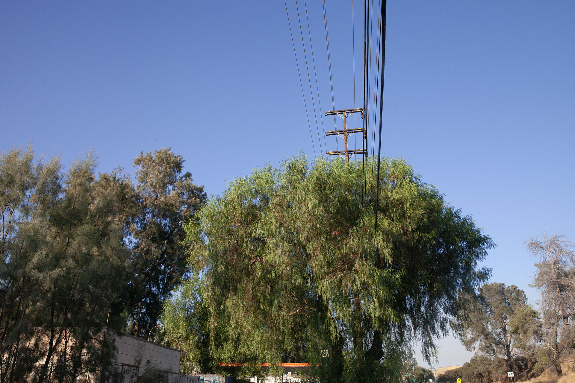
This is the same pole from my visit in 2020. I’d really love to return to The Zone to get a better shot of the sky.
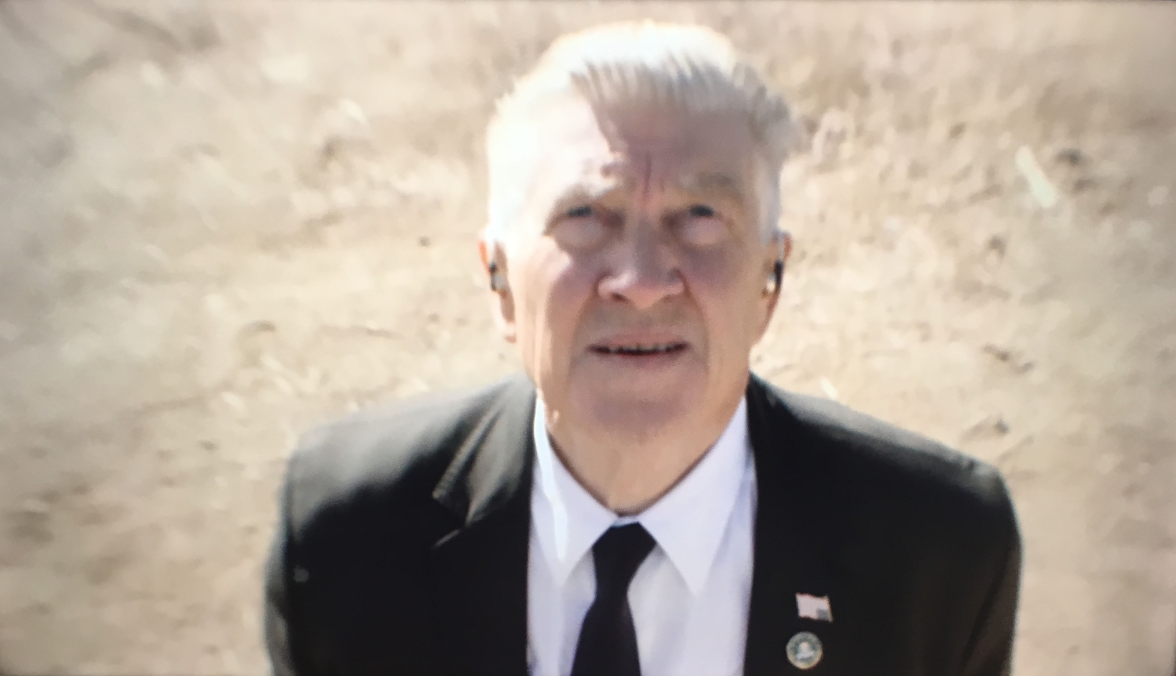
Look again at Cole’s American Flag pin as it’s now upside down!
Part of this scene was used used in one of the first teaser trailers Showtime released on December 18, 2015. Of course, we didn’t know about The Zone when this was released. It’s wild to think that they had just filmed this scene roughly two-and-a-half weeks earlier.
Albert Rosenfield will eventually pull Cole out of The Zone.
I love the staging of this scene captured from the ladder. Most likely, this was another take as the additional crew pictured in the previous images are present. They would have done this wide-angle shot followed by close-up shots of Cole by the home and the reverse of him looking up at the sky.
BILL HASTINGS IN THE CAR
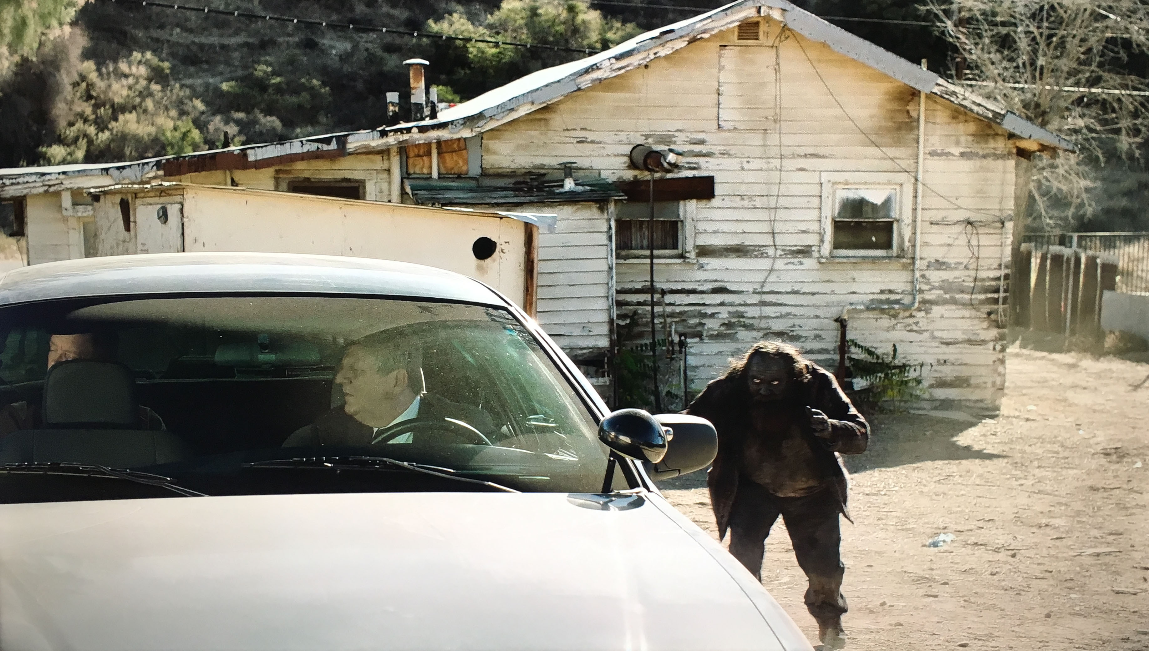
There are additional scenes with Bill Hastings sitting in the backseat of Detective Macklay’s car. They are parked behind another white house on the property. Some of the scenes were shot on Nov. 30 while close-ups of Hastings (including what happens to him) were shot days later on Dec. 8.
The Woodsman in this scene (and the previous one with him behind the other house) were played by Christian Calloway.
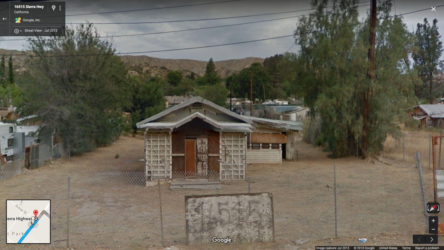
This is the view of the other house as seen from Google Street View.

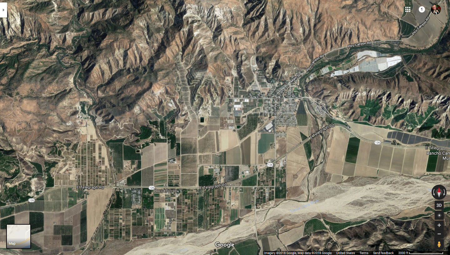
Diane watches the scene unfold, including the Woodsman approaching Hastings.
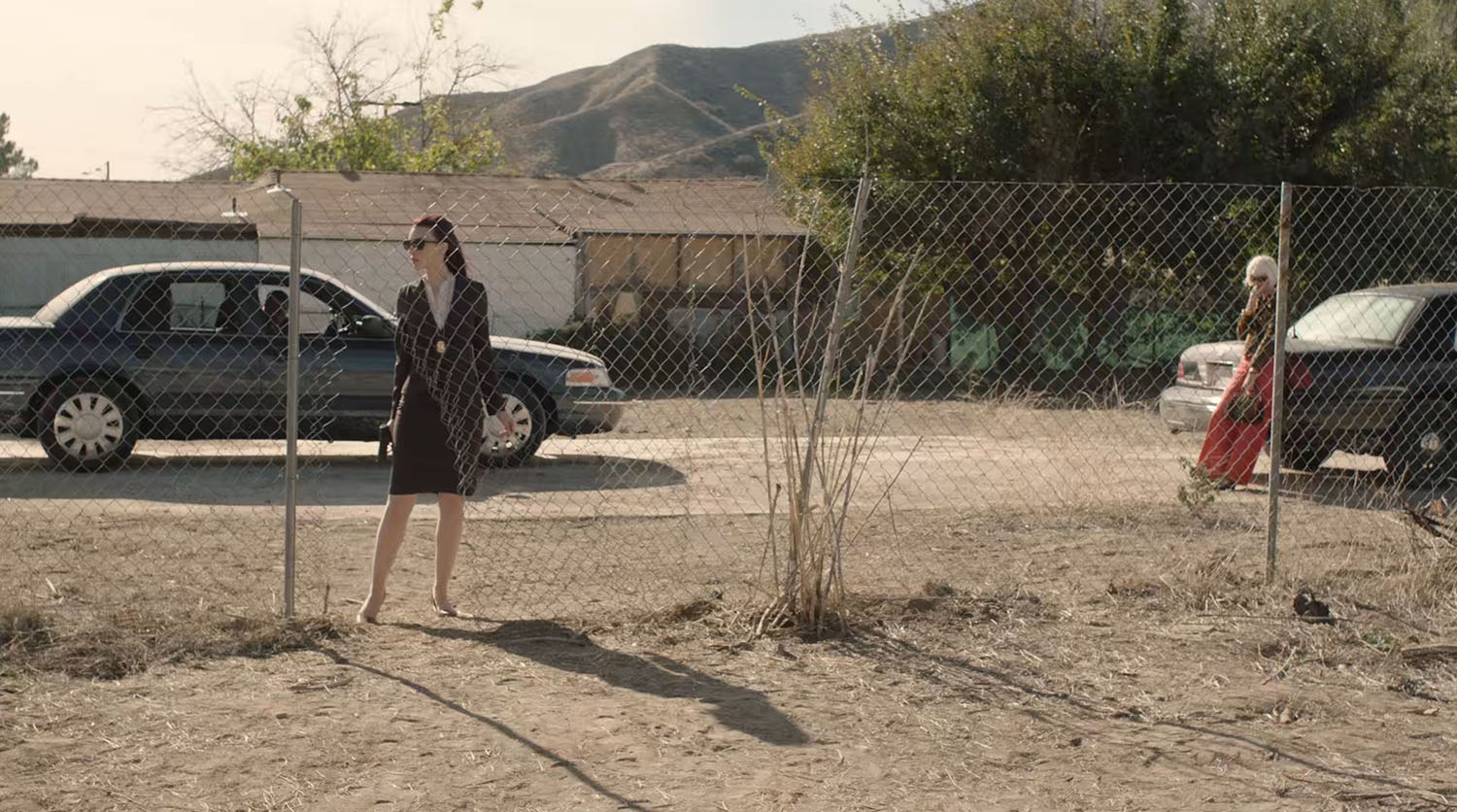
Throughout all the action, Agent Tammy Preston and Diane wait patiently behind the chain-link fence.
FINDING RUTH DAVENPORT’S BODY
From the Behind the Curtain footage from this scene, it looks like Cole and Rosenfield were going to discover Ruth Davenport’s body by a tree in the distance next to a run-down shack.
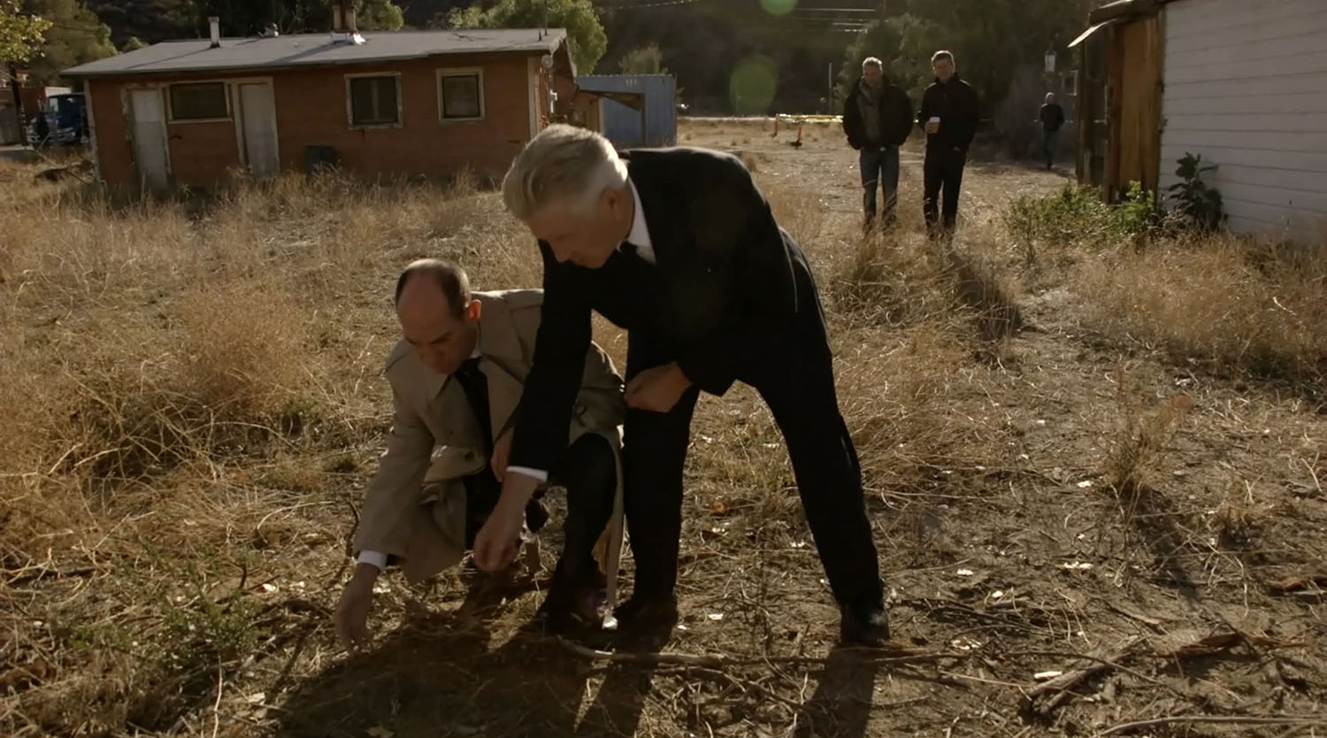
They may have been blocking the scene at the time (Assistant Director Scott Cameron and Cinematographer Peter Deming wait in the distance). Lighting could have been a factor in why the scene was reversed.
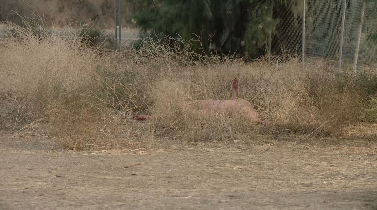
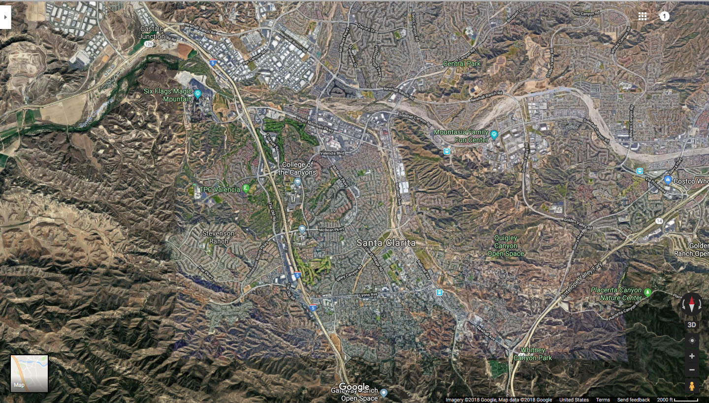
In the scene, Ruth’s body is found in the grass closer to the highway.
This is the location in the late afternoon on September 20, 2020. The grass area would have been to the front left of the image. Compare how the sun is setting in this image to the scene. Most likely the captured discovering Ruth’s body in the afternoon.
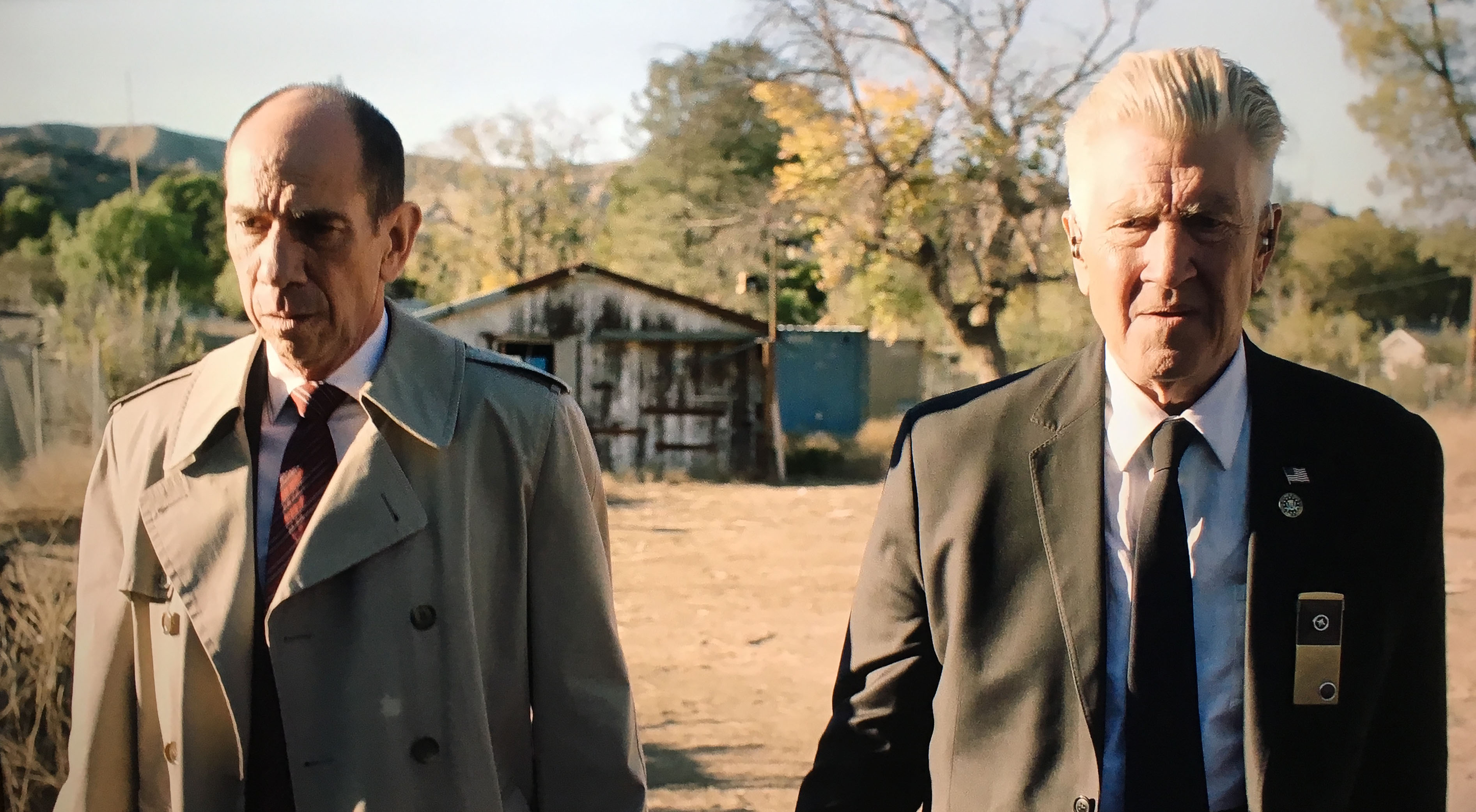
Cole and Rosenfield walk slowly toward the body. Now Cole’s American Flag on his lapel is correctly displayed.
This is the Google Street View image from 2018.
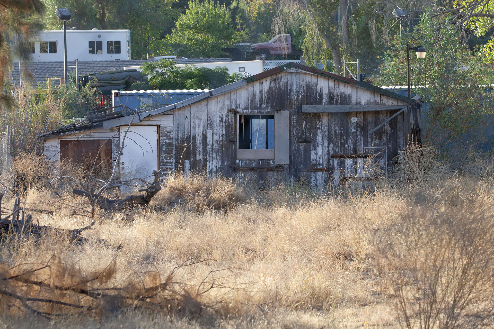
This is a closer look at the wooden shack in the distance behind the two agents.
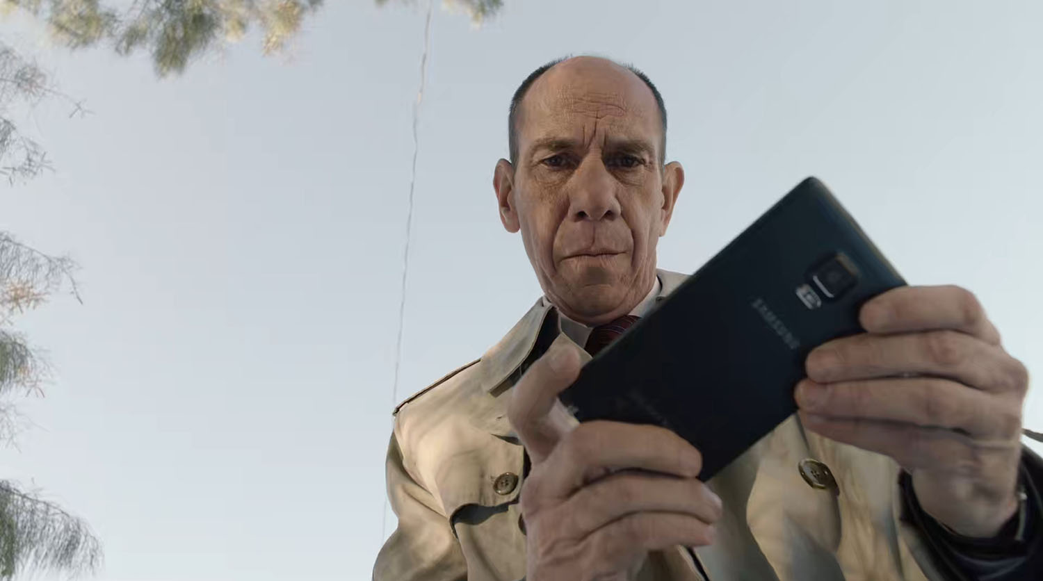
Agent Rosenfield uses a Samsung Galaxy Note 4 to take a photo of the coordinates written on Davenport’s arm.
Gordon and Albert standing in the grass looking down at Ruth’s body.
The scene will end with something unfortunate happening to Bill Hastings at the hands of a Woodsman.
Author
Discover more from TWIN PEAKS BLOG
Subscribe to get the latest posts sent to your email.
Hi, I think that the shot of the woodsman is reversed because it’s seen through the eyes of Tulpa Diane. Just an hypotesis. Great site
@Daniel Oh wow! Love that idea. Thank you for sharing
I Love your work !
Wow, amazing sleuthing! I guess the one other place in Part 11 that holds a candle to the spookiness of the location of the wormhole to The Zone is the ruins where the Mitchum brothers plan to shoot “Dougie”. Any idea where that might be?
IMDb has “Palm Springs, California, USA (Dougie’s and the Mitchum brothers’ meeting)”, but evidently that’s referring to the Morongo Casino. It’s been too long since I’ve been to Palm Springs or Vegas to be able to tell by the landscape whether the location of the ruins is likely to be in one of those two places, or somewhere else entirely.
A curiosity, whether that was a small residential development that long ago succumbed to the elements, one that never got completed in the first place, or something stranger.