If there was a cousin to Ronette Pulaski’s bridge, it would most likely be the Meadowbrook Bridge that’s seen in both the Pilot Episode and Part 18 on Showtime. This historic bridge is located just down the street from Ronette’s, and has the distinction of being seen in the first and the last episode of Twin Peaks.
WHERE IS THE BRIDGE FROM THE TWIN PEAKS PILOT AND PART 18 LOCATED?

There are really two distinct shots of the bridge. The Pilot scene was shot around 47°31’34.1″N 121°48’43.9″W, while the scene in Part 18, which features Richard/Cooper driving across the bridge with Carrie Page, is found at 47°31’35.8″N 121°48’44.2″W.
HISTORY OF MEADOWBROOK BRIDGE
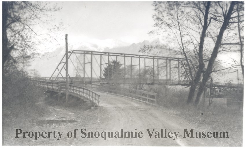
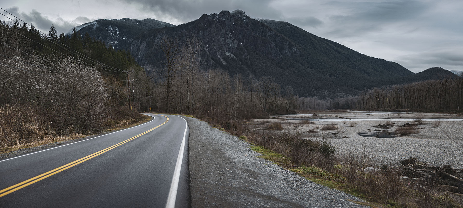
Spanning the Snoqualmie River, the Snoqualmie Valley Historical Museum has a photo of an early bridge from 1913. This was about ten years before the town of Meadowbrook was established. A dirt road leads to the bridge where one must make a sharp right turn before crossing it. Mount Si and a snow-topped Mount Teneriffe are seen in the background.
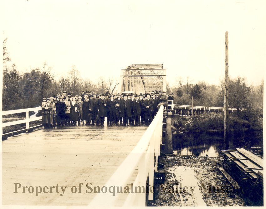
Following the opening of the Snoqualmie Falls Lumber Co. Mill in 1914, the area saw a dramatic increase in both population and traffic. The old dirt road bridge needed an upgrade. On October 19, 1921, townsfolk gathered to dedicate a new Parker through truss bridge.

A dedication plaque still exists on the bridge – No. 1725 A in King County, Washington. Don H. Evans served as the bridge engineer, while Ward & Ward, Inc. was the contractor on record.
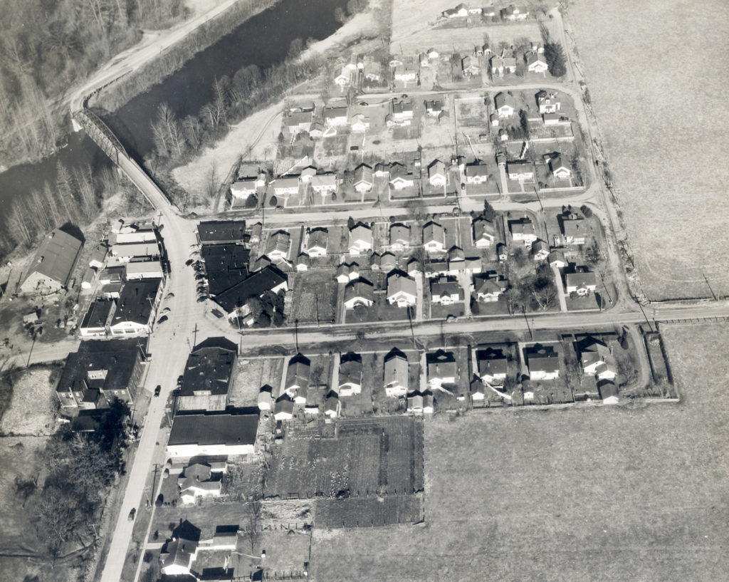
The new bridge was a perfect addition to service the town of Meadowbrook, established in 1923 by Arthur Platt and his wife. The town would later be annexed to Snoqualmie in 1952.
REHABILITATED MEADOWBROOK BRIDGE

In December 2004, the Metropolitan King County Council approved an agreement between the county and city of Snoqualmie to rehabilitate the historic Meadowbrook Bridge.

The county converted it to a one-lane bridge, with traffic controls at each end. The bridge was closed about seven months during construction. About 70 percent of the project’s $6.1 million cost was covered by federal grants.
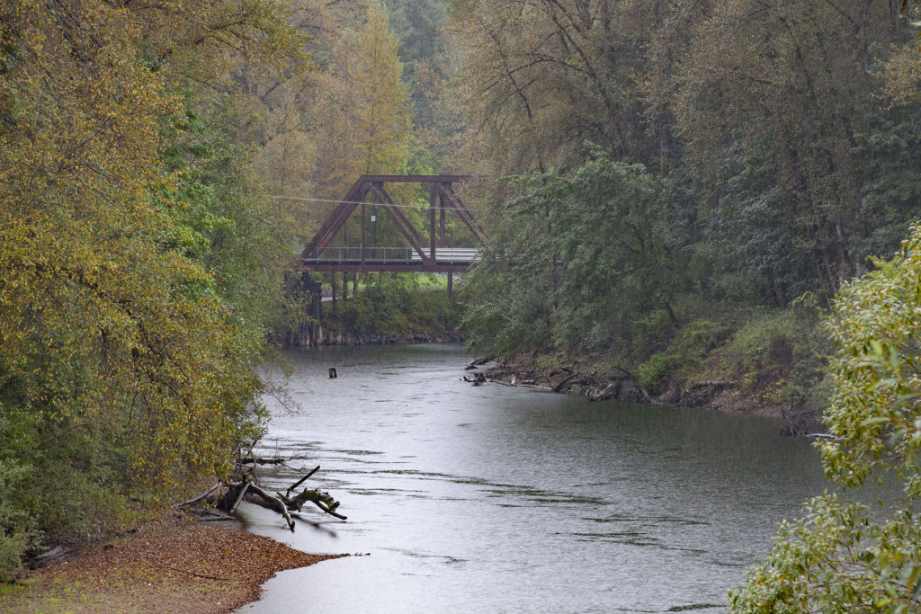
According to the Snoqualmie Valley Record, three community input meetings were held by the county in October and December of 1996 and December 1997.
‘The choices included tearing down the bridge, opening the bridge to pedestrian and bicycle traffic only, repairing the bridge and keeping it as a two-lane road or reconstructing the bridge and installing a new structure.
“The sentiment was don’t close the bridge,’ Bill Oakes, a King County supervising engineer said of the public hearings. ‘They said they could live with the one-lane option or they wanted the bridge completely replaced.’

The design consultant was ABJK, Inc. and the contractor was Wilder Construction. The roadway over the bridge was repaved and thetimber approaches were replaced with concrete. The steel archway and pedestrian walkway, however, were not modified by design.
“It’s going to remain with the historical character and that’s important to us,” said Snoqualmie City Administrator Gary Armstrong. “If money and funding were available, we’d prefer it to be a two-lane bridge … but it’s better to have an improvement done than nothing at all.”
“GUARDIANS” PUBLIC ART BY BRUCE MYERS

One of the unique aspects of the refurbished bridge is a public art addition by Bruce Myers. A plaque on the bridge from 2005 provides insight about his bronze art titled “Guardians”:
“The four entrance panels to the historic truss bridge are symbolic of the vision of the community to preserve the connection to the landscape and the past. The eagle, referring stylistically to Northwest Native art, and the elk antlers, representing the strength and significance of nature to the region. Inspired by the once dense forests and the local loggers that worked there, the log sections are from Douglas fir and cedar trees.”


BRIDGE IN TWIN PEAKS PILOT

The first time we see the bridge is when Joey Paulson and Donna Hayward are seen escaping from the Roadhouse. This location is in Snoqualmie while the Roadhouse exterior is about six miles away in Fall City, Washington.
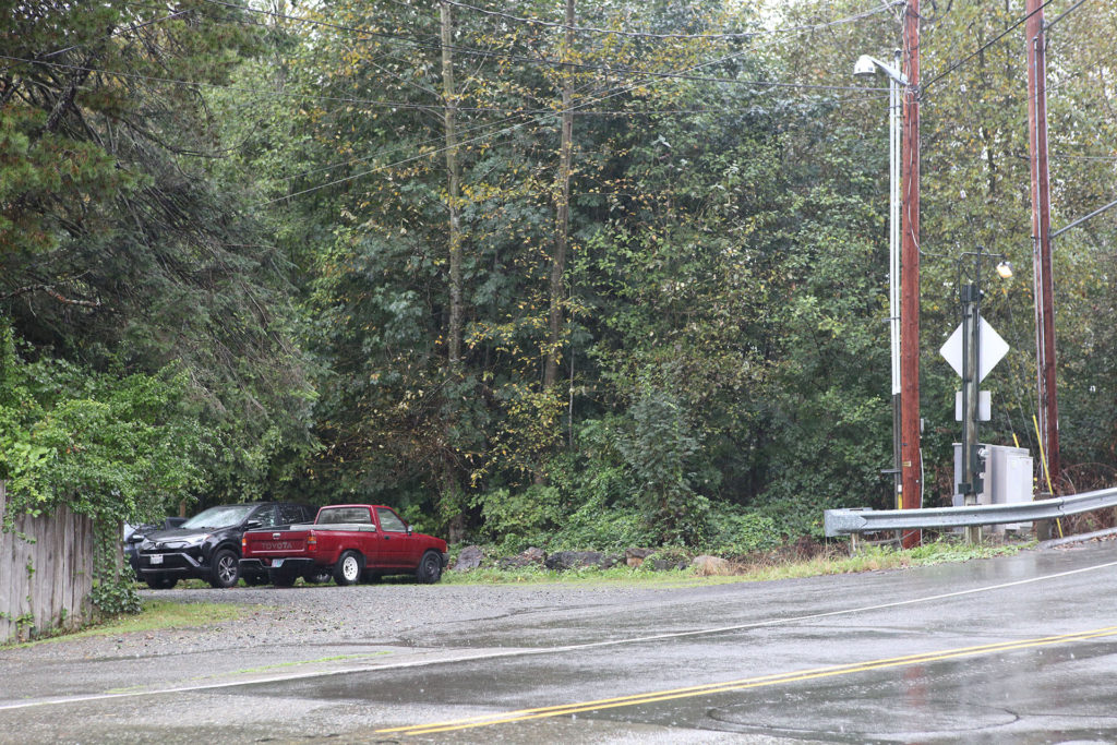
They take a gravel road onto Meadowbrook Way. Behind them would have been the Riverside Mobile Home Park, which served as the film location for the Fat Trout Trailer Park in Twin Peaks: Fire Walk With Me.

If they turned right instead of crossing the bridge, they would end up at the Intersection, Mo’s Motor and Gersten Hayward’s apartment.


The camera follows Joey as they disappear over the bridge.
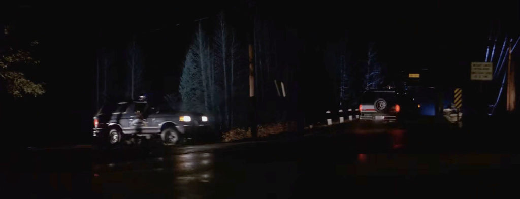
I combined two shots that show Sheriff Truman’s vehicle silently following Joey and Donna after they cross the bridge.
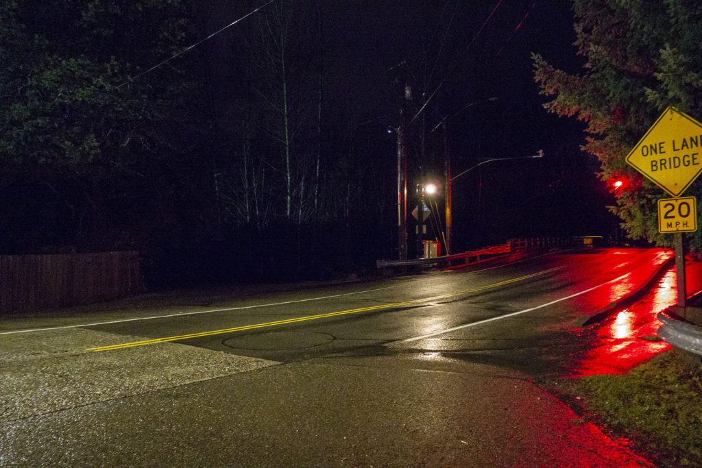
A similar view from Meadowbrook Way at night.
RECYCLED SHOT OF THE BRIDGE IN THE TWIN PEAKS PILOT

Oddly, there is a recycled shot of the Sheriff’s vehicle in pursuit. Truman turns on his lights after spotting James and Donna.

The scene cuts to the Sheriff’s vehicle exiting the same gravel road as before but cuts before we see it drive across the Meadowbrook bridge.
BRIDGE CAMEO IN TWIN PEAKS: FIRE WALK WITH ME
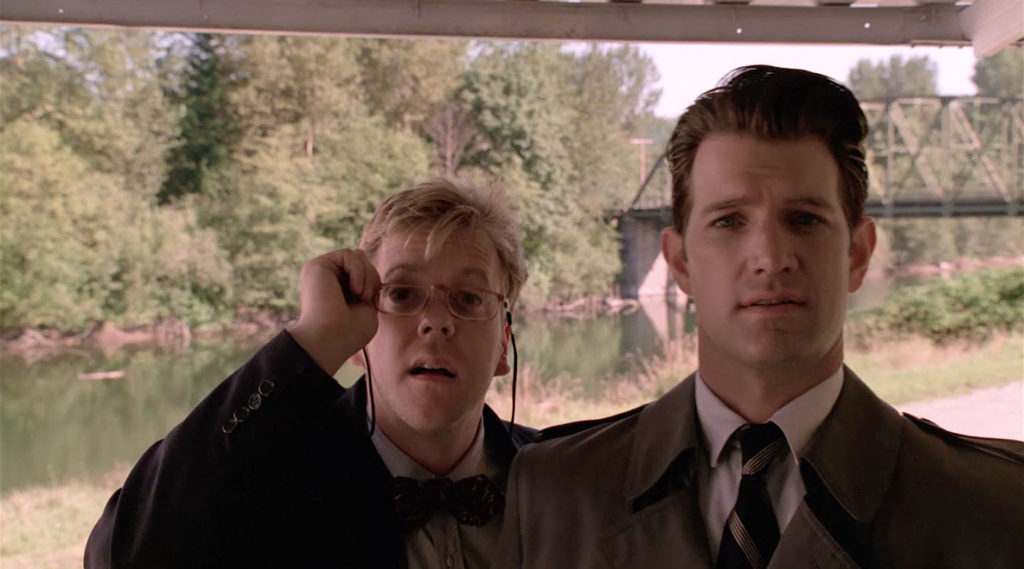
Meadowbrook bridge makes a brief cameo in Twin Peaks: Fire Walk With Me when Agents Desmond and Stanley visit Carl Rodd.
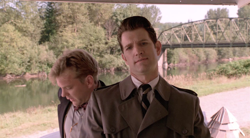

The view today is blocked by a row of trees at the former mobile home park.
BRIDGE IN TWIN PEAKS – PART 18

The bridge makes one final appearance in Season 3 on Showtime when Richard/Cooper drives Carrie Page to the town of Twin Peaks.
I captured a similar nighttime video crossing Meadowbrook bridge.


The couple approaches the bridge at night.
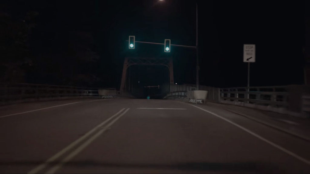
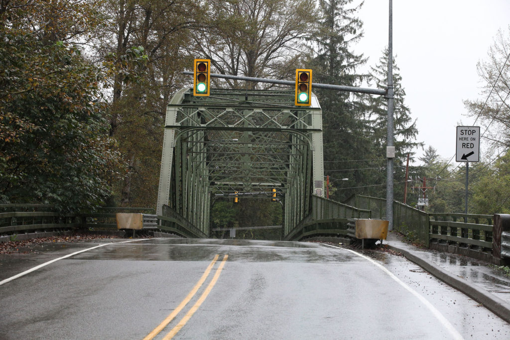
As the light turns green, they proceed forward.


Meadowbrook Way turns into Southeast Reinig Road as you exit the bridge.


As they exit the bridge, you see the traffic light that controls access. While this scene is the last time the bridge appears in Twin Peaks, my fingers remained crossed that we’ll return again one day.
Discover more from TWIN PEAKS BLOG
Subscribe to get the latest posts sent to your email.


