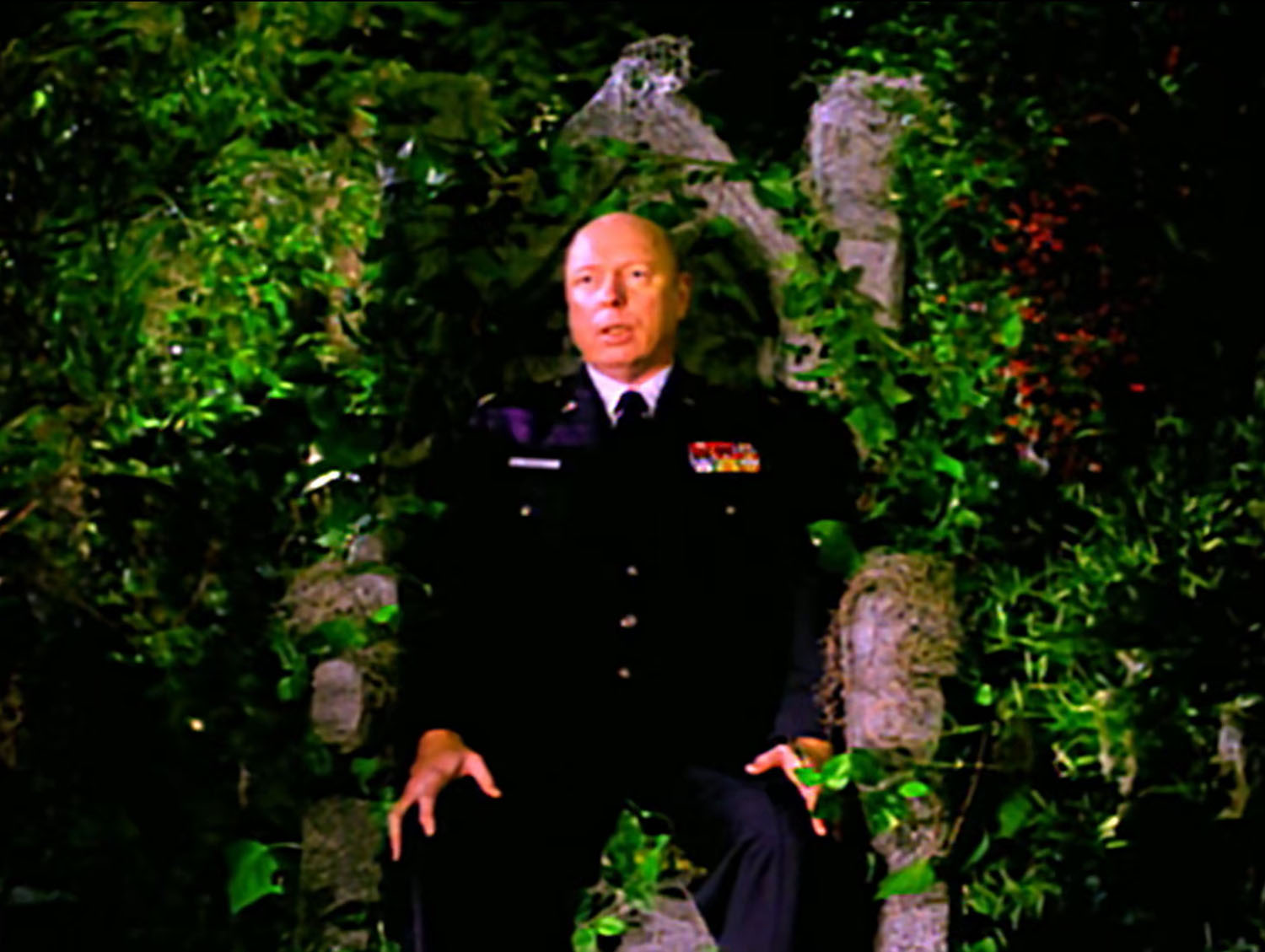
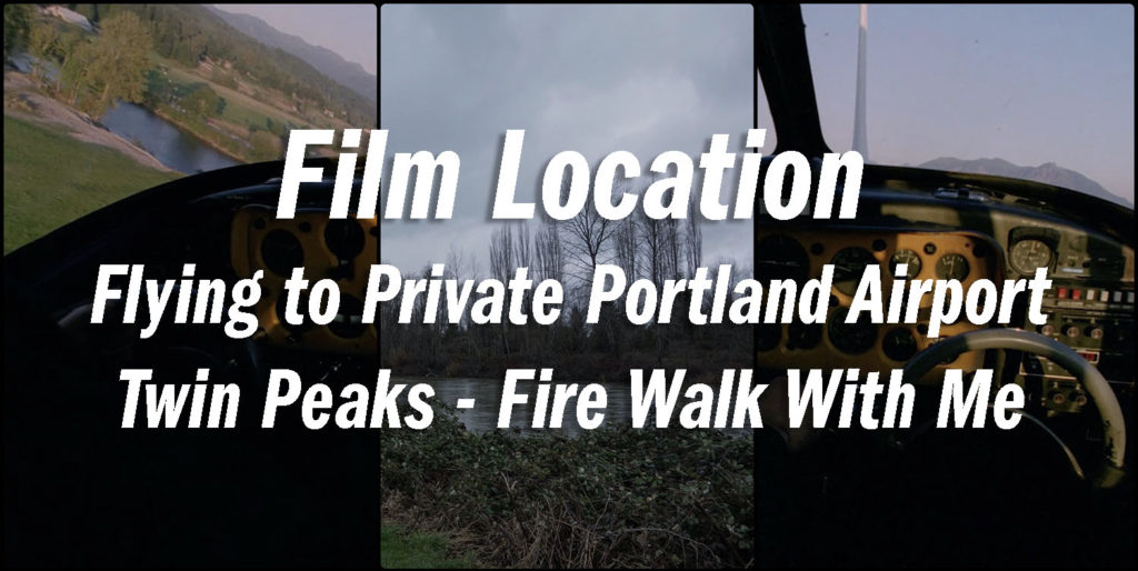
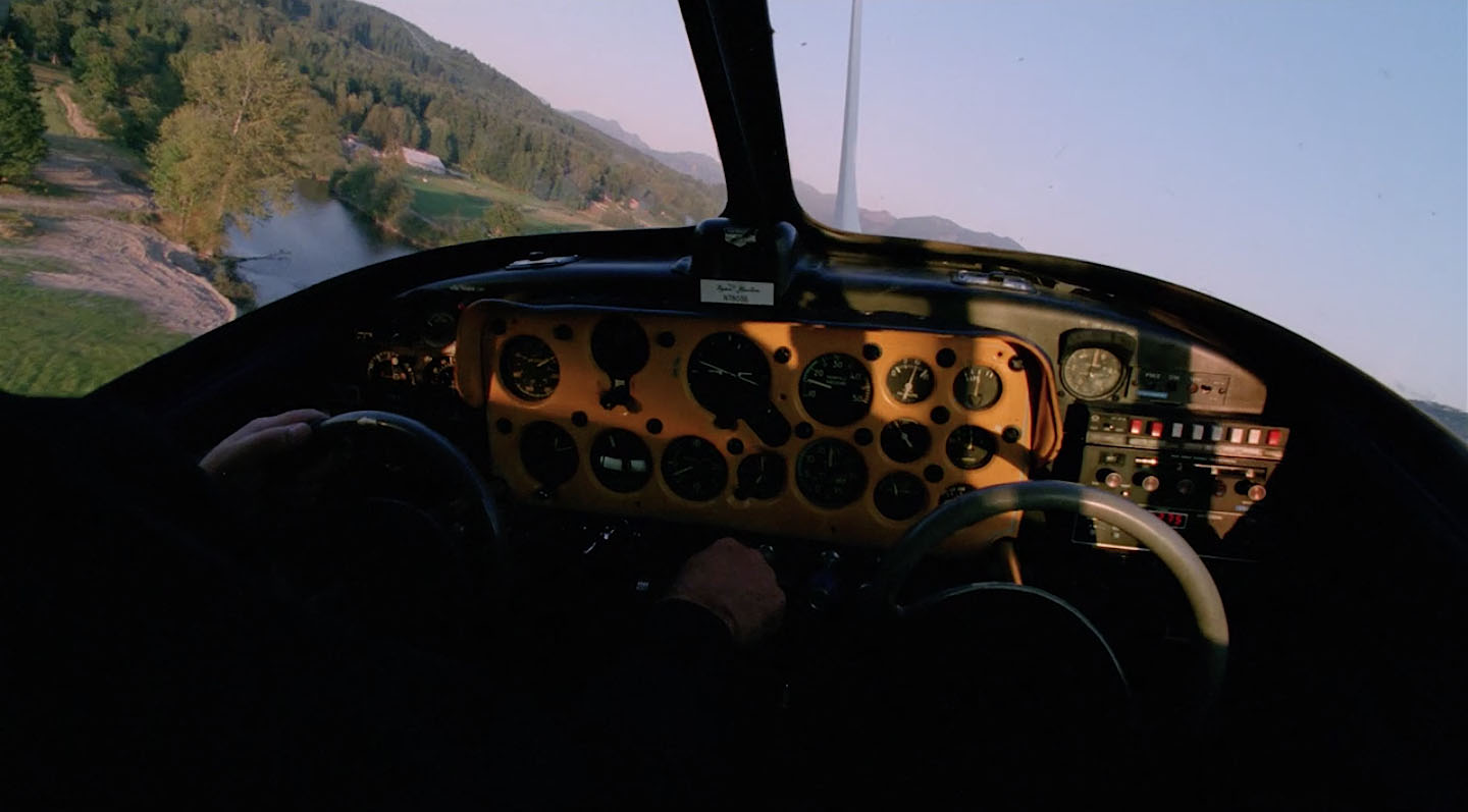
In Twin Peaks – Fire Walk With Me, Regional Bureau Chief Gordon Cole makes arrangements to meet Special Agent Chet Desmond at a private airport in Portland, Oregon. There is a seven-second transition shot from the cockpit of the plane approaching the small airport. This may be one of the more extreme examples of how obsessed I am with finding locations from my favorite David Lynch film. I first published this article on August 27, 2018. It was updated with photos from my visit on January 25, 2020.
FINDING THE LOCATION
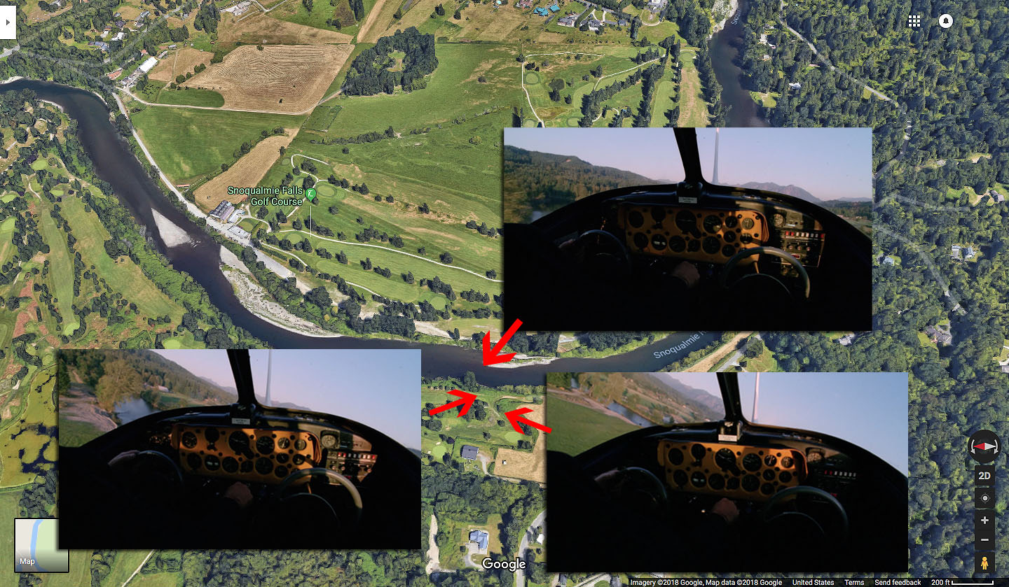
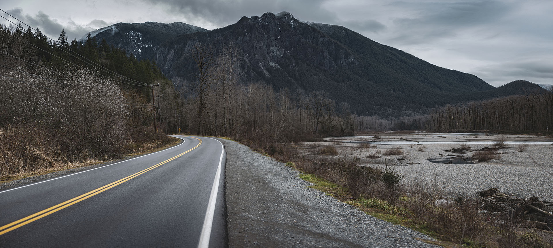
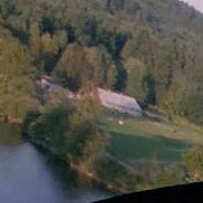
Chet Desmond’s plane is flying over the Snoqualmie River while approaching the Fall City Airport in Fall City, Washington.
The approximate coordinates location where this scene take place are 47°33’48.3″N 121°52’41.5″W.
Since I don’t have an airplane, the closest spot to get photos was along SE Fish Hatchery Road (47°33’48.1″N 121°52’32.8″W).
I’ve loved transition scene as Mount Si can be seen in the background.
GROUP OF TREES
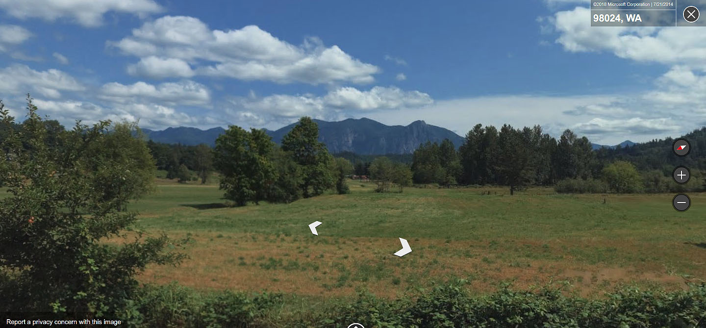
Using an aerial view on Google Maps, I began at Mount Si and drew a line to a spot over the Snoqualmie River. I looked for two things in the area – a white barn and a grouping of trees along the riverbank.
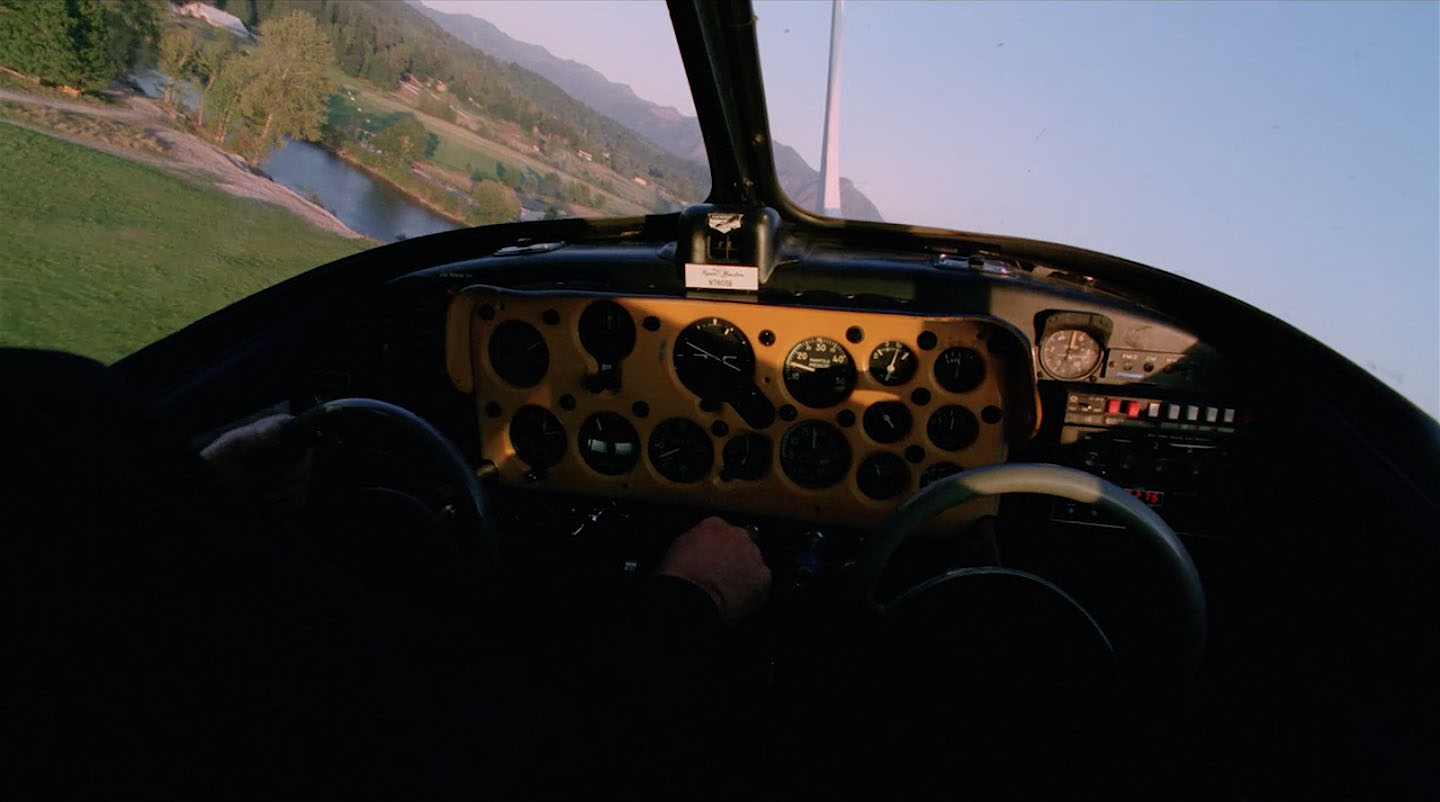
The grouping of trees can be seen in this shot as the plane banks slightly left. You can also see the tail end of Mount Si through the windshield.
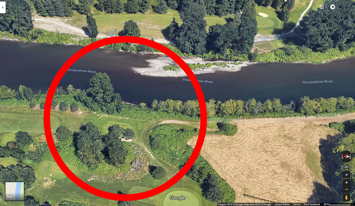
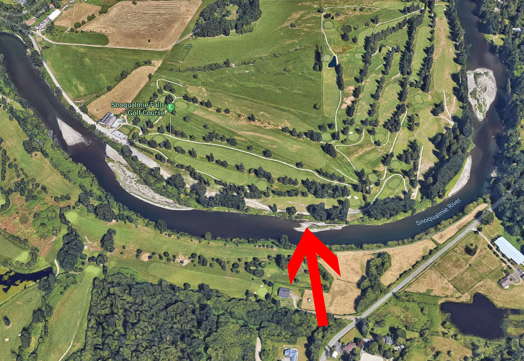
The circled area with trees appeared to be a match. The area is covered in grass today versus the dirt trail seen in the film. Since Google Maps didn’t offer a street view, I turned to Bing.
Using street view on Bing Maps, I found the area along 35109 Se Fish Hatchery Road in Fall City next to Snoqualmie Falls Golf Course. The trees in the red circle appear to match the shape of the trees in the film.
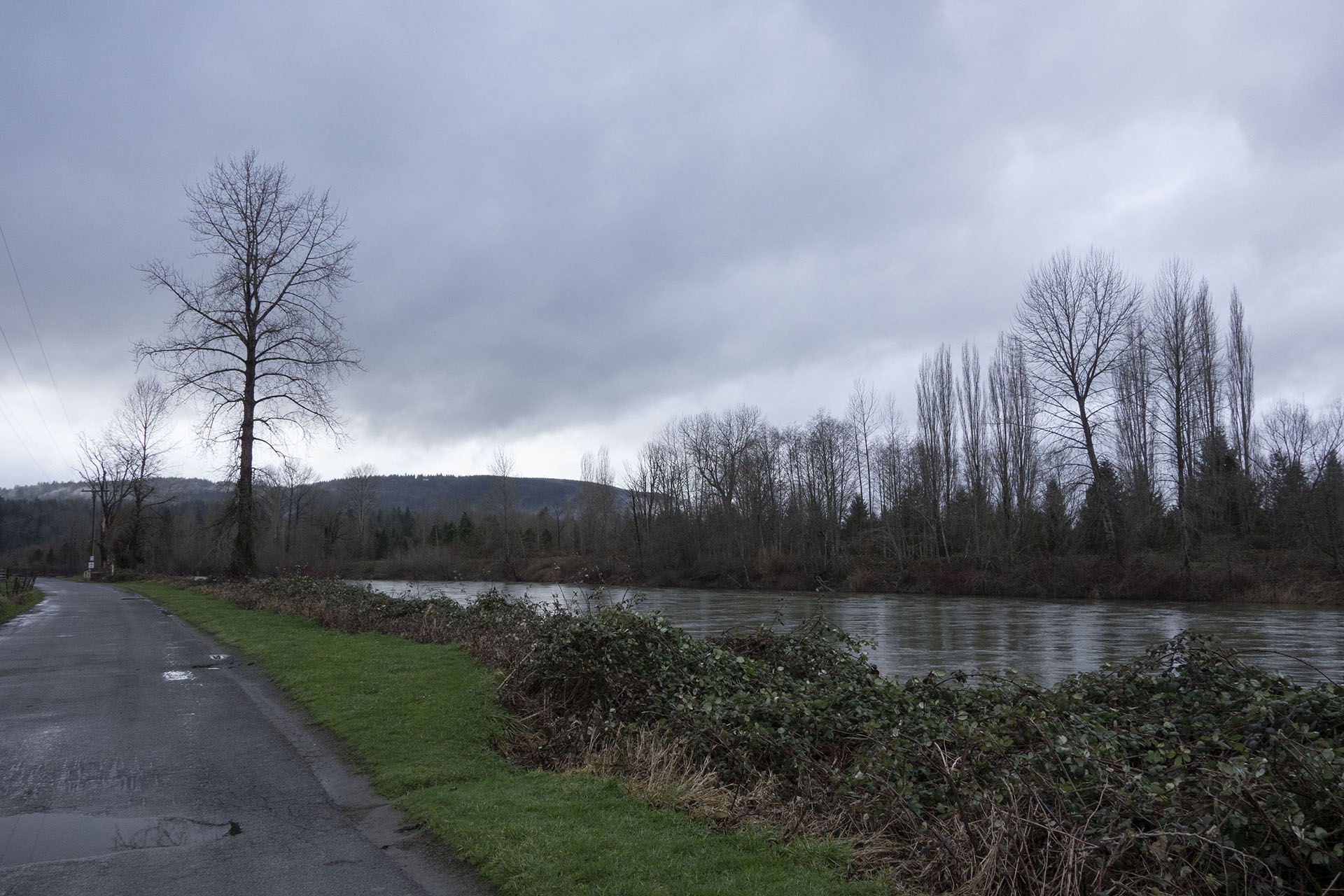
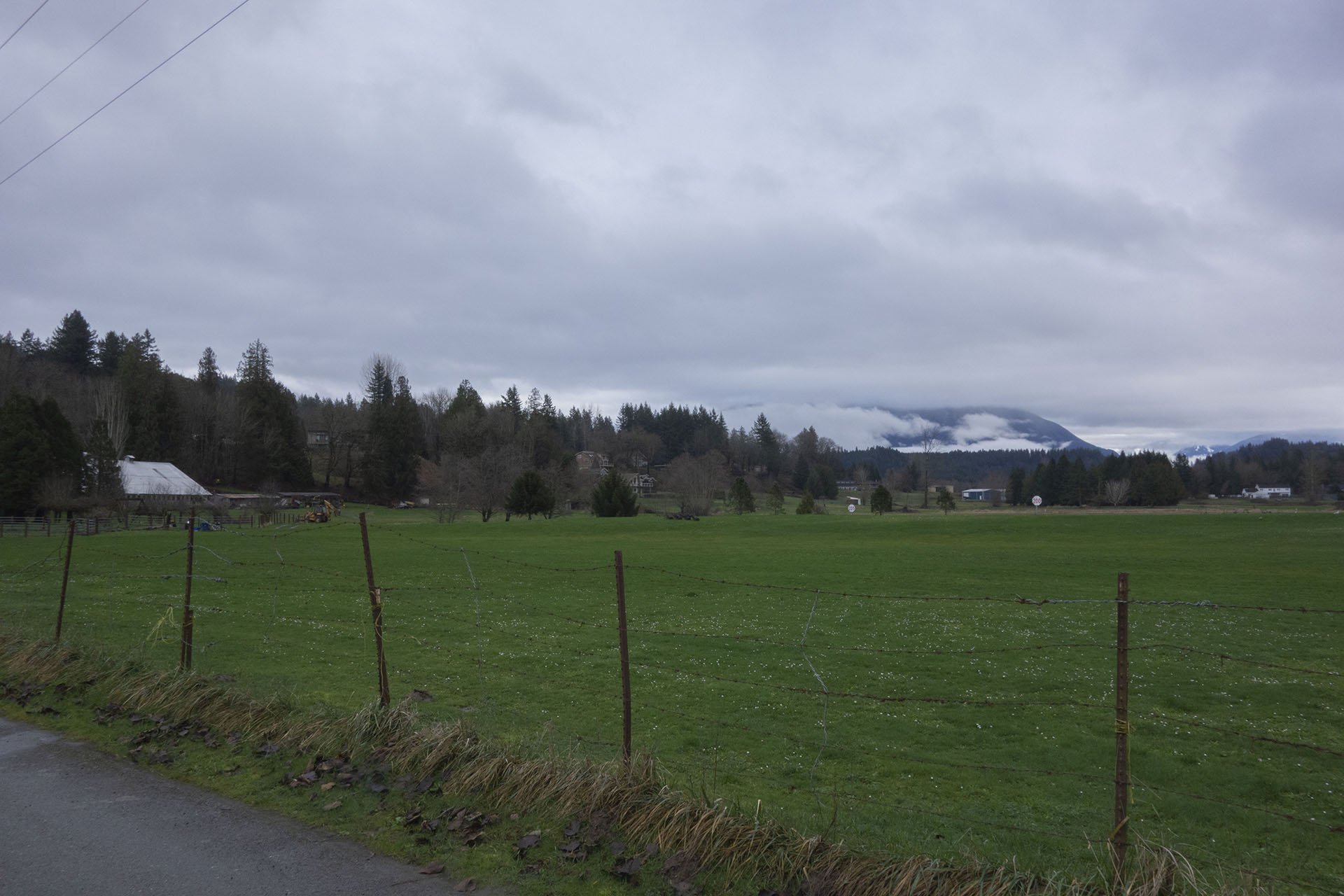
Here are the same trees as seen from the opposite side of the Snoqualmie River on January 25, 2020.
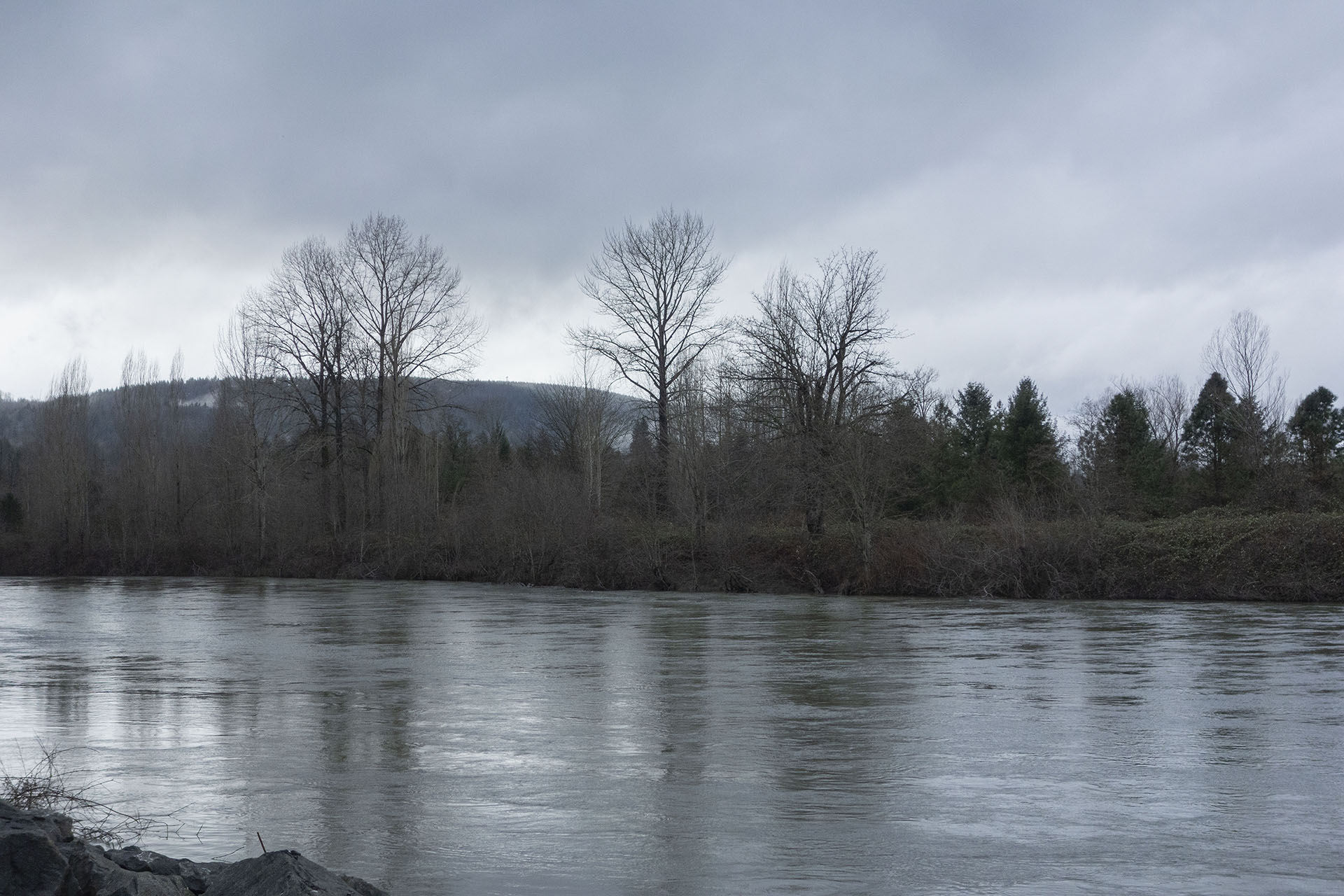
The scene was most likely shot sometime around mid-September 1991. The trees in the area would have been filled with green leaves, compared to the cold, gray skies of the Pacific Northwest in January.
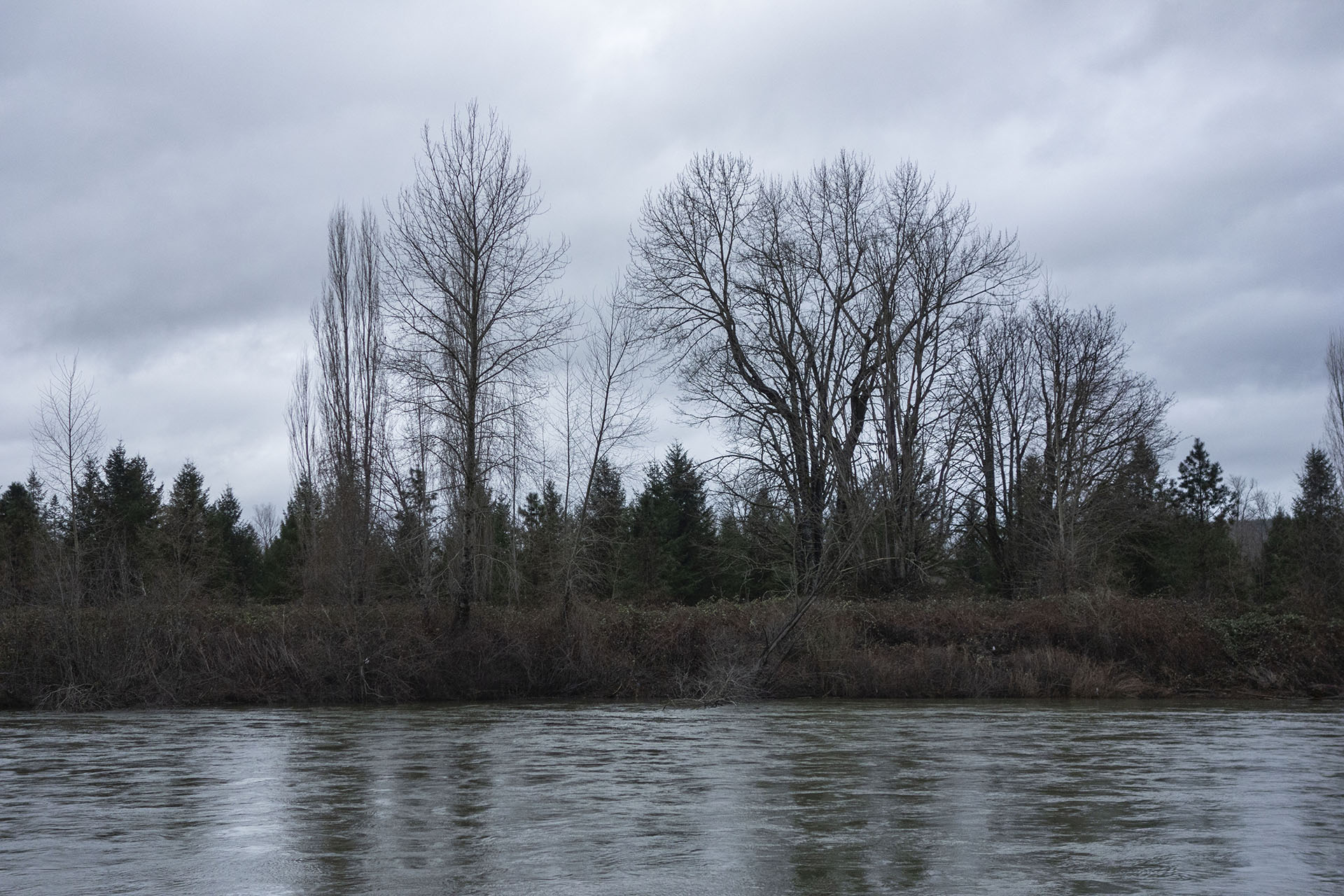
One final look at that grouping of trees across the river.
THE WHITE BARN
The next clue to help identify the spot was the white barn building seen in the distance on the other side of Snoqualmie River.
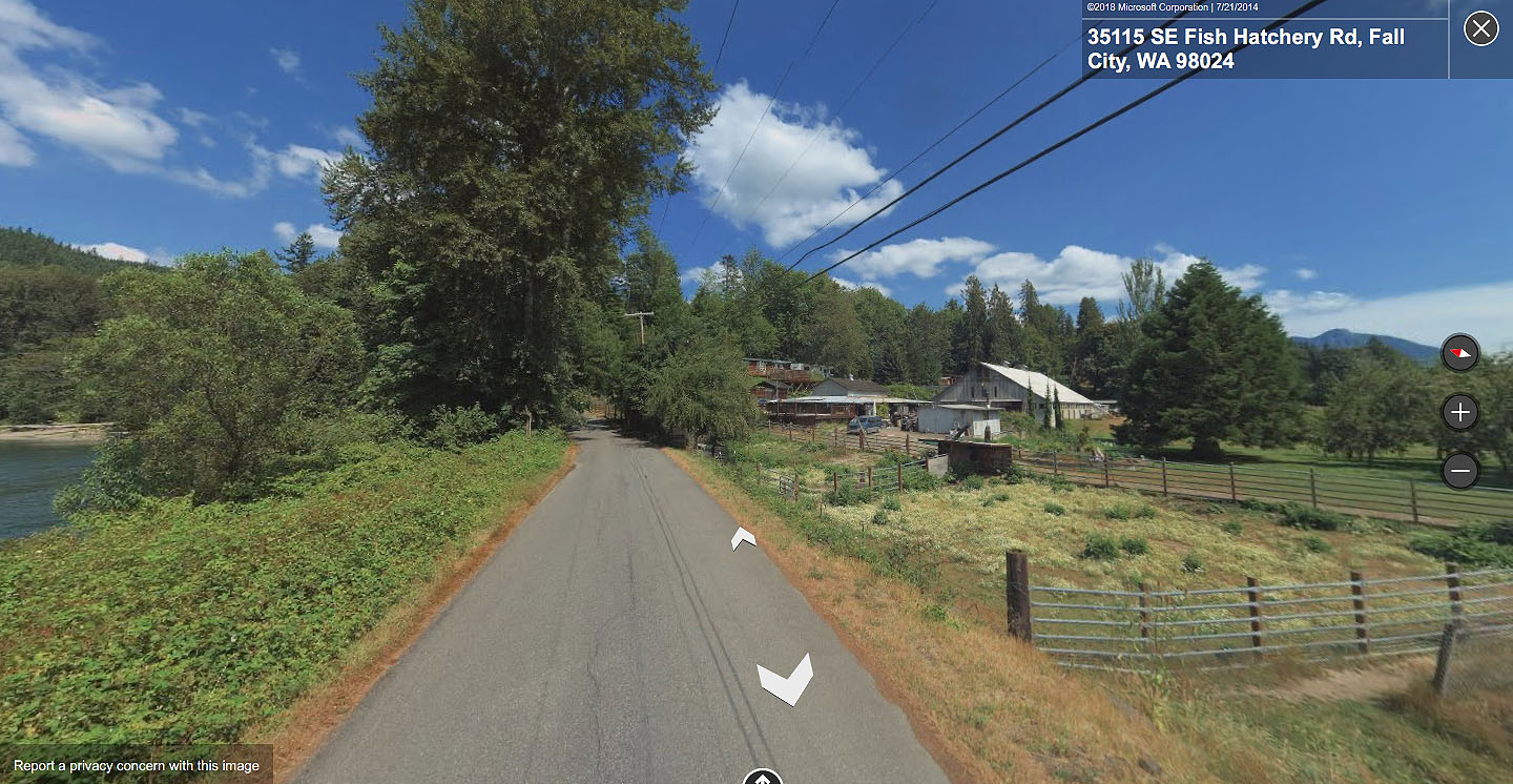
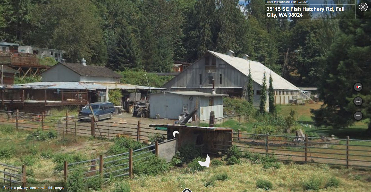
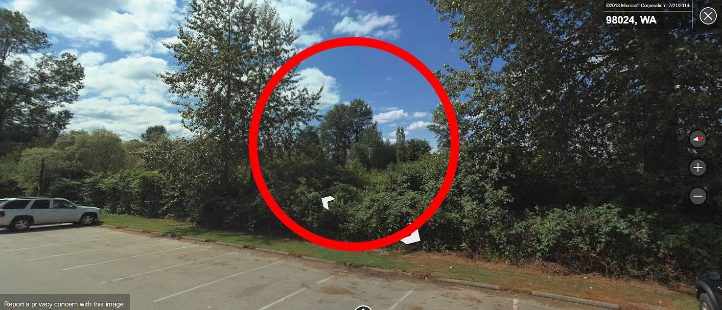
I used Bing Maps street view and traveled down the road from the Snoqualmie Falls Golf Course. This building at 35115 SE Fish Hatchery Road seems to match.
While difficult to see, the slope of the barn, the barn’s color and the details along the side of the building appear to match.
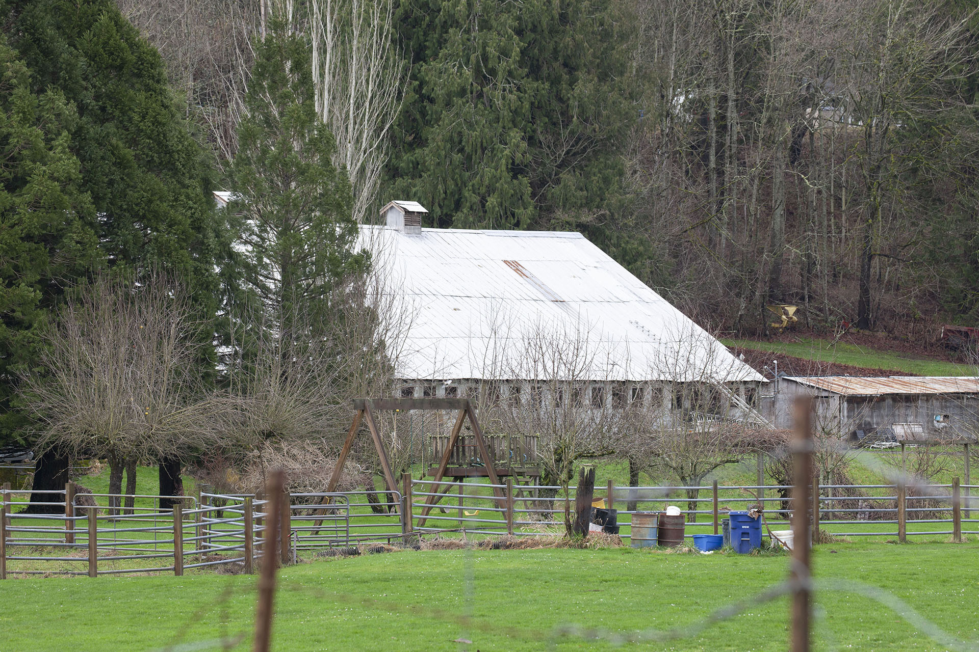
Here is the same barn on January 25, 2020. There is, of course, a wild Twin Peaks connection to the folks who own that barn and surrounding land.
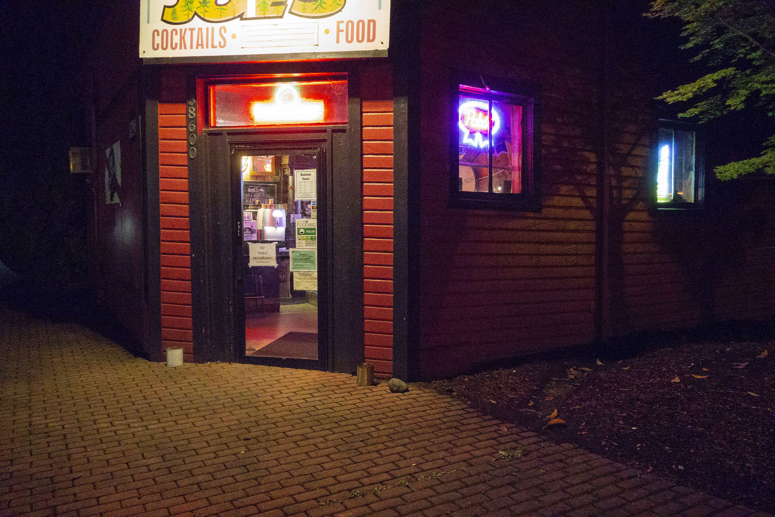
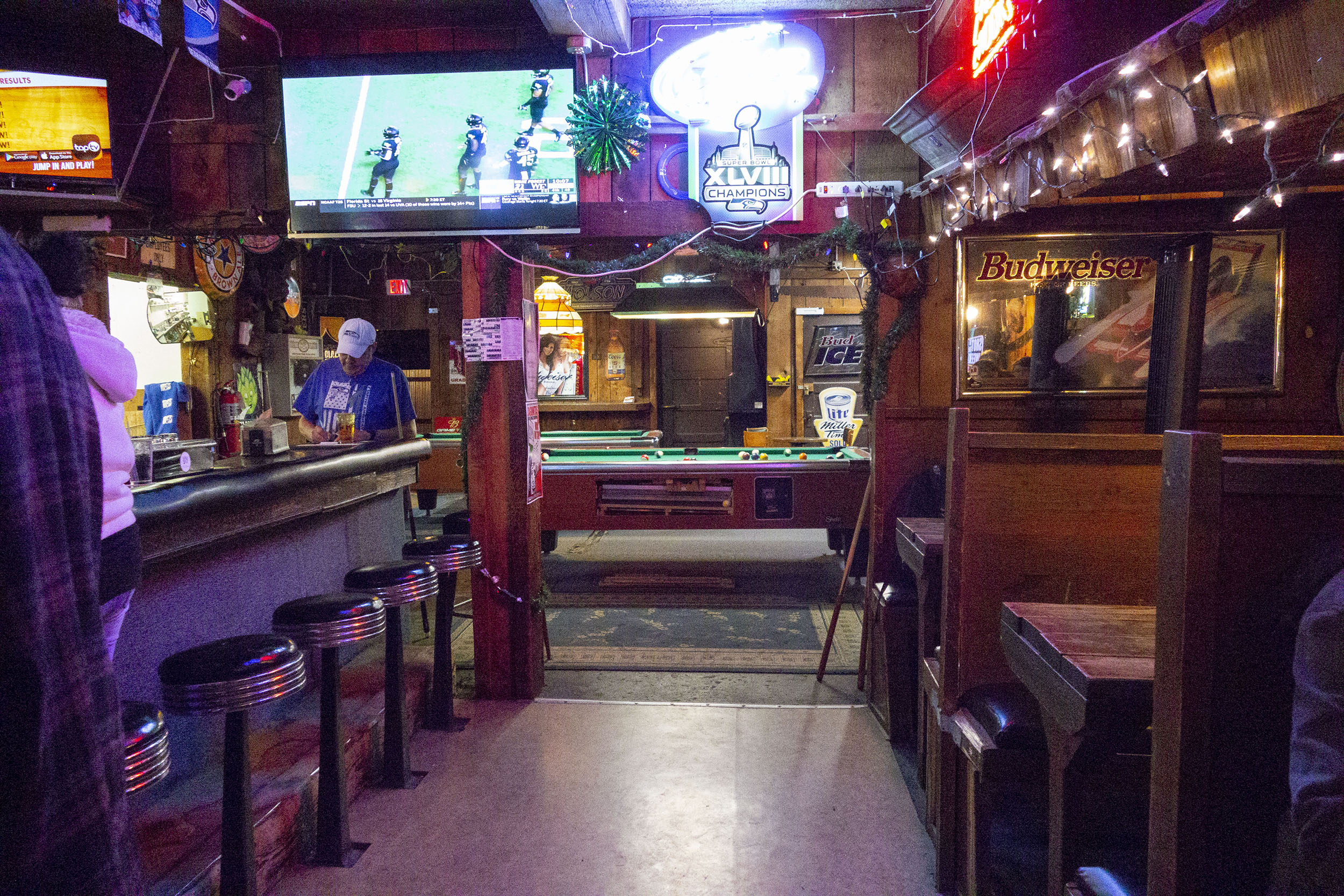
Pam and Jim Leland also own Smokey Joe’s Tavern, which was the filming location fo Elk’s Point Bar #9 in Twin Peaks – Part 14 on Showtime. The Lelands were interviewed on October 2, 2008 in the Snoqualmie Valley Record.
You can read more about this filming location in this article.
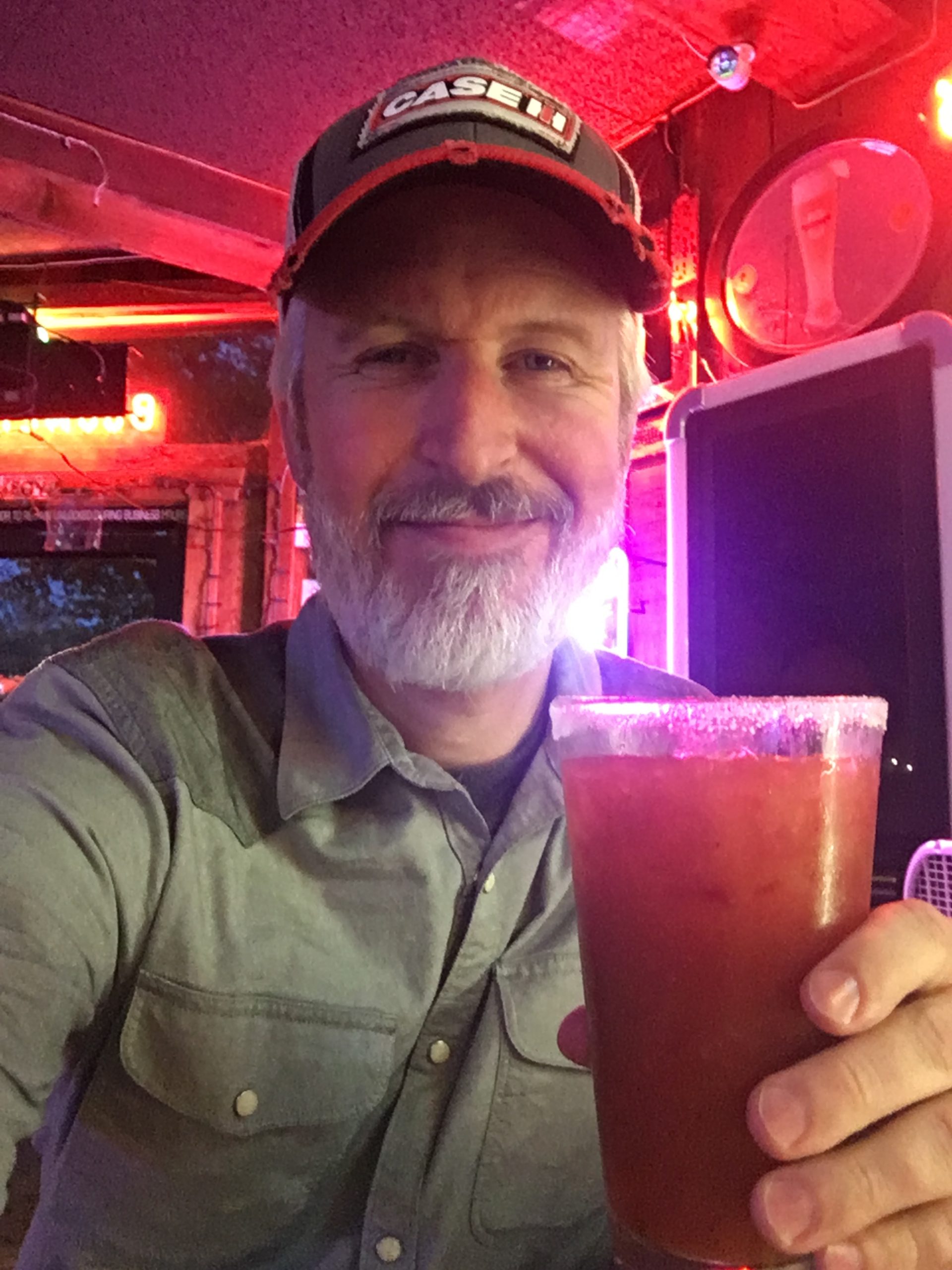
I highly recommend their spicy Bloody Mary, just like Sarah Palmer drinks.
SEEING MOUNT SI
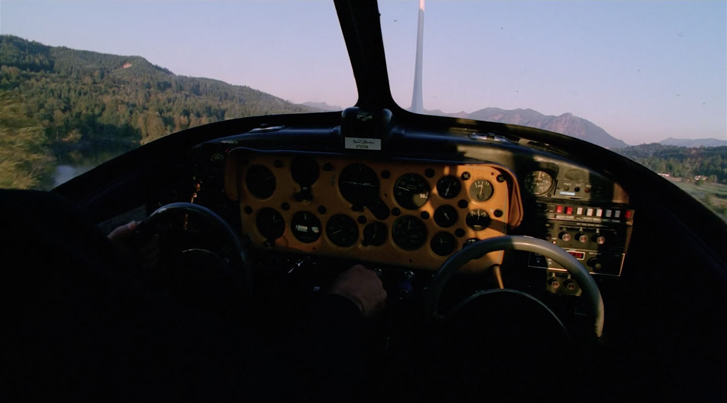
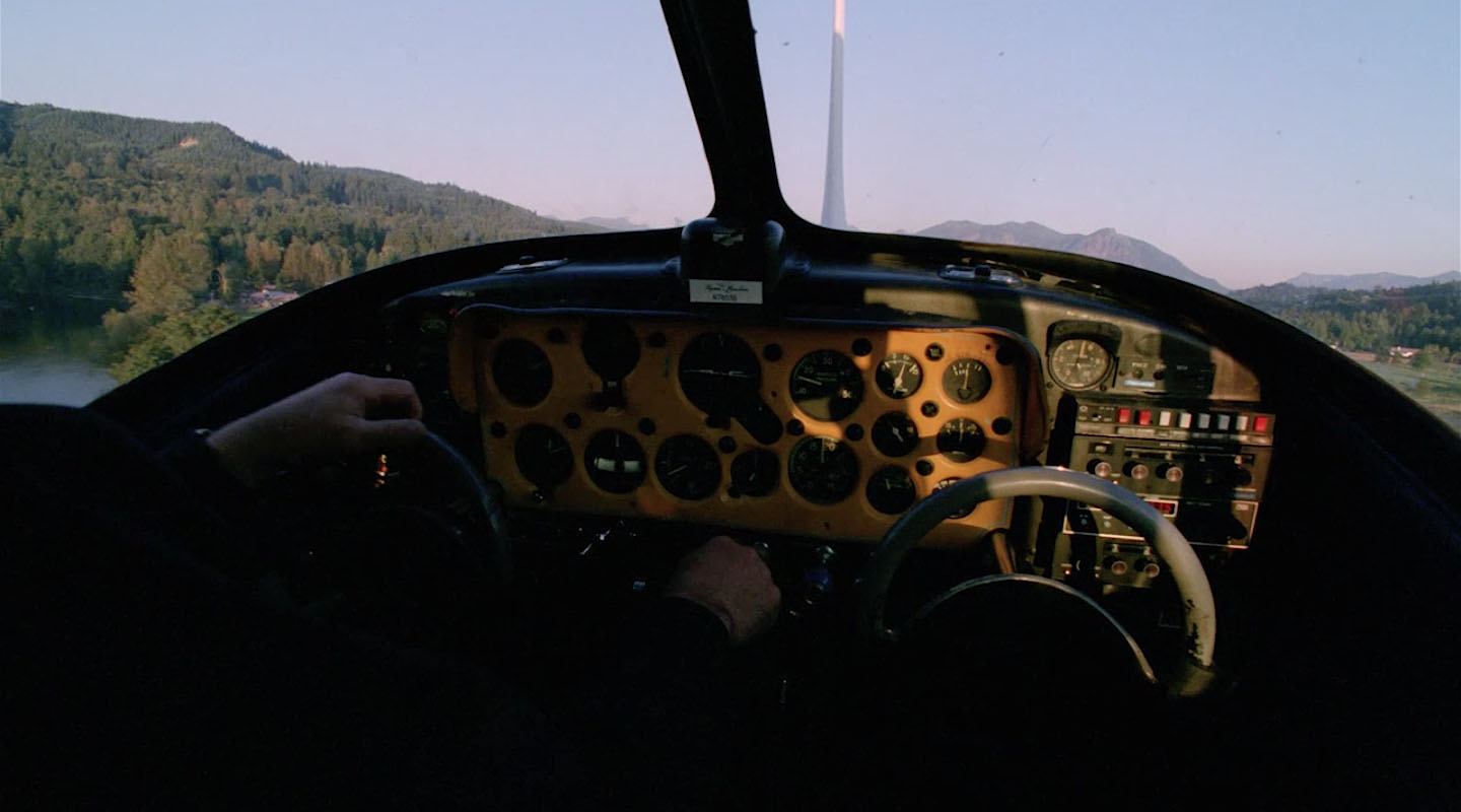
The pilot straightens the airplane and we get a good look at Mount Si in the distance.
This image from Bing Maps confirms the shape of the mountain matches the shape from the film.
On January 25, 2020, the skies weren’t being cooperative so I couldn’t get a clear shot.
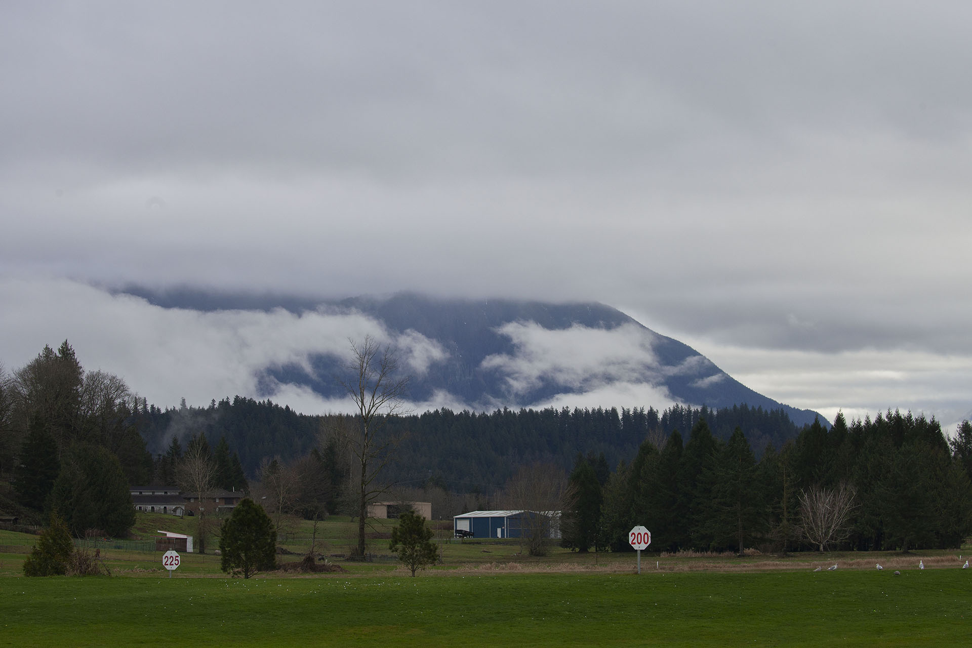
Trust me, that’s Mount Si. The blue shed just below is part of the Fall City Airport, scene where Gordon Cole introduces Chet Desmond to Agent Sam Stanley.
Despite it being an extremely short scene, I love finding film locations like this one that are not often documented.
Author
Discover more from TWIN PEAKS BLOG
Subscribe to get the latest posts sent to your email.