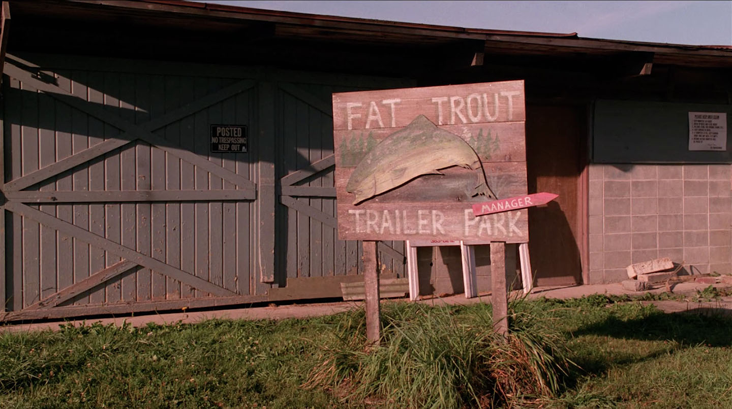
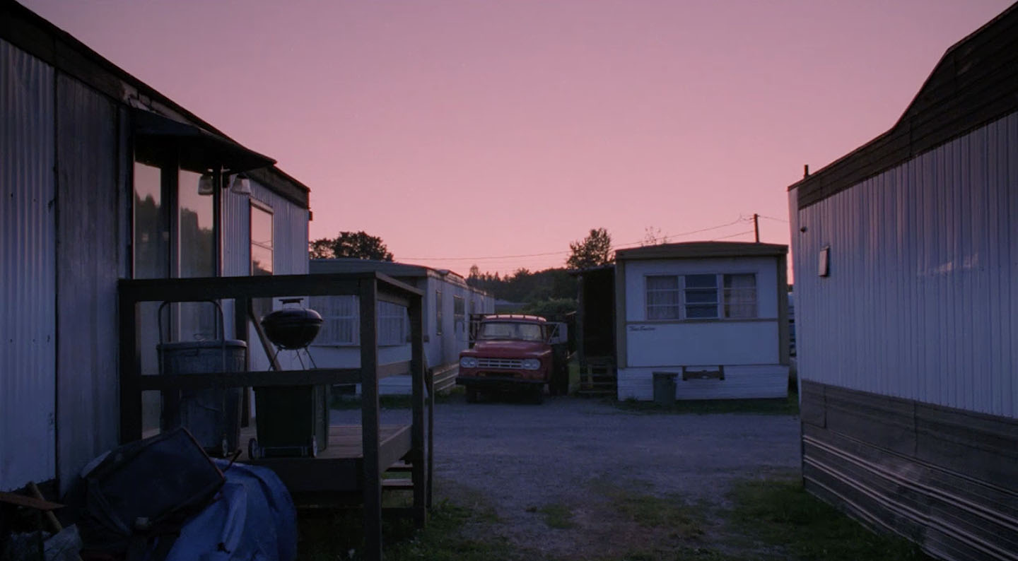
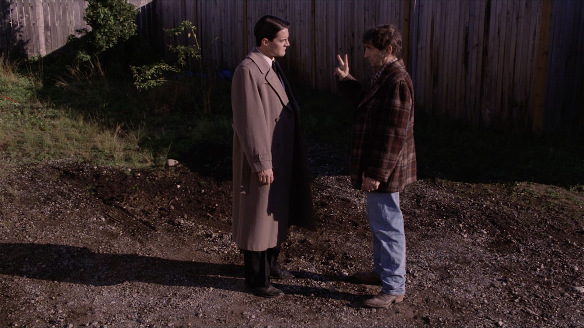
The Fat Trout Trailer Park, home to Carl Rodd, Teresa Banks and Deputy Cliff, first appeared in Twin Peaks: Fire Walk With Me. This location contains my favorite 2-minute scene in all of Twin Peaks. I first visited the trailer park in 1996 during and impromptu stop on the Twin Peaks Fan Fest bus tour. But where exactly was it located?
WHERE IS THE FAT TROUT TRAILER PARK FROM TWIN PEAKS: FIRE WALK WITH ME LOCATED?
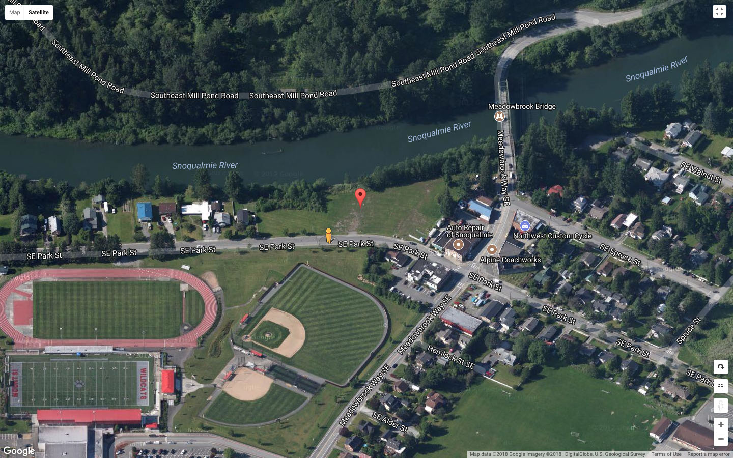
The scenes at the Fat Trout Trailer Park were shot at the former Riverside Mobile Home Park located at 39531 SE Park Street in Snoqualmie, Washington. I had previously identified this location as Park Street Trailer Park due to its proximity along Park Street. The approximate coordinates are 47°31’33.4″N 121°48’48.2″W. The red marker on the aerial map above shows the exact spot.
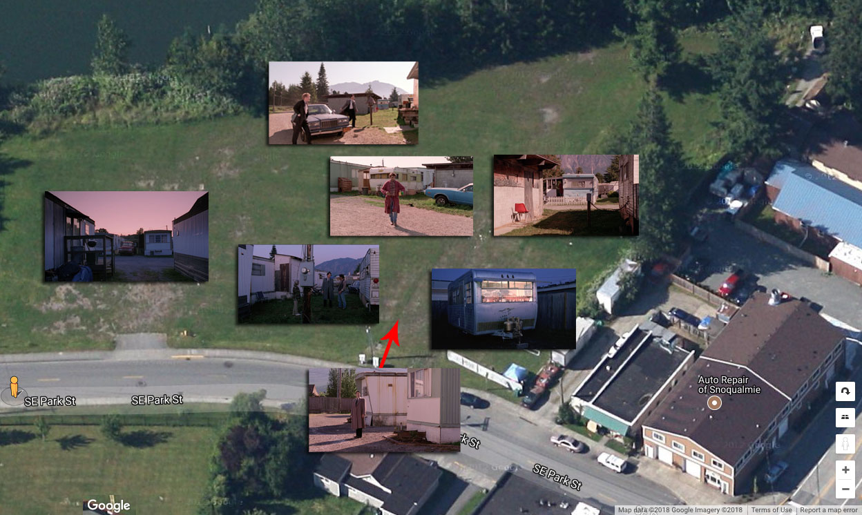
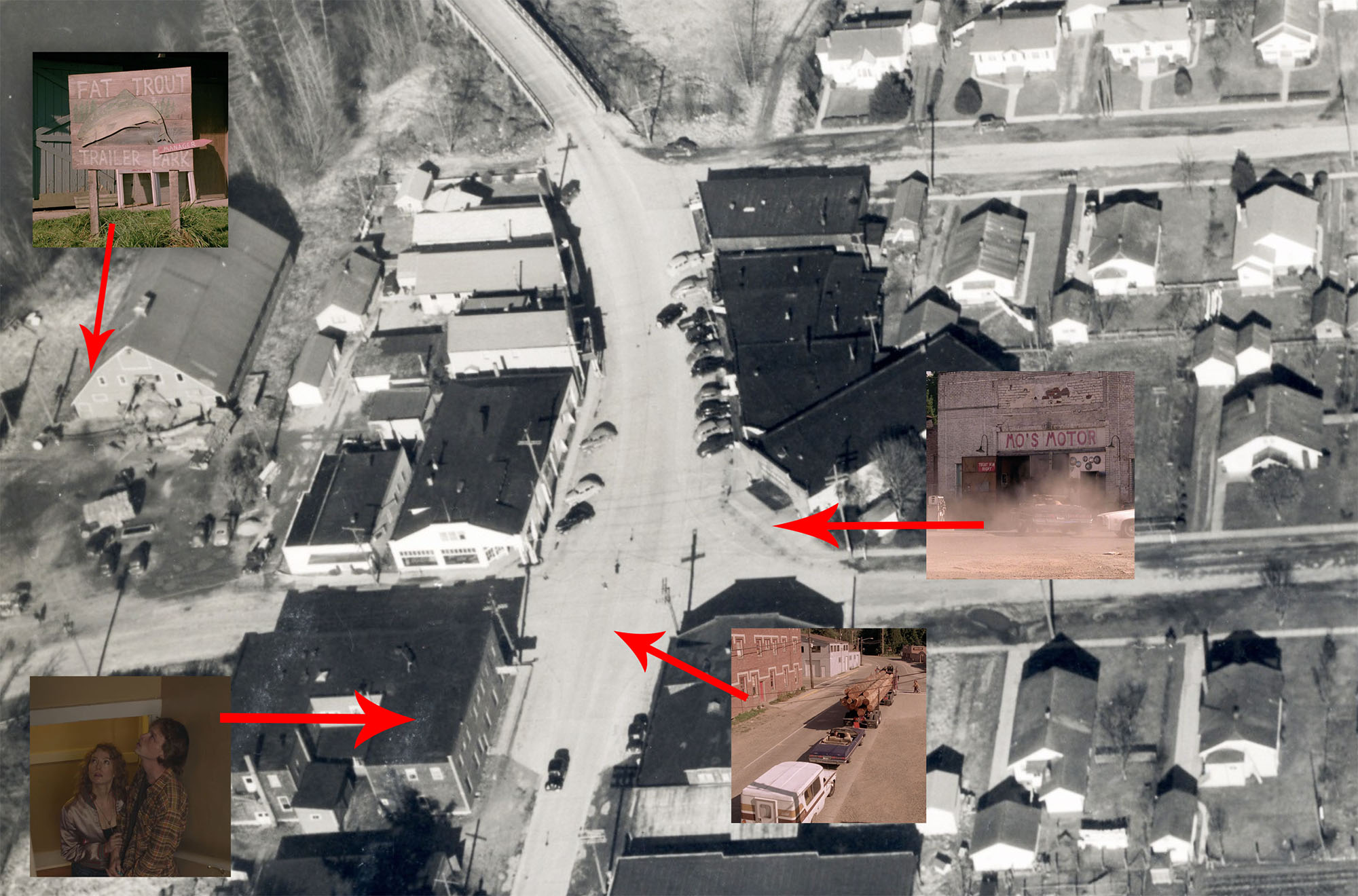
The image above shows approximate locations of key scenes that took place at the Fat Trout Trailer Park.
If you were to drive east on Park Street about another two blocks, you would find the location of Mo’s Motor from Twin Peaks: Fire Walk With Me and the famous intersection from the movie (Mike the One Armed man yelling at Leland), and Part 6 of Twin Peaks on Showtime (where the second Number 6 utility pole was located).
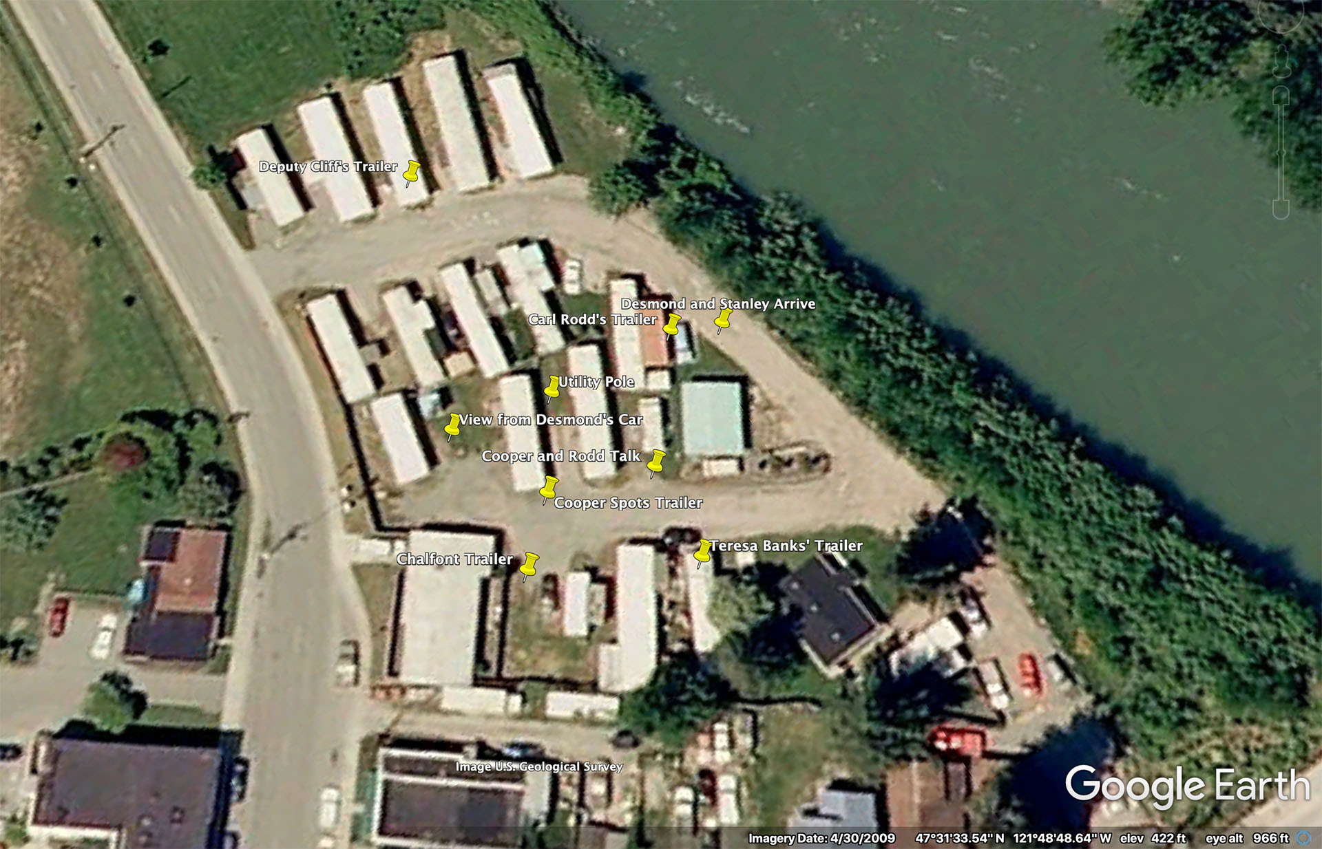
Using an image from Google Earth, I pinned the approximate locations where each scene took place in the trailer park.
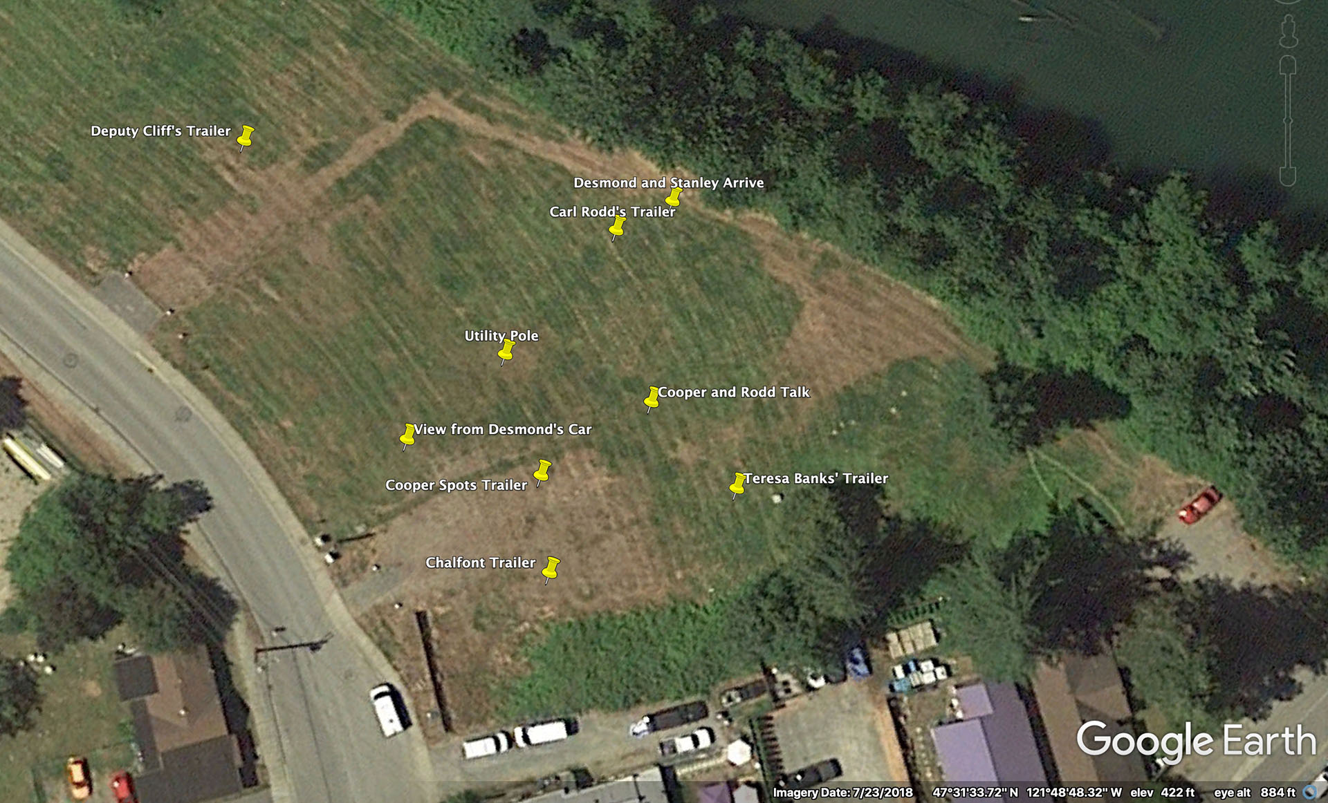
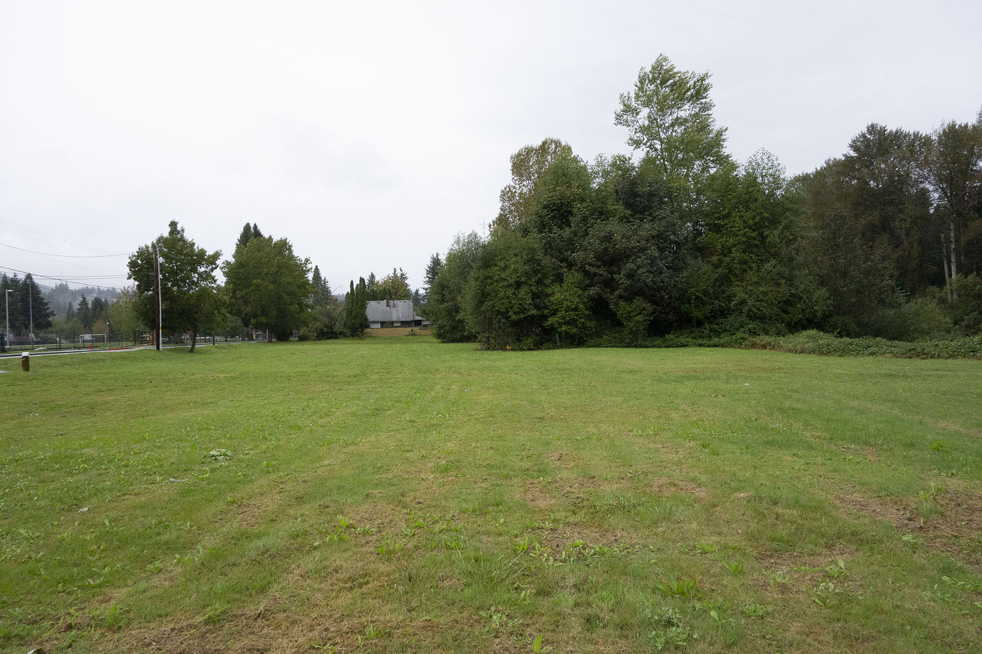
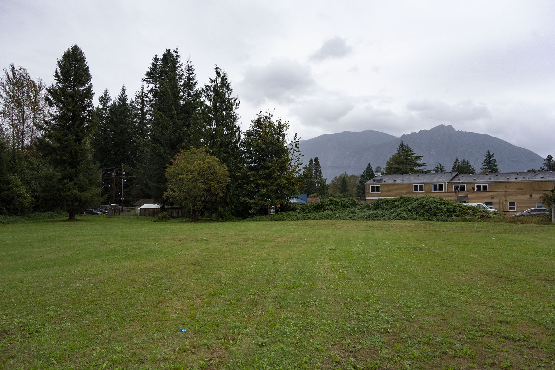
Today, the spot looks more like this image from Google Earth after the trailer park was removed. More on that in a moment.
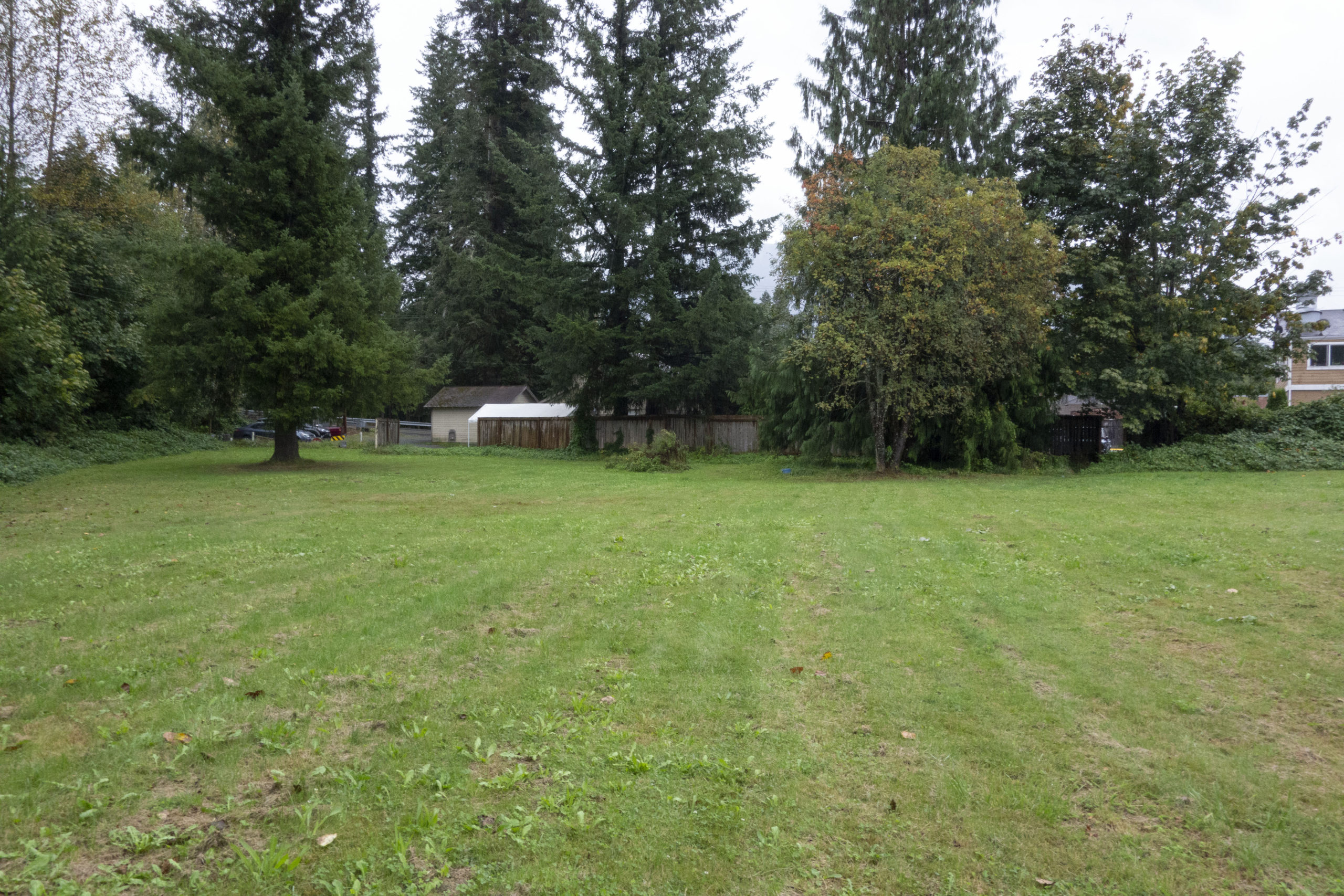
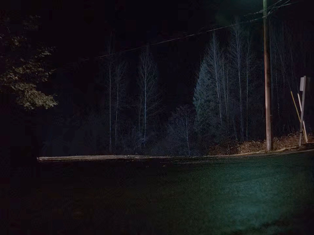
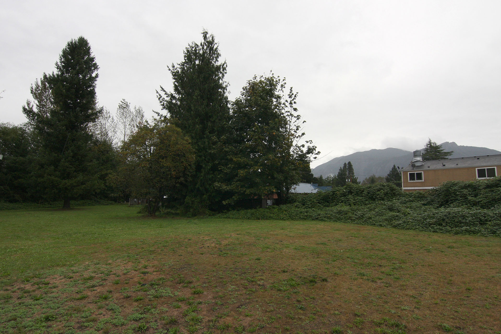
Here’s how the site looked on September 15, 2019. You can hear the ever-present rain and a distant locomotive passing through town. This site actually played an important role in early Snoqualmie town history.
FORT ALDEN IN SNOQUALMIE VALLEY
In the mid-1850s, scores of white settlers crossed into Snoqualmie Valley region. Native American tribe leaders, such as Snoqualmie Chief Patkanim, wanted to keep peace between tribes and the ever growing number of settlers. A hastily-drawn treaty in 1855 that included tribal lands caused tension among the tribes. Some lashed out by initiating raids and attacks on the then small-town of Seattle.
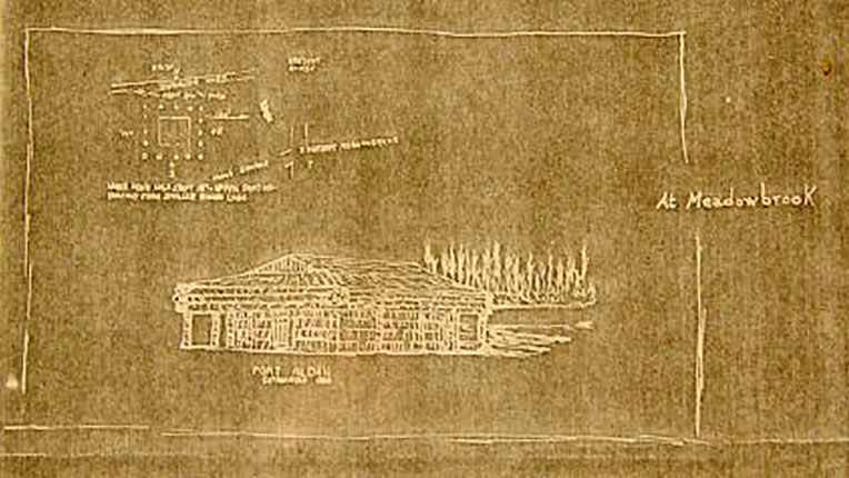
Fearing additional attacks in Cascade region, several forts were built by Washington State Militia Volunteers. One log blockhouse, Fort Alden, was established in 1856 along the banks for the Snoqualmie River. Named for Captain James Alden, Jr. (a direct descendant of James Alden and Priscilla Mullins from the Mayflower), the Fort was down the street from the future town of Meadowbrook. Aside from one or two minor incidents, anticipated skirmishes between Native Americans and white settlers never happened, so Fort Alden was abandoned about a year later.
According to Snoqualmie Valley Historical Museum, the blueprint image above is Fort Alden in Meadowbrook. It’s described on the drawing as:
“Building with sides of horizontal logs; front door of vertical boards with crossbars top and bottom; porch roof of horizontal logs supported by log posts at corners and sides, extending beyond sides of building as balcony- brush and trees across Snoq. River in back. In upper left corner is drawing with dimensions of building.”
JEREMIAH BORST – FATHER OF SNOQUALMIE VALLEY
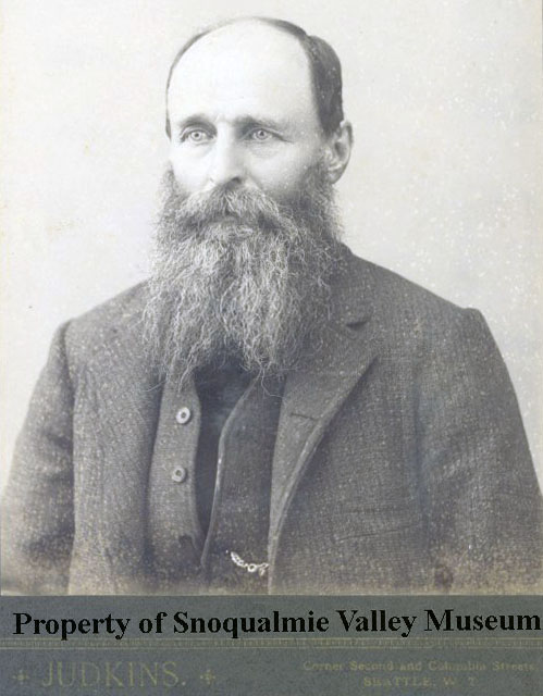
Enter Jeremiah Borst. Sporting a stunning beard, this photograph taken somewhere between 1880-1889 at Judkins on the corner Second and Columbia Streets in downtown Seattle. Twenty-eight year old Mr. Borst arrived in the Snoqualmie Valley via the Cedar River Pack Trail around 1858. A young adventurer with dreams of verdant farmland, he occupied the abandoned Fort Alden and eventually married a Snoqualmie woman named Mina.
Known today as the “Father of Snoqualmie Valley,” Borst acquired more than 900-acres of land. He even planted an apple orchard on the land where Mt Si High School (exterior of Twin Peaks High School). Much of his original farming homestead is now found at Meadowbrook Farm. He sold that farm in 1882 to the Hop Growers Association and moved to nearby Tollgate Farm. Borst died on August 10, 1890 at the age of 60 from typhoid fever. He is buried in Fall City cemetery.
MEADOWBROOK IN SNOQUALMIE, WASHINGTON
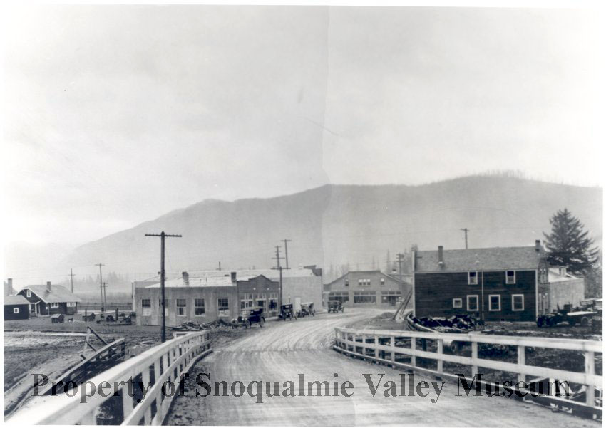
As mentioned, the mobile home park was once located in the town of Meadowbrook. Arthur Platt founded the town in 1923 with some of the land from Jeremiah Borst’s Meadowbrook Farm. The Snoqualmie Sawmill had opened a few years early, so the town, located just down the street from the mill was a prime spot for workers traveling by each day. I’ve discussed Meadowbrook in previous articles about Gersten Hayward’s apartment from Season 3 and Mo’s Motor from Twin Peaks: Fire Walk With Me.
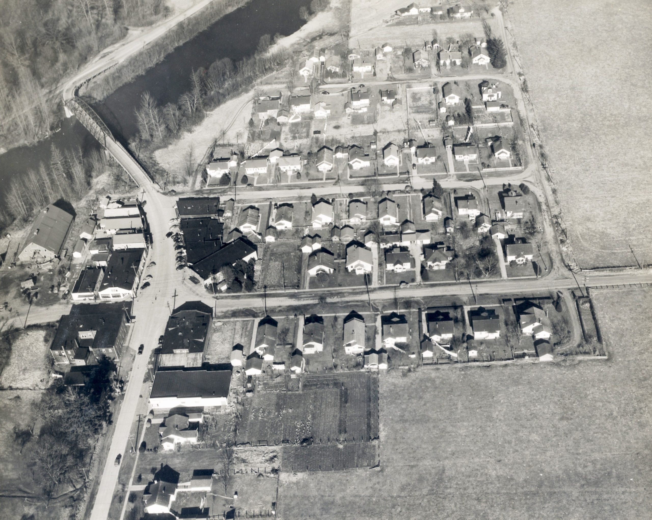
This 1943 image shows the small town, complete with houses where many of the mill workers lived.
I added images for several film locations to the image. If you look carefully, you’ll spot a giant barn that once sat on the land where the Fat Trout Trailer Park was located.

Alice Borst Rees Rachor, daughter of John and Mina Borst, is seen standing near that Snoqualmie River at the Fort Alden site in Meadowbrook sometime between the late 1930s and 1952. The land appears similar to the 1943 aerial photo shown above.
EASEMENT HISTORY IN MEADOWBROOK
Finding any bits of information about this land beyond the 1943 aerial image was nearly impossible. From the King County Property website, I located easement history of the land dating back to 1911. It appears a sewer pipeline was added on February 23, 1968, which could signify residential work on the land.
RIVERSIDE MOBILE HOME PARK
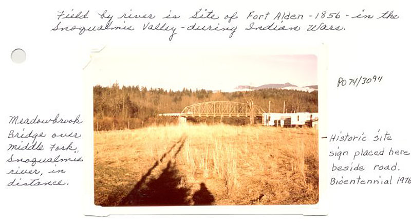
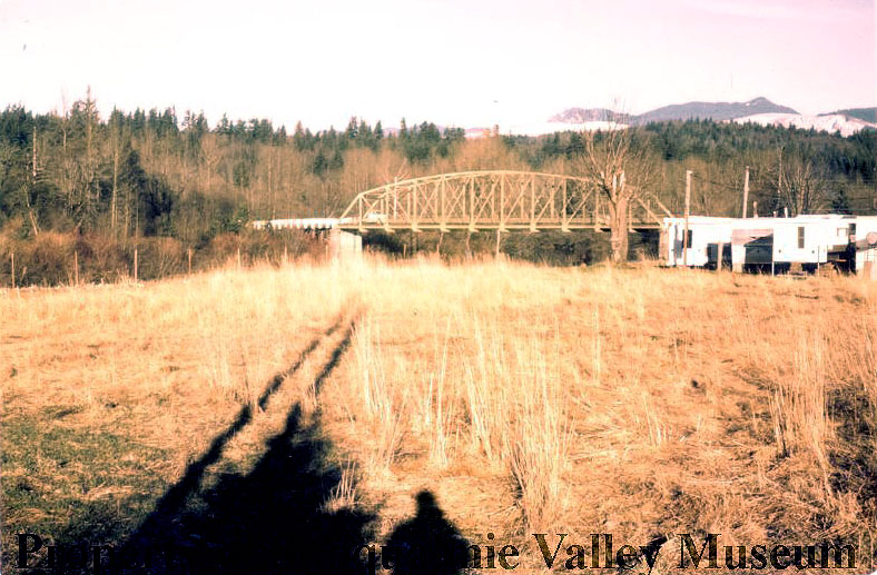
Digging a little further in the museum archives, I found this 1976 photo of the former Fort Alden site with Meadowbrook Bridge in the distance.
The Museum wanted to place a temporary sign by the road during the 1976 American Bicentennial to signify the location of Fort Alden. Notice the mobile home trailers in the background.
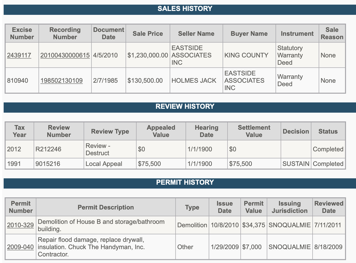
The King County Property Appraisers website had some transaction history for the land. It appears Jack Holmes sold the land to Eastside Associates, Inc. for $130,500 around February 7, 1985. The easement history above listed a waiver and covenant not to sue the City of Snoqualmie on November 13, 1985.
Eastside Associates, Inc. was once registered to Norman McCue of Bellevue, Washington. The company was established on December 28, 1982 and expired on December 31, 2012.
McCue and Associates (assuming McCue disbanded his previous company), was acquired by Trestle Community Management on June 13, 2015. According to their press release, the “combination creates a mid-sized firm with management of more than 50 communities and 2,600 homes in the Seattle area, with a pure focus on managing community associations.” McCue, described as “a pioneer in the industry,” served as an advisor in the role of “Of Counsel” to Bob Brencic, President and Owner of Trestle.
This means that at the time of filming in 1991, the mobile home park was being managed by Eastside Associates. Mr. McCue may have passed away on November 19 in Redmond, Washington at the age of 84. I’ve found no obituary of note other than a line in the Seattle PI.
It would seem the property changed hands in 1985, which could be the time that Riverside Mobile Home Park was established.
REPETITIVE FLOODING NEAR MEADOWBROOK
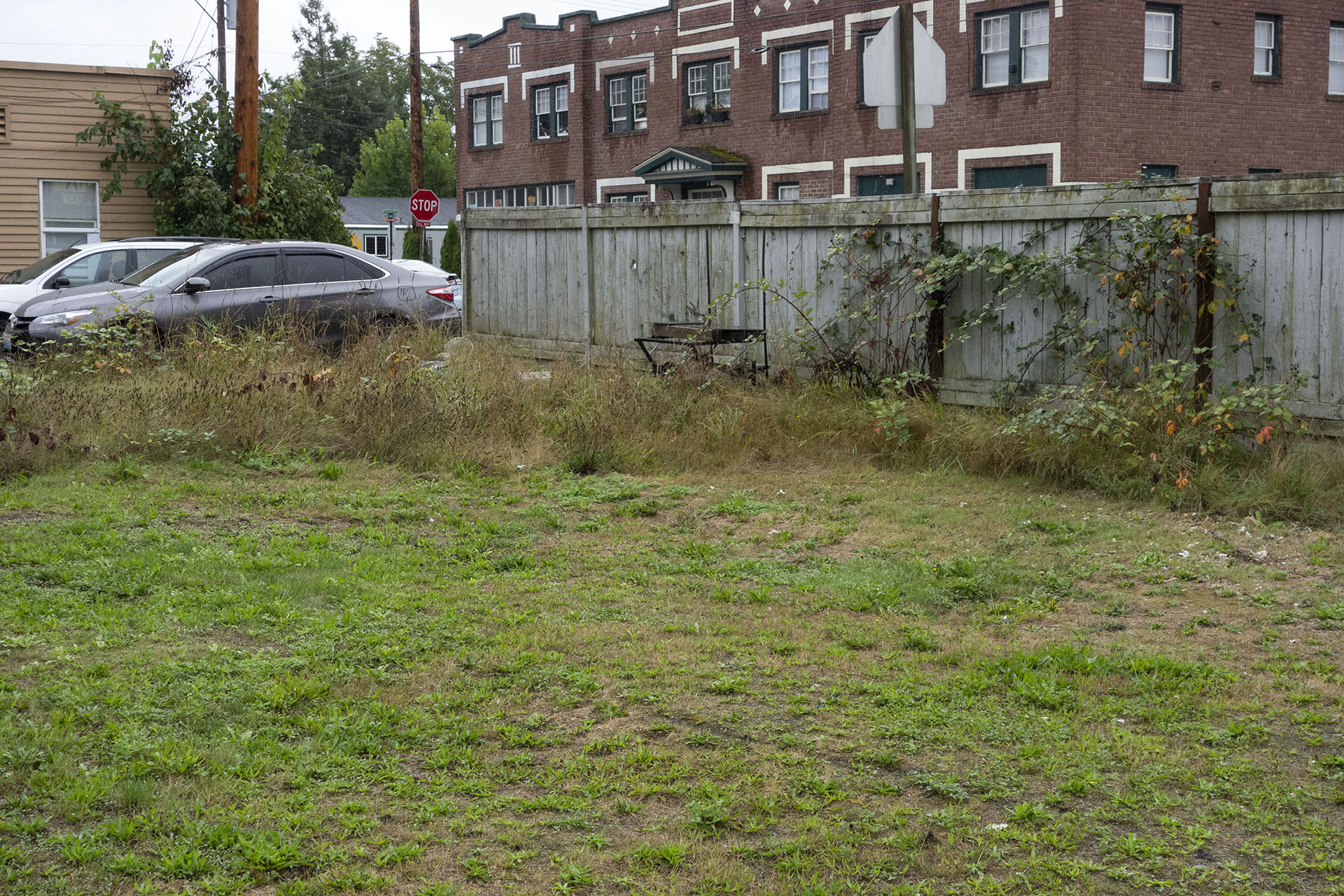
So what happened to the Riverside Mobile Home Park?
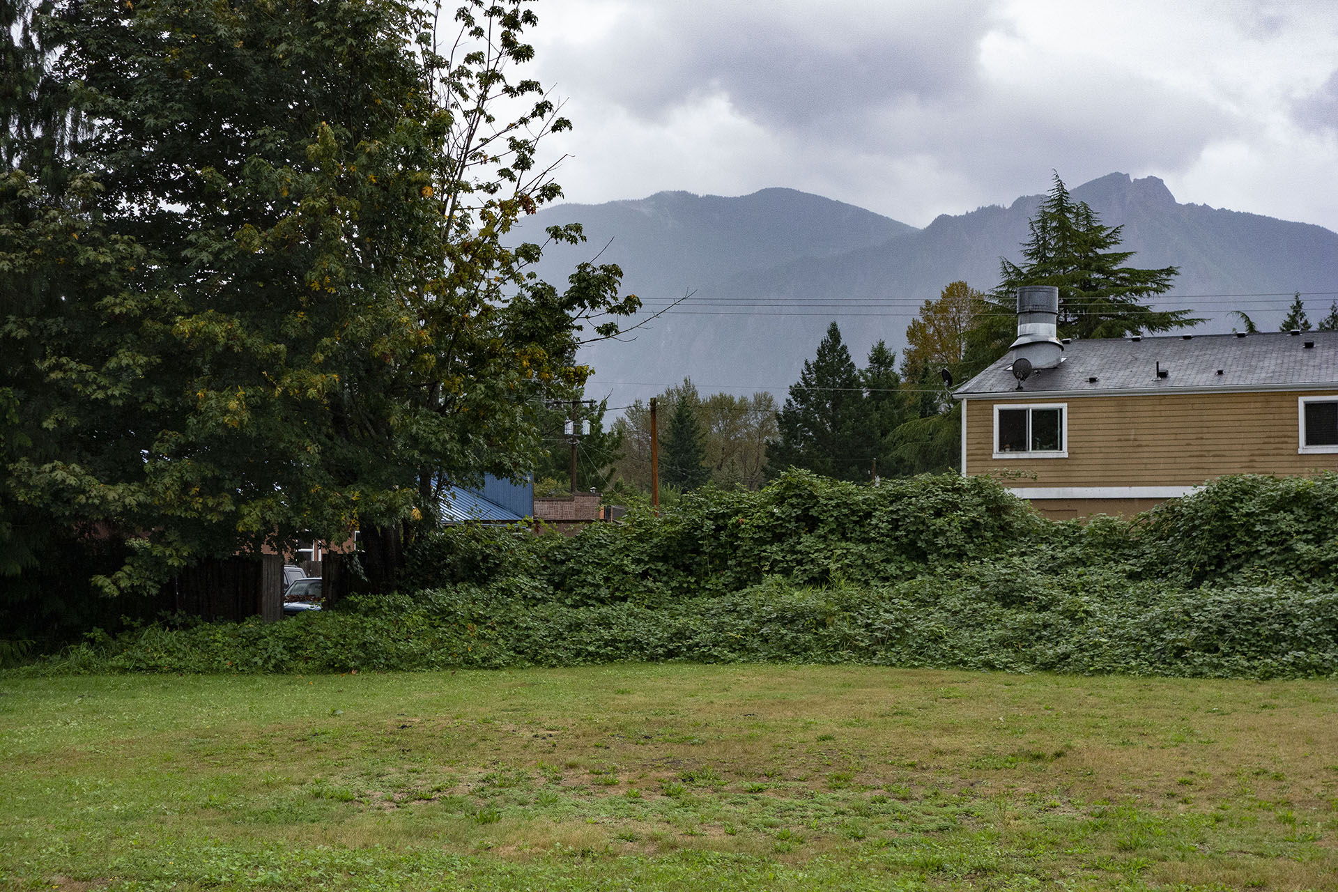
As you saw from the video at top, it’s now an empty field. The easiest answer to this question comes from the image above – repetitive flooding from the Snoqualmie River.
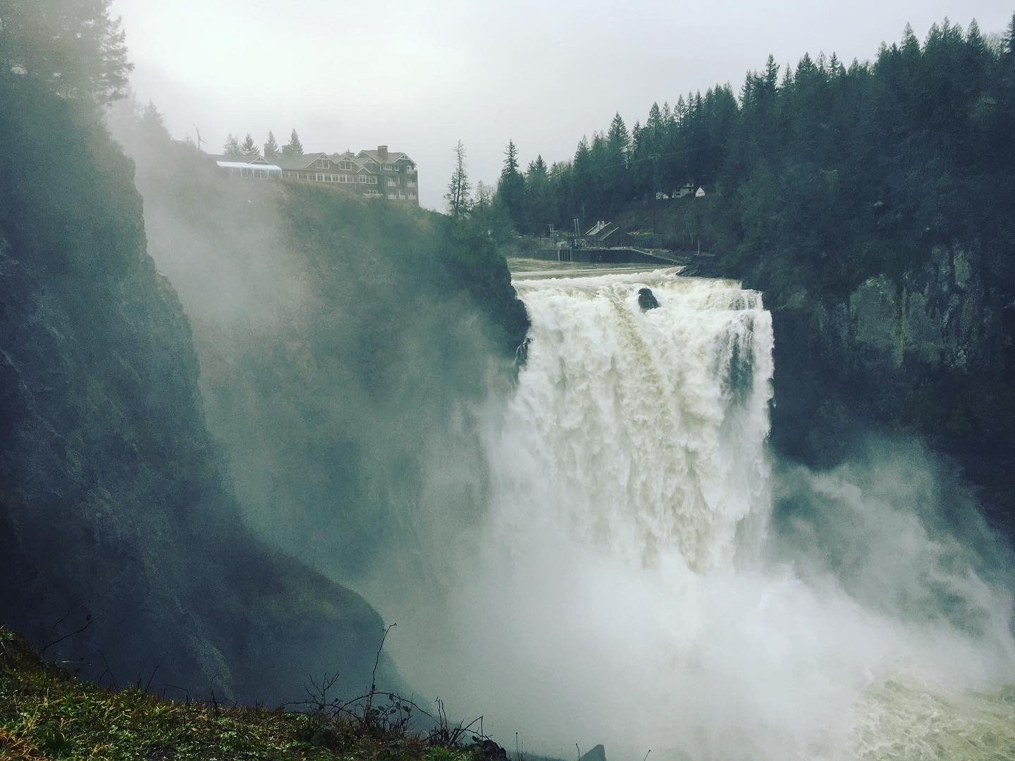
The adjacent Snoqualmie River, which flows downstream another 2.5 miles to Snoqualmie Falls, crested its banks many times throughout the years. In the 1990s and 2000s, there were several major flood incidents that lead to the eventual closure of the mobile home park. Even during my most recent trip to Washington in January 2020, I saw just how strong the waters of the Snoqualmie can be during flood conditions.
In November 1990, devastating floodwaters damaged homes and killed numerous dairy cows in the region.
Another flood took place on November 6-7, 2006. The mobile home park and Gersten’s Apartment building are seen in the distance in the photo from Mt. Si High School.
More flooding occurred in November 2008.
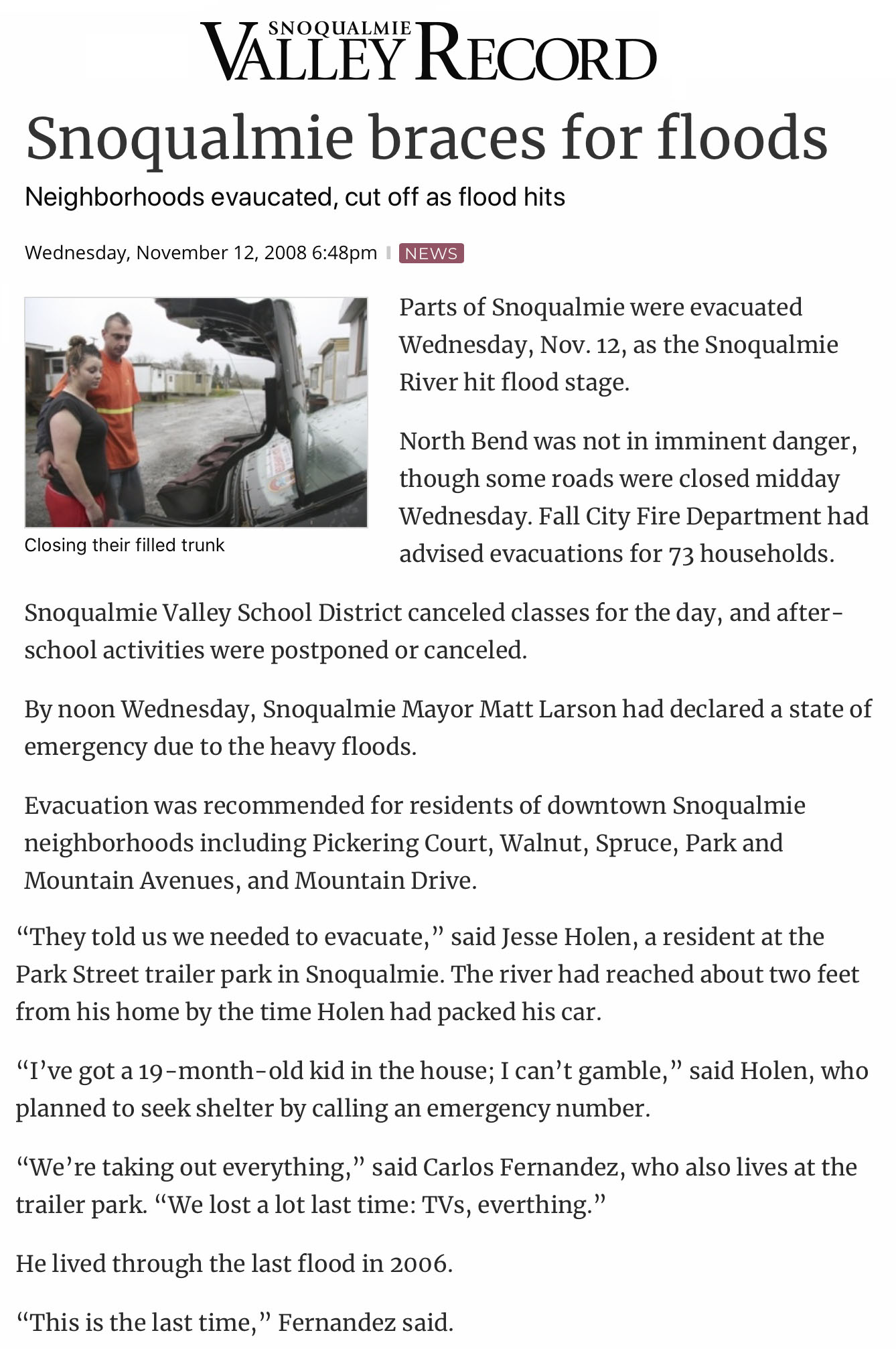
On November 12, 2008, the Snoqualmie Valley Record spoke with two residents – Jesse Holen and Carlos Fernandez – who were living at the Riverside Mobile Home Park at the time. They even included a photo from the park (it’s the back row where Deputy Cliff’s trailer was located).
According to a November 18, 2008 article, high water that flooded the Valley Wednesday “crested late in the day, with a peak of about 45,000 cubic feet per second rushing over Snoqualmie Falls about 5 p.m.”
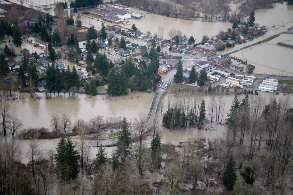
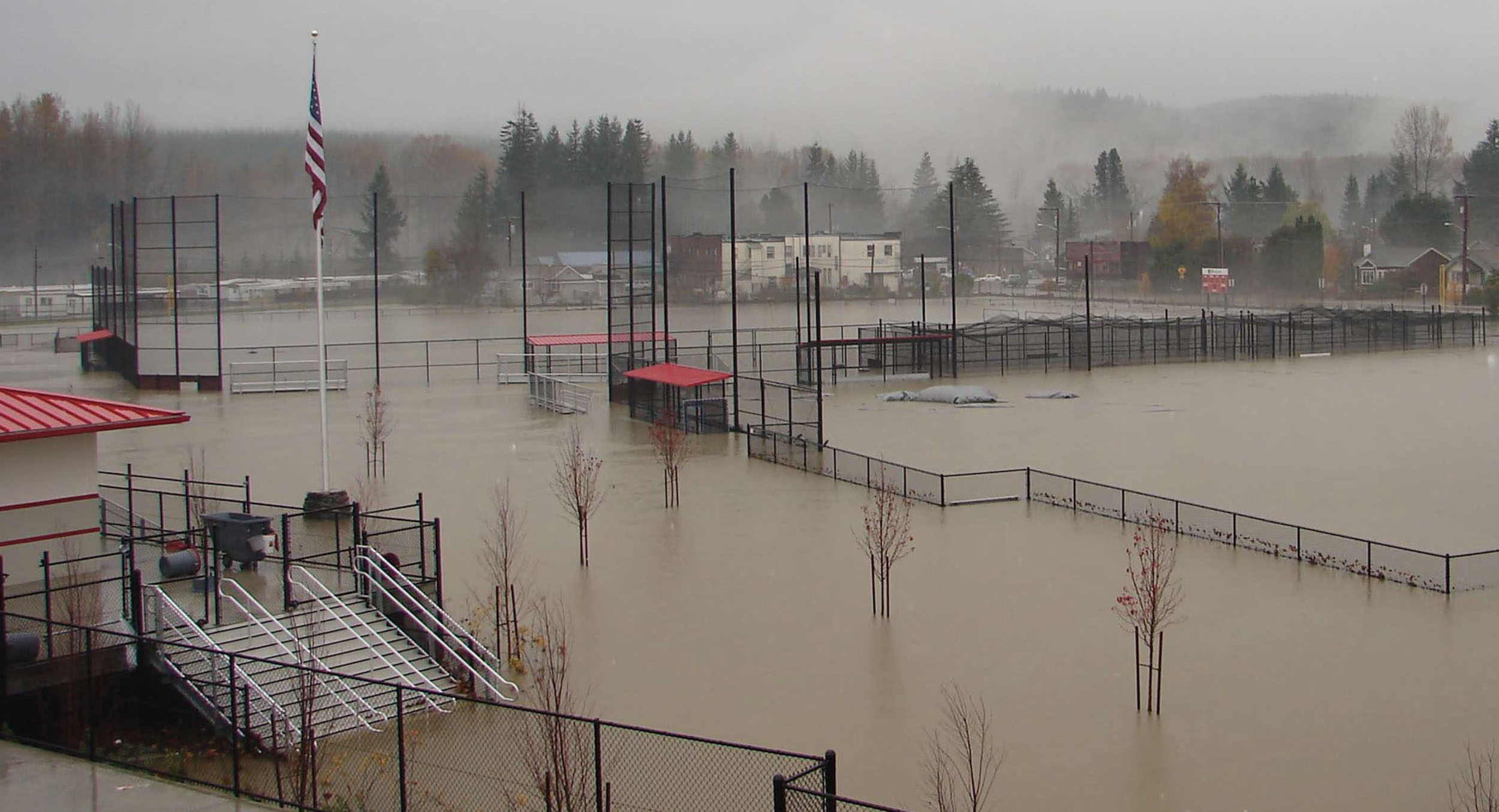
The final straw was historic flooding that occurred in January 2009. The image above from the Flickr account for King County shows the overflowing Snoqualmie River. The Riverside Mobile Home Park is seen in the bottom right corner, with flooded Mt. Si High School fields seen to the north. The flood was “more powerful than any since the November 1990 flood that measured 78,800 cfs at Snoqualmie.” (!!!)
KING COUNTY RESPONDS TO FLOODING
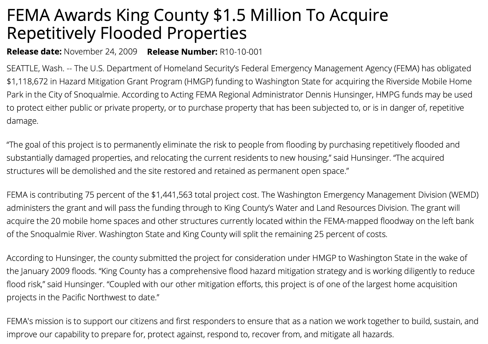
King County leadership had enough and worked with the U.S. Department of Homeland Security’s Federal Emergency Management Agency (FEMA) to secure funds to purchase the mobile home park and relocate its residents.
On November 24, 2009, FEMA gave $1.1M in funding to “permanently eliminate the risk to people from flooding by purchasing repetitively flooded and substantially damaged properties, and relocating the current residents to new housing.” The 20 mobile homes and other structures would be demolished, and the area would be converted to open space. Total cost of the project was $1.4M to which FEMA contributed 75-percent.
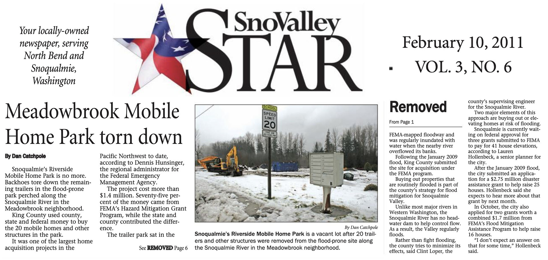
.By early February 2011, the final structures at Riverside Mobile Home Park were torn down.
SCREEN-TO-LOCATION COMPARISON OF THE FAT TROUT TRAILER PARK
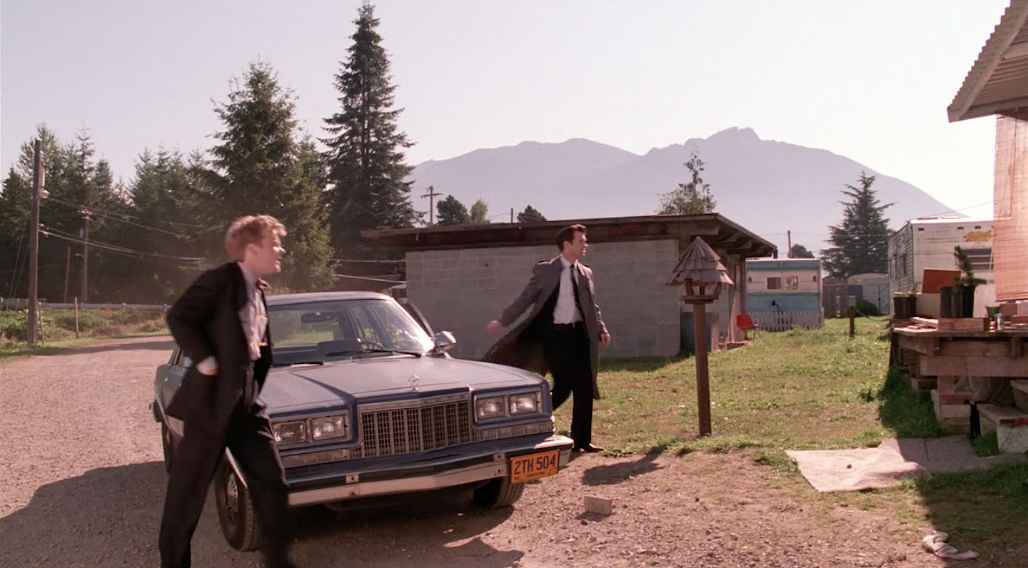
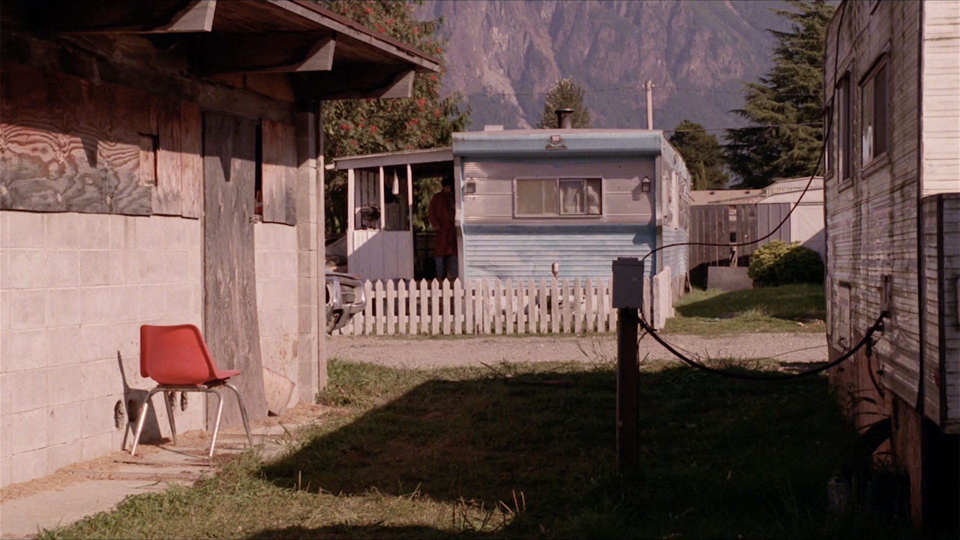
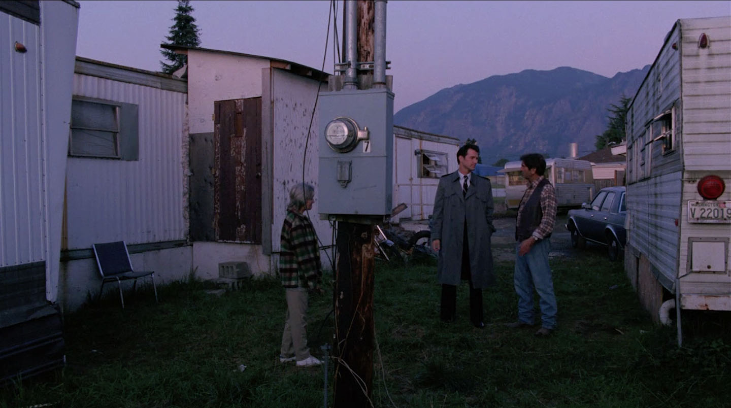
When Agents Desmond and Stanley arrive, you can see Mt. Si looming over the trailer park (aka the “Twin Peaks” of the town of Twin Peaks). Teresa Banks’ blue trailer is also seen on the right side of the image. In the background, you can also see Meadowbrook Way. There was an entrance to the community from this road.
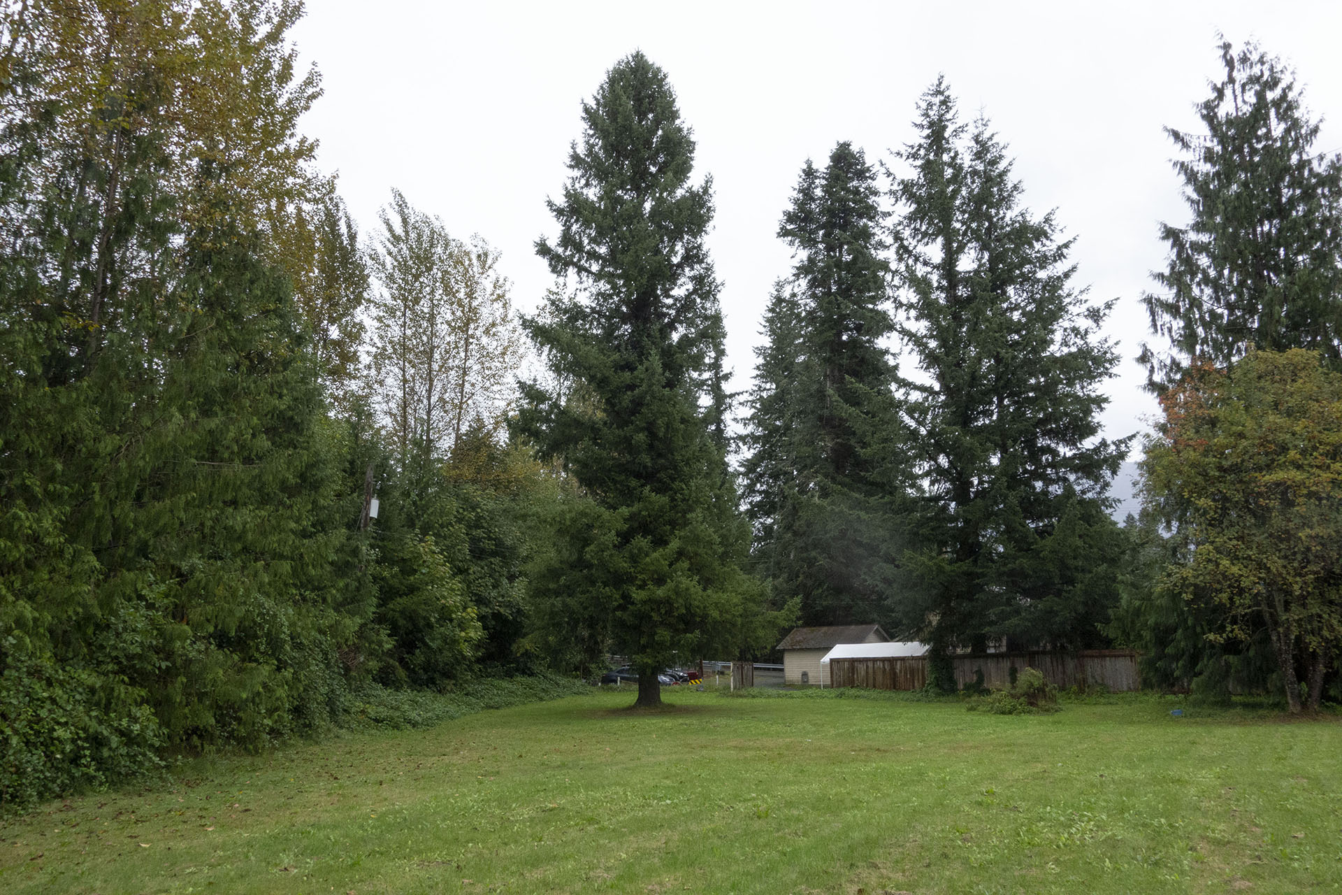
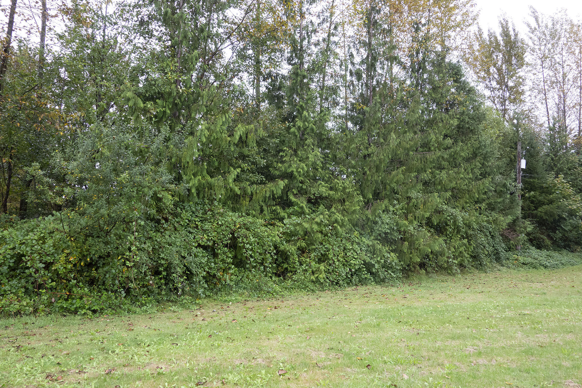
Some of the tall trees are still present today but they now block distant landscapes.
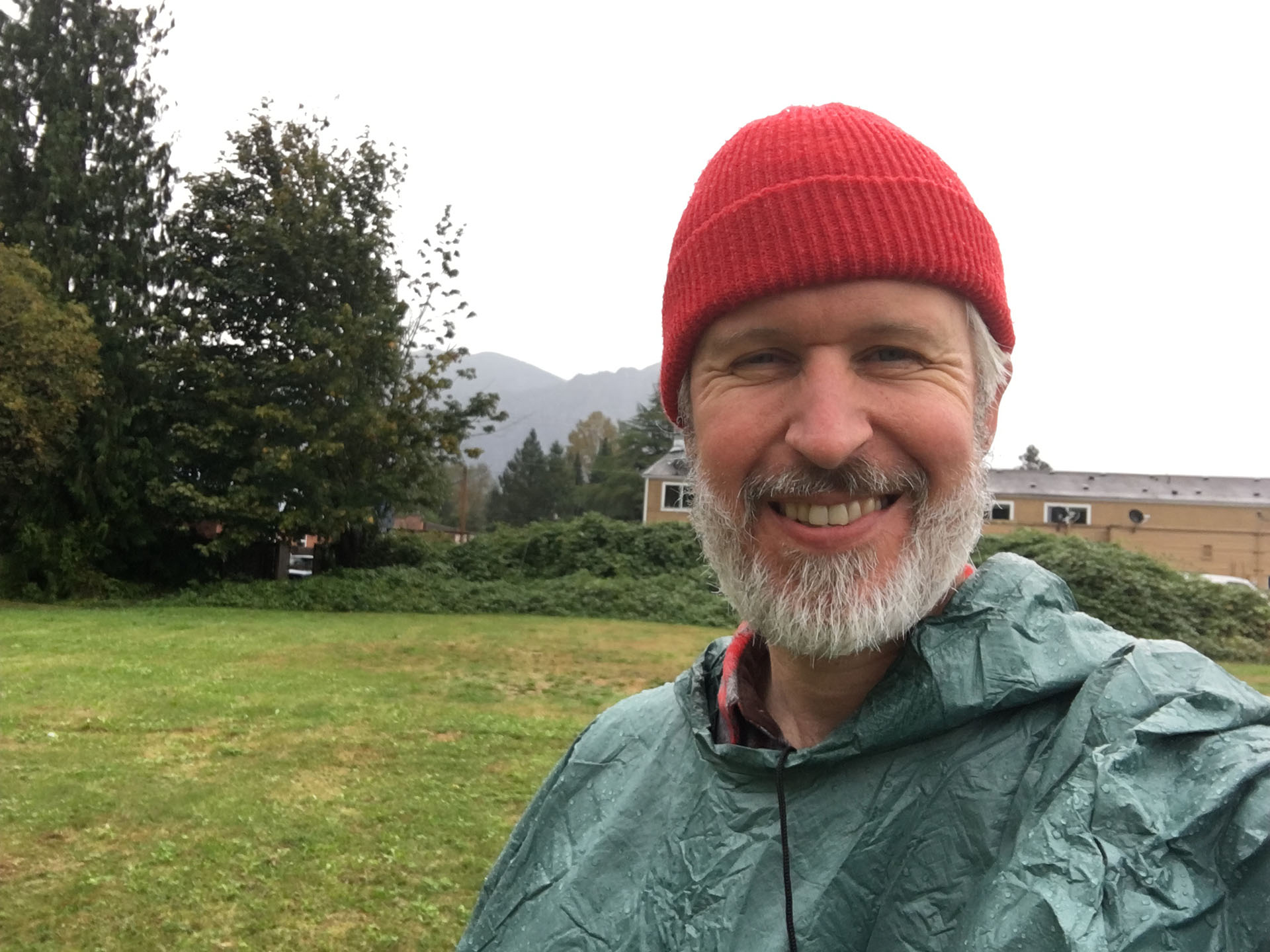
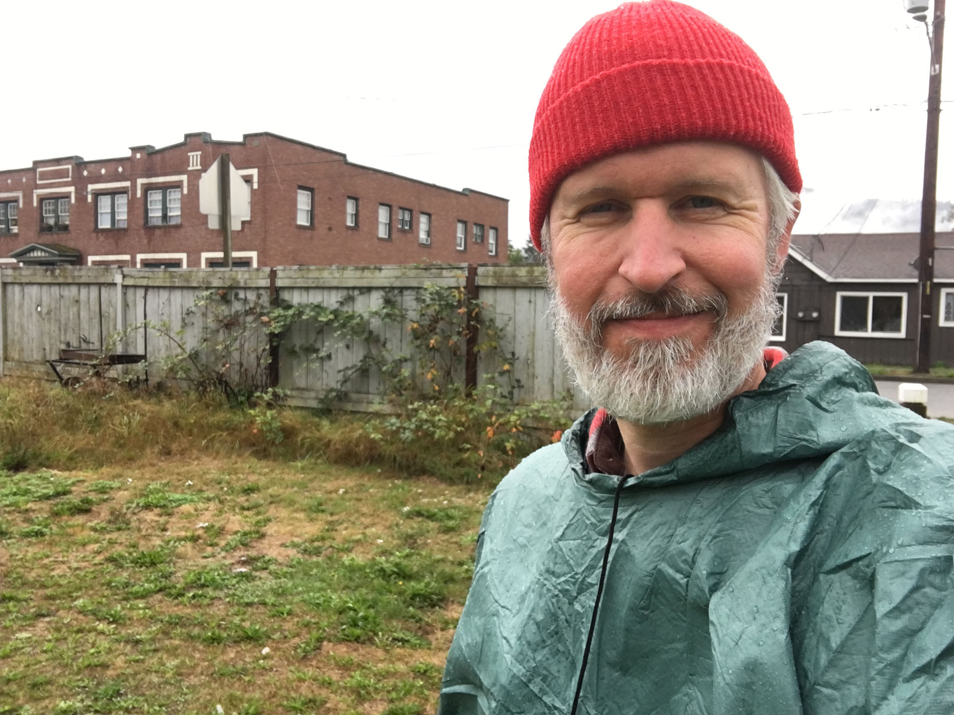
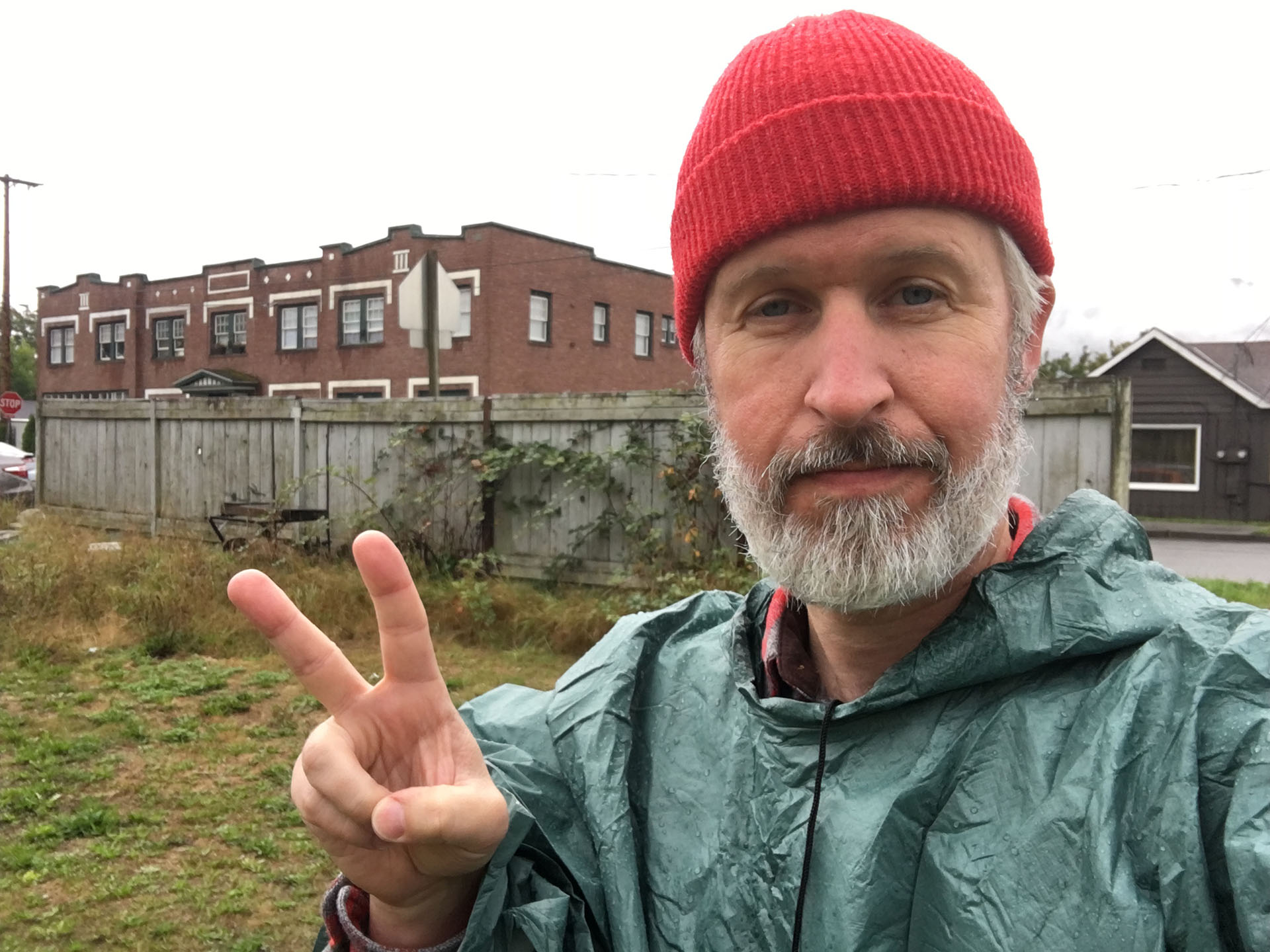
I rained pretty much all morning the day I visited. That didn’t stop me from wandering around the empty field like a crazy person, complete with a poncho and my red cap.
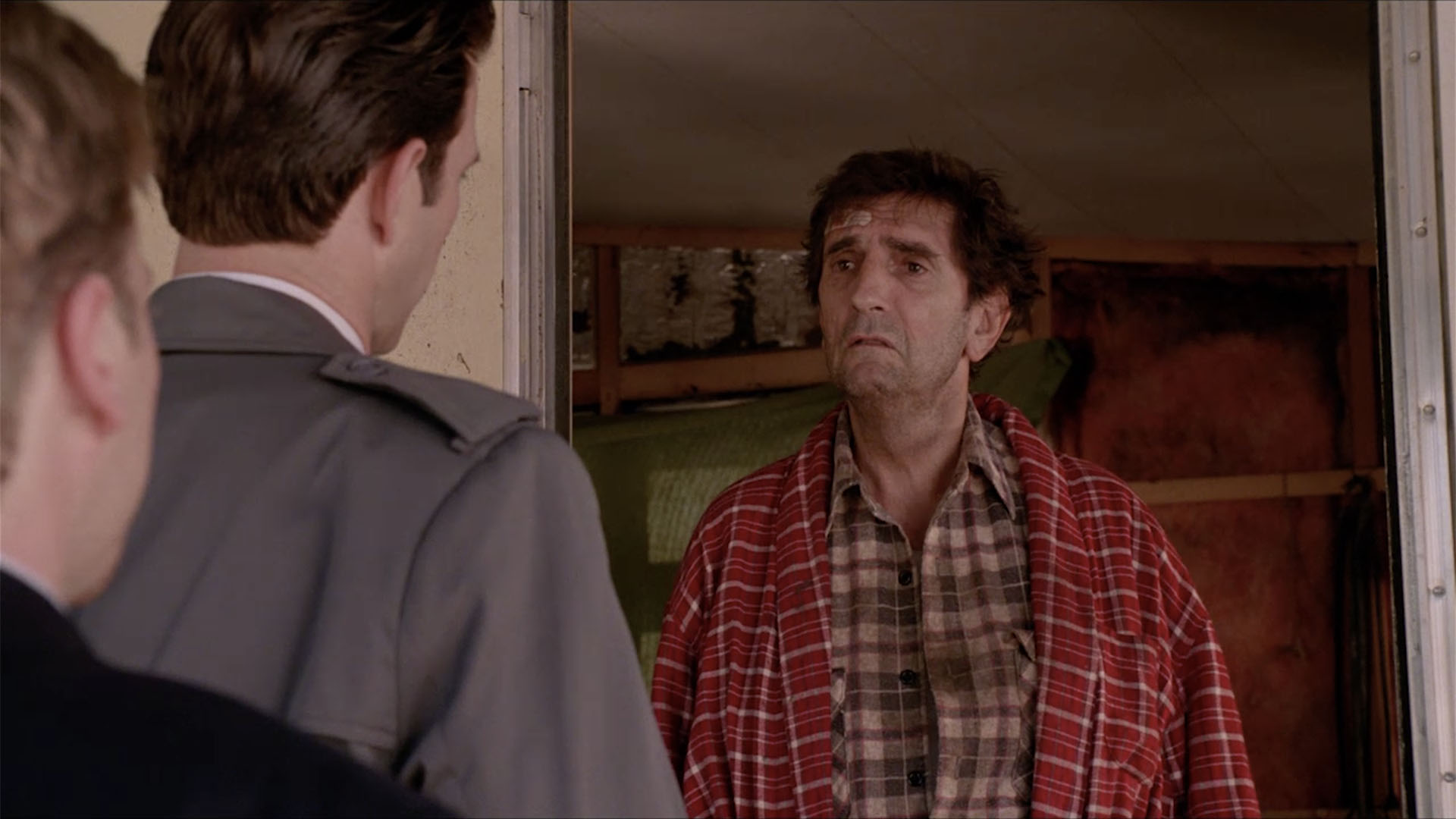
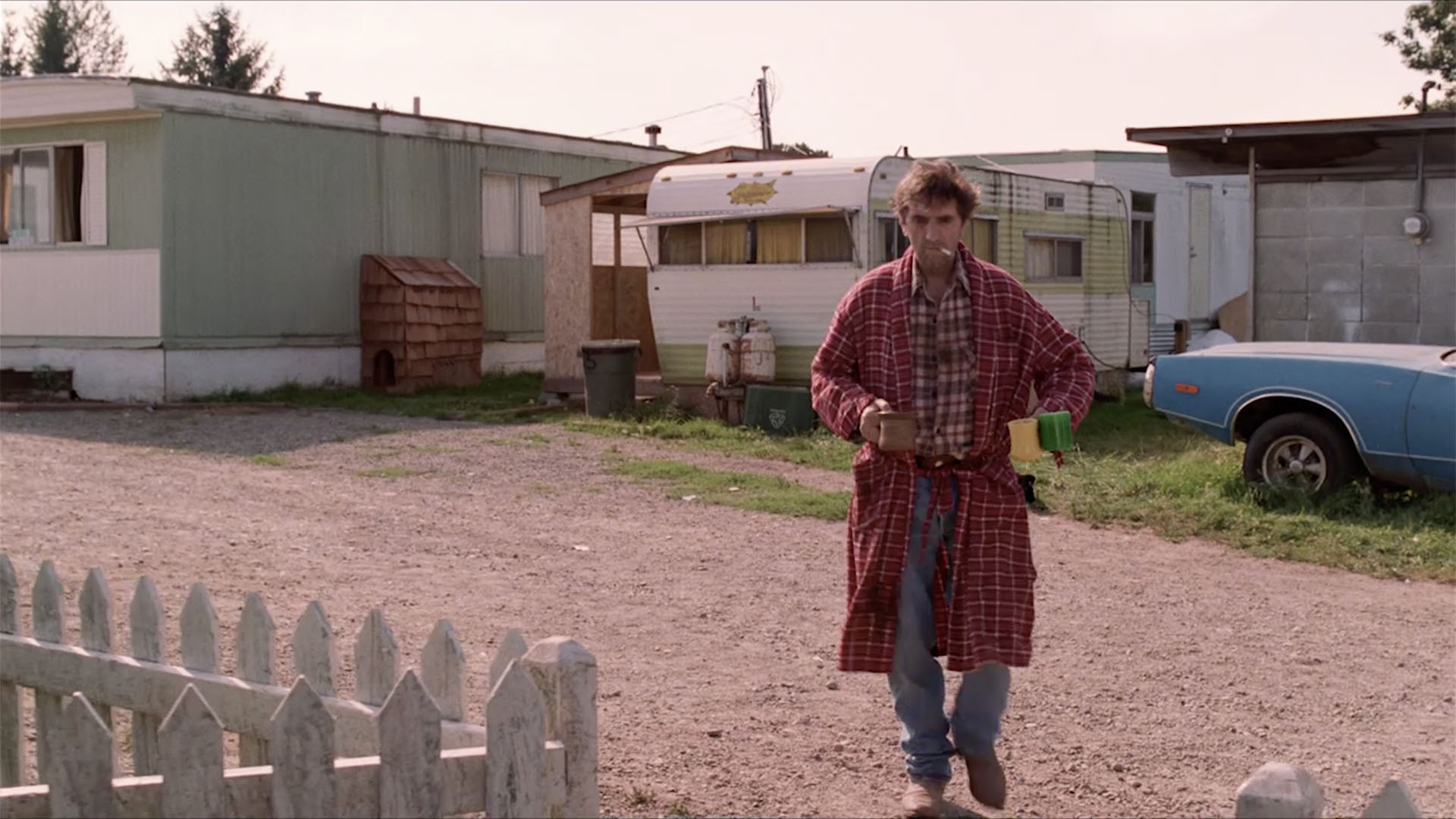
PRESENTING BADGES AT CARL RODD’S TRAILER
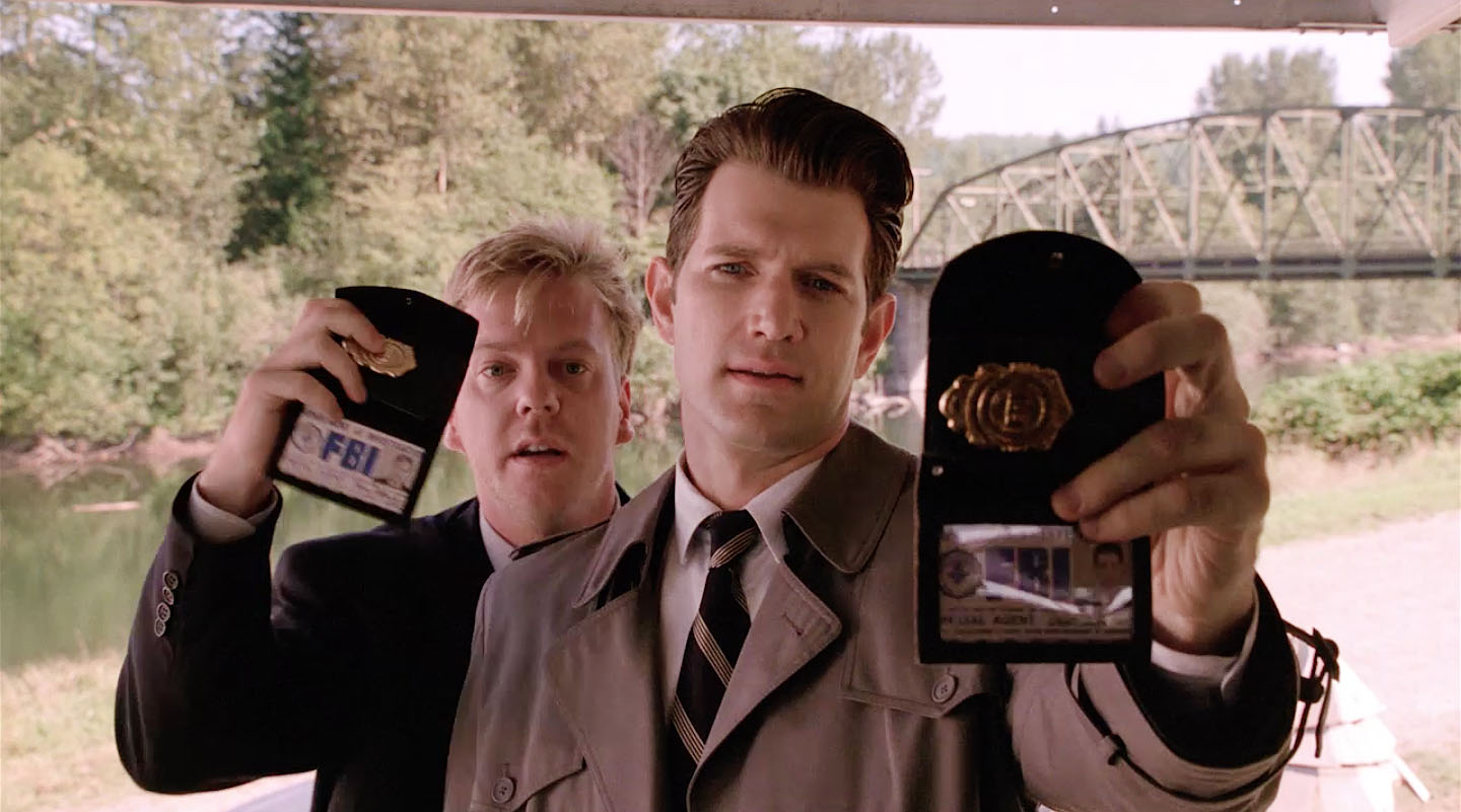
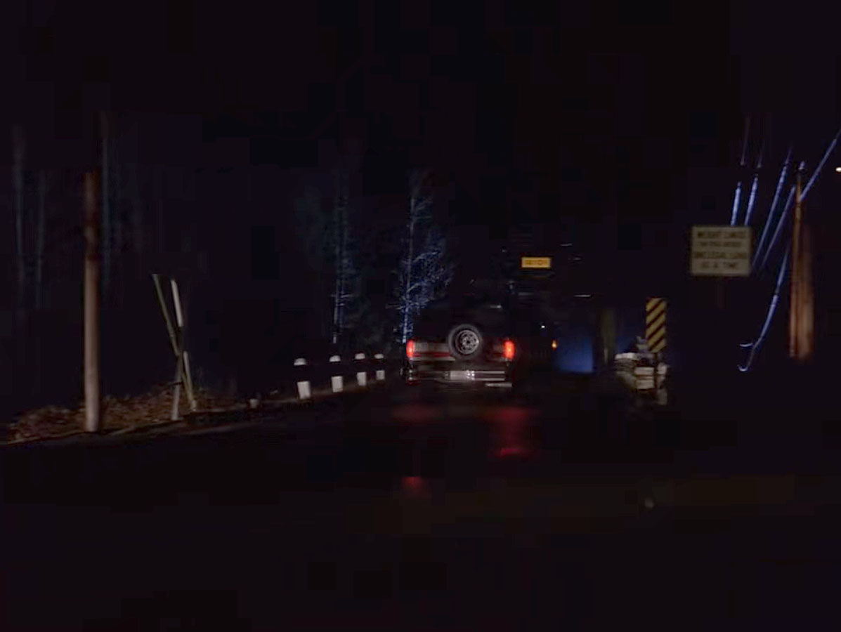
When the Agents present their FBI badges to Carl Rodd, the Meadowbrook Way bridge is seen in the background.
Bushes and trees in the area now block the view of the bridge.
We see the entrance to the mobile home park and the bridge in the Pilot Episode when Sheriff Truman and Agent Cooper first follow Joey and Donna.
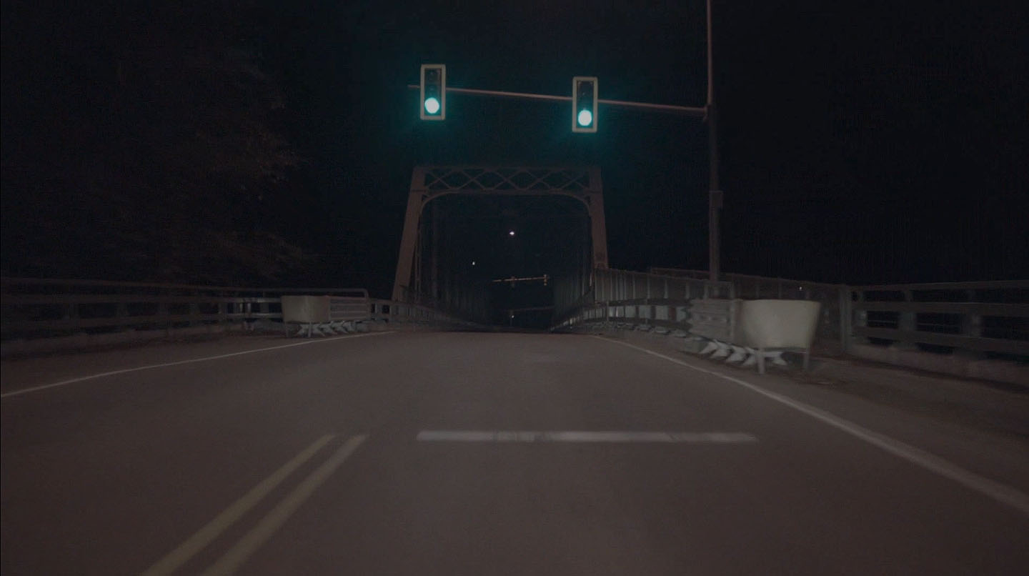
Part 18 also includes a brief scene of Cooper/Richard driving Carrie Page over the bridge.
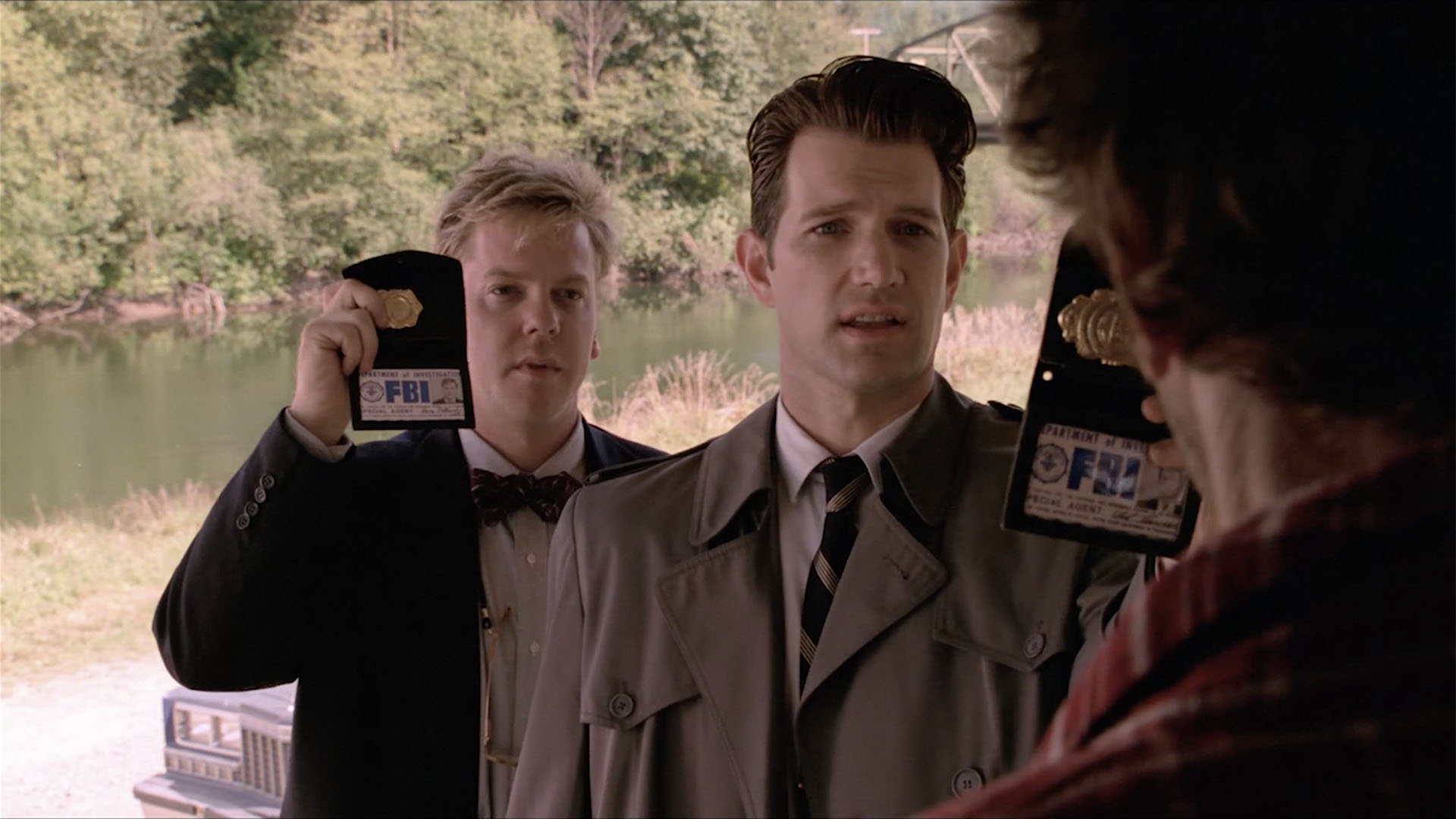
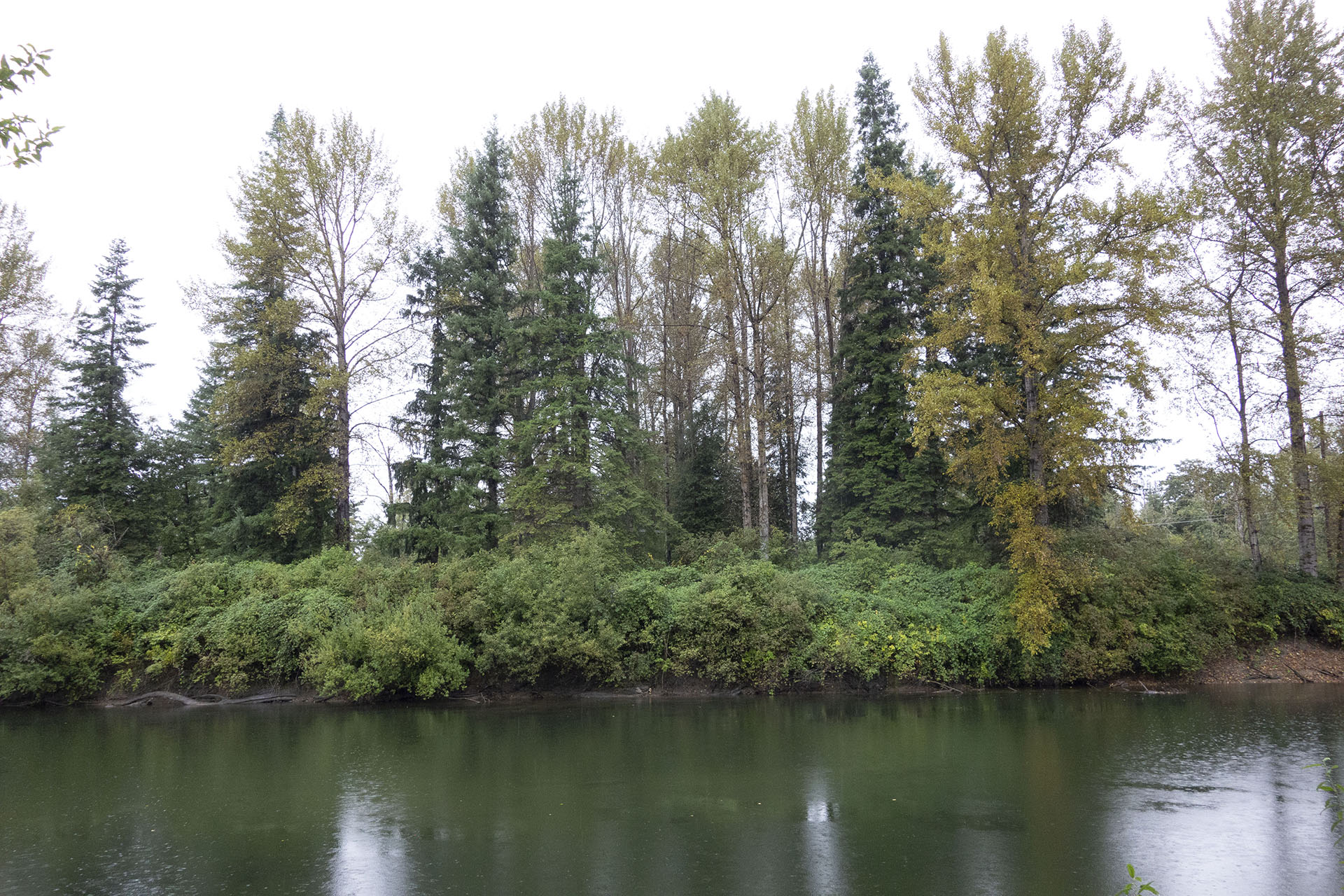
The Snoqualmie River makes a nice cameo behind Agents Desmond and Stanley. The mighty river, the same one that closed the mobile home park, still flows today.
CARL RODD’S TRAILER

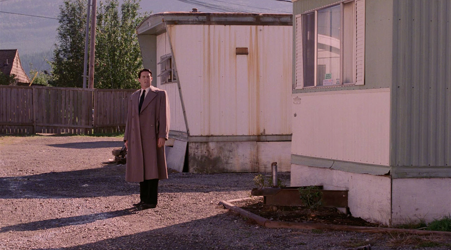
When the Agents approach Carl Rodd’s trailer, you can see Mount Si in the distance.
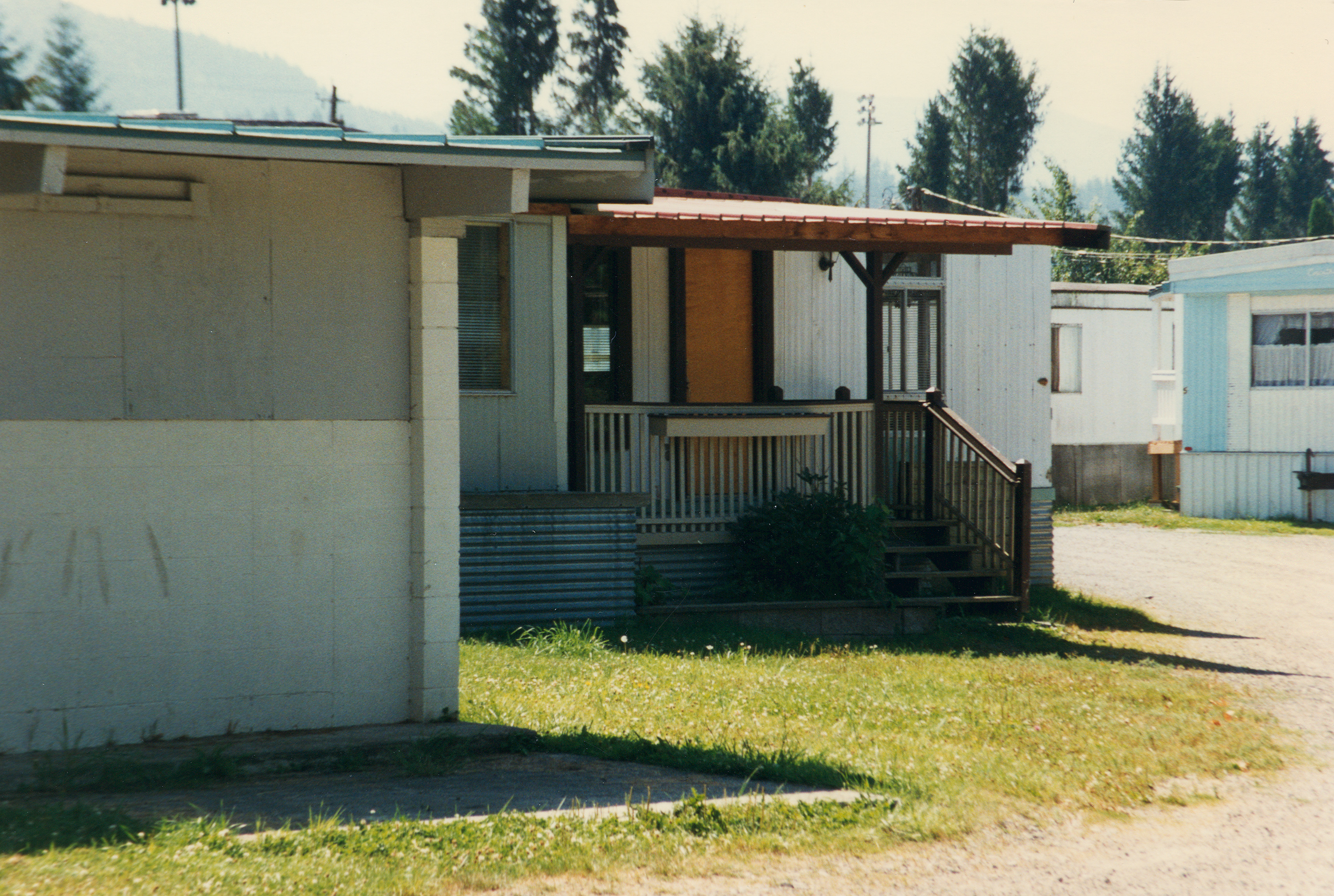
I saw Mr. Rodd’s trailer on August 10, 1996. The porch had been modified and a railing was added to the stairs.
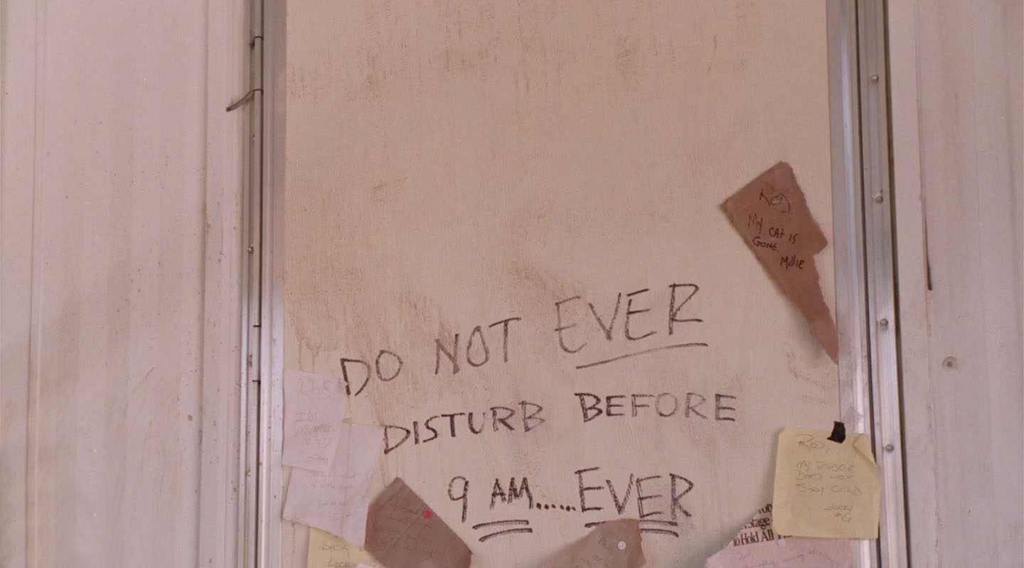
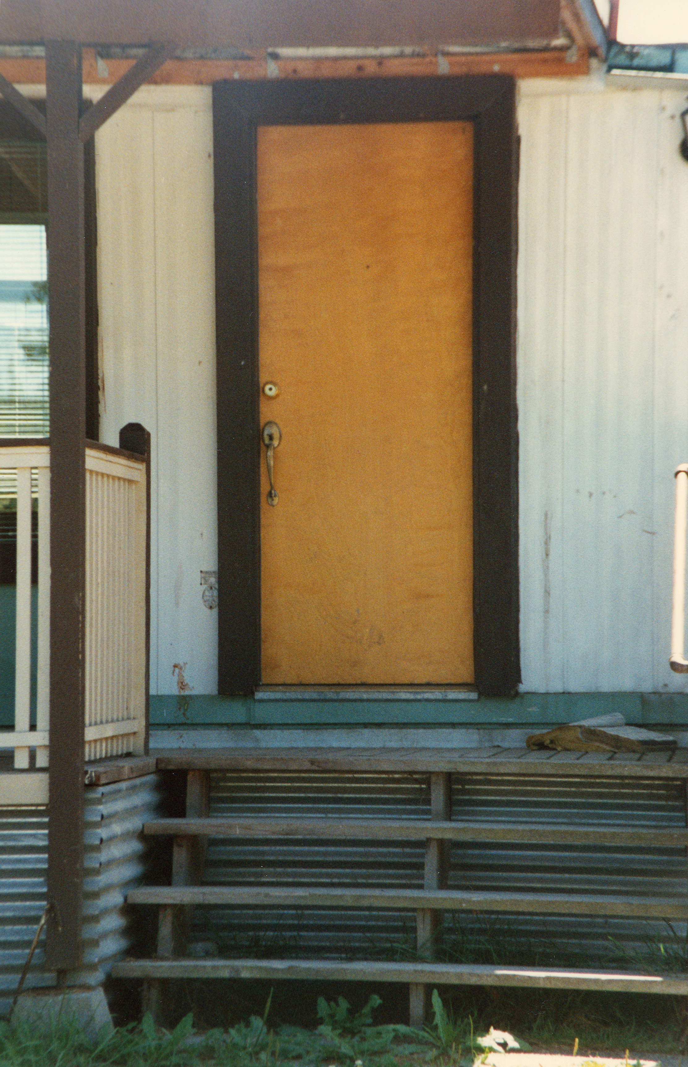
The door had also changed by the time I visited the park in 1996.
Probably was part of all the “shit” that Carl had to do.
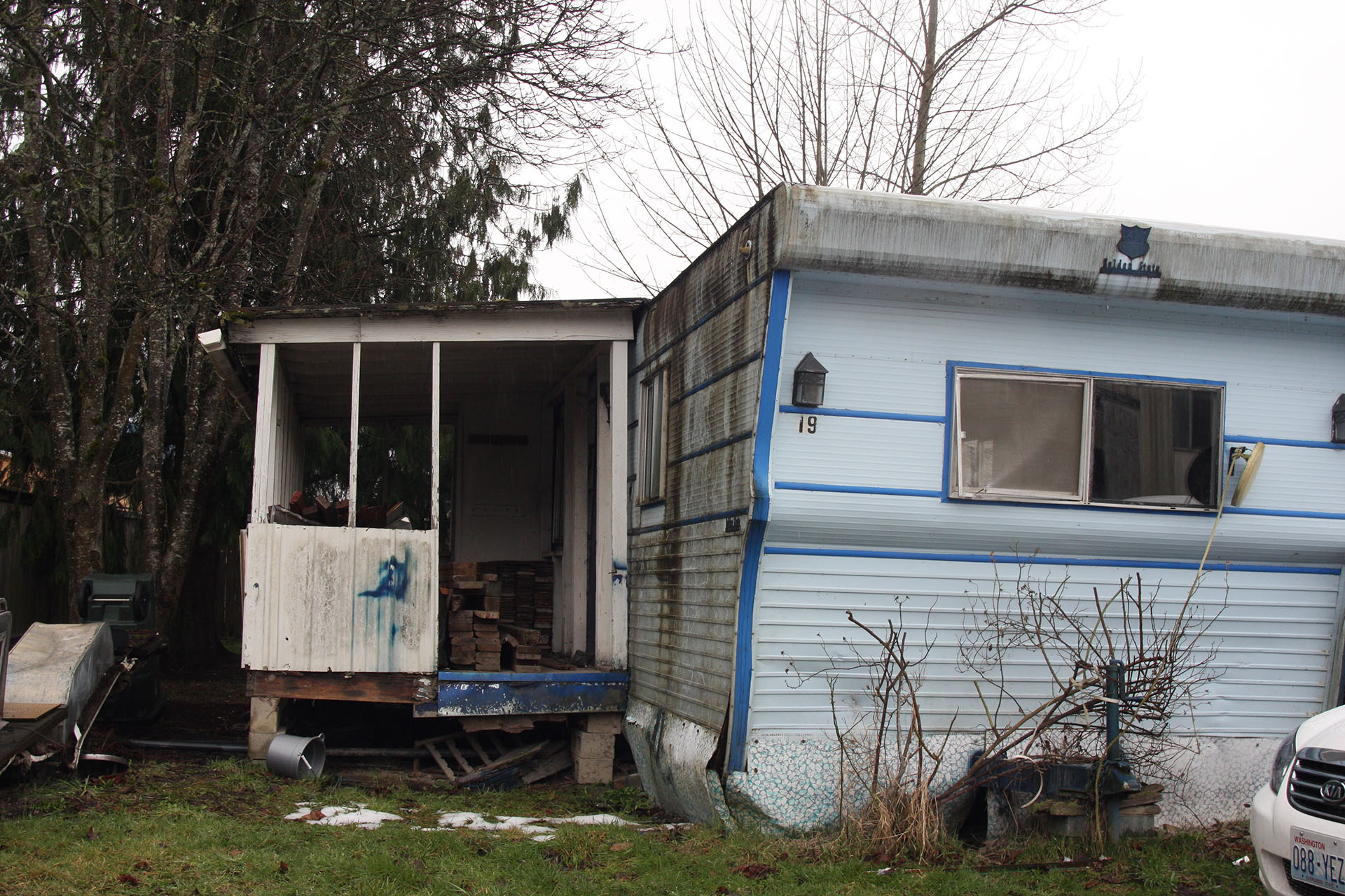
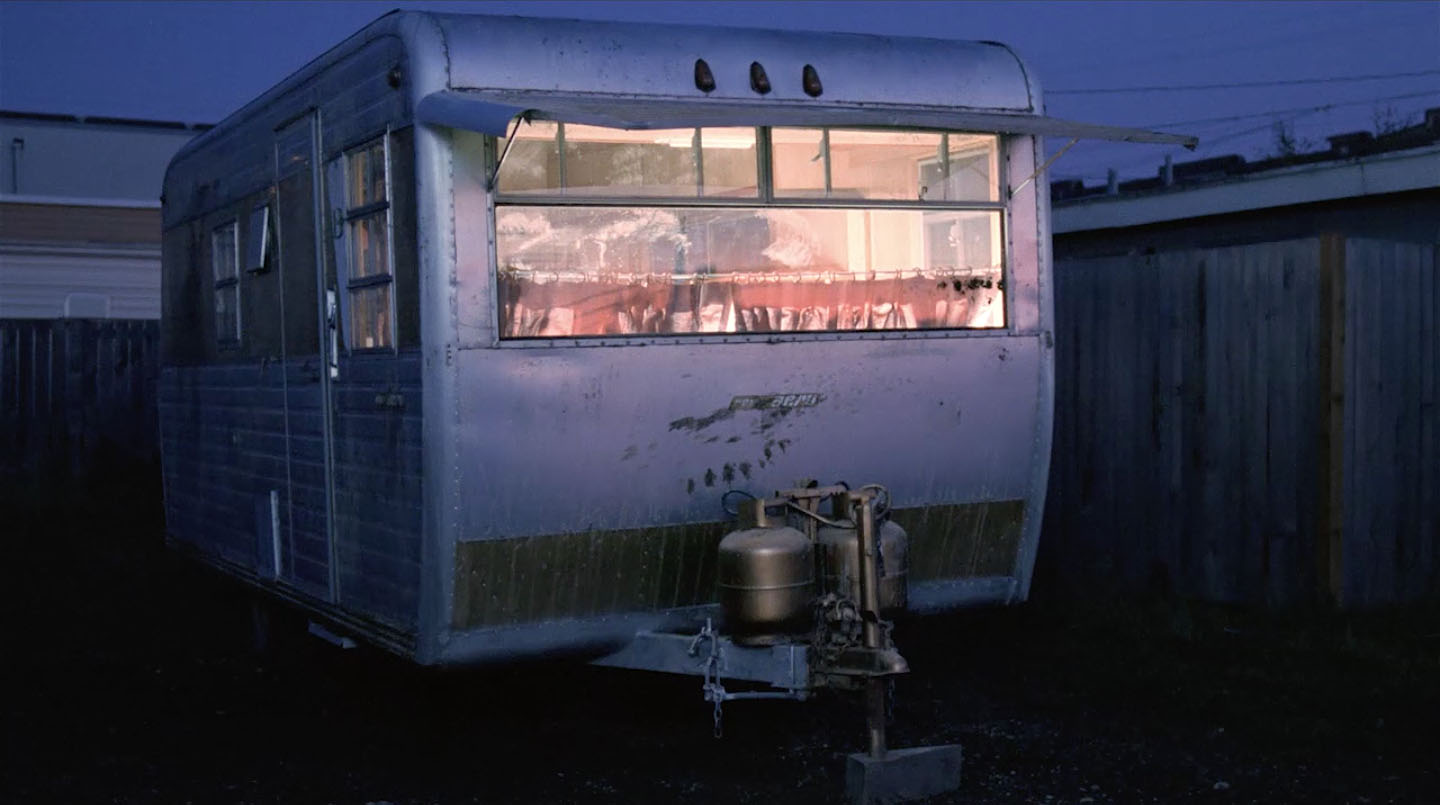
THERESA BANKS’ TRAILER

Teresa Banks’ trailer – #19 – was located on the eastern edge of the mobile home park, closest to Meadowbrook Way.

I spotted it on August 10, 1996 during the Twin Peaks Fan Festival bus tour.
Strangely, the Flickr account for the David Lynch Foundation offered for images from the mobile home park on March 14, 2009. One included Teresa Banks’ trailer.

Fellow Bookhouse Boy Jamey Erickson visited this location on August 29, 2010 and found Theresa Banks’ trailer damaged and empty.
The trailer is now long gone and only the mysteries remain.
CUPS OF GOOD MORNING AMERICA

The David Lynch Foundation shared a similar look from March 14, 2009. Crazy to think that some of the mobile homes were still there.
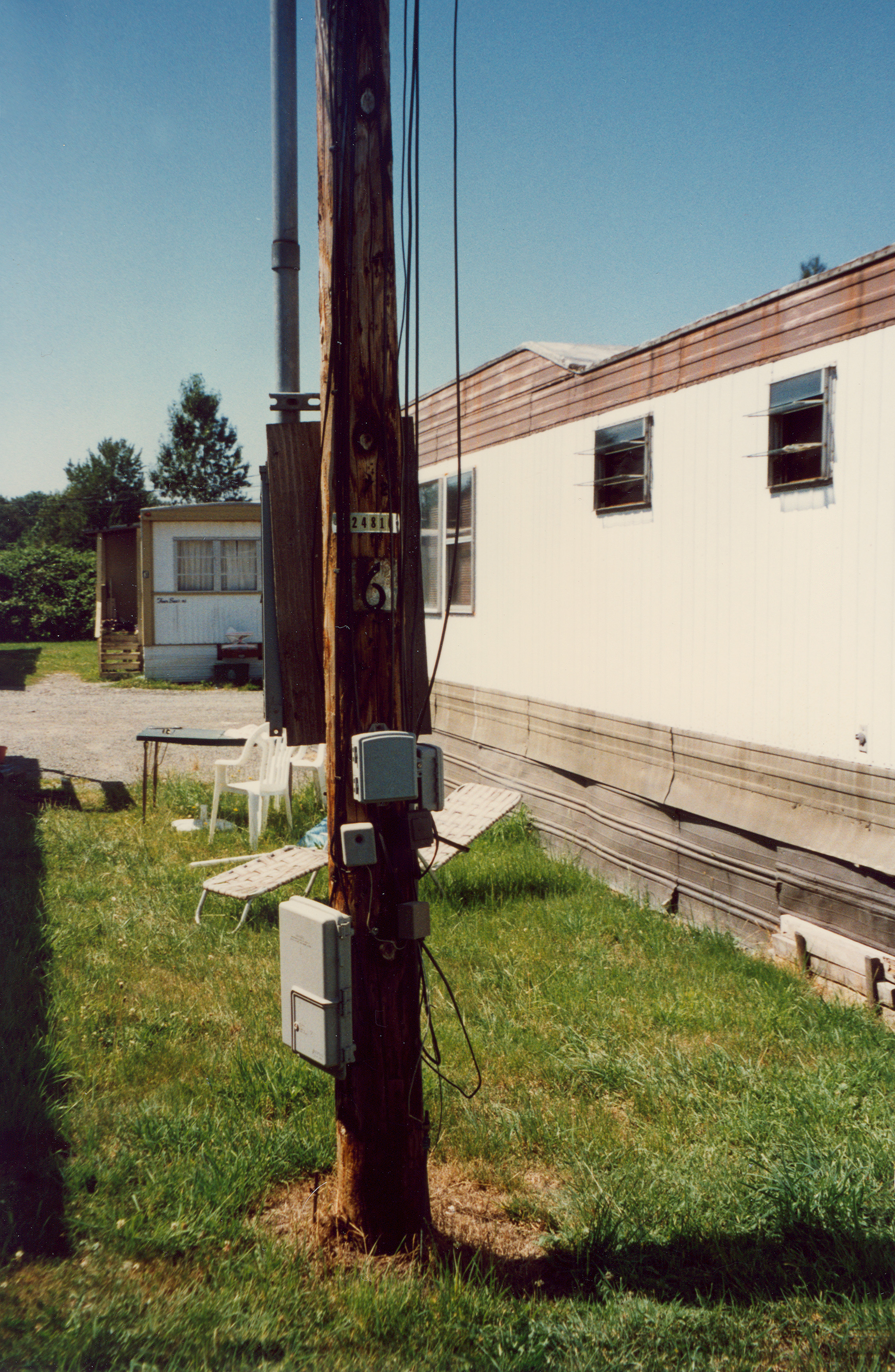
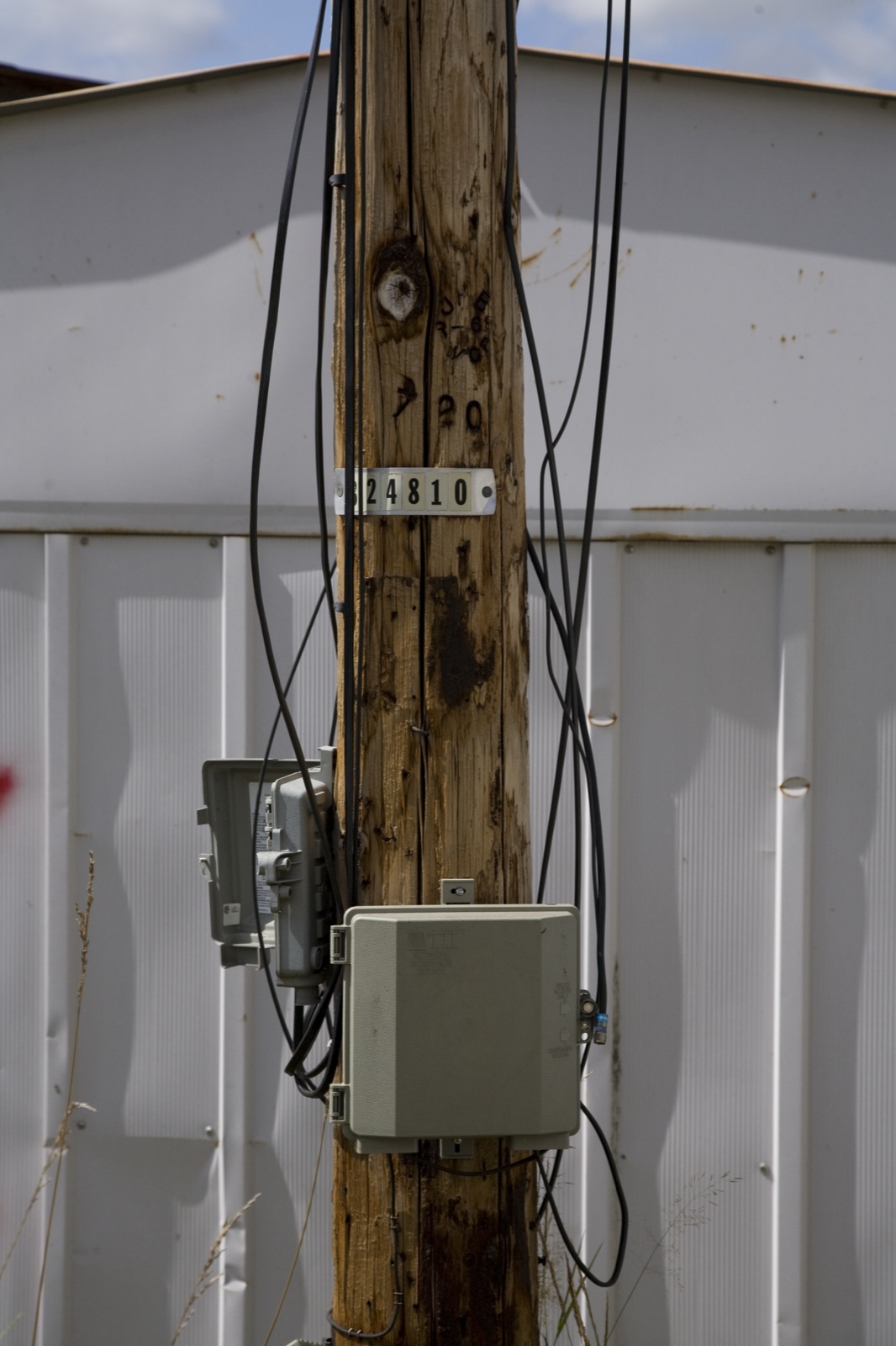
UTILITY POLE WITH NUMBER 6
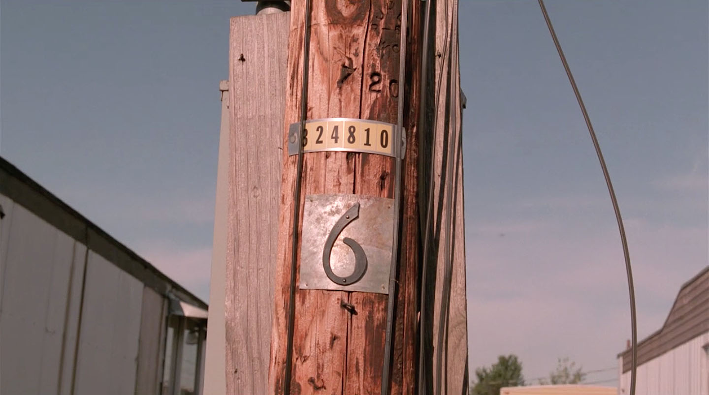
I discussed at length this iconic utility pole in this article.
I’m beyond thankful I got to see the pole when I visited in August 1996.
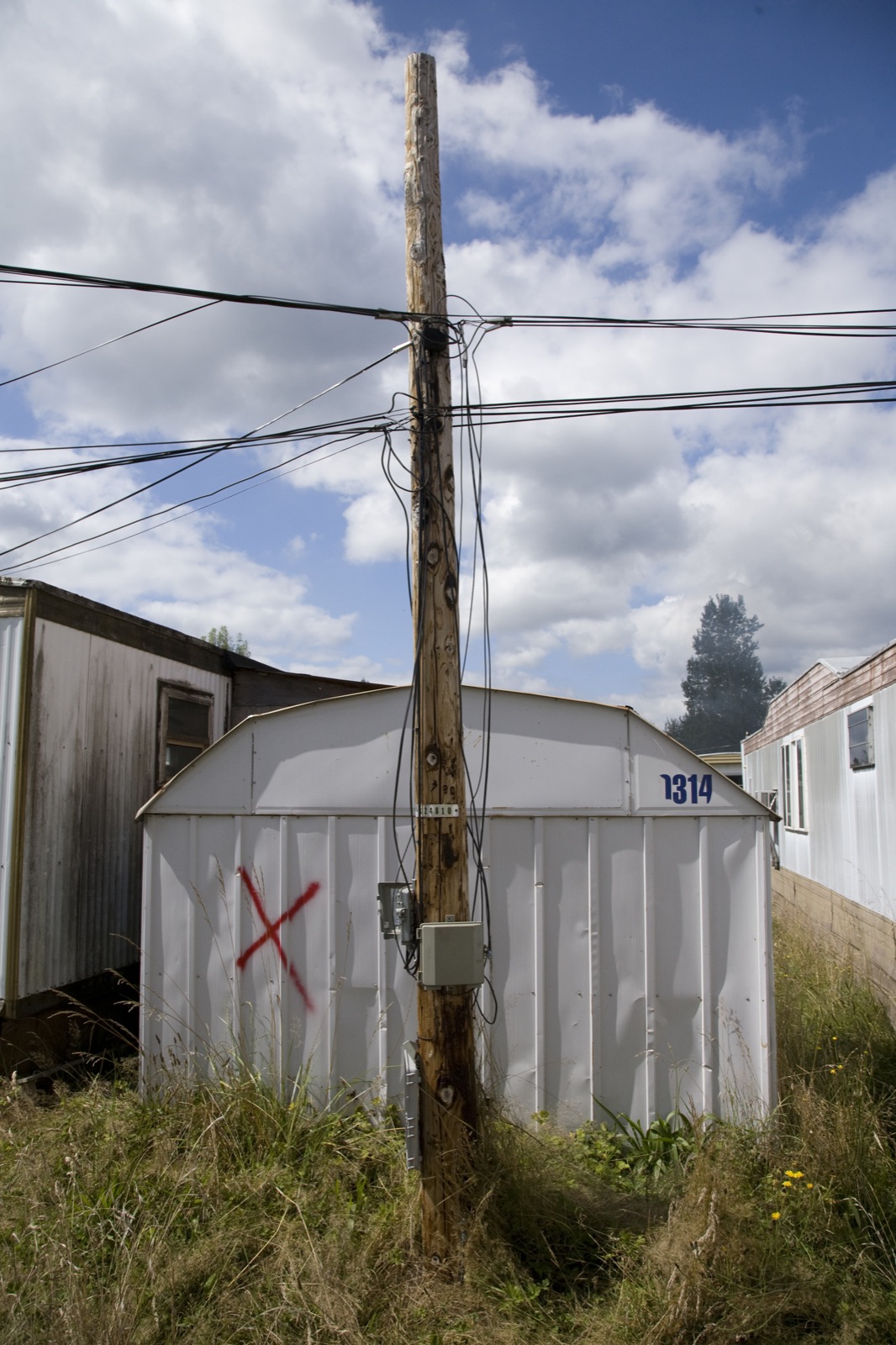
By the time Jamey Erickson visited this location on August 29, 2010, a shed had been constructed behind the pole.
And sadly, the “6” was removed by someone.
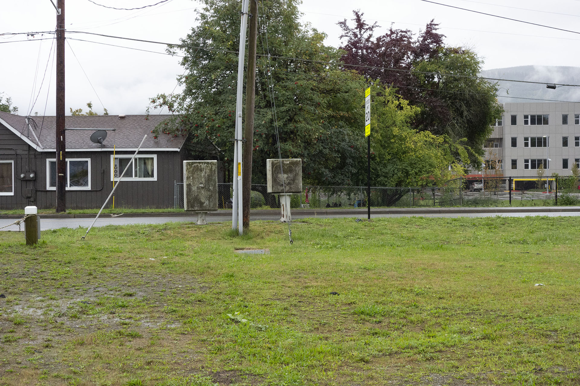
By the time I returned in 2019, the pole and surrounding trailers were long gone.
DEPUTY CLIFF’S TRAILER AT FAT TROUT
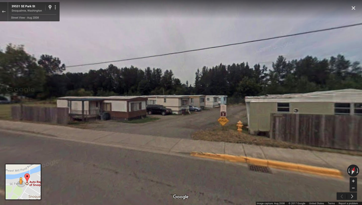
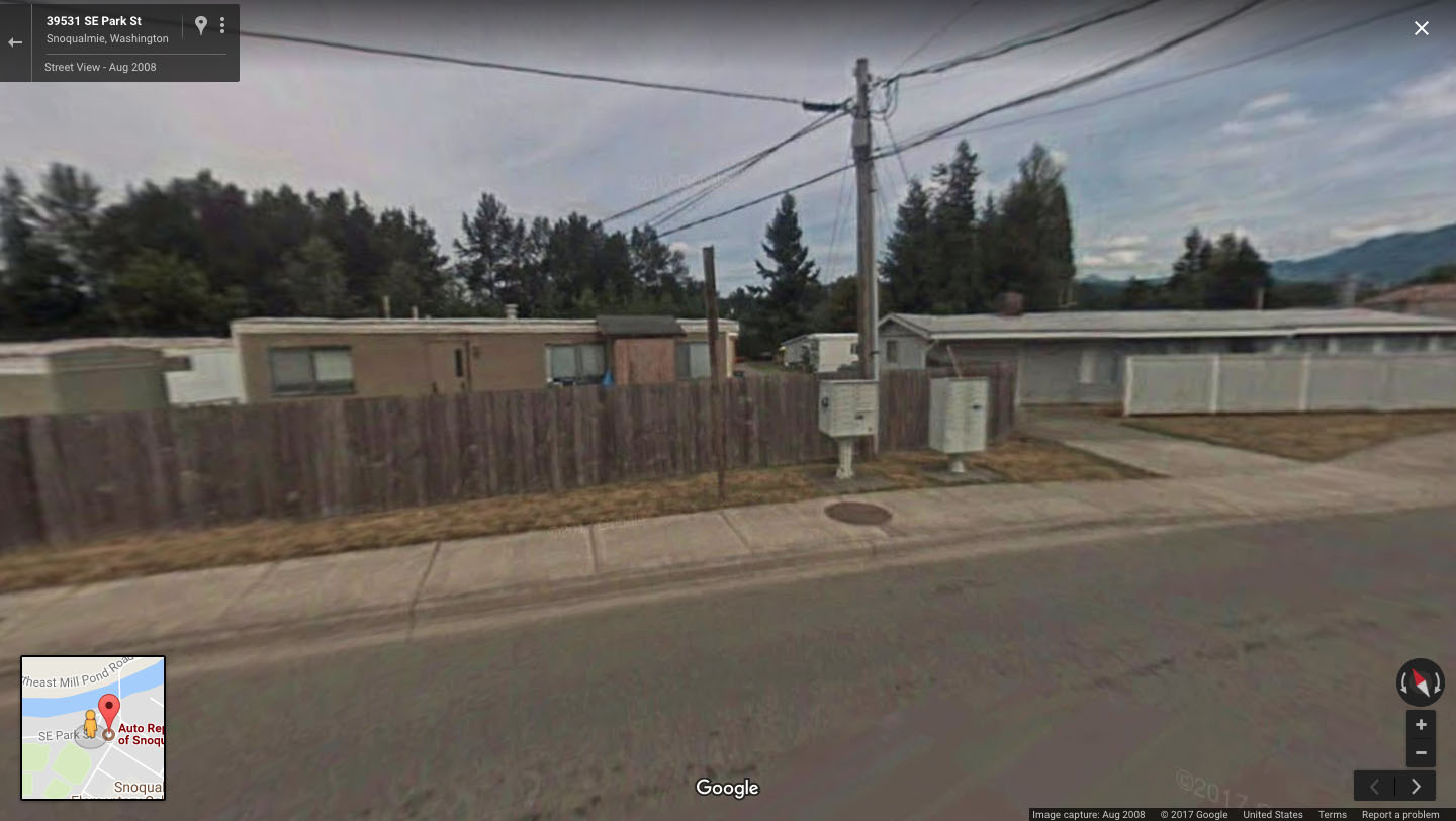
Thankfully the Riverside Mobile Home Park lives on thanks to Google Street view. You can spot Deputy Cliff’s trailer on the left side of the screen in this image from August 2008.
CHET DESMOND RETURNS TO THE FAT TROUT
You can see the tail end of Mt. Si and one of the pine trees in this shot when Agent Desmond returns to the Fat Trout.
CHALFONT TRAILER AT FAT TROUT TRAILER PARK
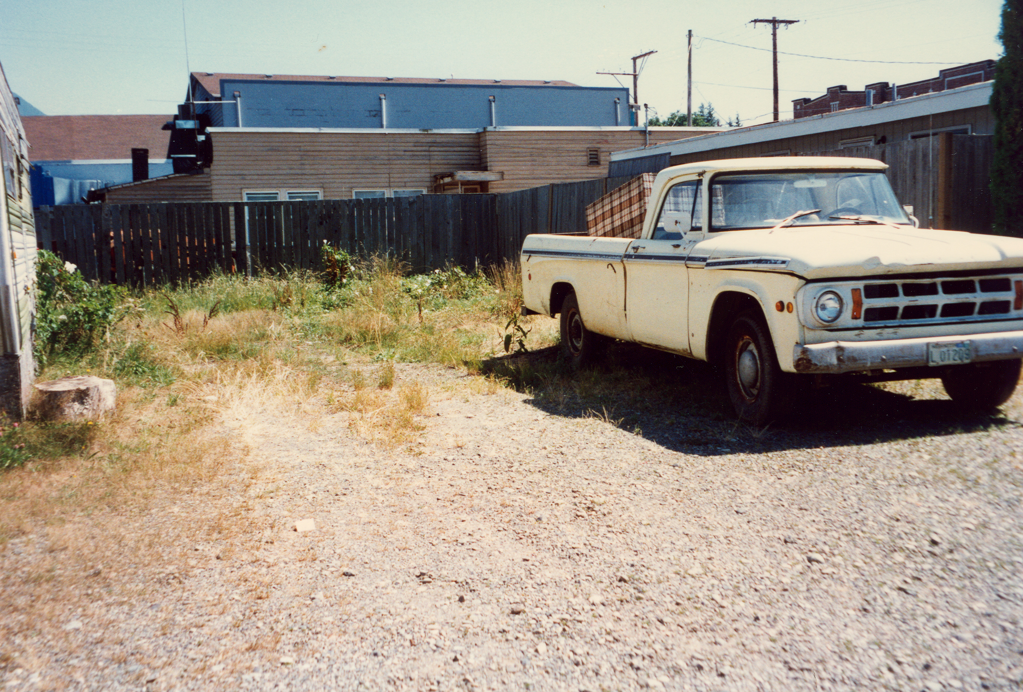
The trailer was located at this spot from an image in August 1996. A home on the corner of this property had a wooden fence (seen behind the truck).
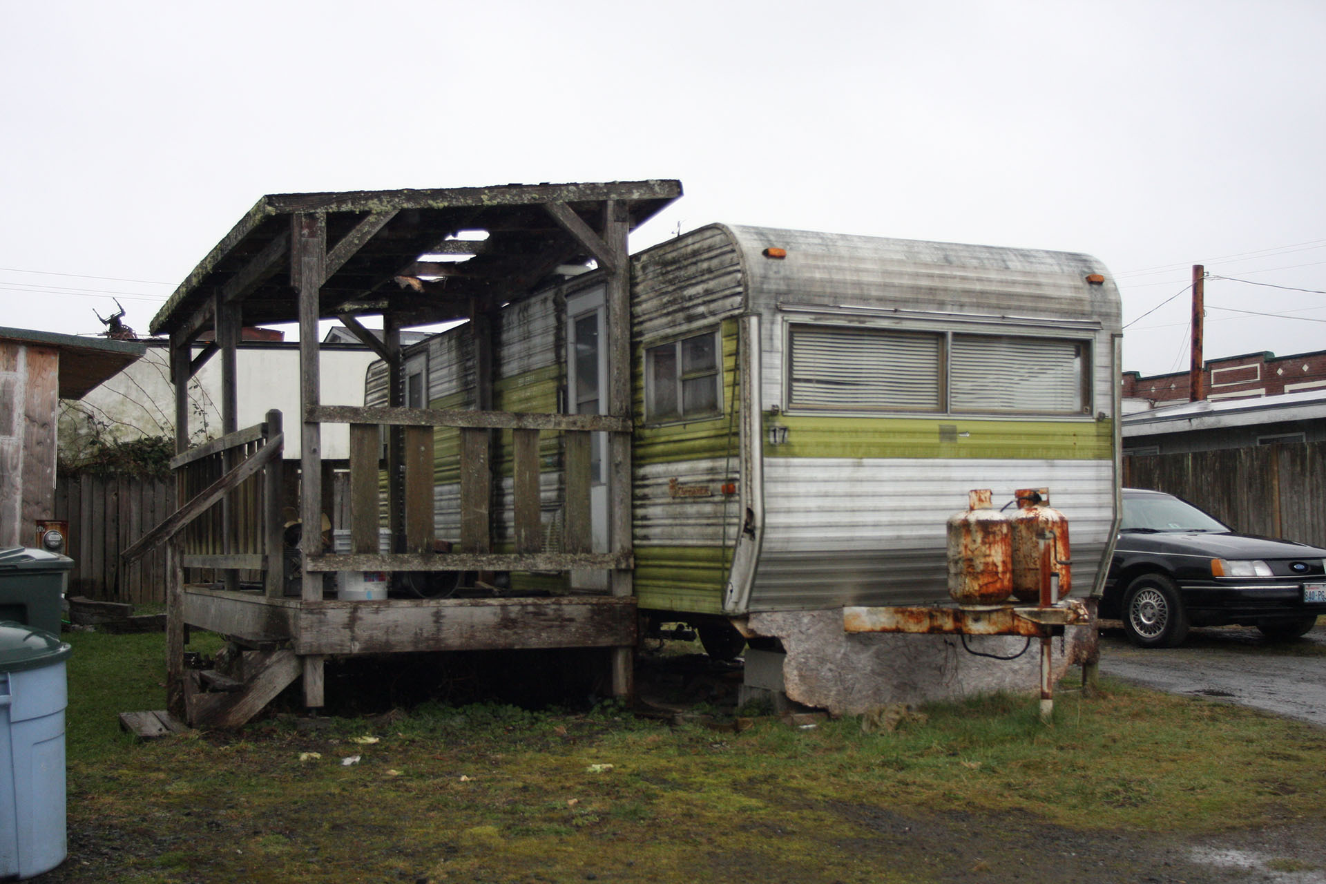
The trailer … well, a different trailer, in the spot on March 14, 2009.
By September 2019, it was gone just like Agent Desmond. I realized tonight that the space was probably a little more to the left than the image above. Gersten’s apartment is seen in the background.
Didn’t stop me from taking a photo.
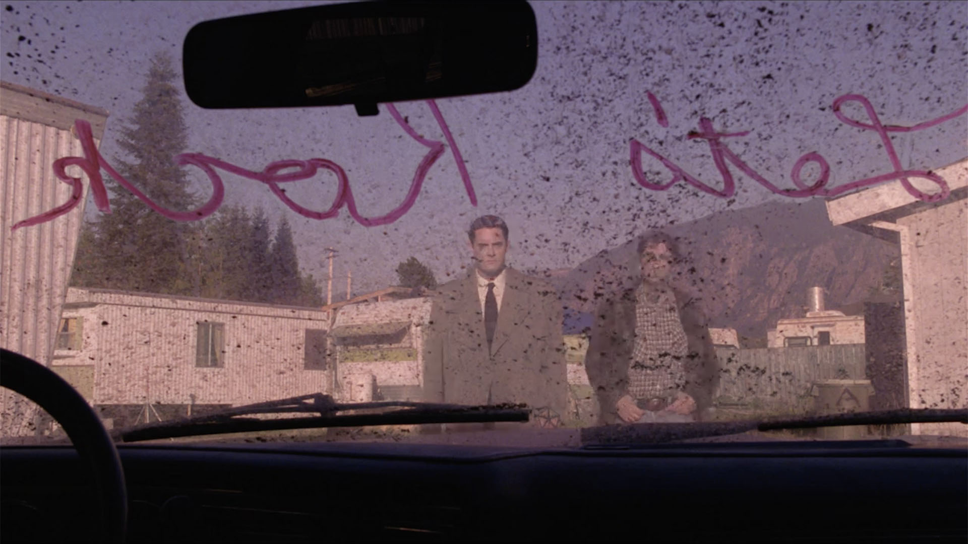
AGENT DALE COOPER AT THE FAT TROUT
I’m going over here.
Two Chalfonts.
AGENT DESMOND’S VEHICLE

Is that Agent Desmond’s vehicle?
Did you ever notice that it’s in the background of this scene? Look to the right of Carl Rodd. You can see the windows are still open on the trailer with the V220 license plate.
Let’s rock!
ADDITIONAL IMAGES FROM TRAILER PARK
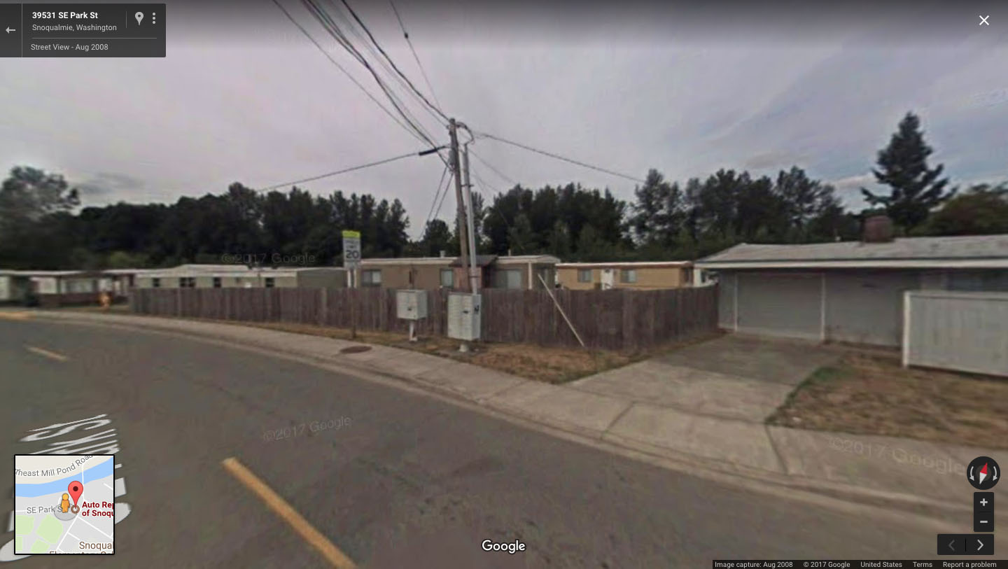
You can still see some details on the Google Street View image from August 2008 including a utility pole, wooden fences, and buildings outside the trailer park.

Behind this home was where the Chalfont trailer was located.
You can see some images and video from my visit to the location in August 1996 in this article – Twin Peaks Fan Fest Memories – Riverside Mobile Home Park.
INTWINPEAKS.COM
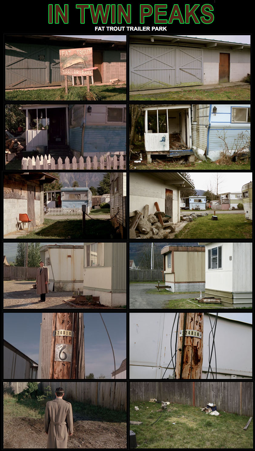
Before it was demolished, Charles from the former InTwinPeaks.com site visited the location and provided side-by-side comparisons of film scenes to the actual location. The image above comes from the now defunct site as I don’t want Charles’ extensive work to disappear like Agent Chet Desmond did when he reached for the ring.
Author
Discover more from TWIN PEAKS BLOG
Subscribe to get the latest posts sent to your email.